


Week 44: Chaco Canyon and more!
And lotsa snow!

Hey, hi, and hello! This was a super busy week which makes for another looooooooong post — so grab a cuppa and settle in for the ride!
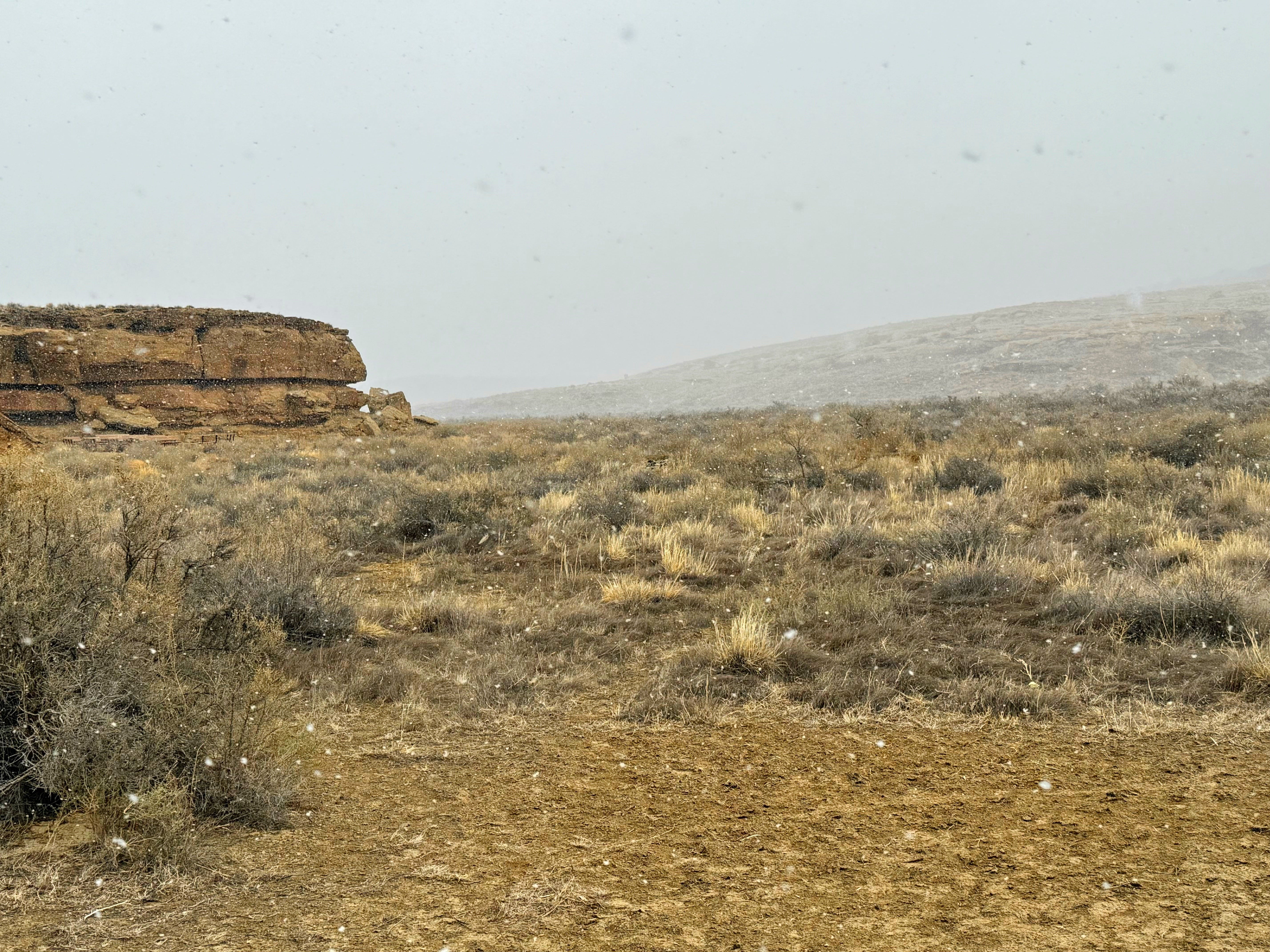
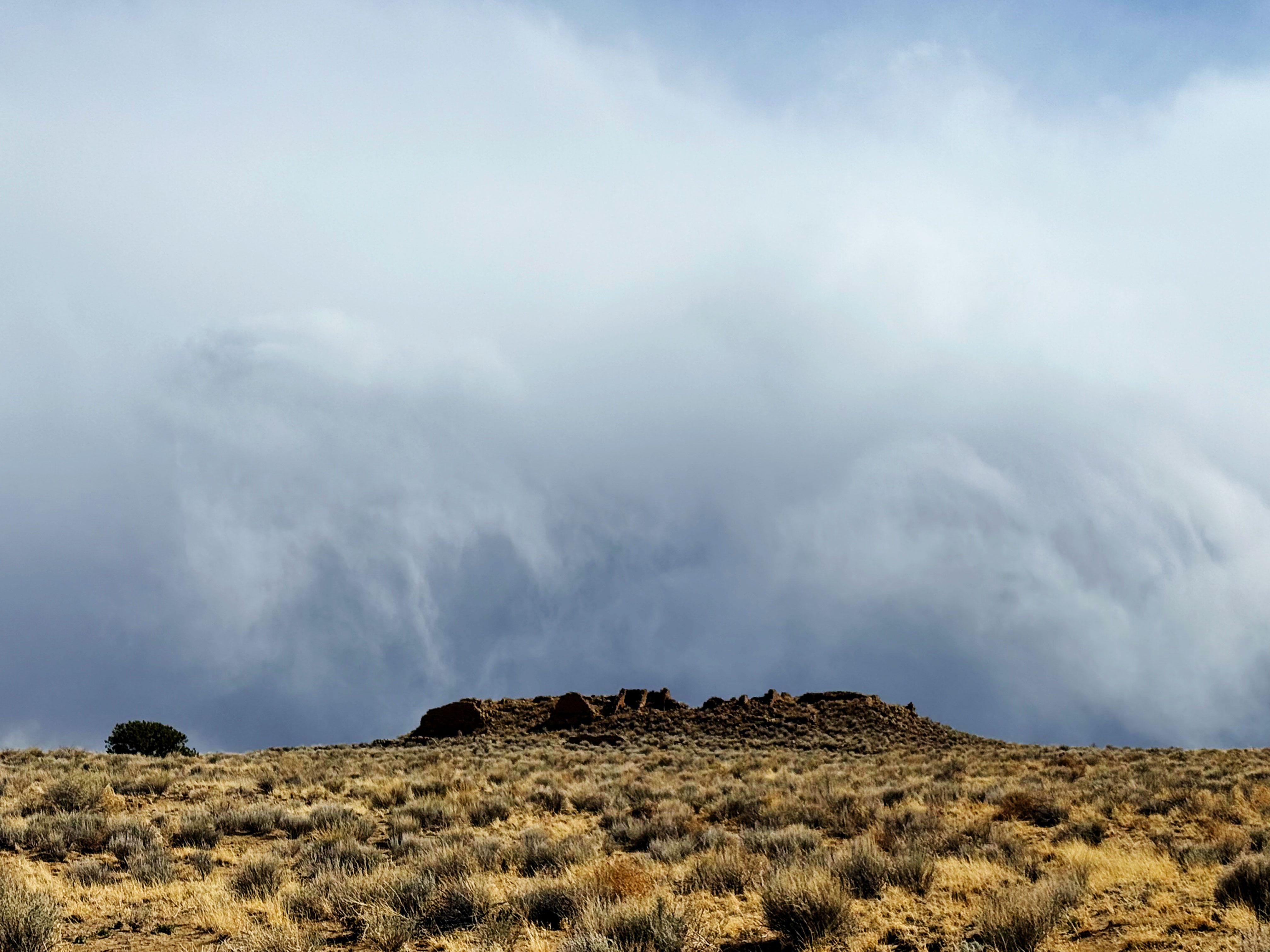
Ah-Shi-Sle-Pah Wilderness
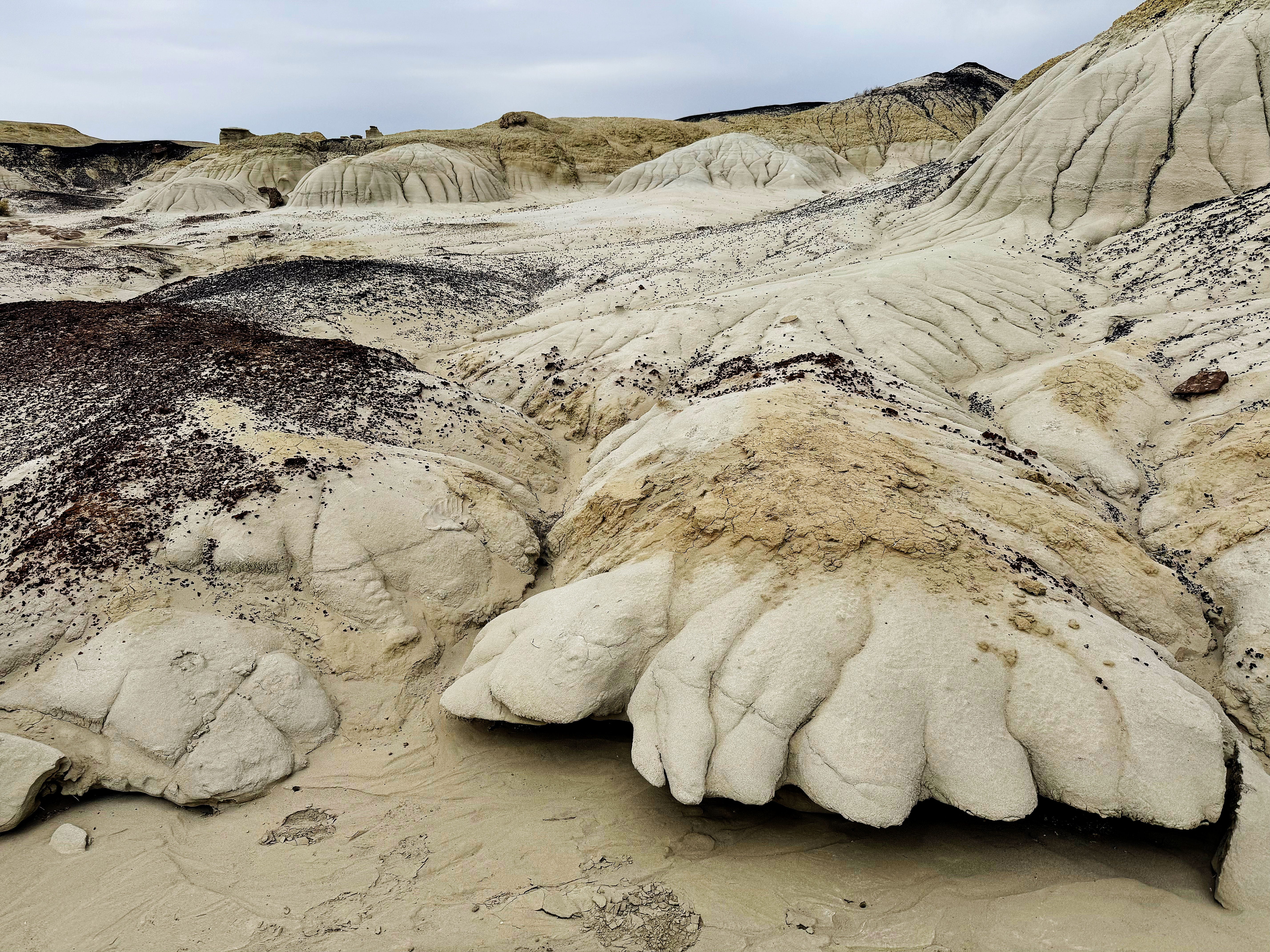
We started out the week on Sunday in the Ah-Shi-Sle-Pah Wilderness in northwestern New Mexico and had to go for one last hike before leaving the area.
From the website:
The Ah-Shi-Sle-Pah Wilderness is located in northwestern New Mexico and is a badland area of rolling water-carved clay hills. The area is rich in fossils and has little vegetation to conceal geological formations. The thin vegetation includes sagebrush, piñon-juniper, Great Basin scrubland, and grassland. It is a landscape of sandstone cap rocks and scenic olive-colored hills. Water in this area is scarce and there are no trails; however, the area is scenic and contains soft colors rarely seen elsewhere.
It’s hard to describe what it’s like hiking in this landscape — without trails! (Don’t worry, friends and family! We made sure to take plenty of water and snacks, our Garmin inReach so we could get help if needed, battery packs, and Jason had offline maps in the Gaia app.)
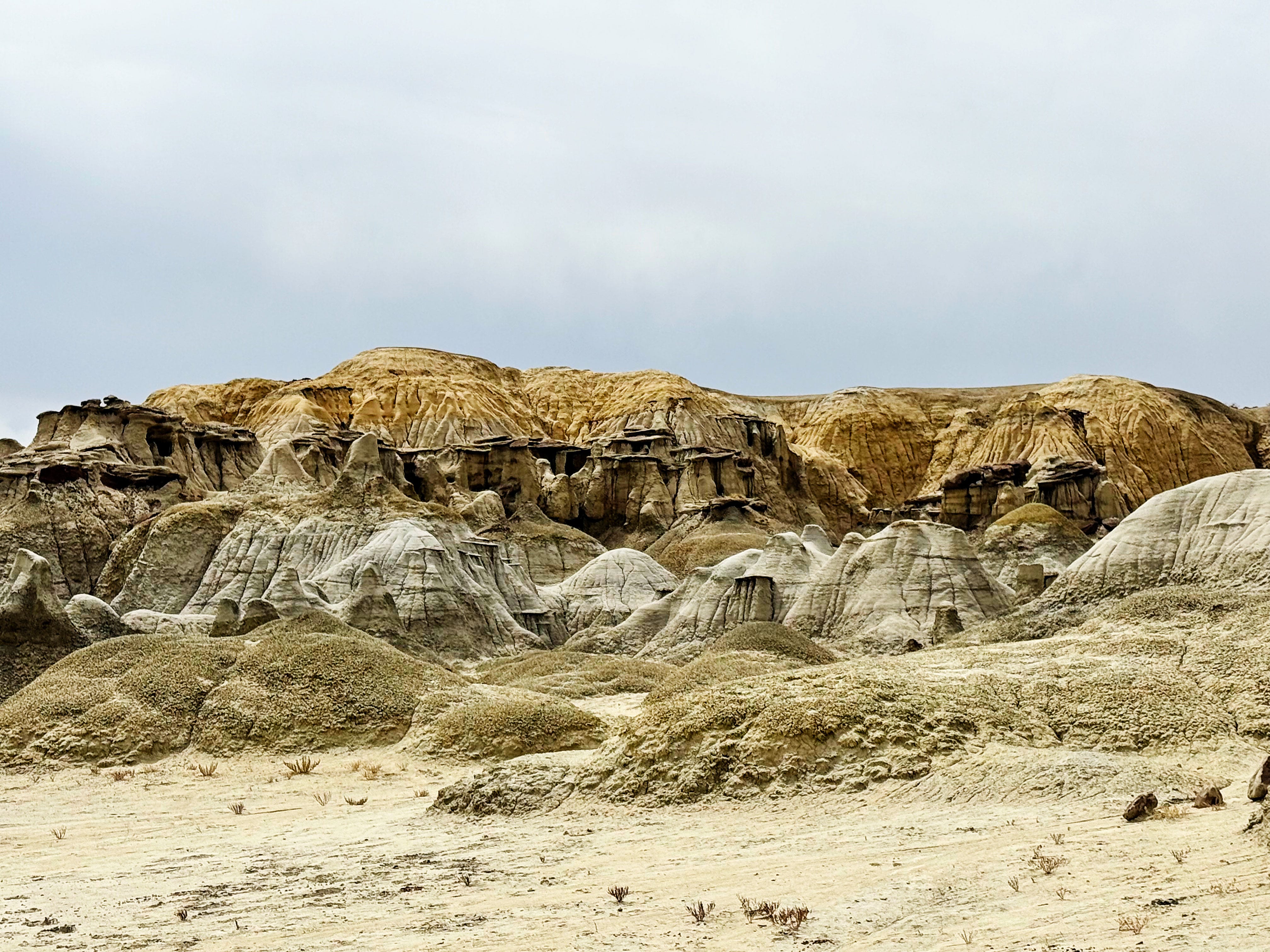
Walking through these weird formations was so cool — there was a new bizzare formation around every corner, and the soil crunched beneath our feet.
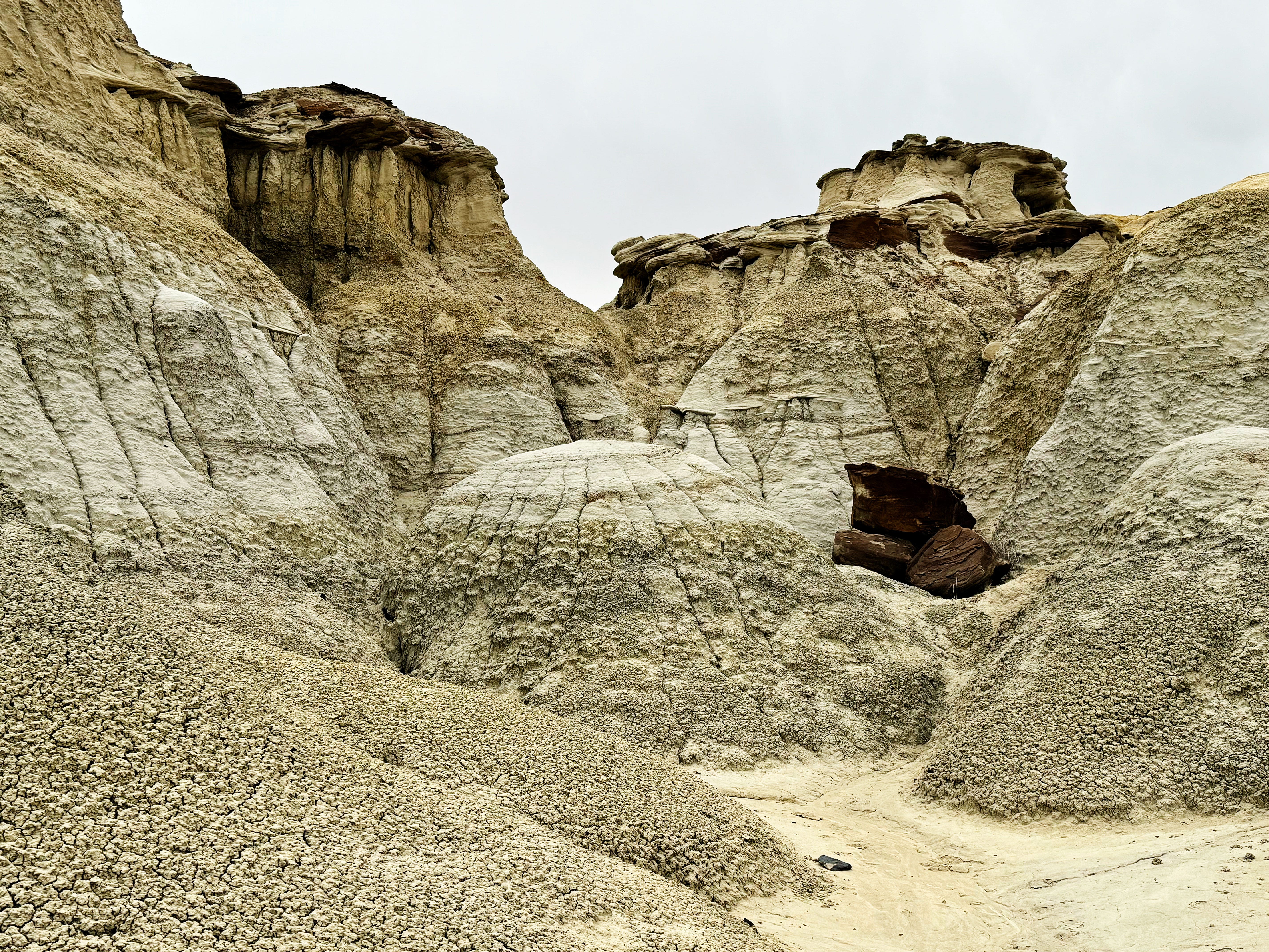
Making our way through these amazing landforms was such an incredible experience.

Here’s J pointing back the way we had just come after scrambling up the side of this canyon.
After our 6 mile hike we headed to…
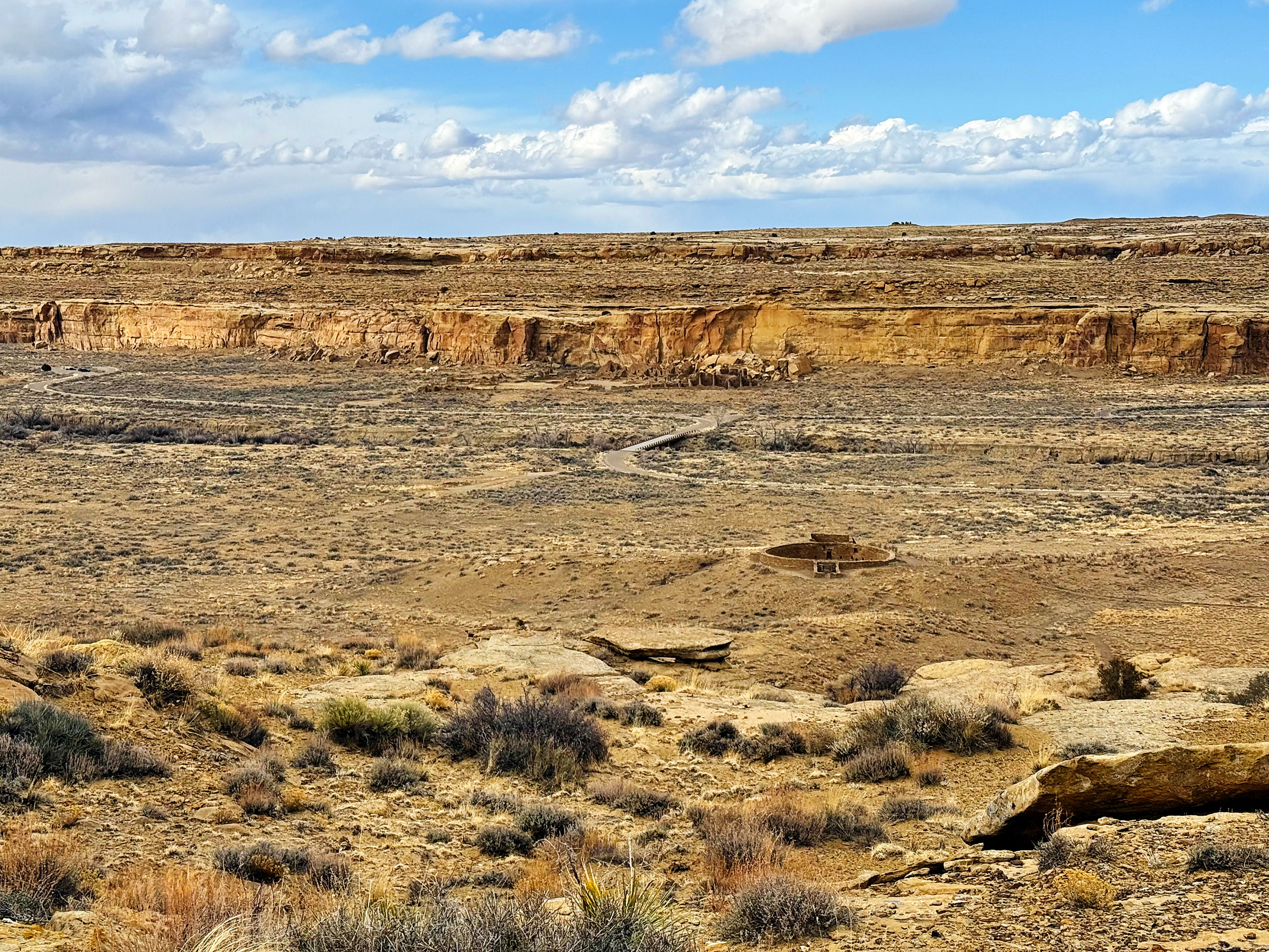
Chaco Culture National Historic Site
I’ve always wanted to visit Chaco Culture National Historic Site, and after learning about the Ancestral Puebloans during my residency at Canyons of the Ancients National Monument (CANM) it seemed like the logical next stop. (Catch up on my time as an artist-in-resident at from the beginning here in this post.)
I tried to prepare for our visit by watching The Mystery of Chaco Canyon, narrated by Robert Redford, reading as much as I could find online and House of Rain: Tracking a Vanished Civilization Across the American Southwest by Craig Childs, but nothing prepared me for the scale and feeling of this amazing place. Here is a good intro on the park website.
Some random facts that we learned:
Chaco Canyon was a major cultural center for the Ancestral Puebloans between AD 900 and 1150.
They built 15 major complexes without metal tools, hauling wood from high in the mountains 60 miles away across the desert!
There are petroglyphs and pictographs throughout the area — more on these below.
Chaco Canyon is at an elevation of 6175 feet, and is considered a “high desert” with 8.74 inches of annual rainfall.
It is unclear whether the Ancestral Puebloans grew crops here, but given what I learned at CANM about dryland farming in the deep, windblown soils I’m betting that they did.
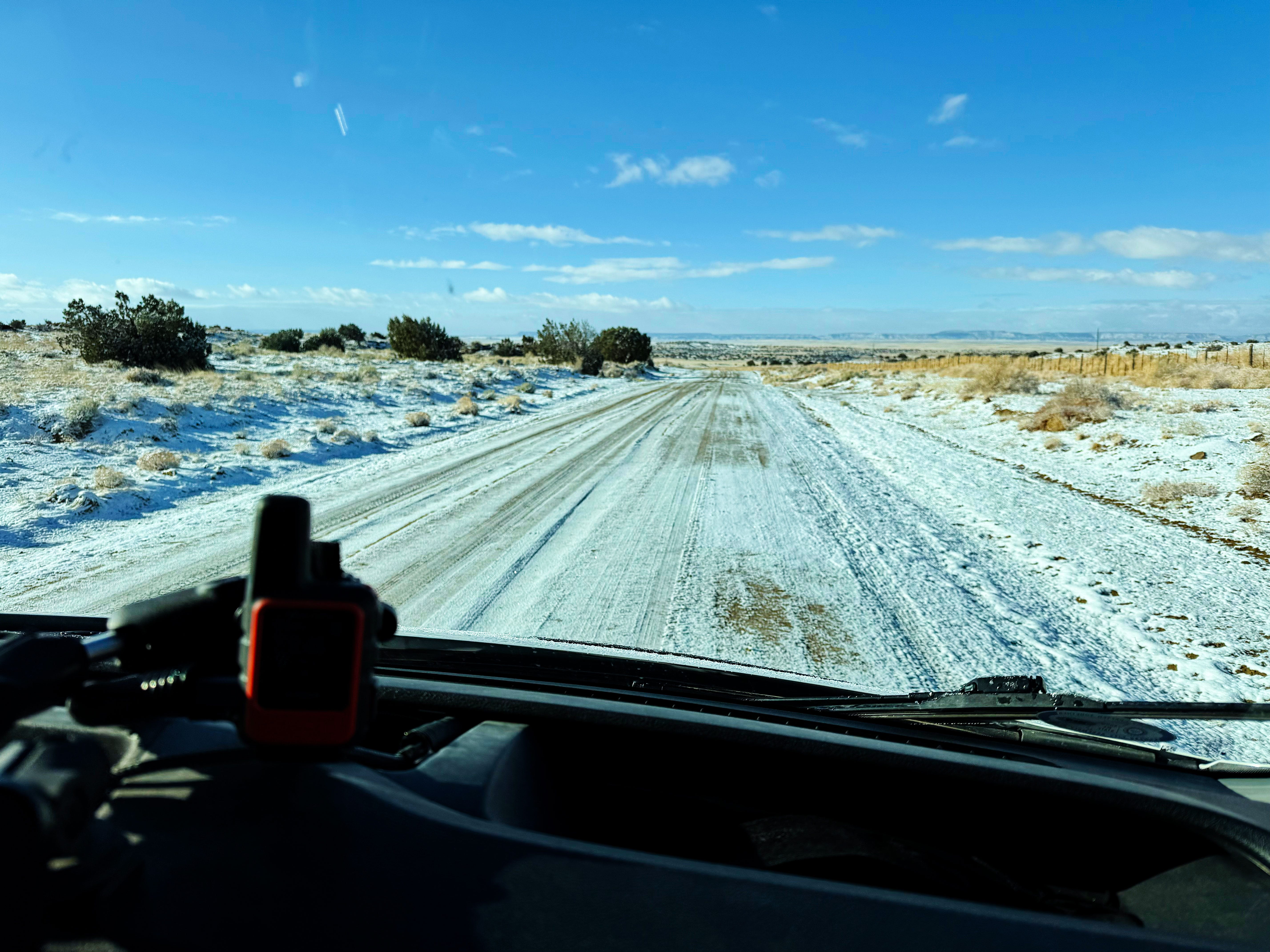
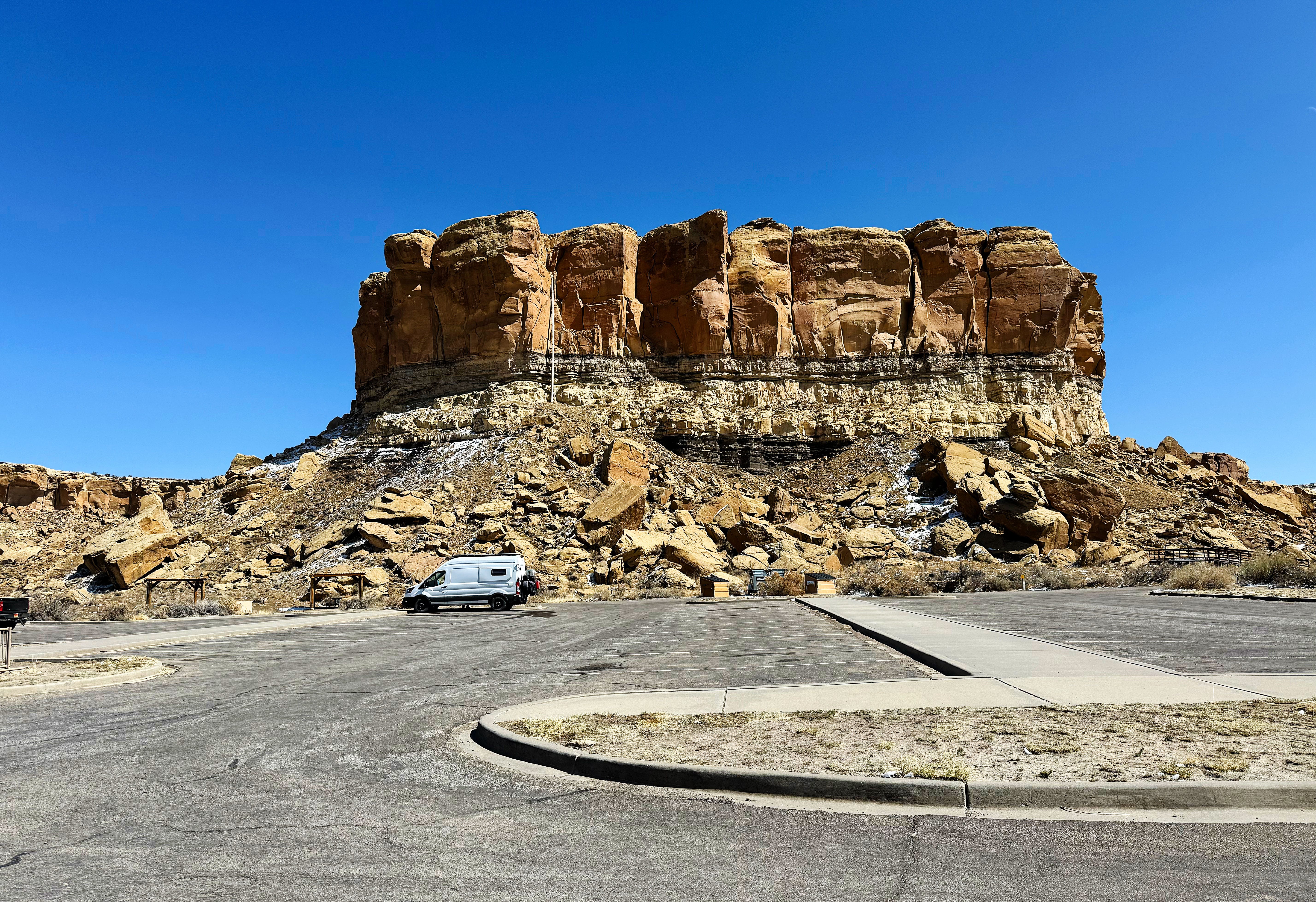
We heard about the infamous bad roads in and out of the park, and I was a little nervous about getting there, but the van handled them like a champ!
We tried to maximize our time there and went hiking every day except Tuesday, when there was a major wind storm with blowing dust and sand — we hunkered down in the van that day and I was thankful once again that we weren’t in a tent!
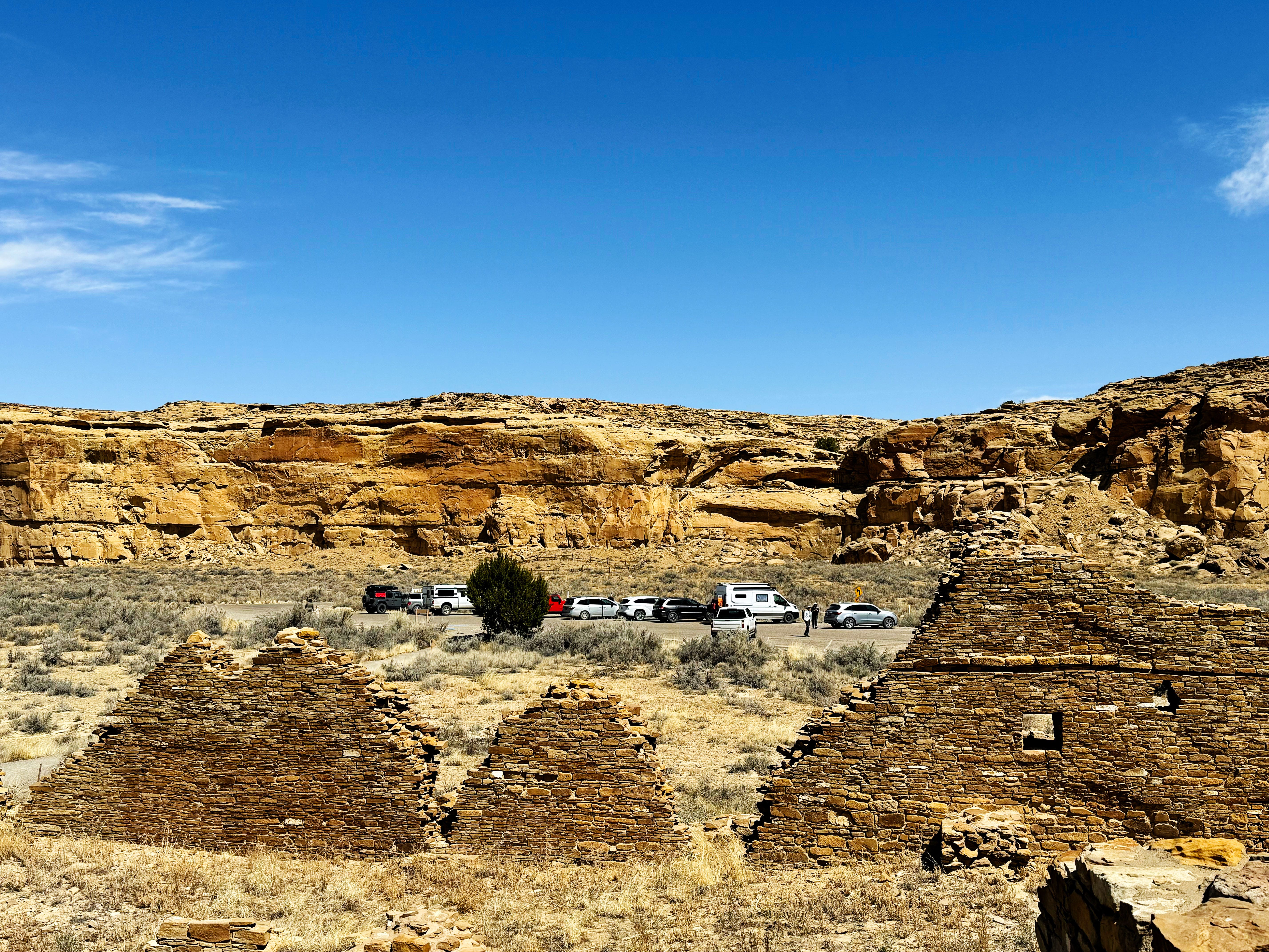
First, a bit about the layout of Chaco: once you arrive by one of the infamous dirt roads (one reviewer said the road “scrambled their kidneys” — accurate!) — there’s a 9-mile paved road that takes you to all of the major pueblos and backcountry trails. When we were there the road was open 7am - 7pm (there’s a gate that prevents access after closing time). The Gallo campground where we stayed has a dirt road, but nothing like the roads here!

Here are the highlights from our time at Chaco Canyon:
Sunday at Chaco: Una Vida
Una Vida translates to “one life” in English, and we wondered how the sites got their names. I found this reference on the park website but it doesn’t have much info.
This Chacoan Great House was occupied from AD 850-1250s, and since it’s right next to the Visitor Center it makes a great first stop.
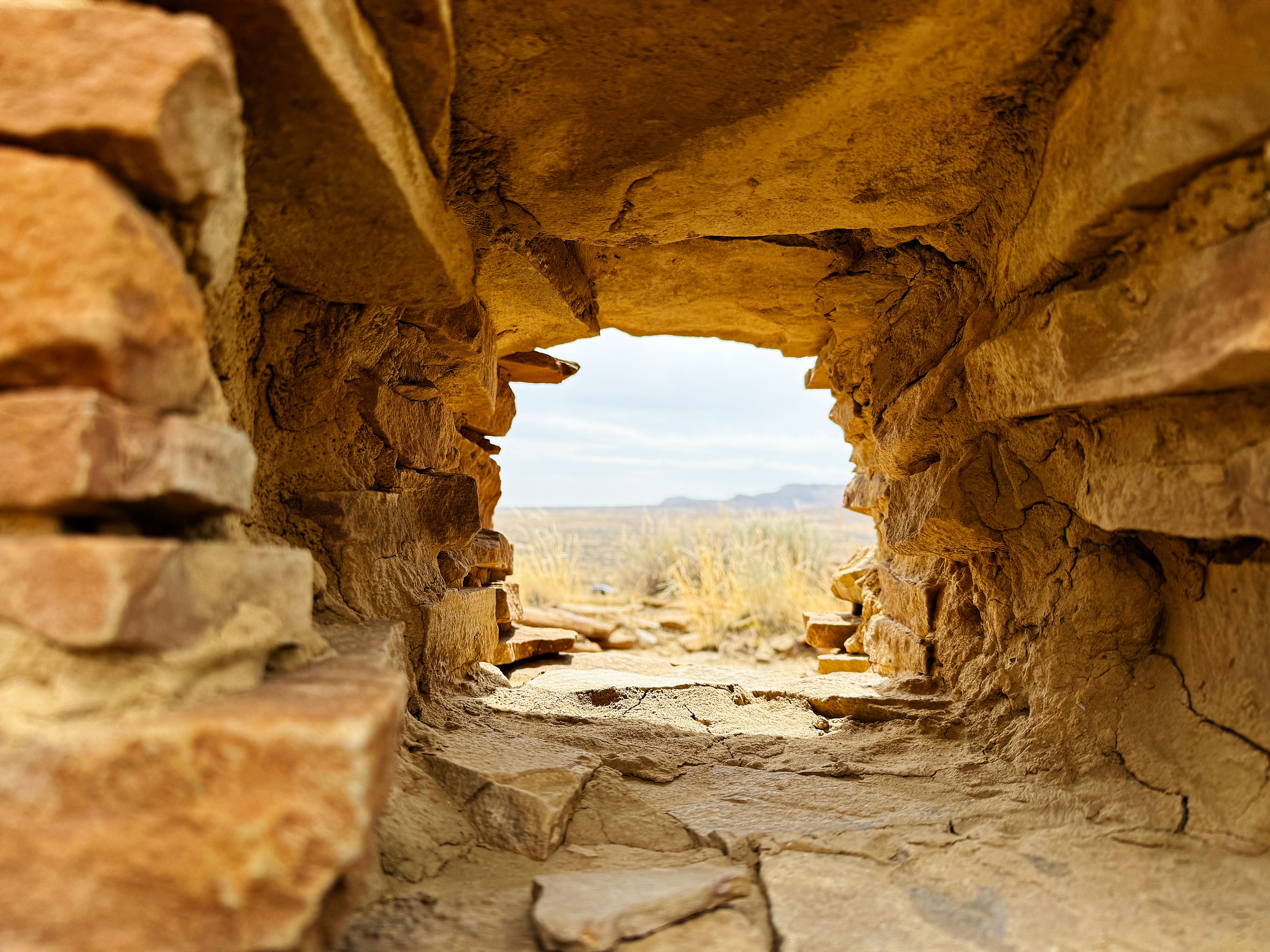
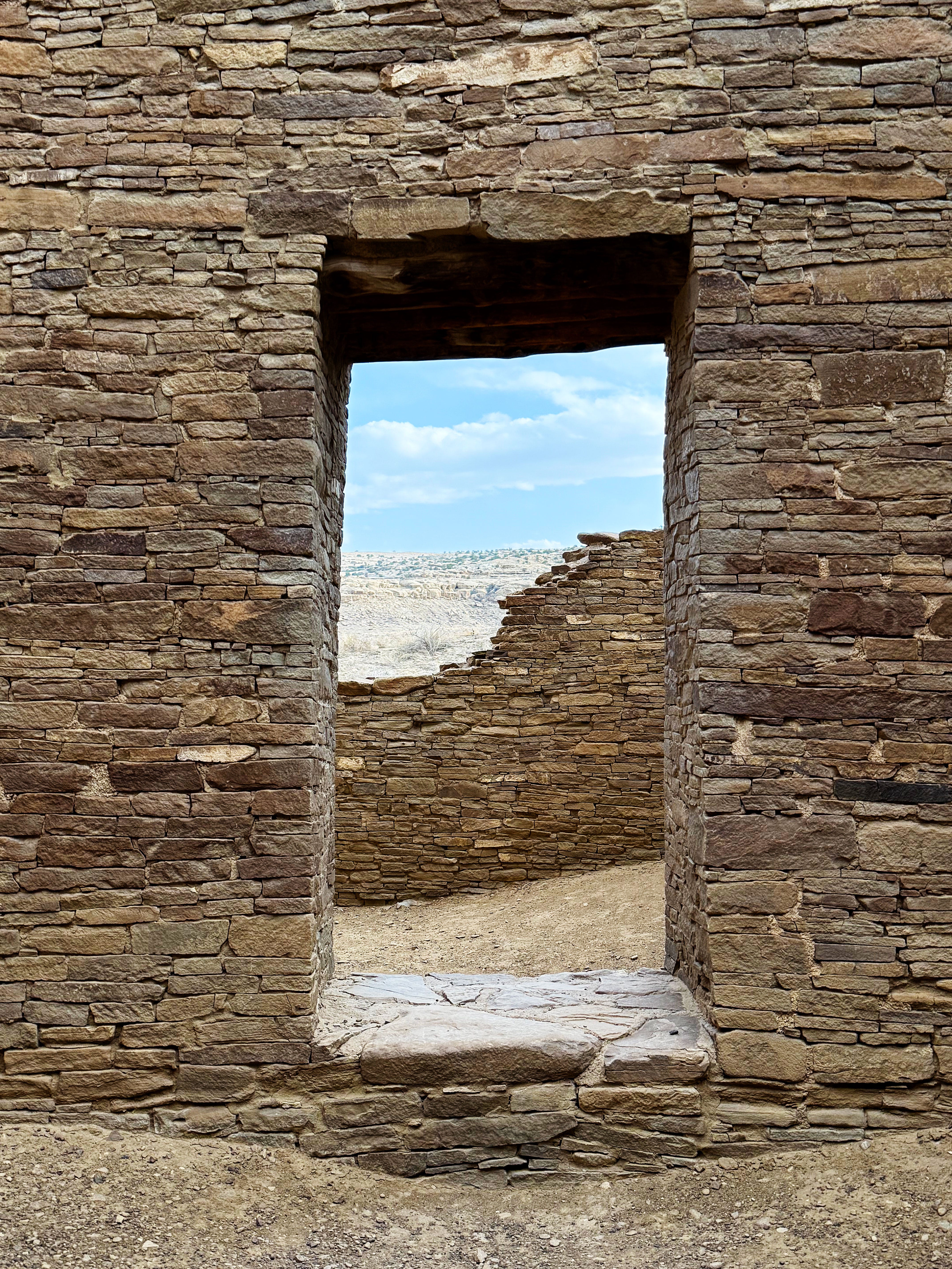
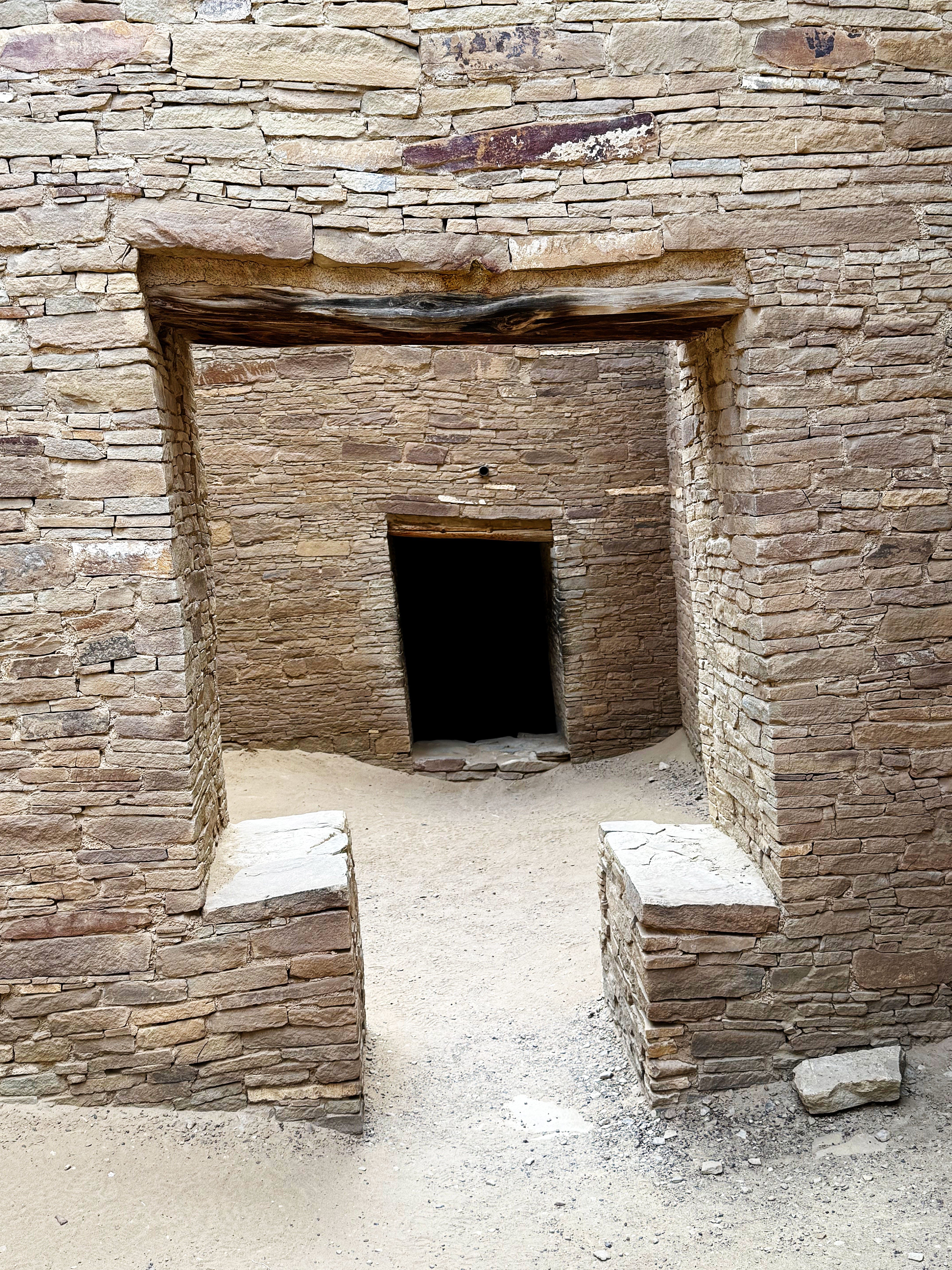
I couldn’t stop taking pictures through the windows, something that I started during my residency at CANM.
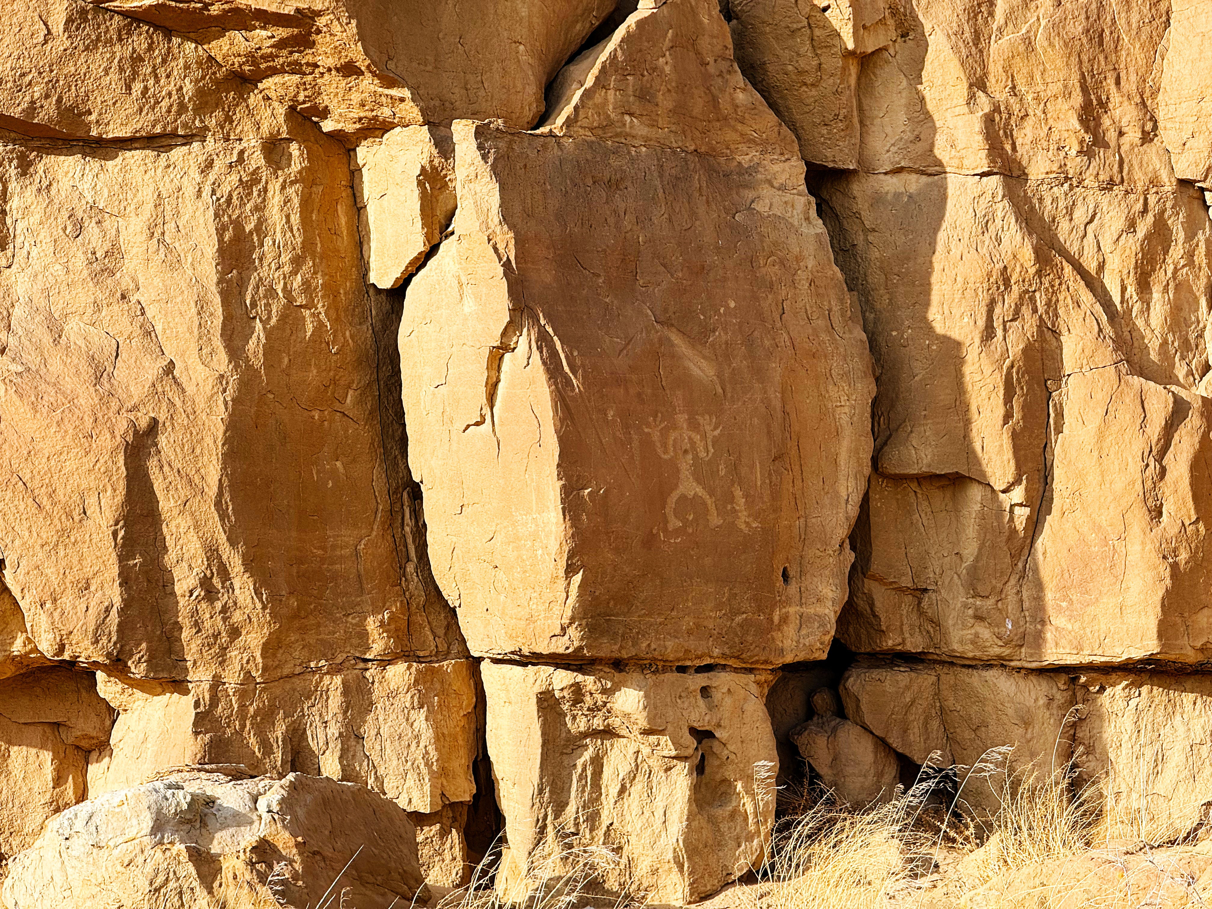
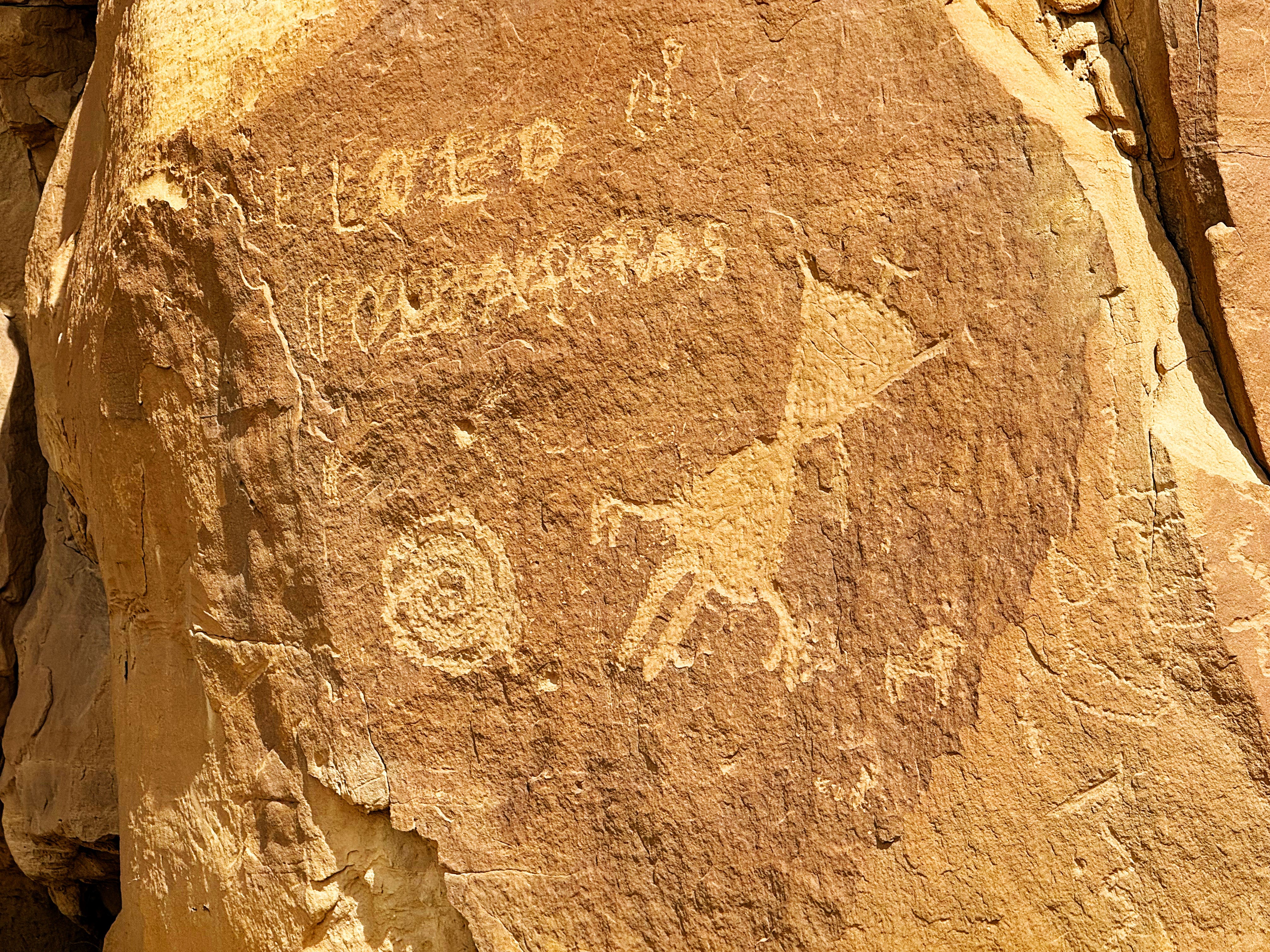
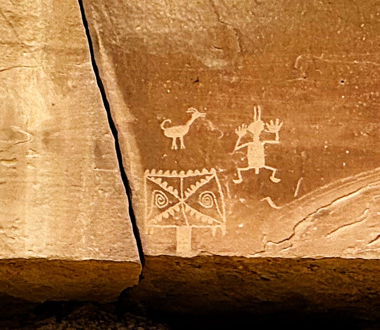
One of the highlights here was seeing the petroglyphs and wondering what they represent.
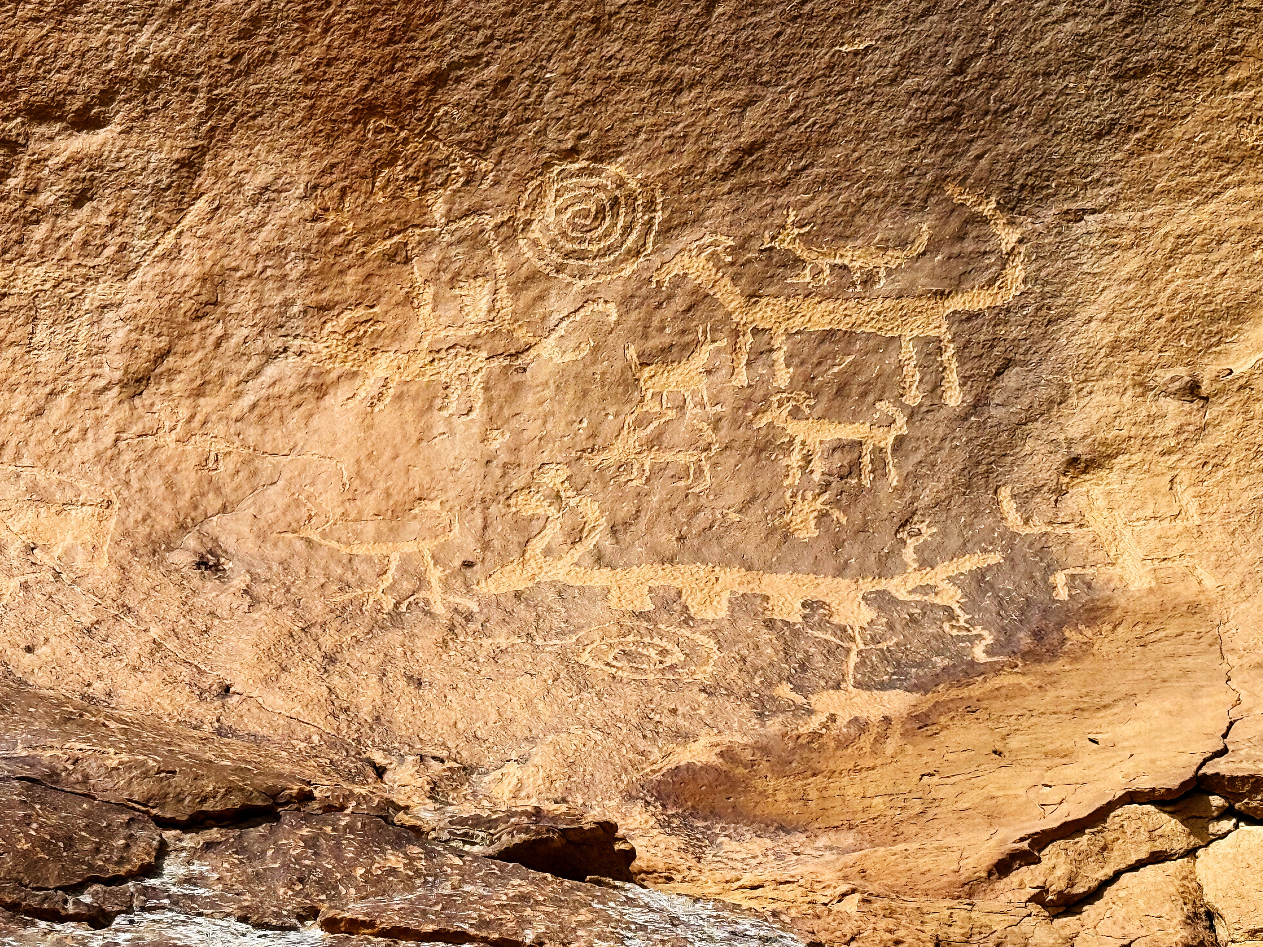
Here’s a closeup so you can see some better:
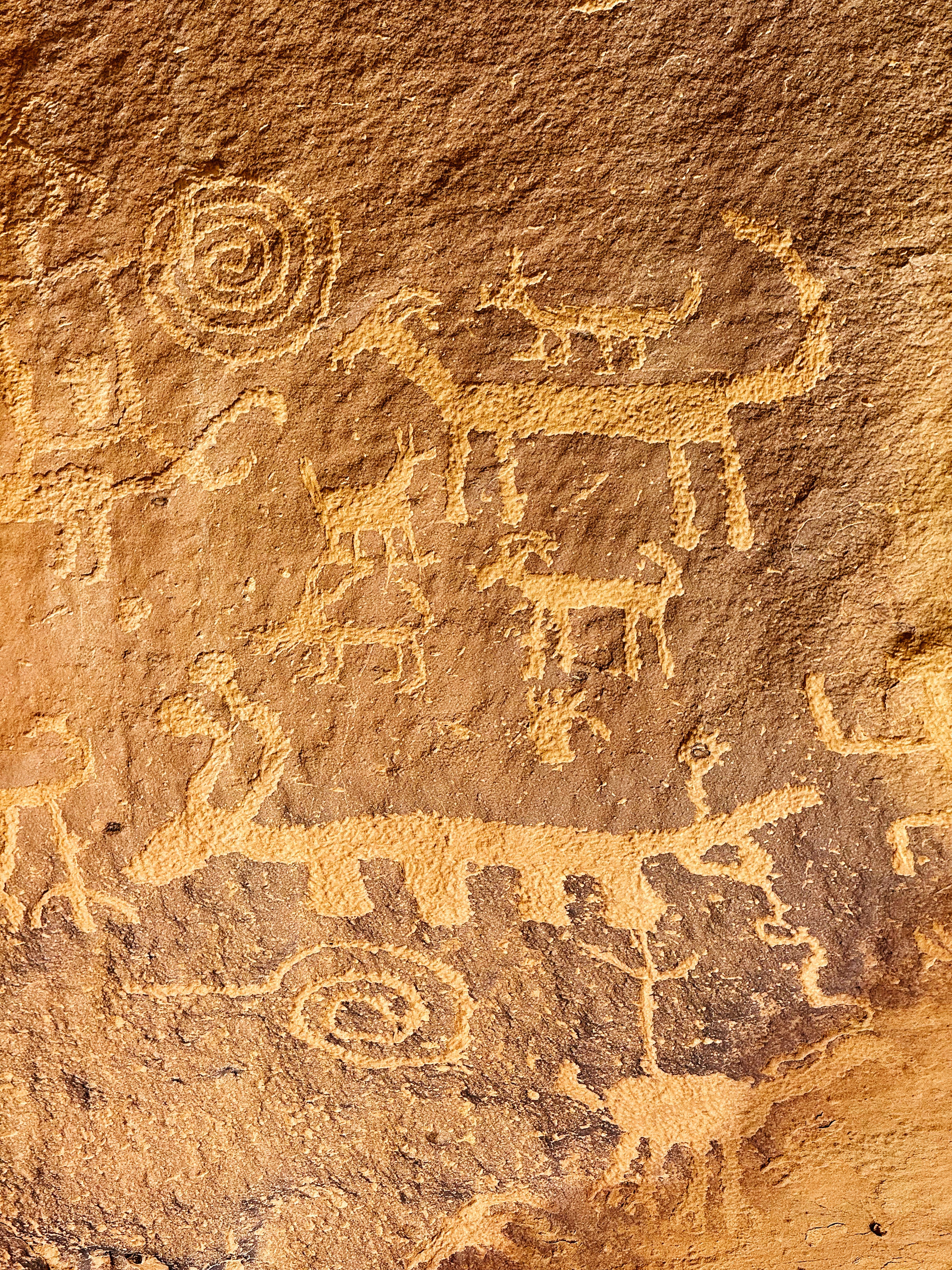
I read that these were most likely carved with an antler used as a chisel since the Ancestral Puebloans did not have metal tools. So amazing.
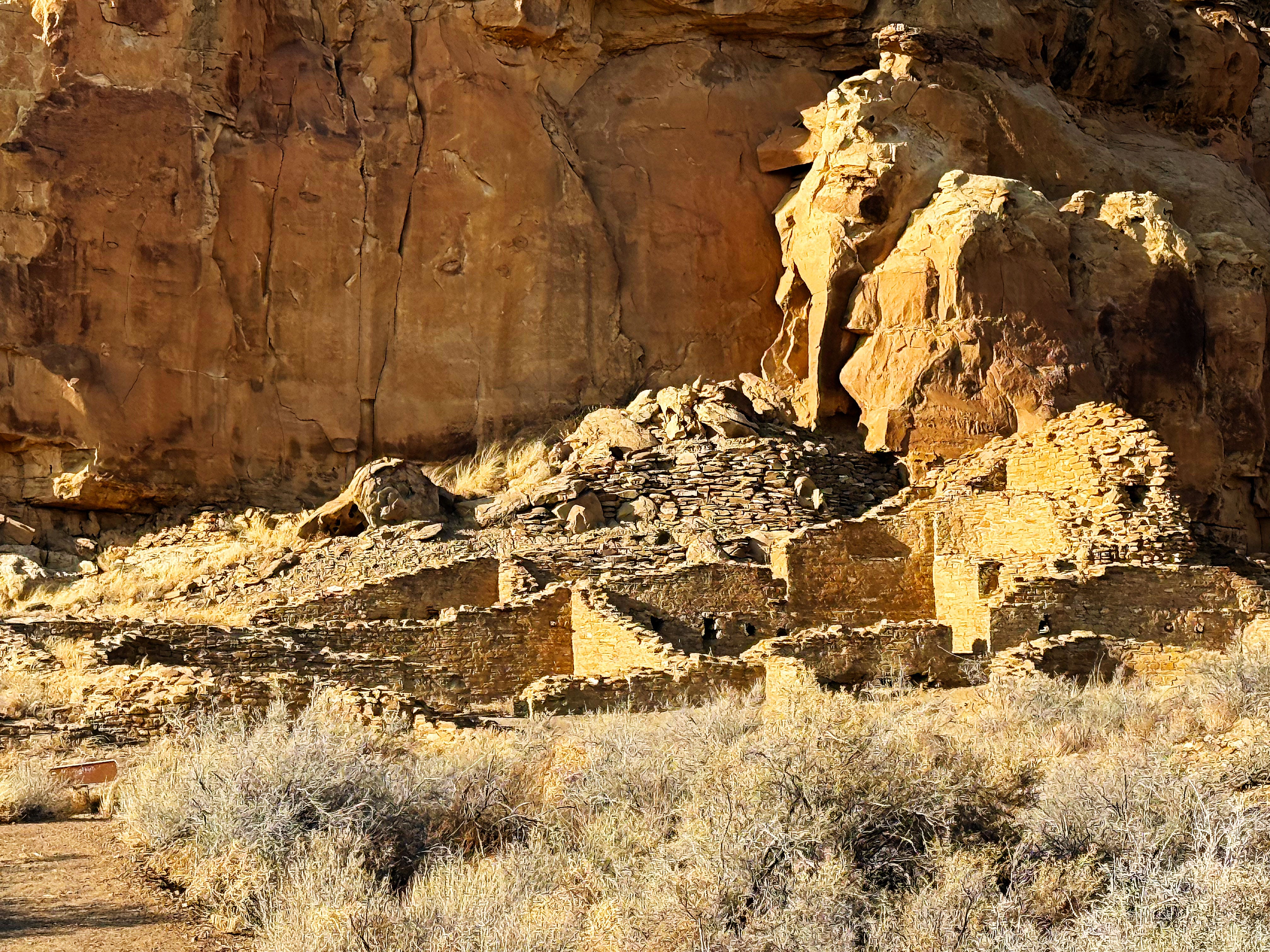
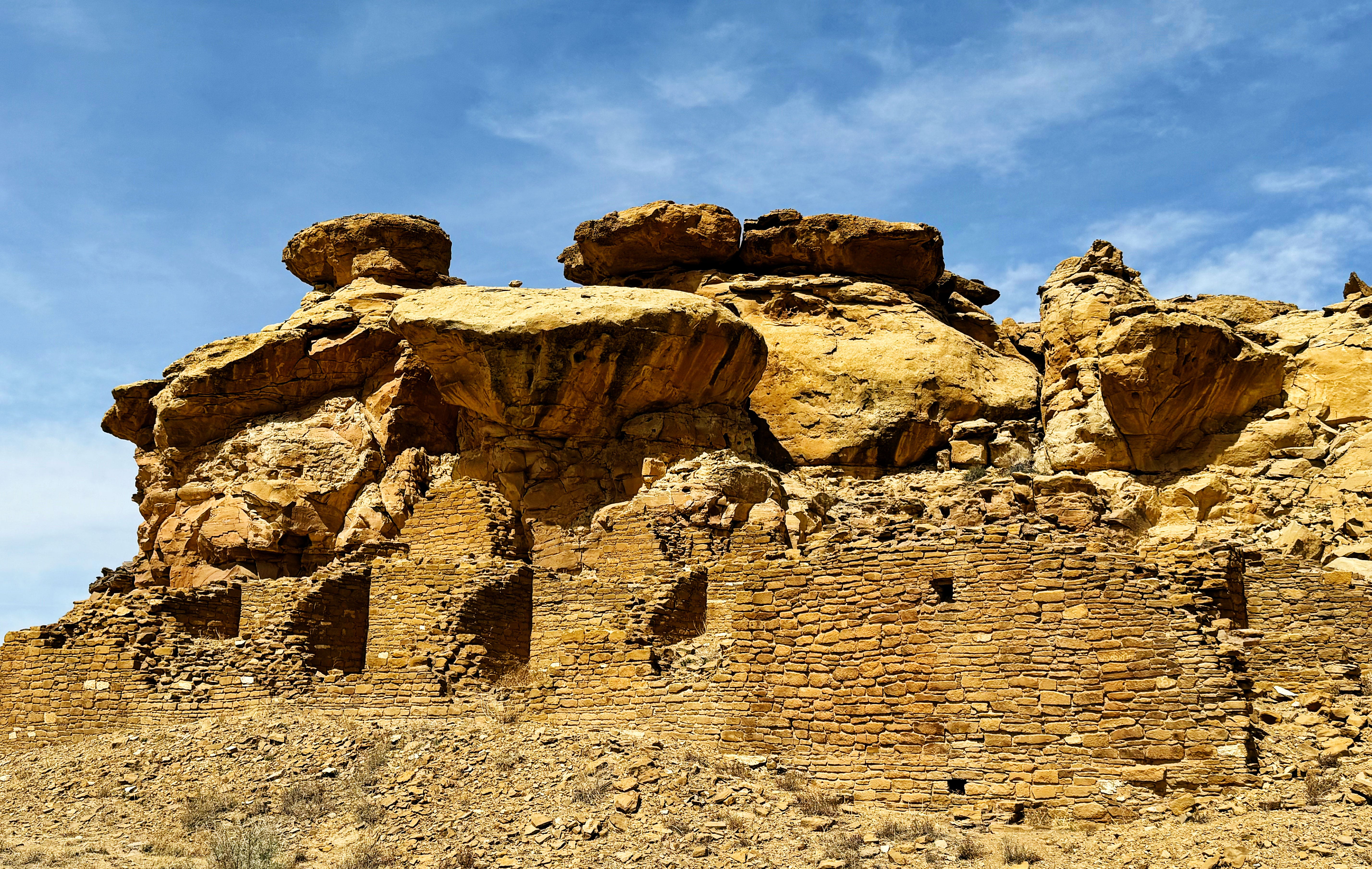
Sunday at Chaco: Hungo Pavi
Our next stop was Hungo Pavi, an unexcavated Great House:

According to the park website:
Hungo Pavi is an unexcavated Chacoan great house (monumental public building) containing over 150 rooms, a great kiva, and an enclosed plaza. It is a good example of what Chacoan sites look like without excavations--covered with a protective blanket of wind-blown sand and native vegetation. Travel in small groups to lessen our impacts to this fragile site.
The more we came to know this place, the more I came to like the unexcavated pueblos. They just seemed to feel “right”.
I love how the kiva wall frames the landscape.
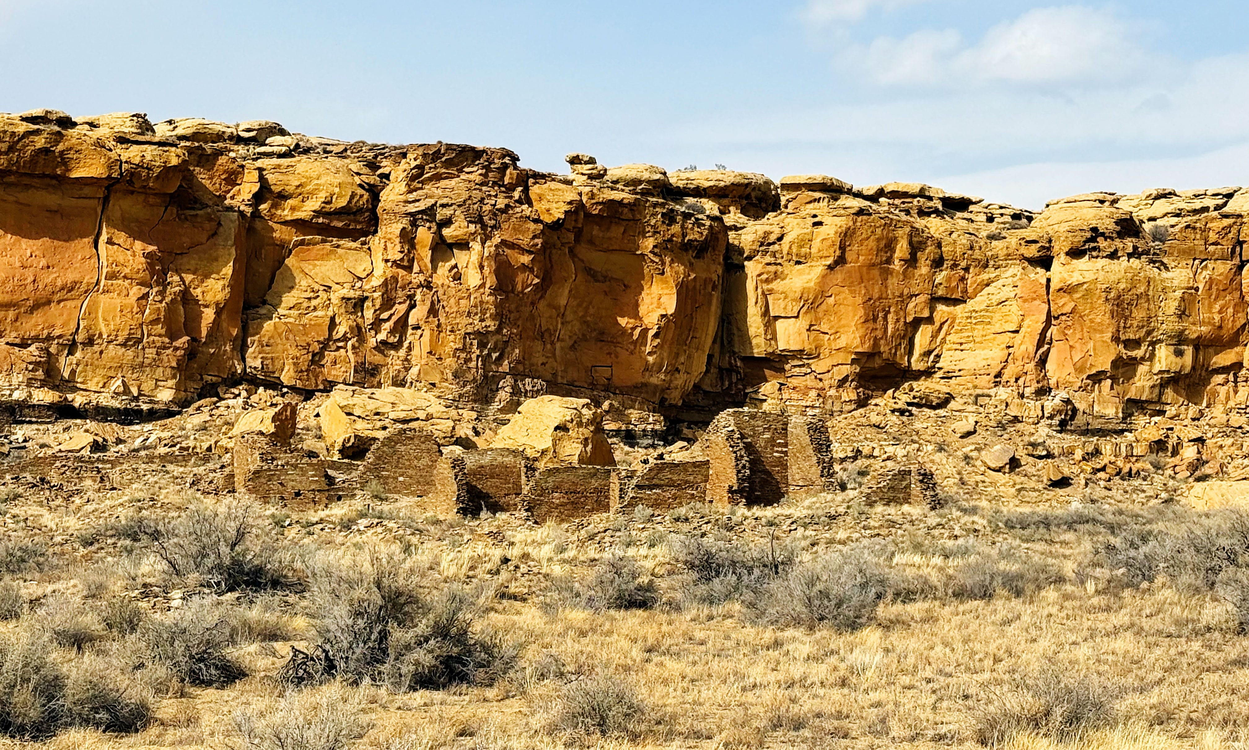
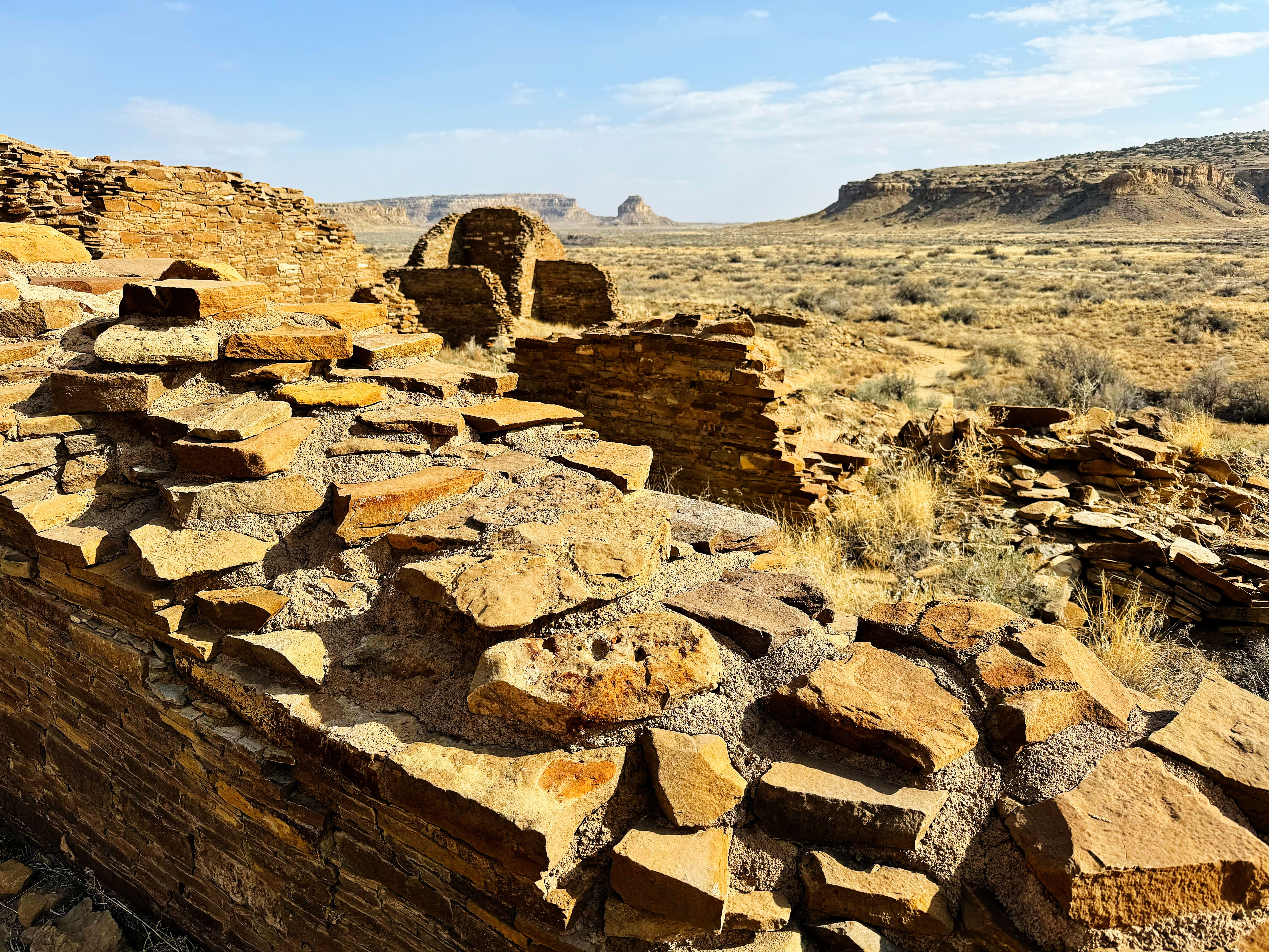
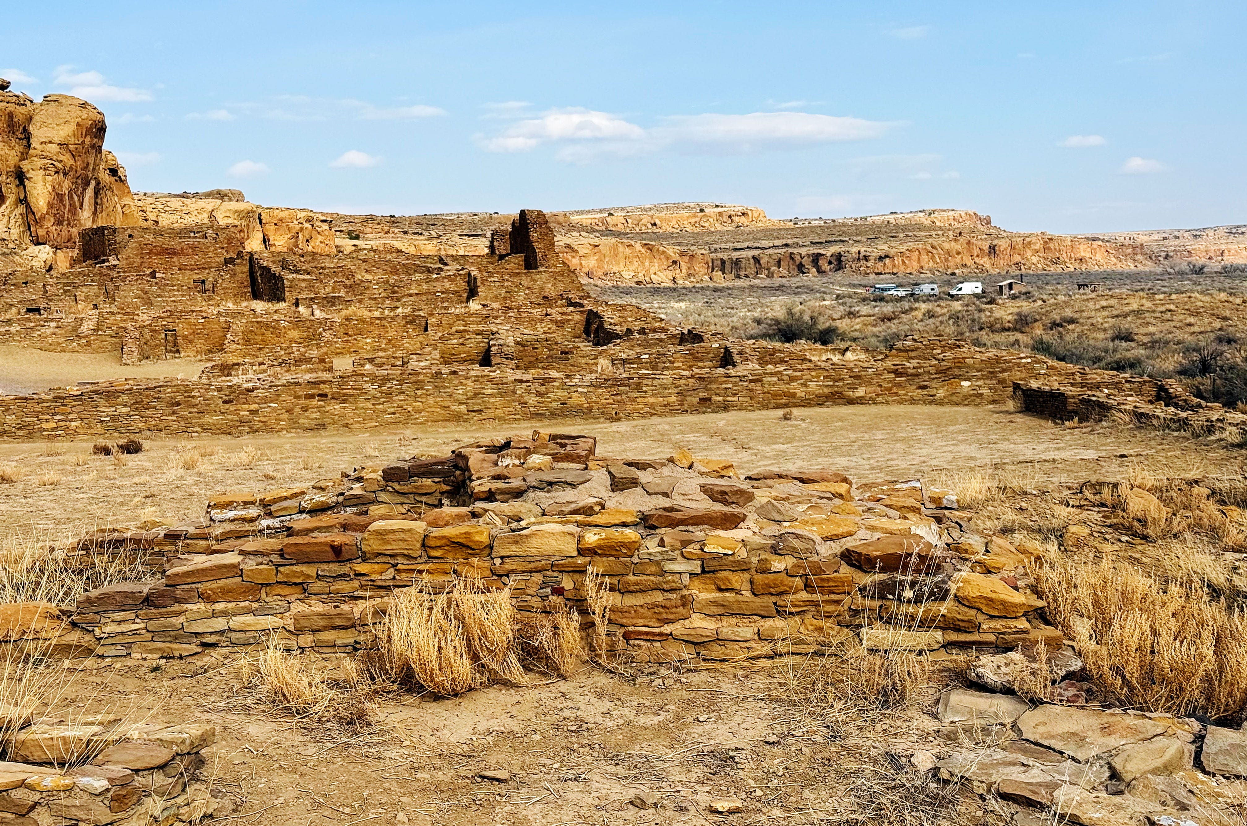
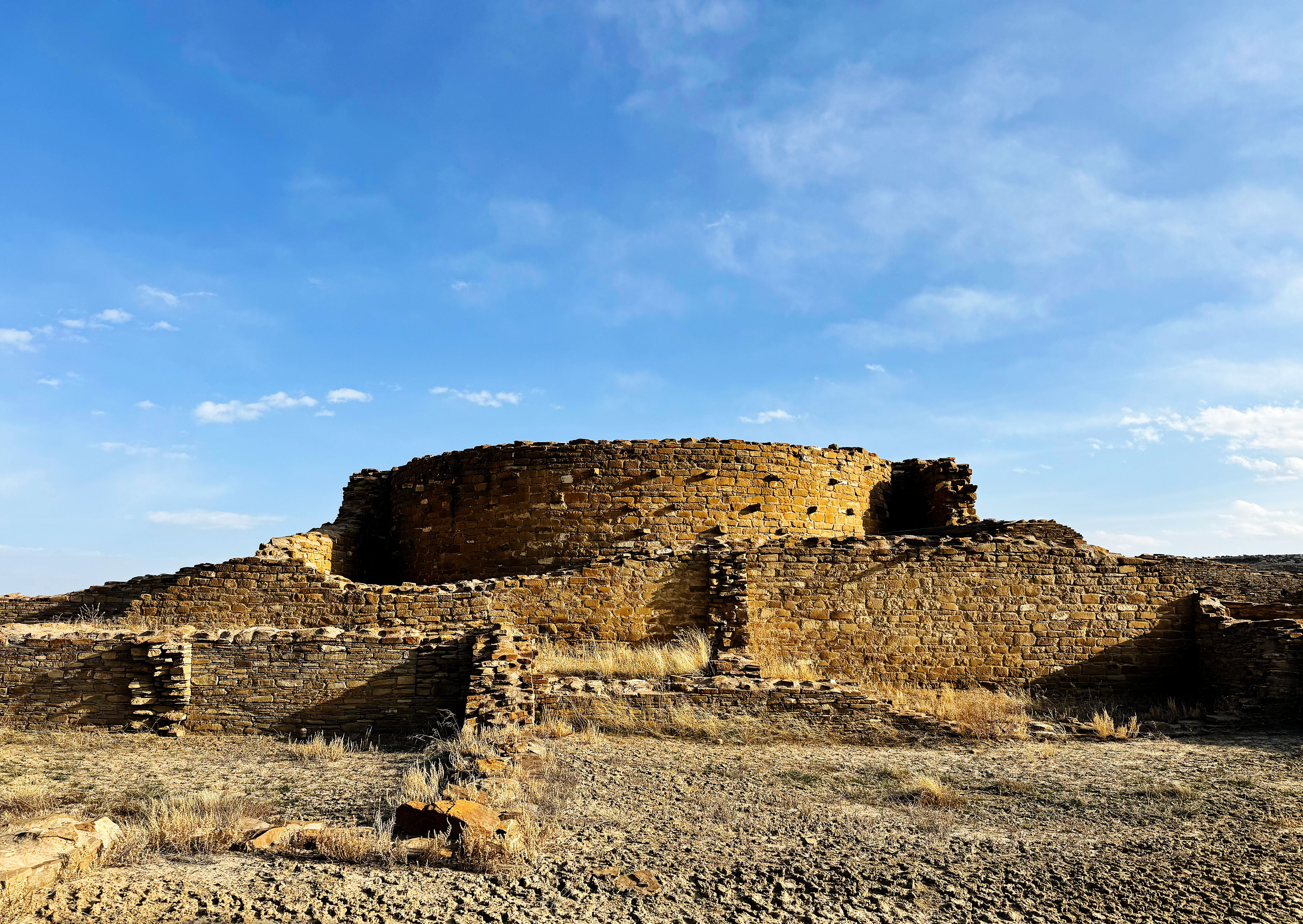
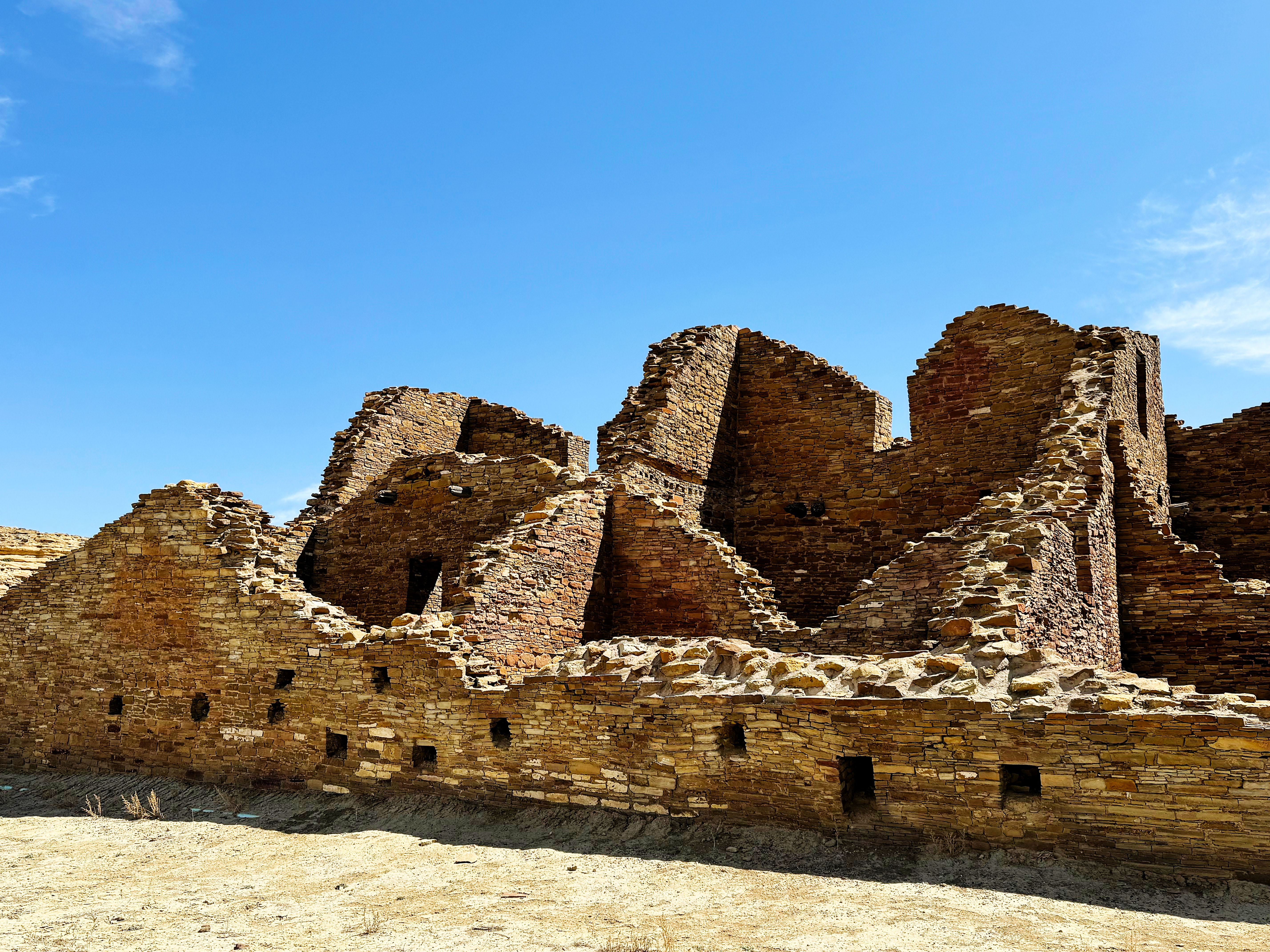
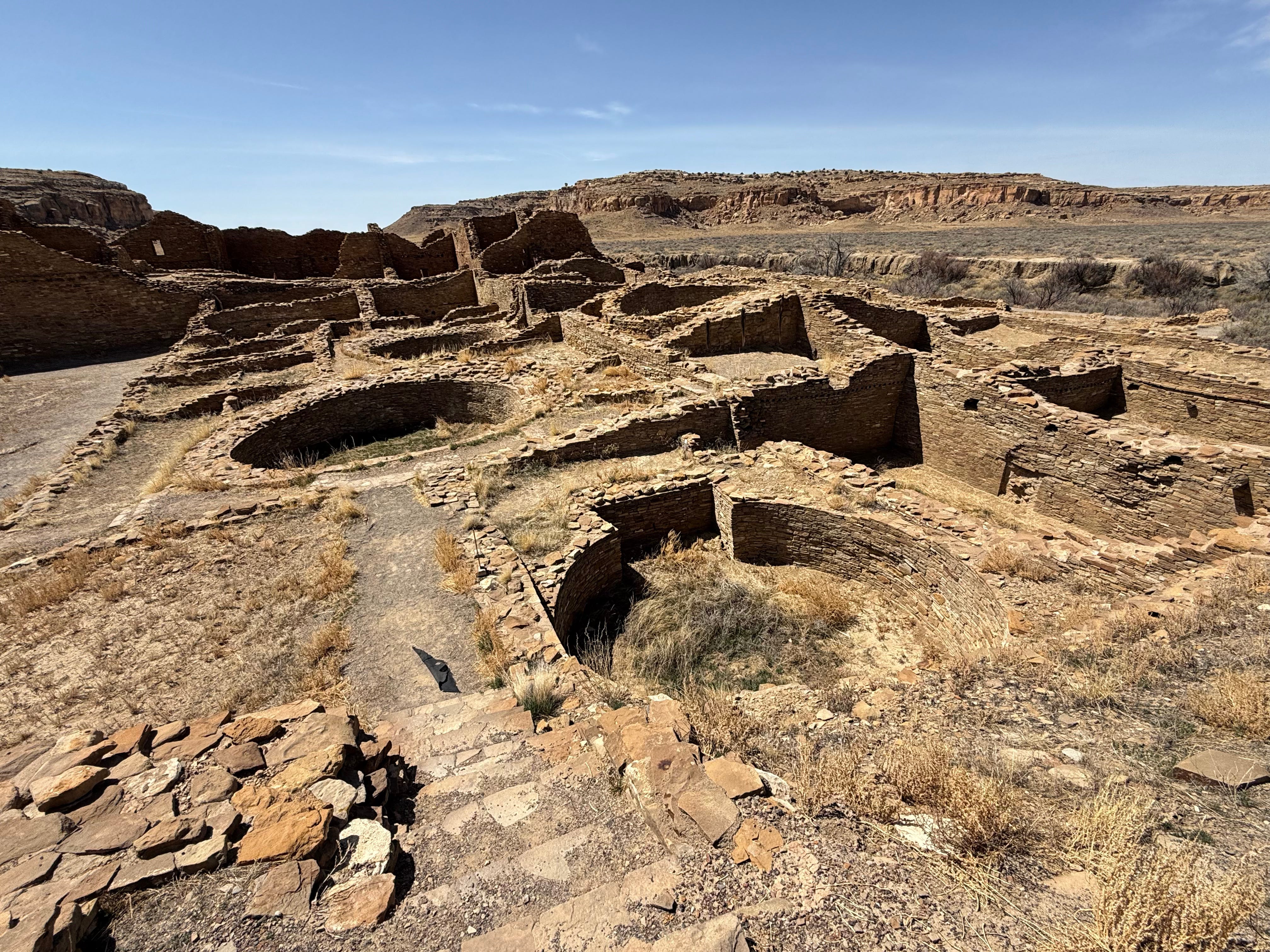
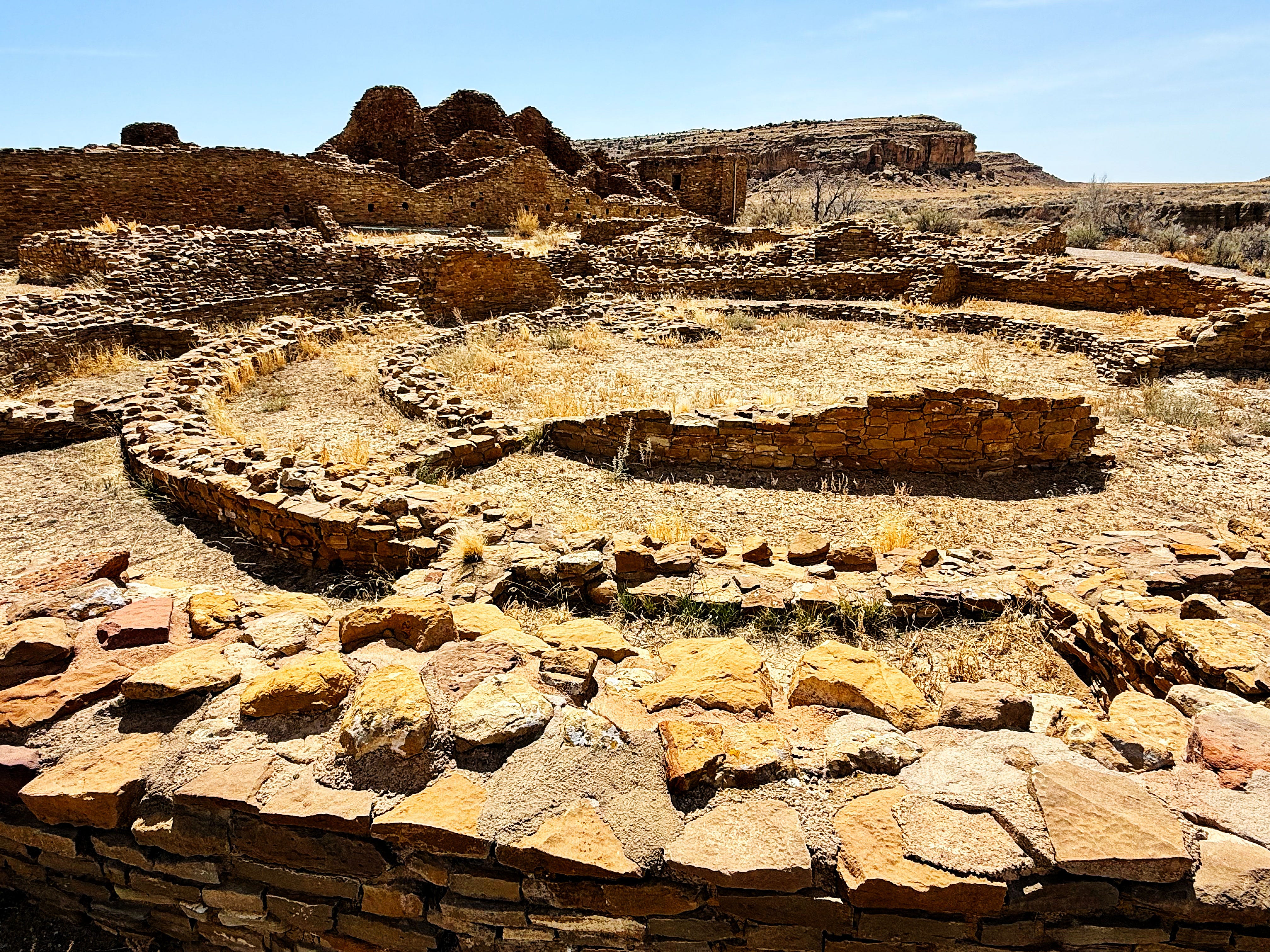
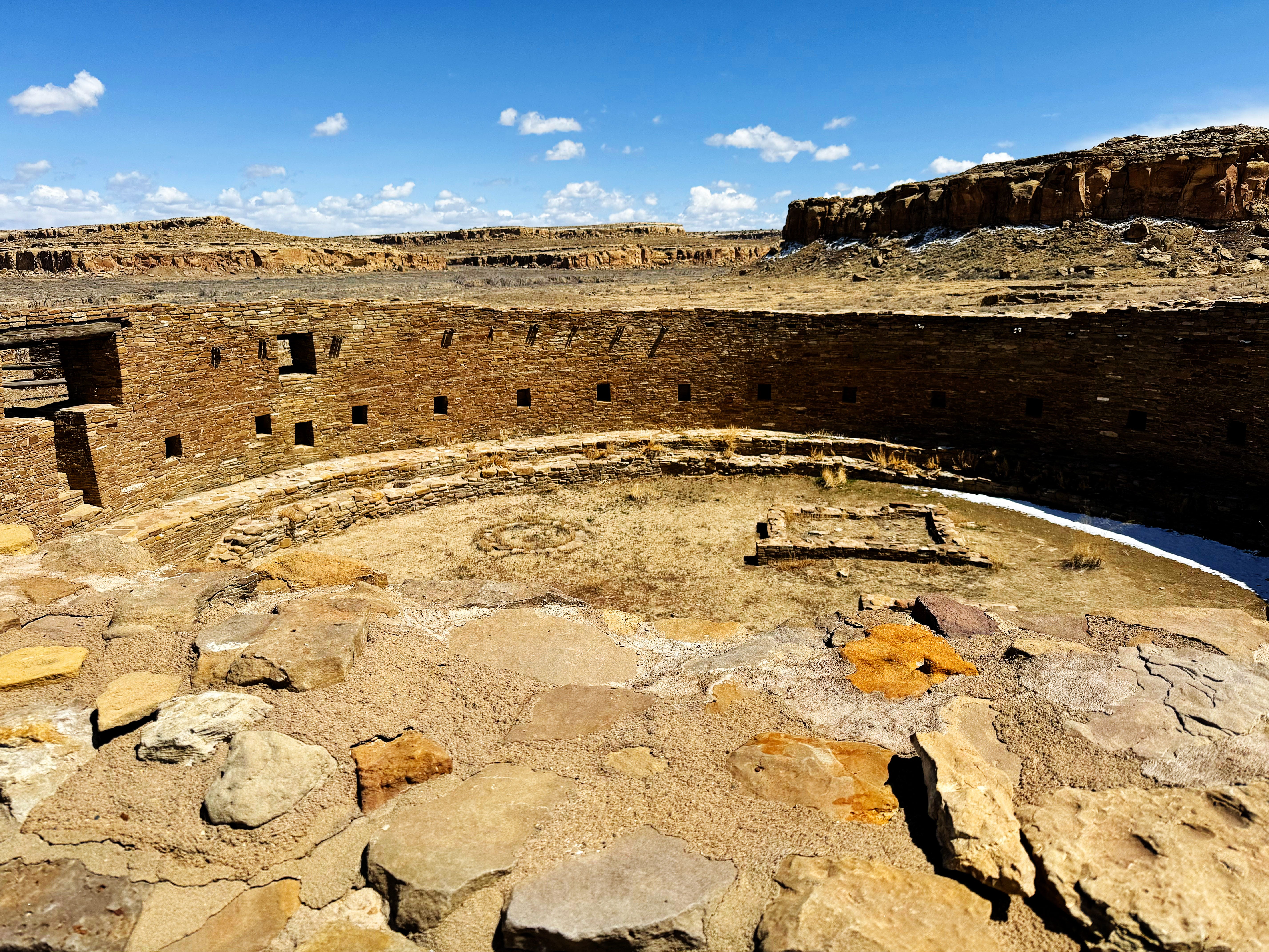
Sunday at Chaco: Pueblo Bonito
Pueblo Bonito is considered the most important cultural site at Chaco, and we could see why! It is truly amazing. It was also the most thoroughly excavated.
Planned and constructed in stages between AD 850 to AD 1150 by ancestral Puebloan peoples, this was the center of the Chacoan world. That world eventually covered a vast area of the present-day Southwest, including the San Juan Basin of New Mexico, and portions of Colorado, Utah, and Arizona. For over 300 years, Chacoan Culture united many diverse peoples within its sphere of influence.
My photos don’t do it justice — it’s hard to capture the size and scope of the complex — the trail through it is .6 mile to give you an idea — and how it fits with the landscape.
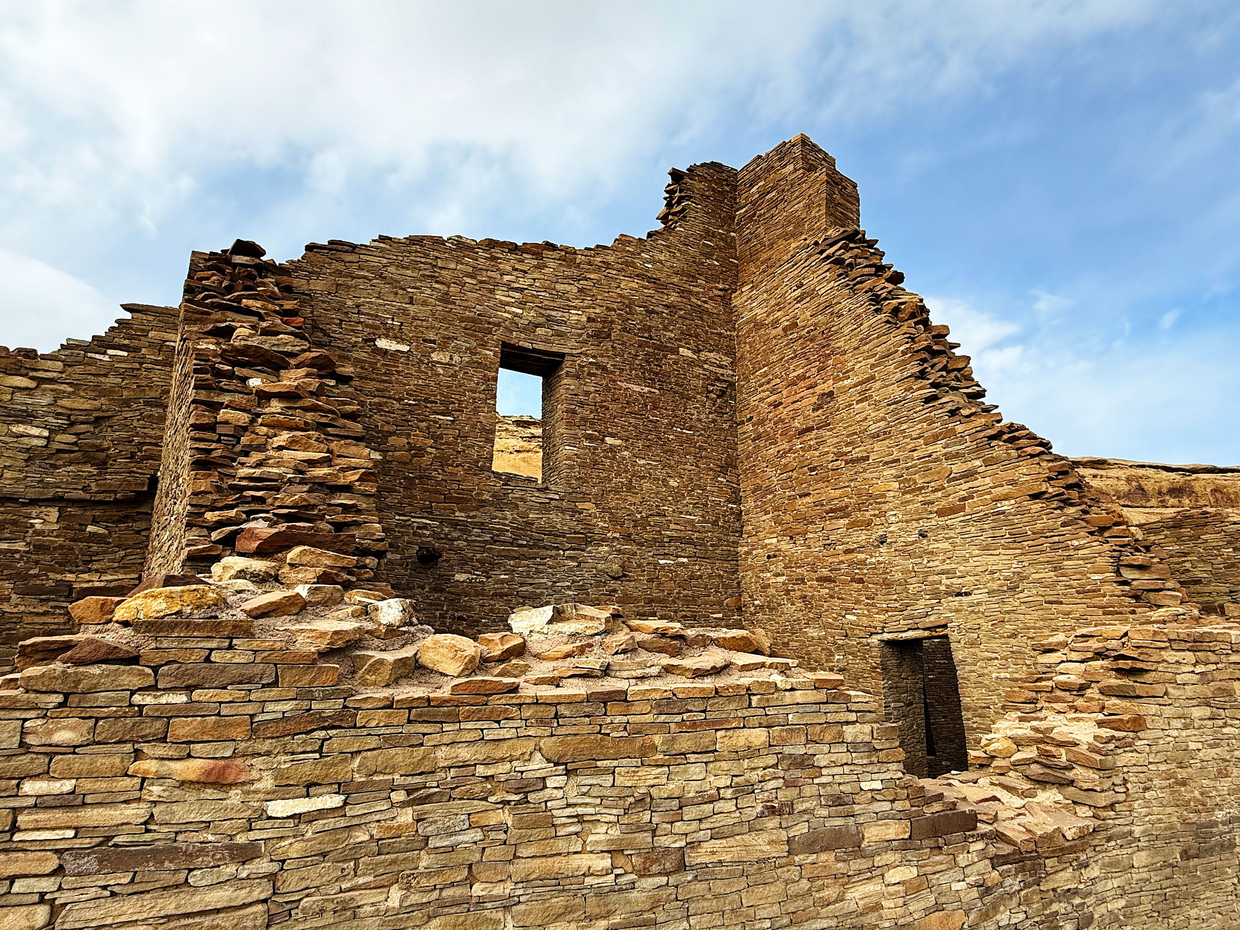
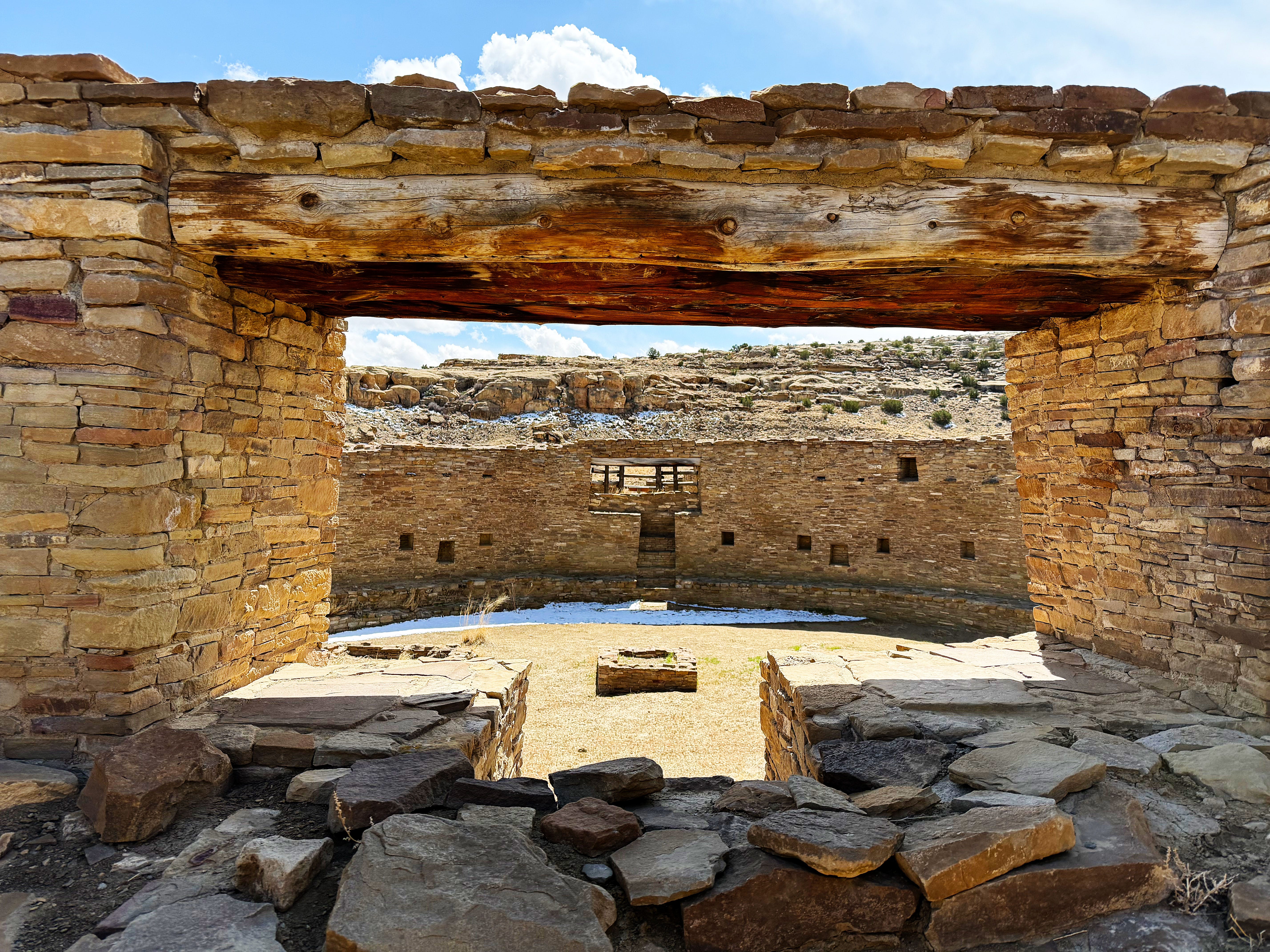
Pueblo Bonito has been “shored up” and you’re allowed to walk through some of the rooms:
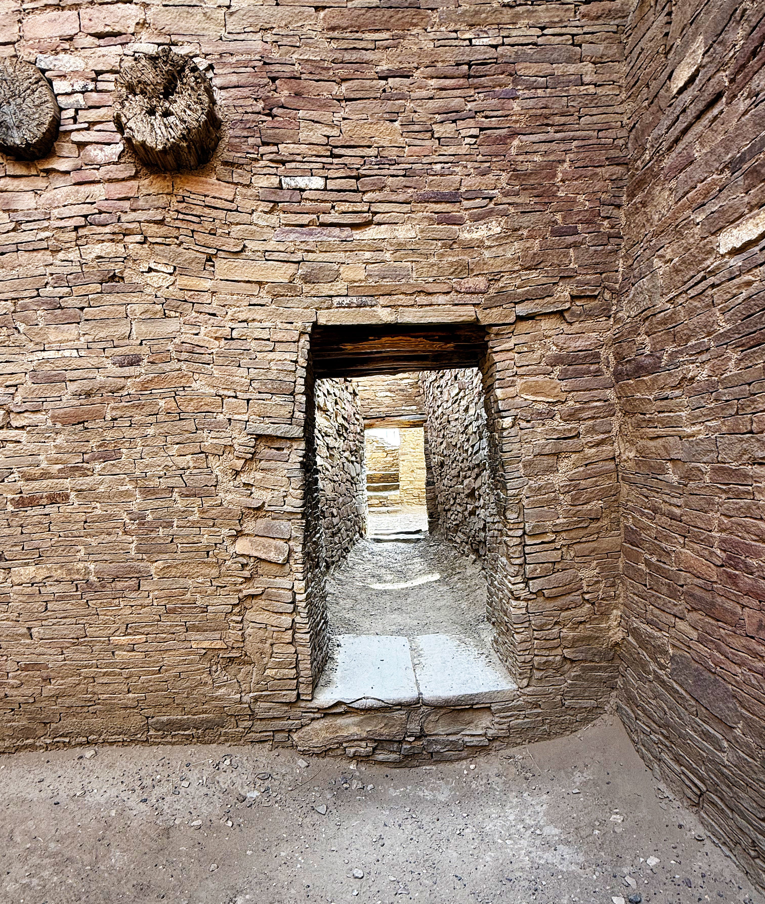
We had to duck to get through a few of them — Jason especially since he’s over 6 feet tall.
What a view.
That wooden beam was carried across the desert from up in the mountains — 50-60 miles away! Note the scorch marks.
Then we took the petroglyph trail from Pueblo Bonito over to Chetro Ketl.
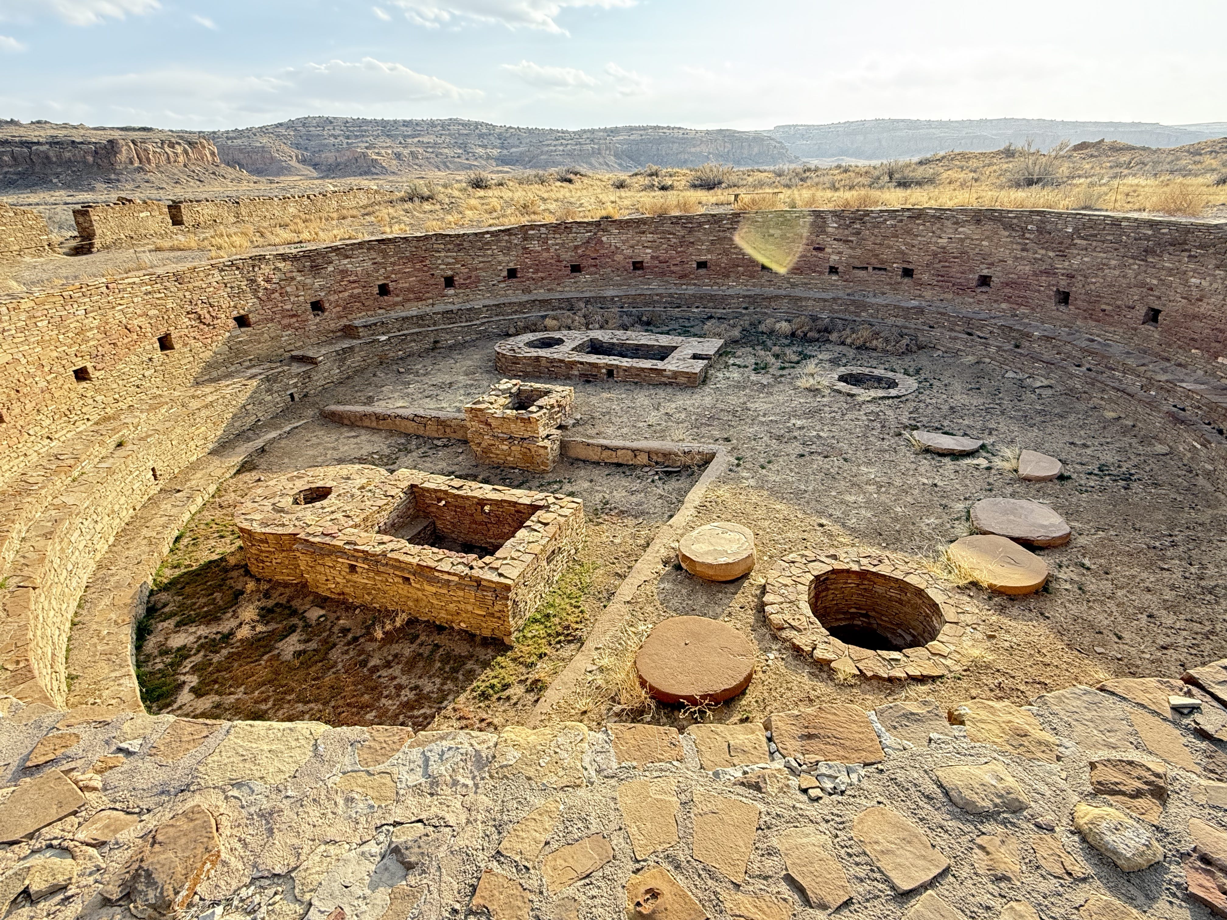
Sunday at Chaco: Chetro Ketl
Chetro Ketl is the second largest Chacoan great house, covering over 3 acres.
One of the interesting features is an elevated kiva:
And a Great Kiva — a kiva that is over 40 feet across:
At this point we’d hiked over 8 miles including the hike at Ah-Shi-Sle-Pah Wilderness earlier that morning, so we decided to call it a day and headed for the campground.
What an awesome day!
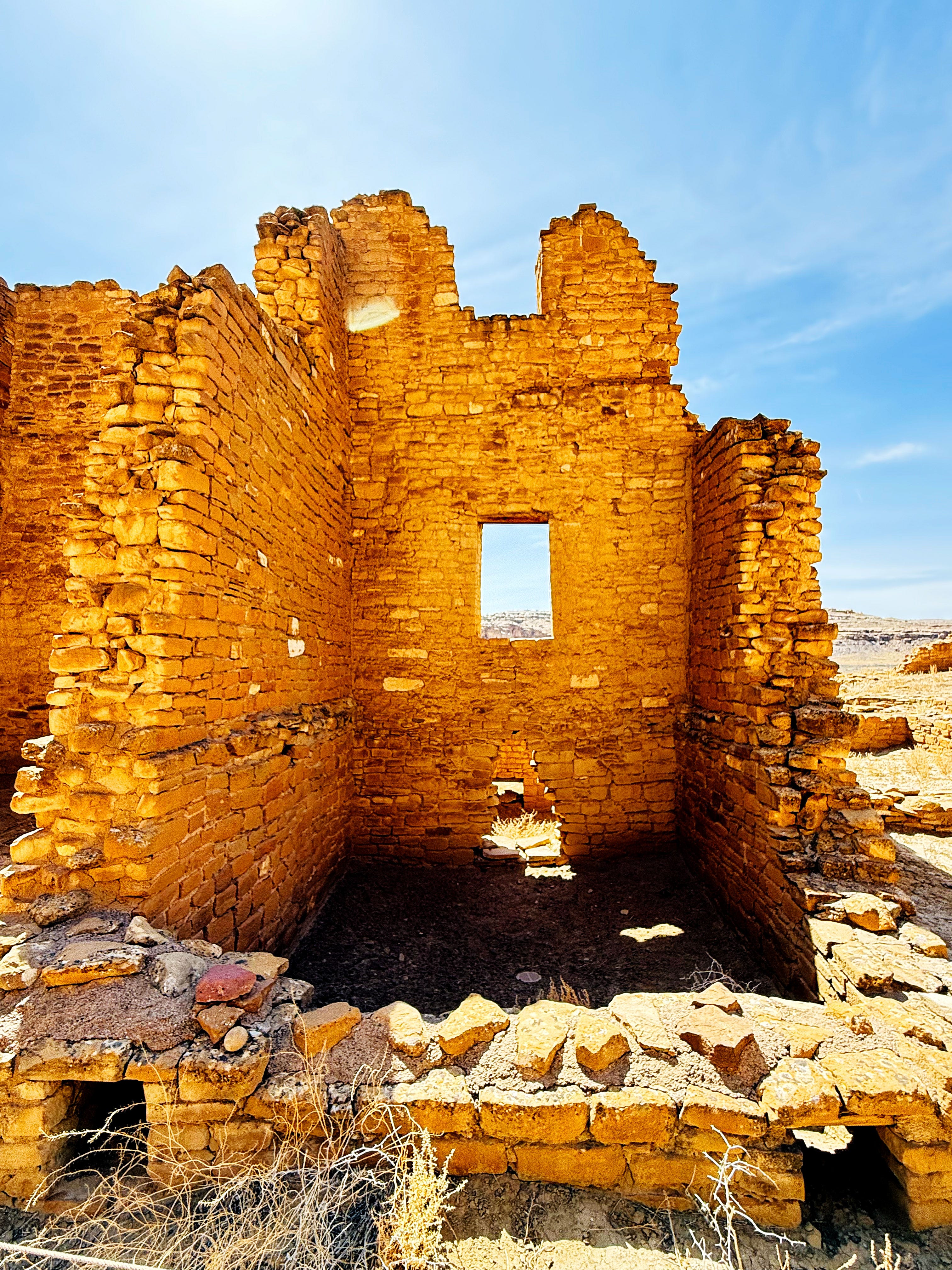
Monday at Chaco: Pueblo del Arroyo
Pueblo del Arroyo was planned and constructed in two short stages from about AD 1025 to AD 1125. As a reminder, the Ancestral Puebloan builders didn’t have metal tools — I kept having to let that sink in.
It has a triple-walled kiva:
After walking around the rest of the pueblo we left the van in the parking lot and headed for the Peñasco Blanco trailhead.
Monday at Chaco: Peñasco Blanco Trail
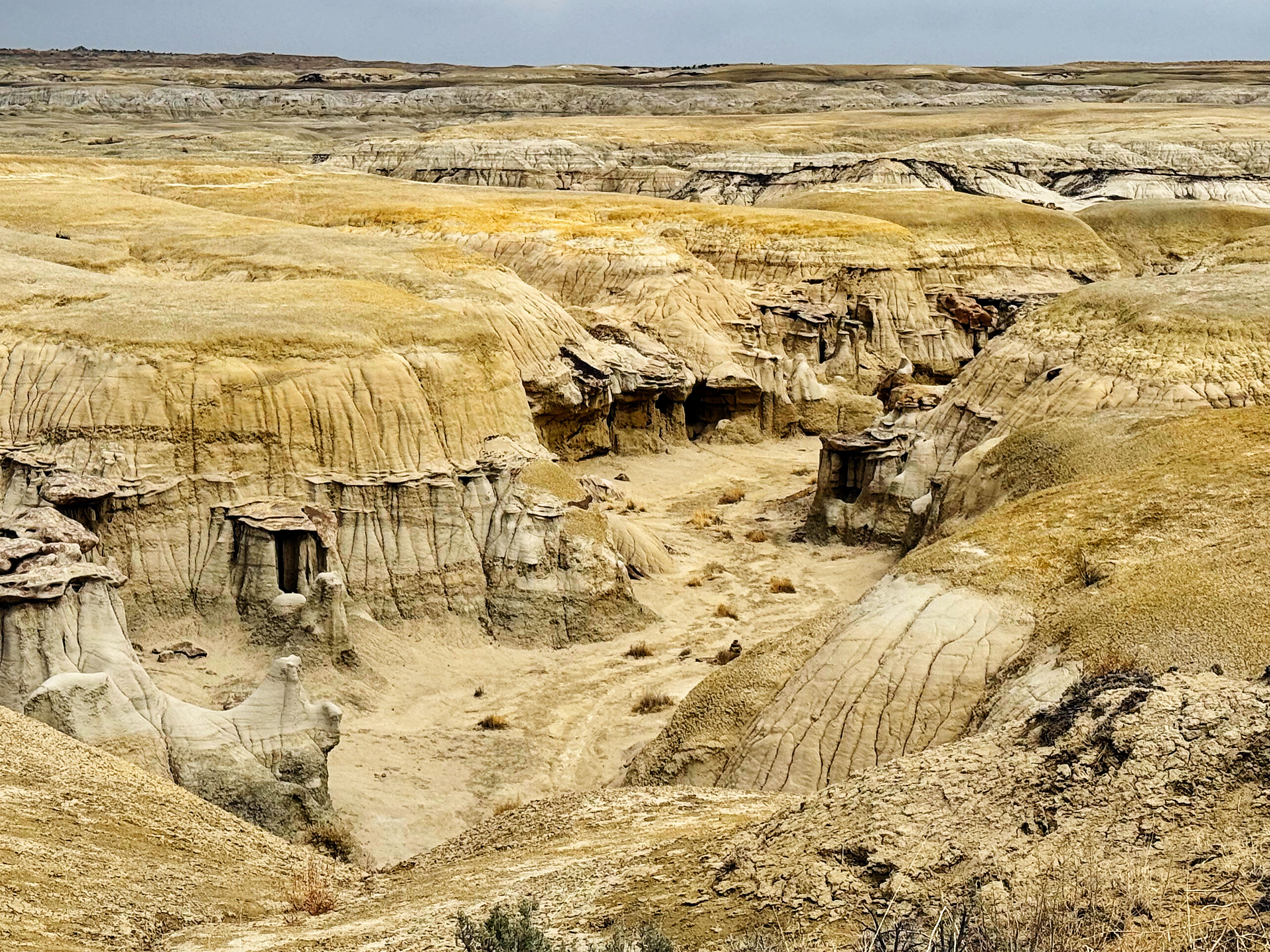
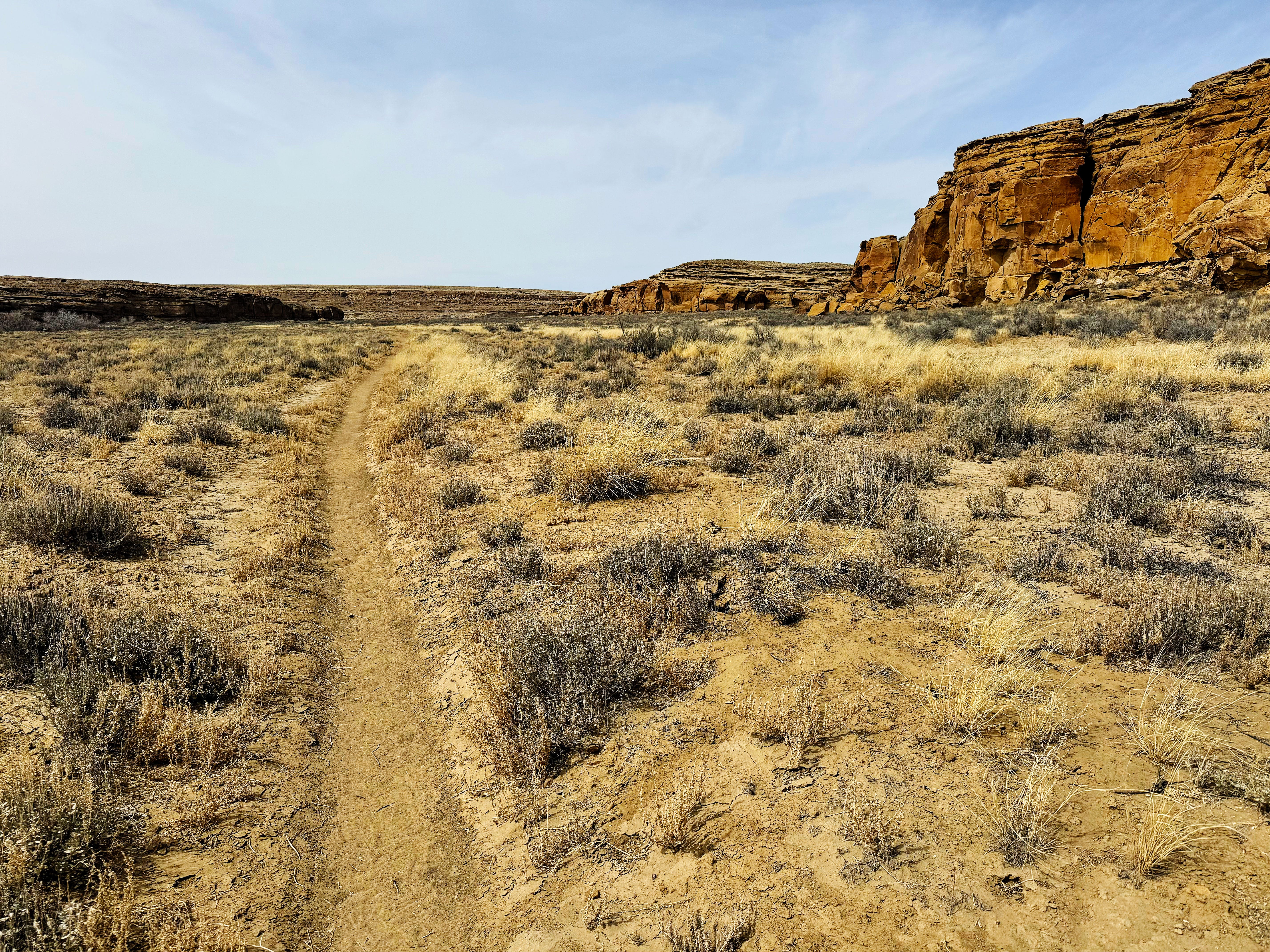
This is the longest trail in the park, with reports of milage varying from 7.5 to 8.2 miles — we recorded 8.2 miles — we think some of the info is from before they had to reroute the trail due to damage from flooding.
Peñasco Blanco Trail: Kin Kletso Pueblo
Near the start of the trail is Kin Kletso, which is Navajo for “yellow house”. Construction has been dated to A.D. 1125-1130 based on a strong cluster of tree-ring dates.
Peñasco Blanco Trail: Casa Chiquita
Soon afterwards we came to Casa Chiquita, a compact great house dating to the 1060s.
The views here were spectacular!
Peñasco Blanco Trail: Petroglyph Spur Trail
A spur trail leads to a series of petroglyphs and historical grafiti, where we couldn’t stop taking photos! Here are just a few favorites - click on an image to view it larger:


Around this time the wind started kicking up so we in turn kicked up our pace to get to the supernova pictograph!
Peñasco Blanco Trail: Supernova Pictograph
I was glad we ran into 2 fellow hikers before we got here who told us to look up to see the supernova or we might have missed it. (They were the only other people we saw the whole hike!)
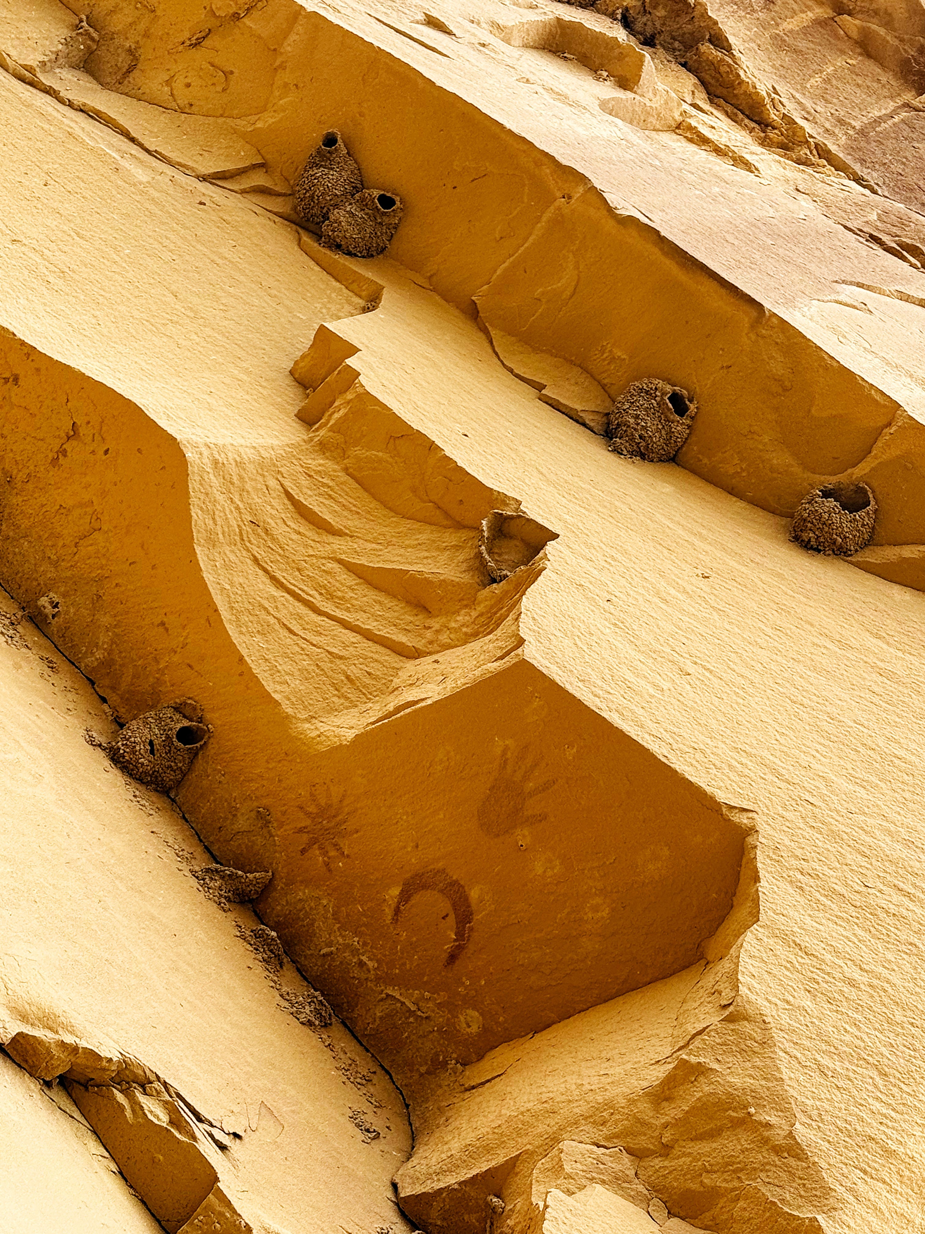
Here’s a closer look:
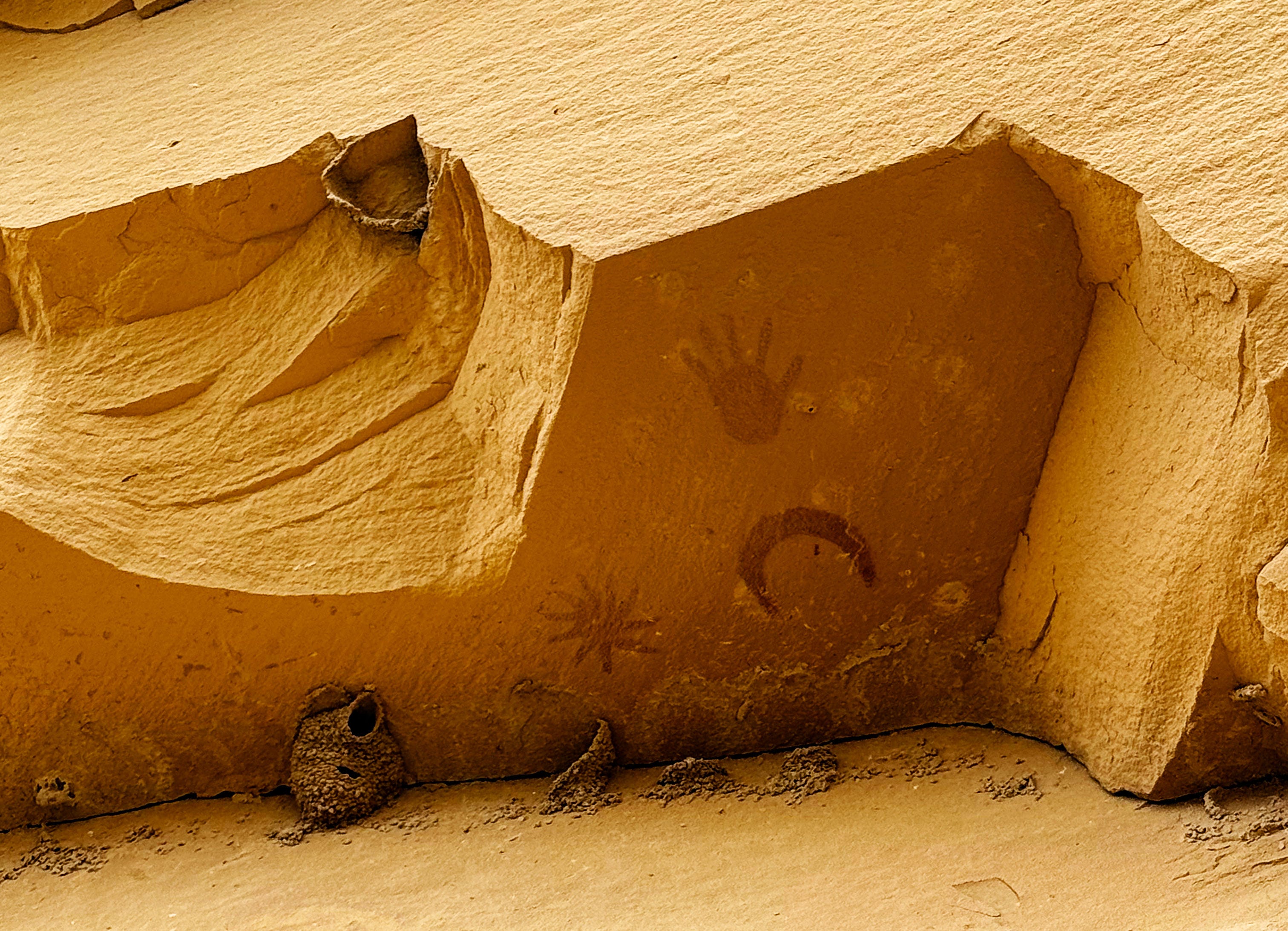
I was so impressed at how the artist was able to paint this with such crisp detail — and that it’s lasted for so long — the arid desert really helps preserve things. I wonder what was used to create the paint — maybe red earth from a sacred site?
From the Backcountry Trail guidebook:
These paintings are interpreted to represent a star, a crescent moon, and a human hand. In 1054, astronomers around the world recorded a supernova, the remains of which we call the Crab Nebula today. The supernova lit the night sky for about a month, and was even visible during the day for a while! Hopi oral traditions reveal that their ancestors saw this “blue star” and it directed a convergence of clans at Chaco.
Wow! Just wow. So amazing that this was painted almost a thousand years ago. I was in awe.
After we took a few moments to soak it in I did a quick sketch and then we headed on to Peñasco Blanco.
Peñasco Blanco Trail: Peñasco Blanco Pueblo
Peñasco Blanco means “white bluff” in Spanish and we can confirm it’s an accurate name. Peñasco Blanco, is an excavated great house, with a unique oval design and a sweeping view from West Mesa.
People have made “collection piles” of pottery sherds on rocks and pylons all around the pueblo (which they aren’t supposed to do):

I just had to take a moment to add a sketch to my nature journal.
It was about this time that the wind really started blowing — and it was a cold wind, too! So we didn’t stay long.
I turned around for one last glimpse of the pueblo — just look at that sky!

Then it was back down the way we came.
We started double timing it, with both of us taking turns in the lead to set the pace as the wind got stronger — and colder! I was glad we brought our jackets!
We only stopped a few times, once to see these petroglyphs again — 35 feet up on the canyon wall.
We made it back to the van at 6:15 pm and then warmed up back at camp.
What a great day!
Tuesday at Chaco: Much Needed Rest Day
There was a wind advisory in the forecast for Tuesday with high winds and dust storms, so we were already planning on a much needed rest day — but little did we know that there would also be snow!
This was our view out the window of the van in the campground — so cool!
It was the perfect day to make these Anasazi beans that I picked up in Dolores, Colorado — we both really liked them. There’s just something about heirloom beans that taste better, amiright?
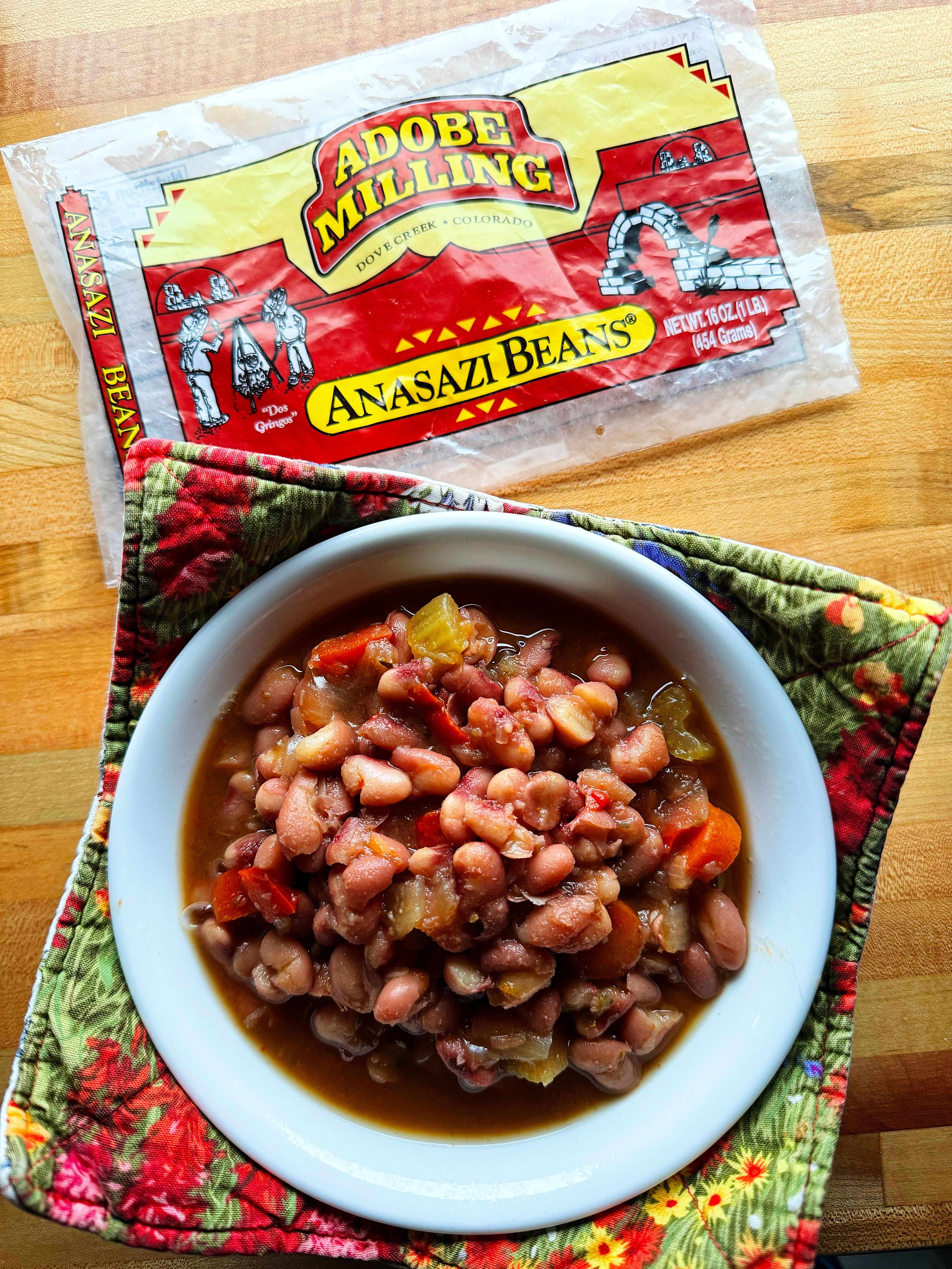
Note: Anasazi is an outdated term for Ancestral Puebloan — read more on that here.
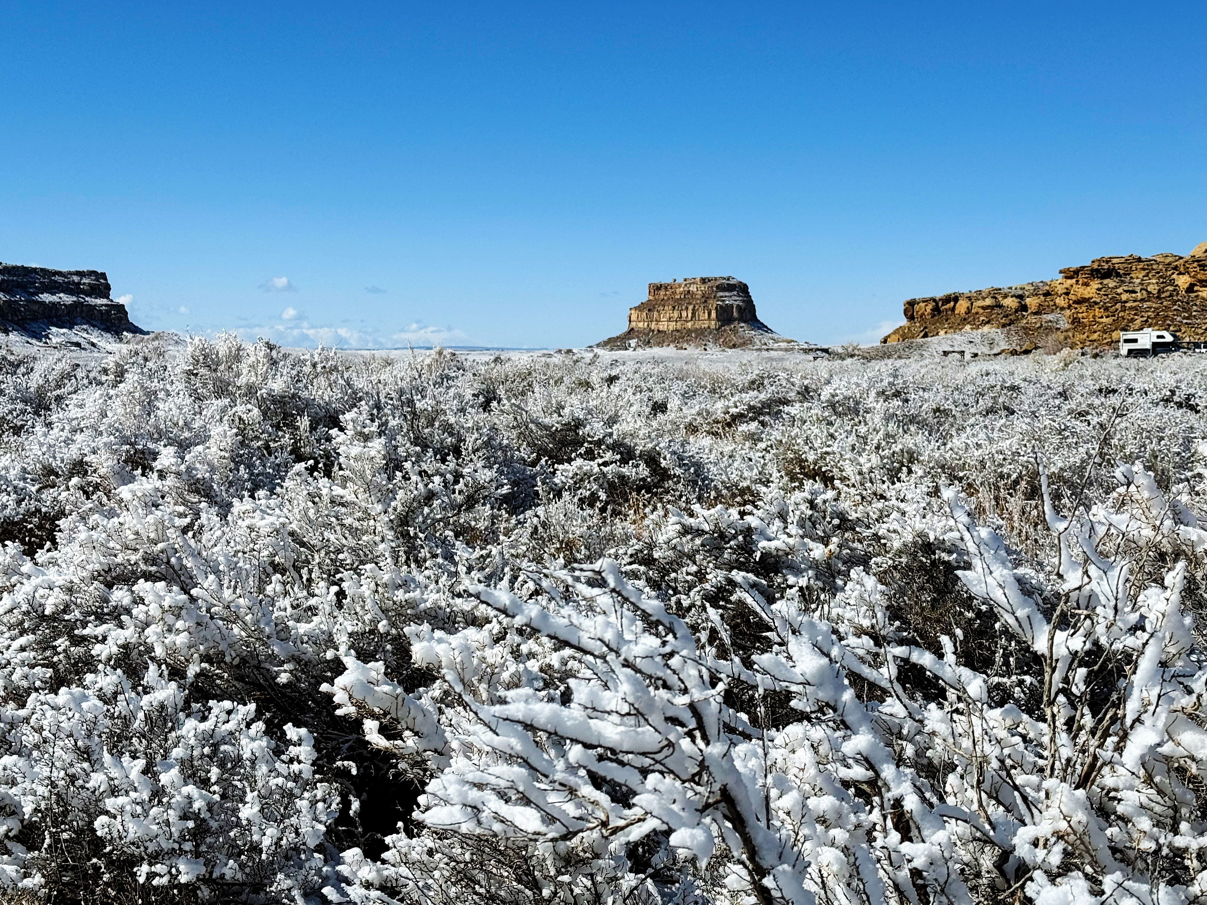
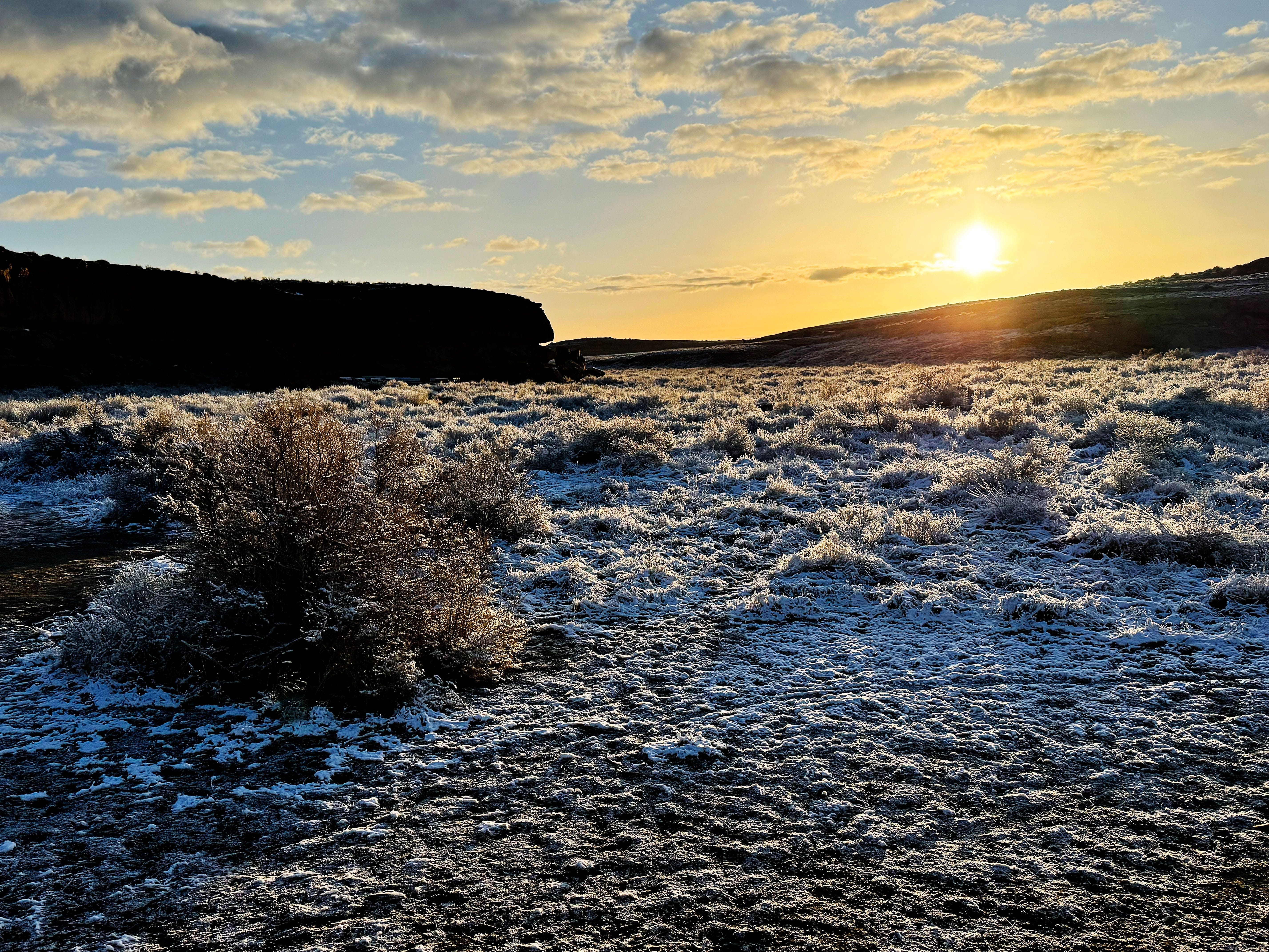
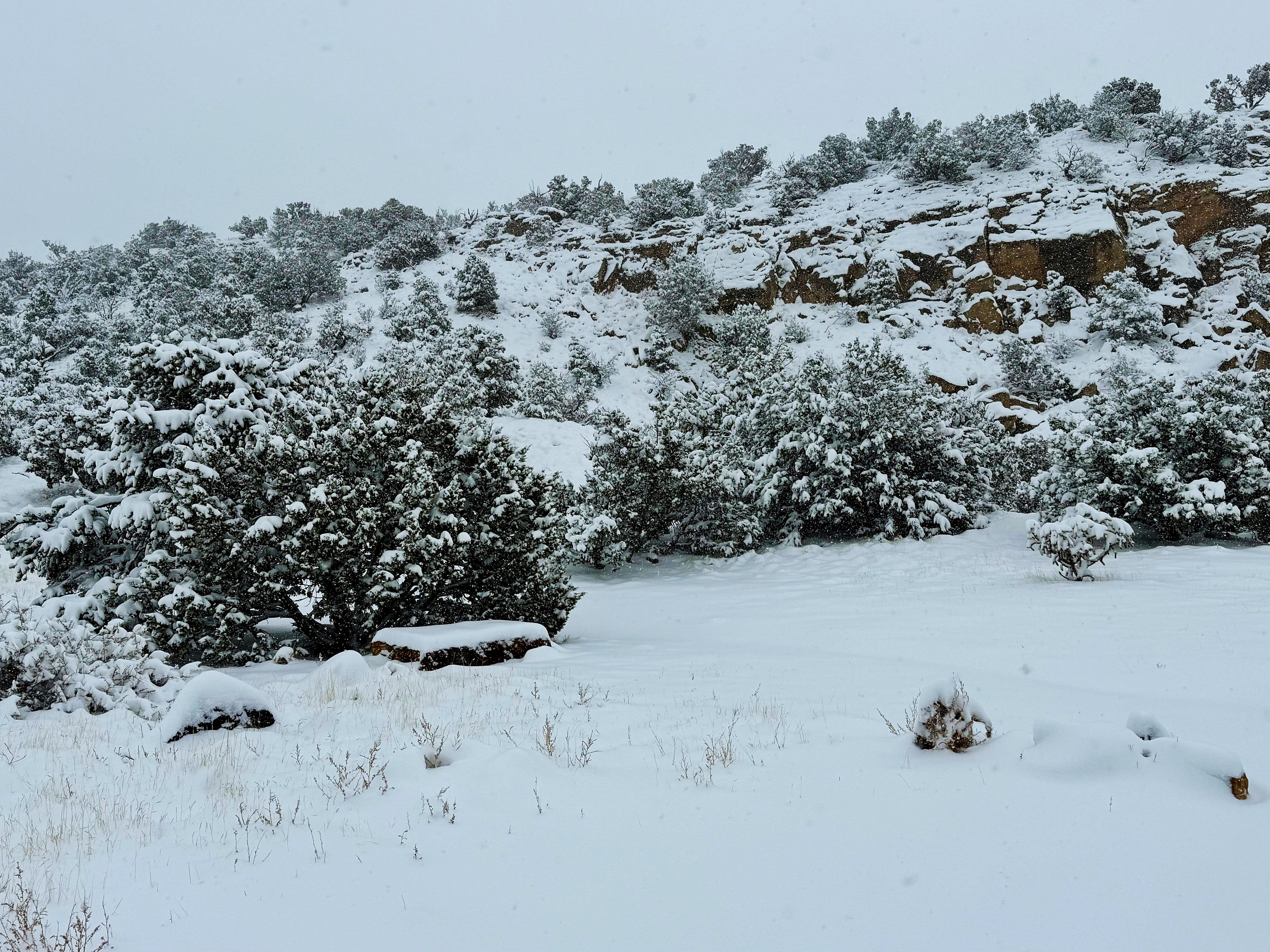
Wednesday at Chaco: SNOW and the South Mesa Trail
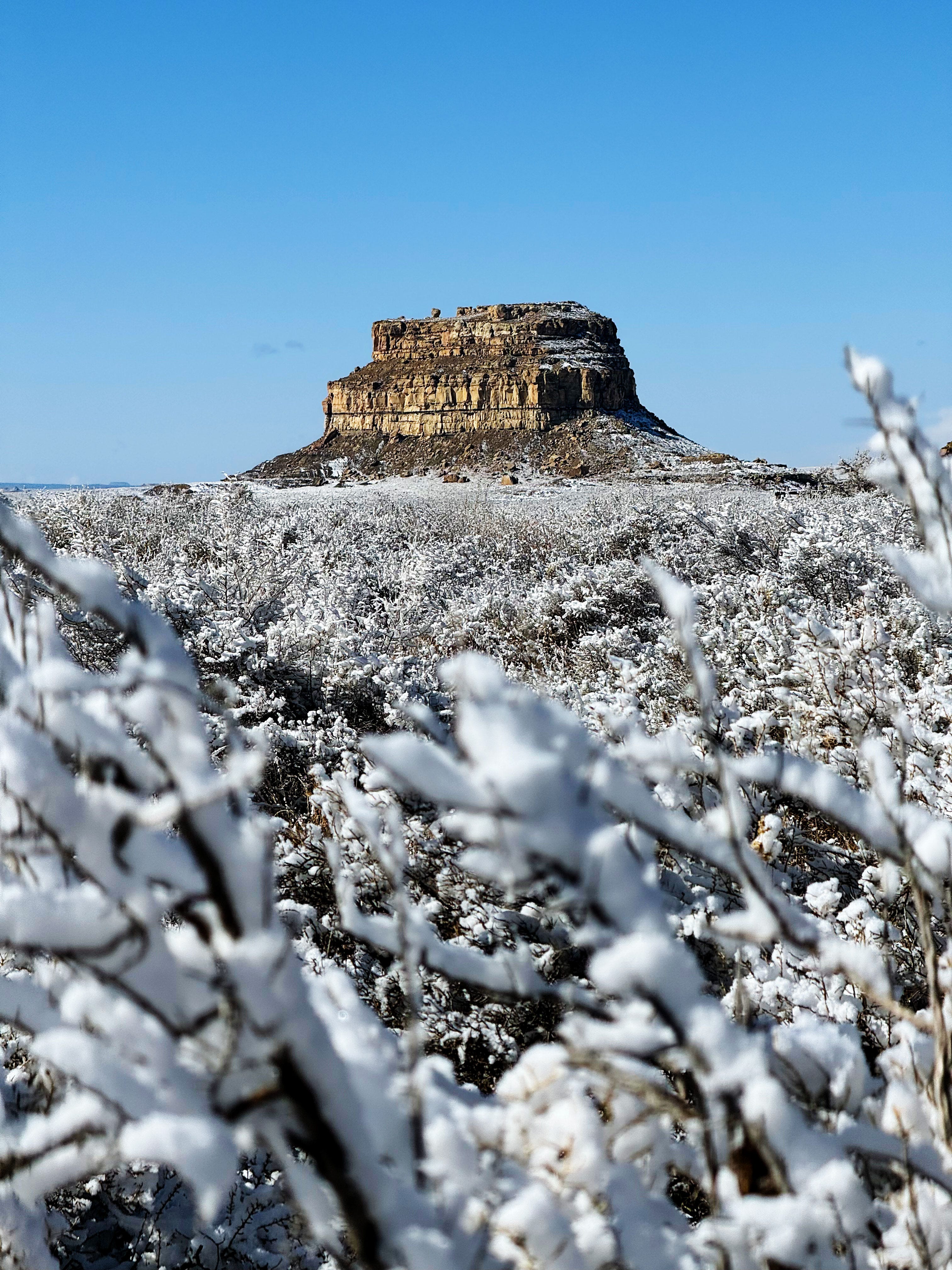
Wednesday we woke up to SNOW in the campground! It was so beautiful I couldn’t stop taking photos. Snow in Chaco Canyon is pretty rare, so I felt like a kid at Christmas!
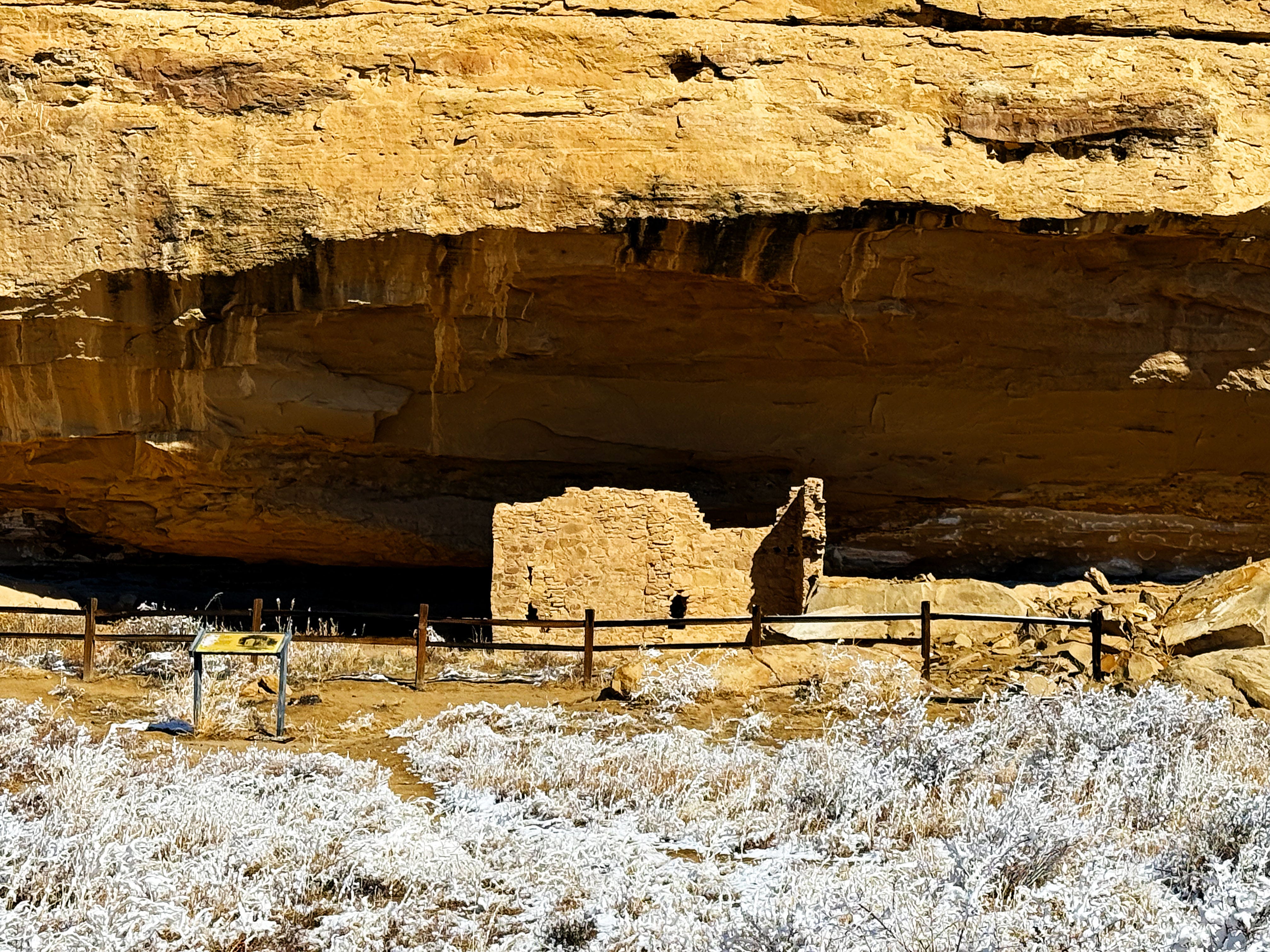
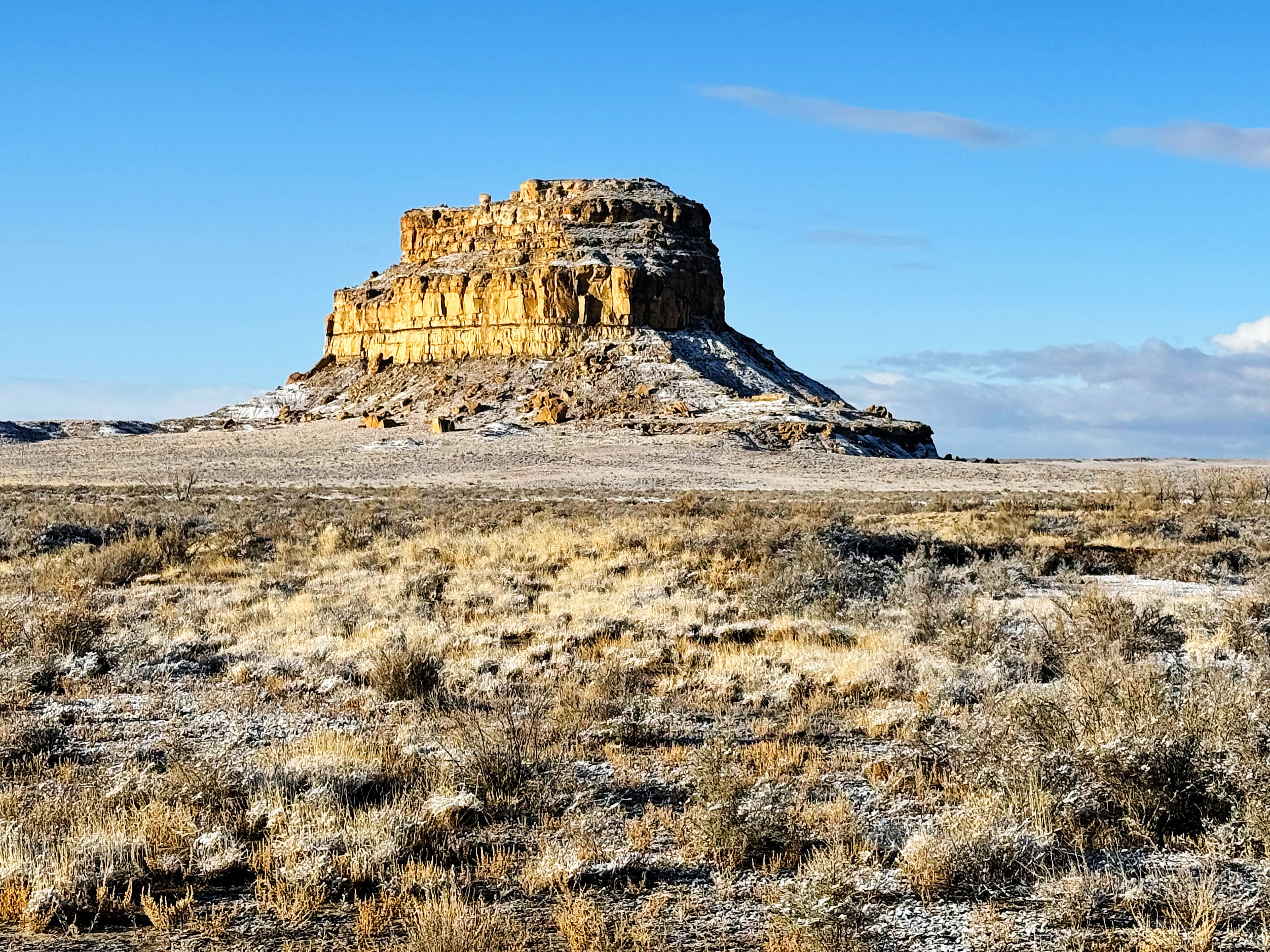
Here’s Fajada Butte in the snow — this is the butte with the famous Sun Dagger site that marks the solstice. (It’s closed to visitors.)
The Cliff House in the campground seemed to sparkle:
The snow melted quickly so I was really glad I got these shots.
Then it was on to…
Hiking the South Mesa Trail (and more snow!)
When we pulled into the parking lot I saw some critter ears sticking up out of the sagebrush and said to J: “HEY! What are those cows doing here?! I didn’t think grazing was allowed in the park!”
And then!
We discovered that they were cow — ELK!
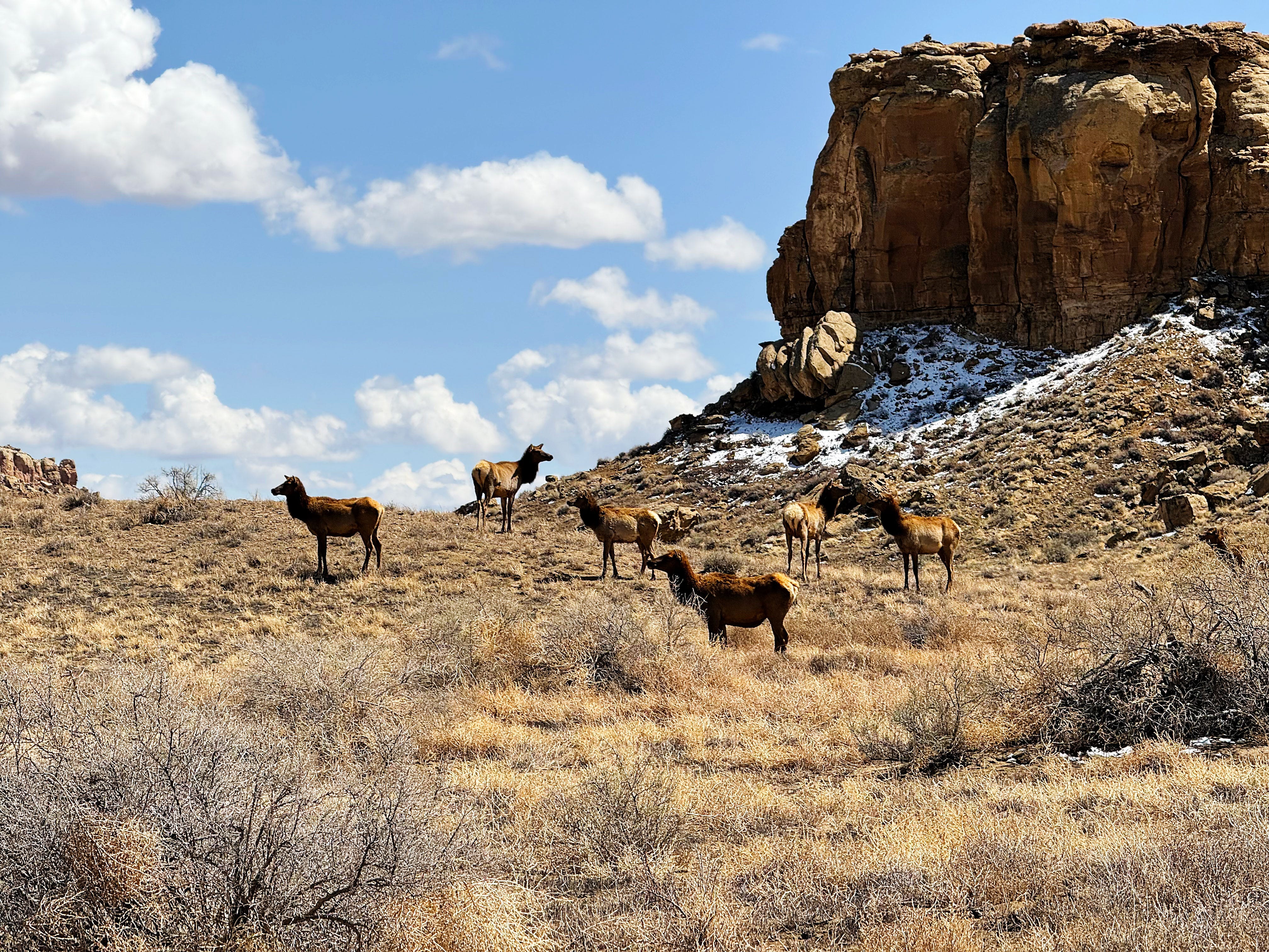
I couldn’t stop taking photos! (Noticing a theme here? :)
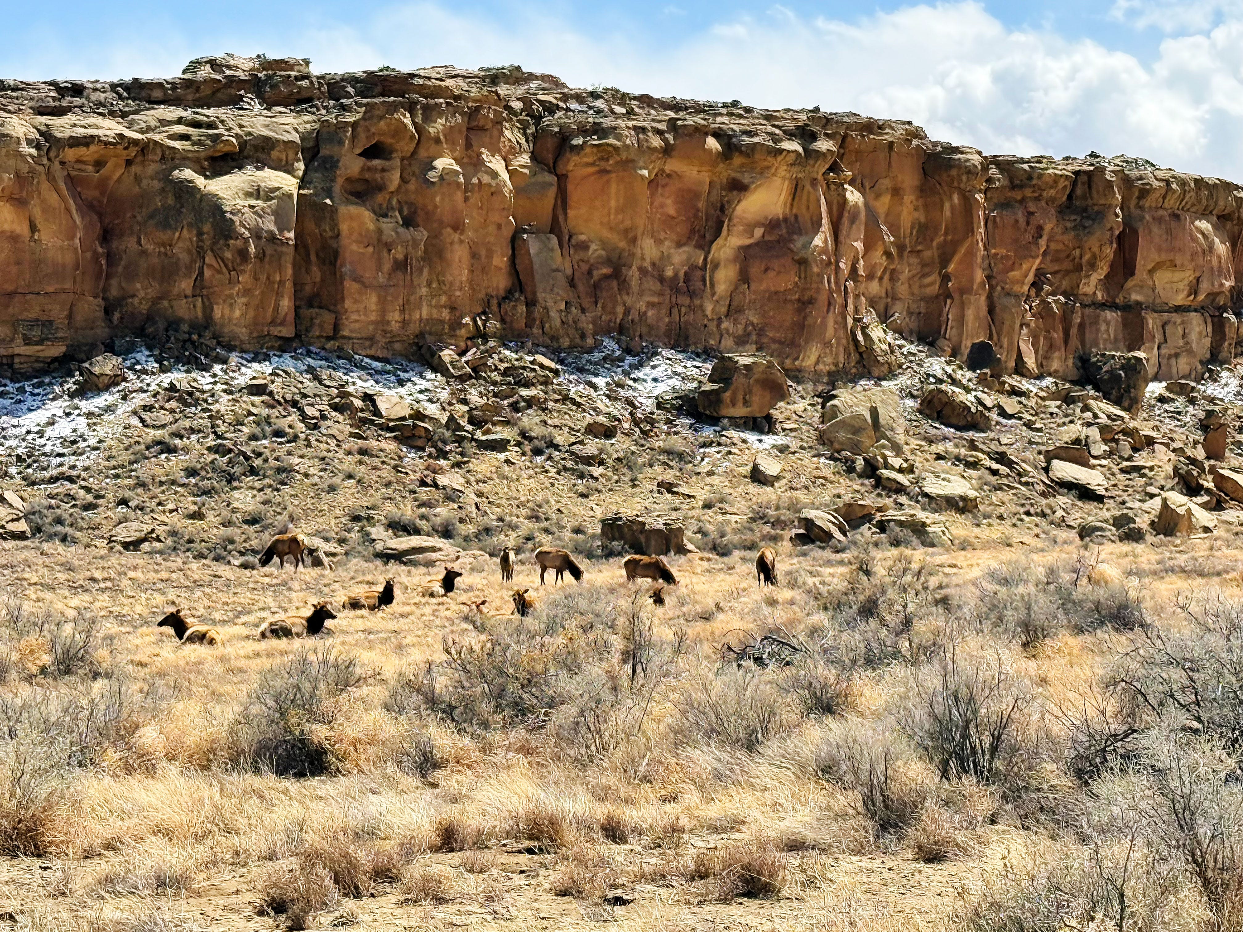
It was so cool seeing them — we hadn’t seen this many in a long while!

Then it was on to the mesa!
First we hiked up the hill to see the Great Kiva in the Casa Rinconada complex, which has the largest Great Kiva in the park. It’s hard to appreciate the scale of it!
As we continued hiking up the mesa, following one of the old Chacoan roads, the wind started kicking up.
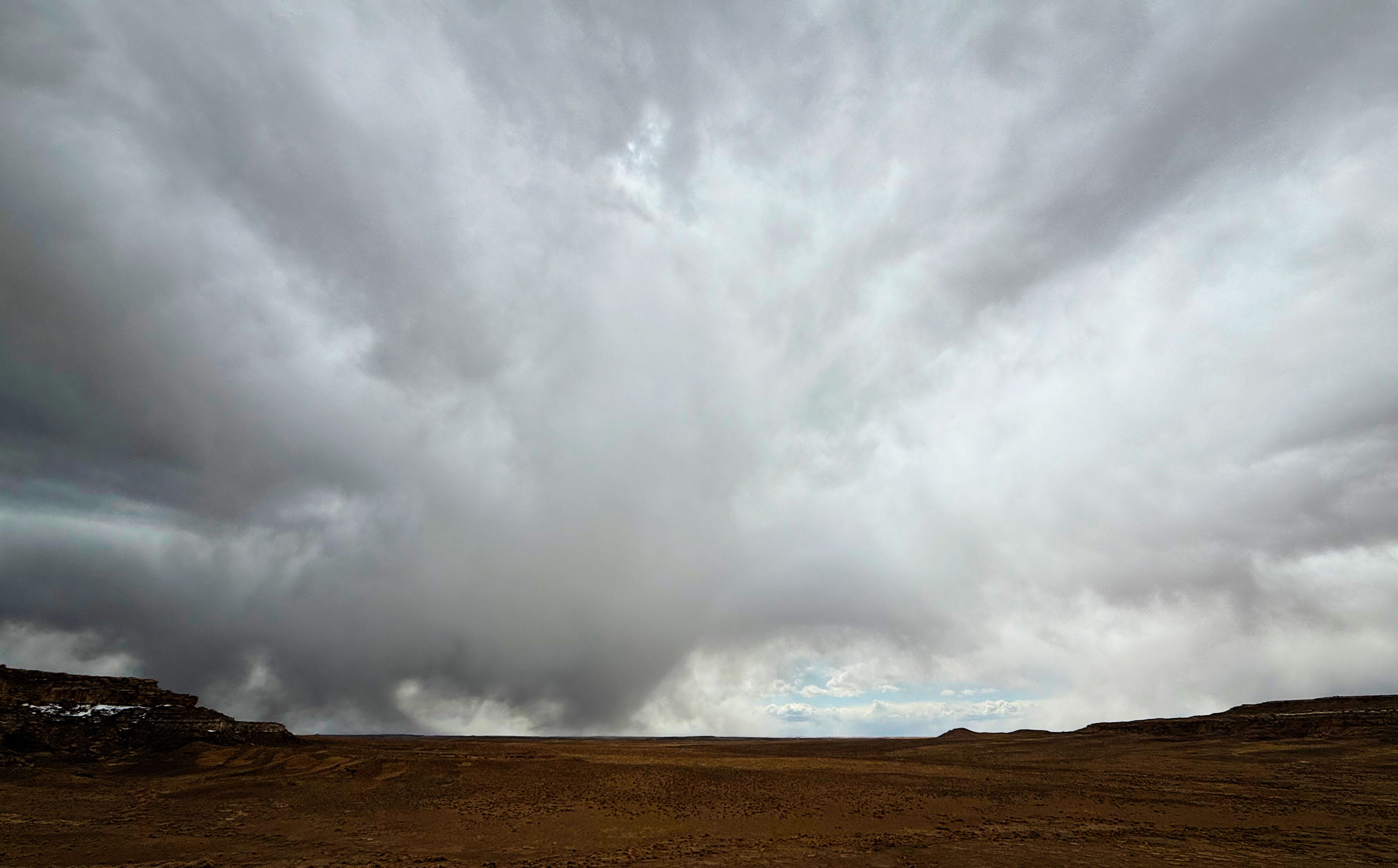
I didn’t like the look of some of those clouds…

And then it started snowing! Zoiks!
Snow was NOT in the forecast, but luckily we had our wind jackets with us, hats and gloves!
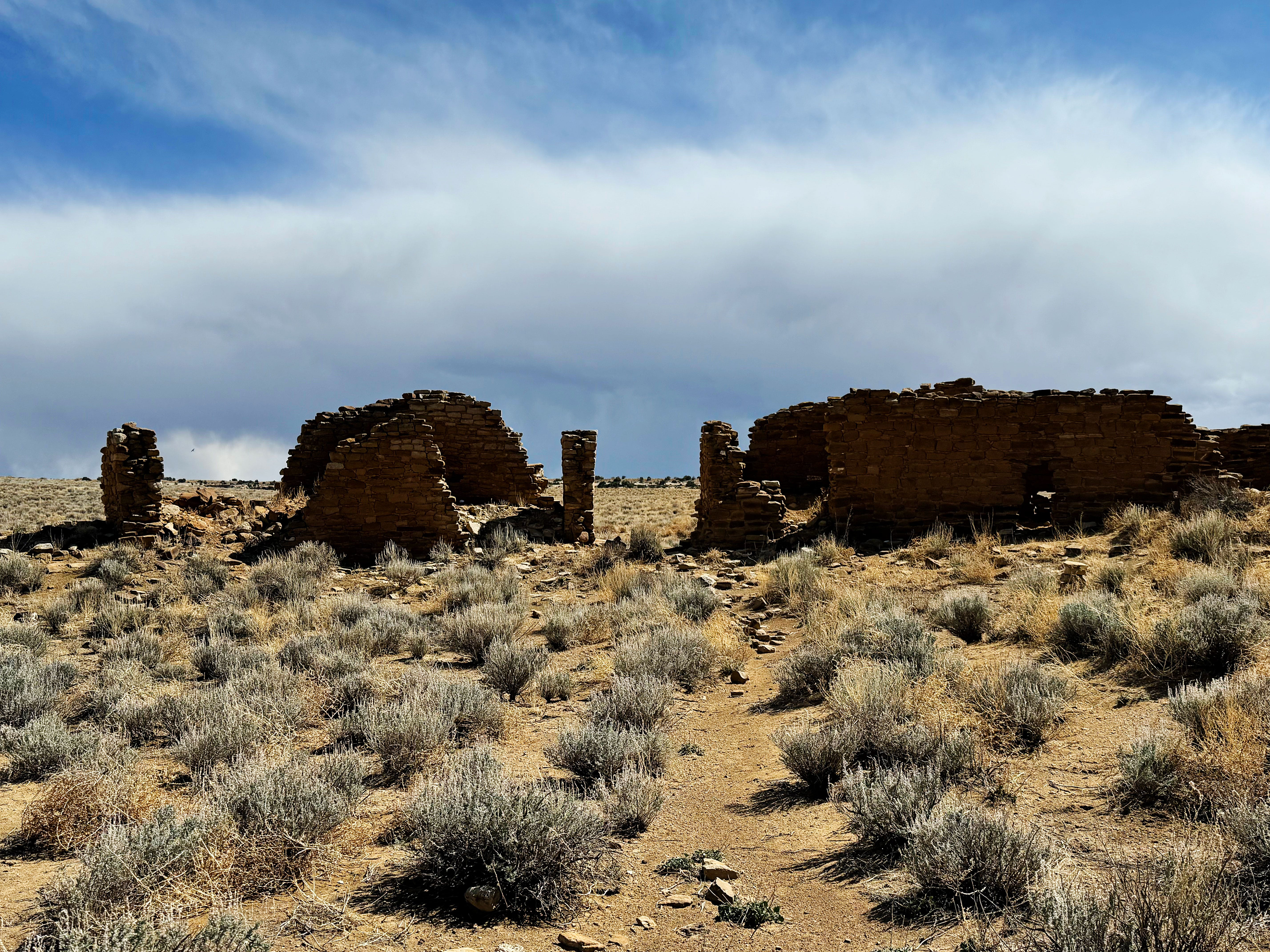
South Mesa Trail: Tsin Kletsin Pueblo
By the time we made it to Tsin Kletsin Pueblo the sun was out again — what crazy weather!
Tsin Kletsin is only about 2 miles from Pueblo Bonito as the raven flies.
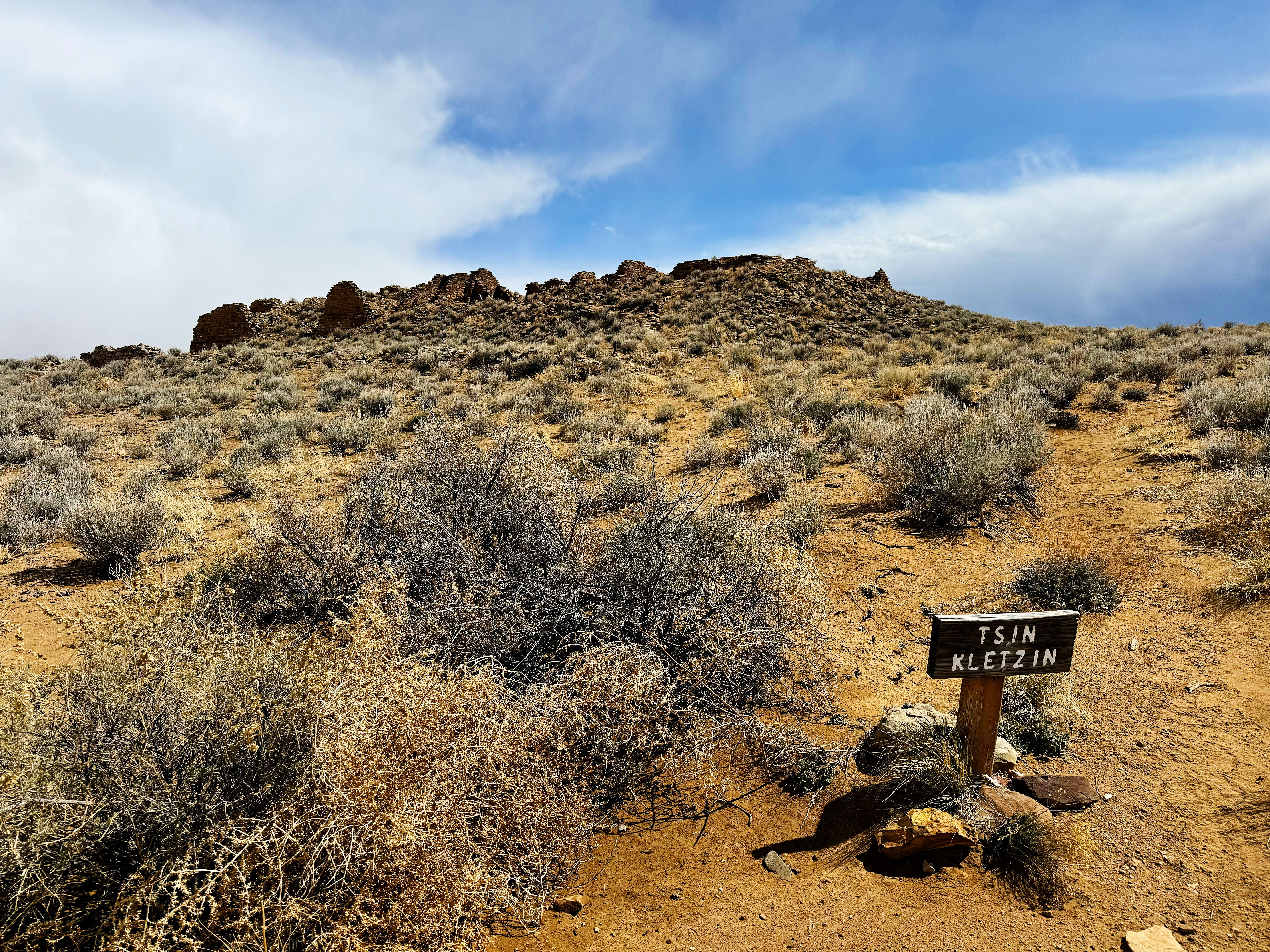
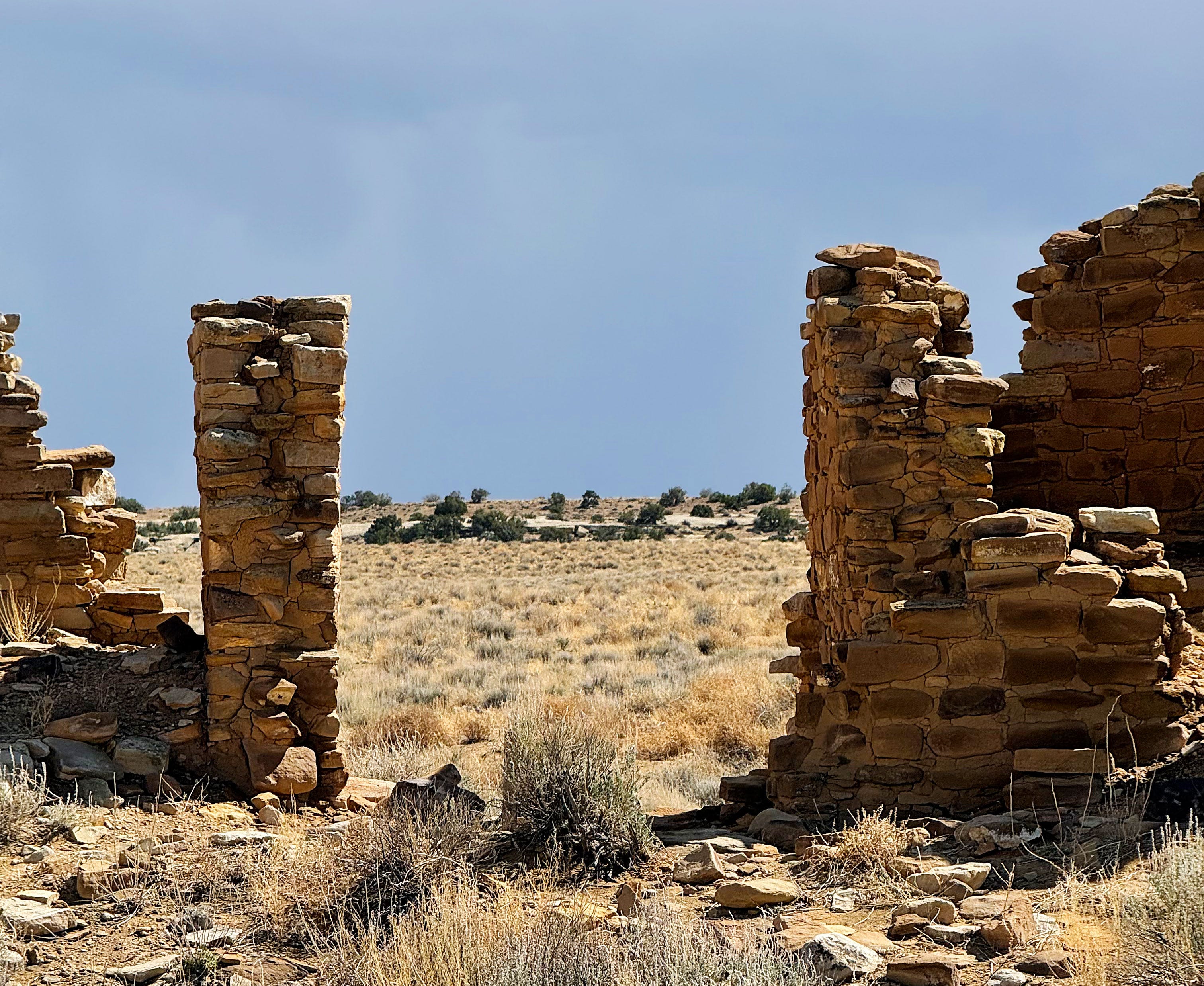
This turned out to be one of the most beautiful pueblos that we explored.
Then we found a mano and metate, used for grinding corn:
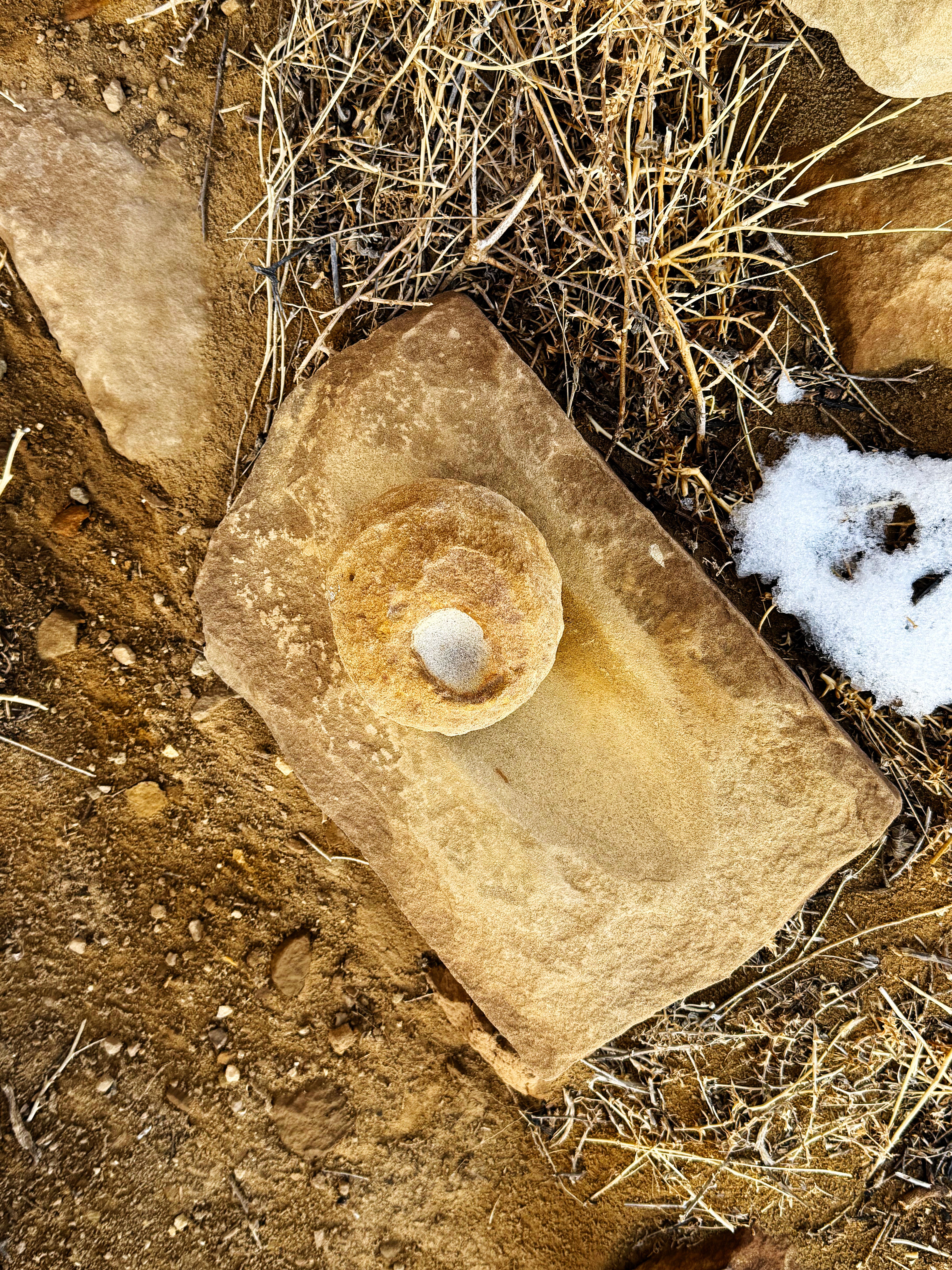
I picked up the mano (the grinding stone) and held it in my hand (mano means “hand” in Spanish), thought of other people using it, then carefully put it back. What an experience.
As we headed back down the mesa I turned back for one last look and noticed that another snow cloud had rolled in. What a dramatic sky!
Continuing on, we came to this stunning view of the Great Kiva at Casa Rinconada, with Pueblo Bonito across the road, and Pueblo Alto up on the mesa across the canyon.
What a great hike, for 6.5 miles total on the day.
When we got back to camp some more dramatic clouds rolled in…

I was sure it was going to snow again!
Thursday at Chaco: Farewell (For Now)
And I was right! We woke up to…
…more SNOW!
Wow!
Rain was in the forecast for Friday and Saturday, which could make the roads out of Chaco totally impassable, so we sadly headed down the road around 8:00 am.
We had to stop and to see Fajada Butte one last time:
Observations and notes from our time at Chaco Canyon:
Pueblo Bonito was truly amazing in scale and architecture, but it was also the most crowded. We saw so many people here not visiting with respect and it got me so mad: there were people were sitting on walls taking photos (older people who should know better, not teenagers!), one person had a drone, and several people had dogs in the archeological sites. All of these are prohibited in the park. Jason yelled “Drones aren’t allowed!!” and shook his fist at the drone and that person took it down, finally. I didn’t say anything to these people and kept moving, because when I have in the past at other places people just argued with me and I stayed mad for hours. But now I wish I would have. Any advice for me? Leave it in the comments below! Edited to add: I’ve asked several ranger friends what to do in cases like this, and they all said not to engage, and report the activity instead.
We both thought it was sad and wrong that all of the significant artifacts found during excavation of the pueblos has been carted off and put in far-away museums. The pueblos are like empty, looted husks. There are several empty display cases in the Visitor Center where they were going to have artifacts on loan starting in 2017, but since the HVAC system isn’t up to par it’s been put on hold. Here’s an article that explains it. I can only imagine what the present-day Native Americans whose ancestors lived here feel about this.
My favorite hikes were Peñasco Blanco and South Mesa. Some common threads between the two were that the pueblos weren’t excavated — and we hardly saw any other people. Hmmmm.
The collection piles at Peñasco Blanco were really neat to see on the one hand — but on the other hand I learned during my residency at CANM that we shouldn’t make piles of pottery sherds and other artifacts because it makes them too easy to steal, plus it makes it where the provenance and history of the piece is lost.

I came away from our visit even more amazed by the Chacoans and Ancestral Puebloans. I hope we get to come back someday and hike the rest of the backcountry trails.
Grants, New Mexico
By 10:30 we made it to the town of Grants, New Mexico to get gas and groceries and do laundry. Highly recommend Capri Laundromat — the owner there is super nice! Grants was on old Route 66 so they have some kitchzy touches in town — wish we had more time there.
Then it was on to…
El Malpais National Conservation Area
After a full day we arrived at the Joe Skeen Campground around 6:00 pm — what a day! We knew a storm was headed our way on Friday, and were super happy to get one of the last spots in the campground.

Late the next day the snowstorm started, and we woke up to this view outside the window:
I was super excited to see more snow — but J wasn’t — he said he’s “done with snow”! I happily texted pictures to family in Ohio, and Dad sent me back a text with this magnet I left on his fridge, ha! (Dad is in Jason’s camp :(
One last thing before I go…
My Artwork in a Traveling Art Exhibit
I’m honored and excited to share that some of my paintings from my time as artist-in-residence at Valles Caldera National Preserve will be part of a traveling art exhibit, including this painting that I did of the “Tres Amigos”:
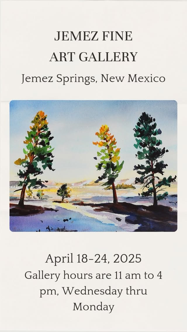
Featuring original artwork by regional creatives and National Park Service artists in residence, 𝑪𝒂𝒍𝒅𝒆𝒓𝒂 𝑹𝒆𝒗𝒆𝒓𝒊𝒆: 𝑨𝒓𝒕𝒊𝒔𝒕𝒊𝒄 𝑽𝒊𝒔𝒊𝒐𝒏𝒔 𝒇𝒓𝒐𝒎 𝒂 𝑽𝒐𝒍𝒄𝒂𝒏𝒊𝒄 𝑳𝒂𝒏𝒅𝒔𝒄𝒂𝒑𝒆 celebrates the universal connection between humans and the natural world.
This traveling art exhibit will be on display at Jemez Fine Art Gallery in Jemez Springs, New Mexico from April 18-24, 2025—just in time for #NationalParkWeek! Free entry; gallery hours are 11 am to 4 pm, Wednesday thru Monday (closed Tuesdays).
If all goes to plan, the exhibit will travel to Valles Caldera and then the Fuller Lodge in Manhattan Project National Historical Park in Los Alamos — yes, that Fuller Lodge that was in the movie Oppenheimer! I’ll post more details as they become available.
That’s a Wrap!
That’s it for this week, whew! We have to stop having so many great adVANtures so these posts aren’t so long!
I'm with you and tRuthful in approaching mindless visitors calmly. Have you thought about asking your ranger friends what they suggest? It's hard not to be confrontational, but the rangers may have some sound advice or tips about how to make the MVs aware and more mindful. Agree with Anita that not everyone will care, unfortunately.
Thank you, as always for sharing the beauty and awe that many of us will never see in person. Walk in beauty!!!
This was an amazing travel narrative. The photos were stunning and the history and experience you shared makes me want to go. I so appreciate you and J's awe at these amazing sites. Thank you for the respect you showed and saying something to the people. I have no advice because each situation is different but I do feel that to remain silent allows people to continue with their bad acts. We can't save everyone but we can try to help a few understand.