


Week 50: the one with the heat wave!
100+ degrees in Big Bend National Park! And a bonus gnat attack.

Hello, hello, and welcome back to another advanture update! This was our second week staying in the Chisos Basin Campground at Big Bend National Park, one one of my favorite places in the world. I wanted to max out our time here since the road to the campground (and the rest of the Basin) will be closed for two years for a renovation project. You can read more about that here in last week’s post.
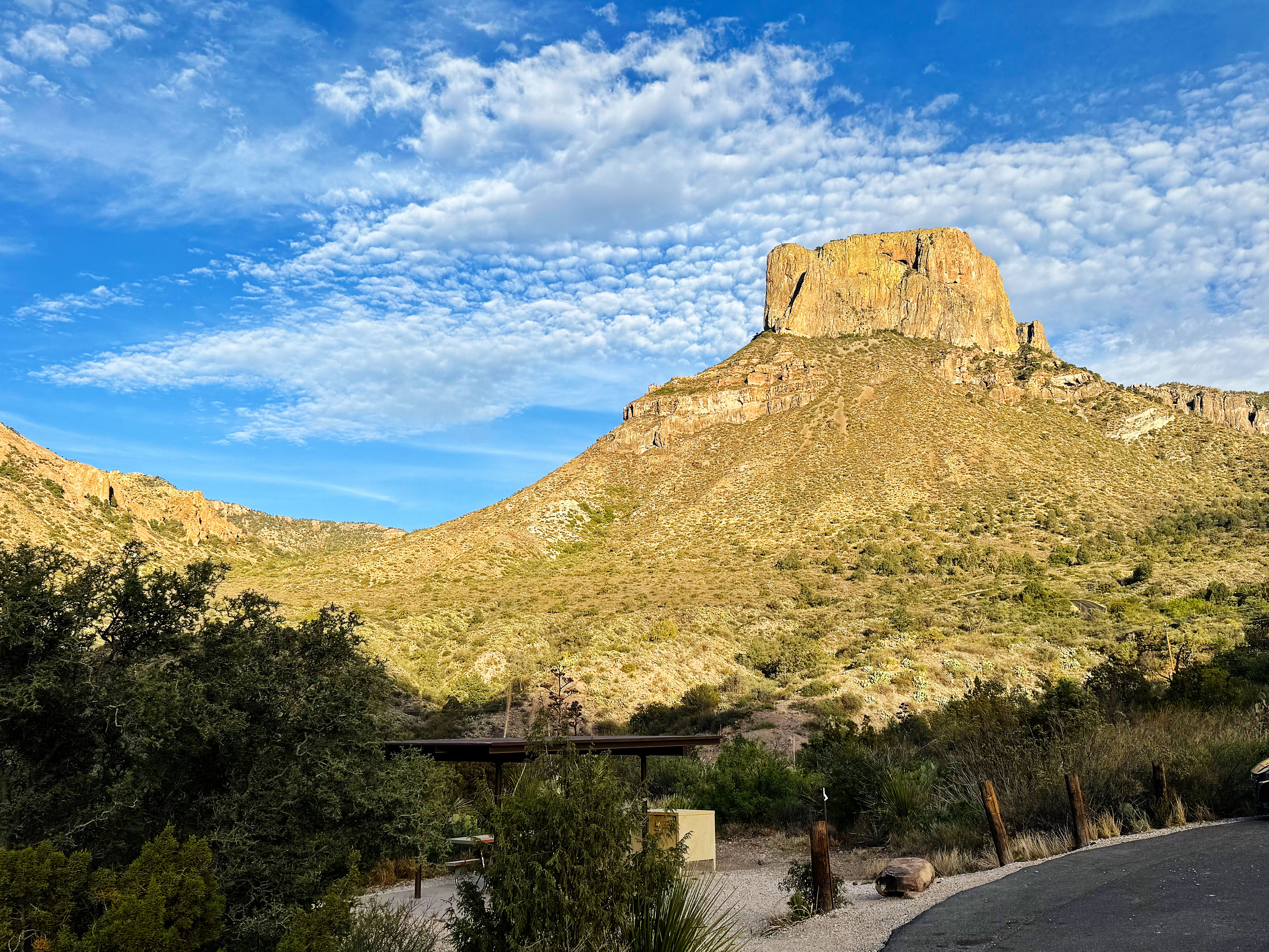
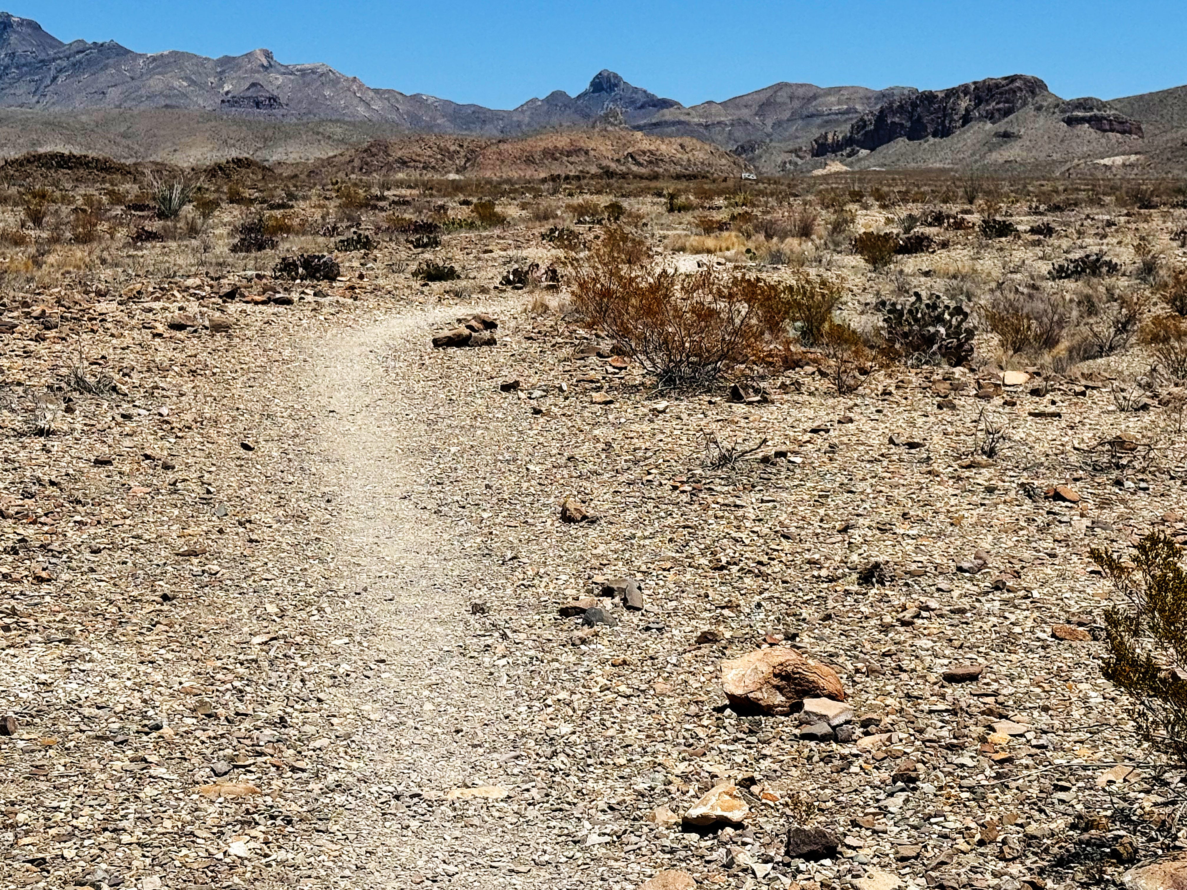
We checked the weather forecast and things were supposed to start getting HOT. So we figured we better get in a desert hike while it was still cool-ish! We debated which one to do and decided to hike the Chimneys to revisit the cultural sites along the trail. I was curious how I’d feel being there after my artist residency at Canyons of the Ancients National Monument since I got to visit so many sites there. (You can catch up on my residency here if you missed it.)
Sunday: Hiking the Chimneys Trail
Here’s a bit about the trail from the park website:
A 2.5-mile hike (5 mile round trip) through desert grassland and across sandy washes will take you to a volcanic dike that stretches across the desert floor. Both pictographs (painted images) and petroglyphs (images carved into rock) decorate the southernmost chimney. The oldest images are several thousand years old. Barbed wire and fence posts mark the more recent ranching history.
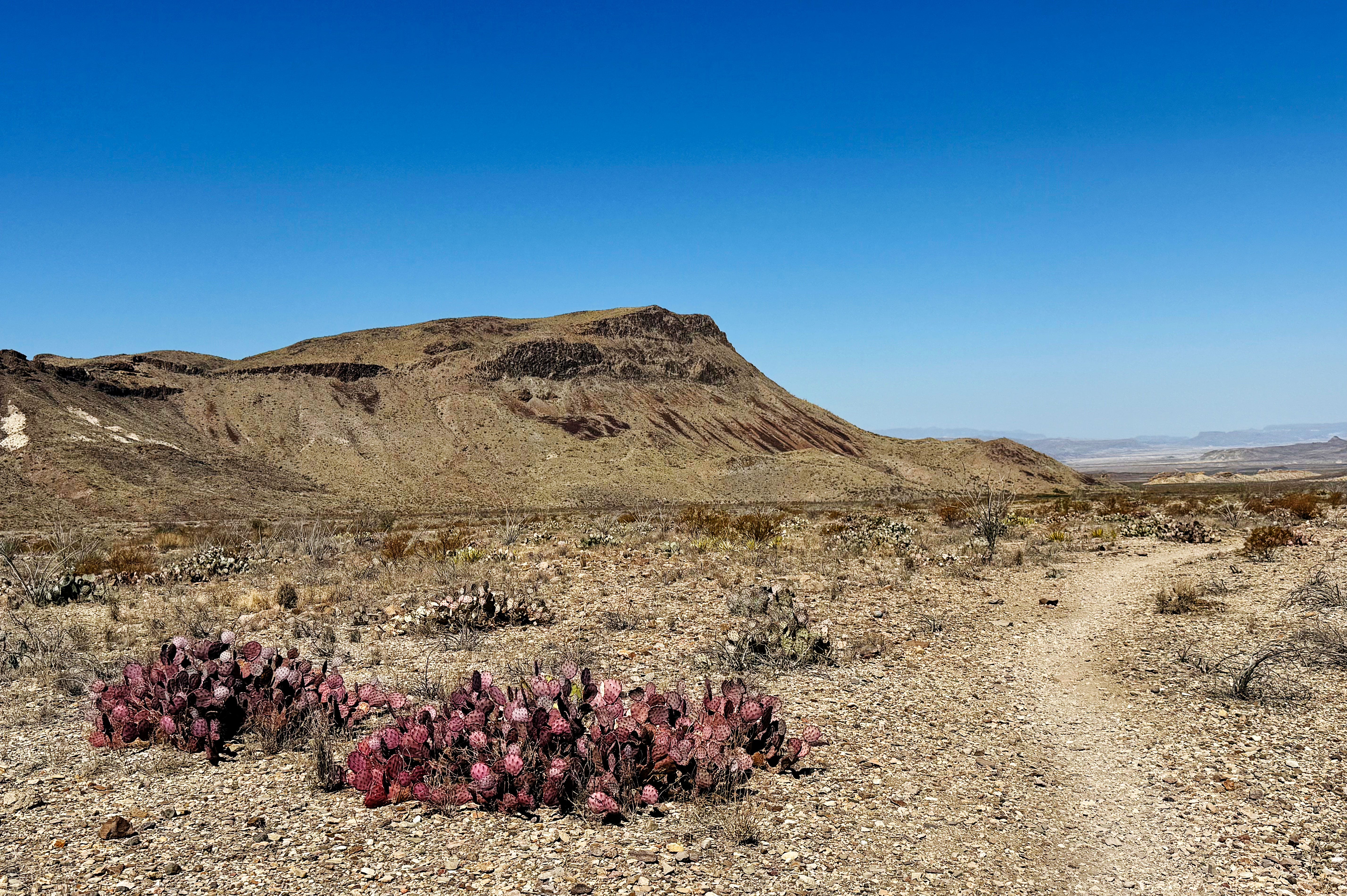
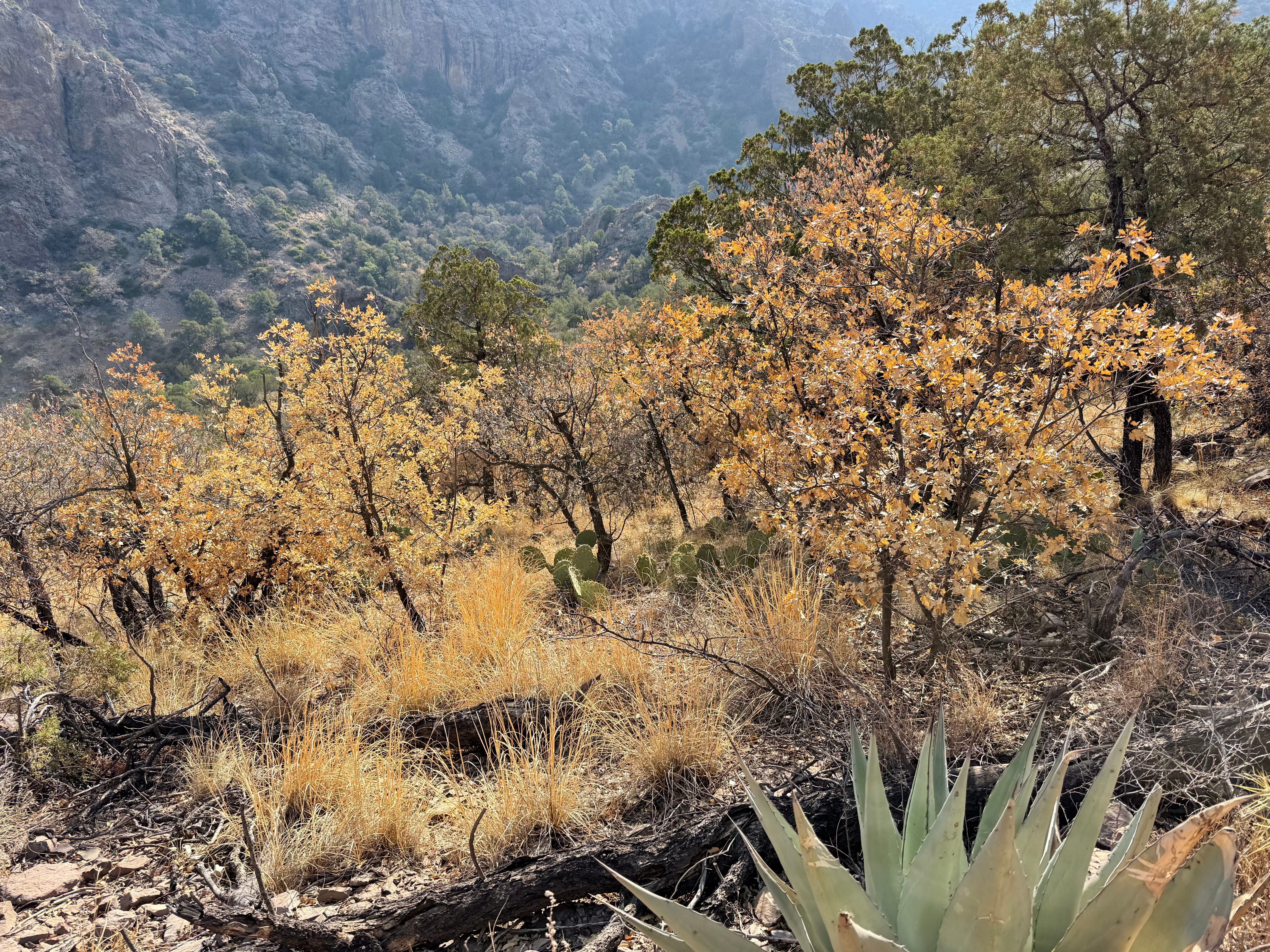
This region of Far West Texas is in extreme drought, and the desert grasses and herbaceous friends are all crispy or non-existent — we’re hoping that they’re dormant.
Even the creosote looks stressed — that’s the shrubby plant in the foreground — and that’s saying something because creosote is one tough plant! It’s normally green:
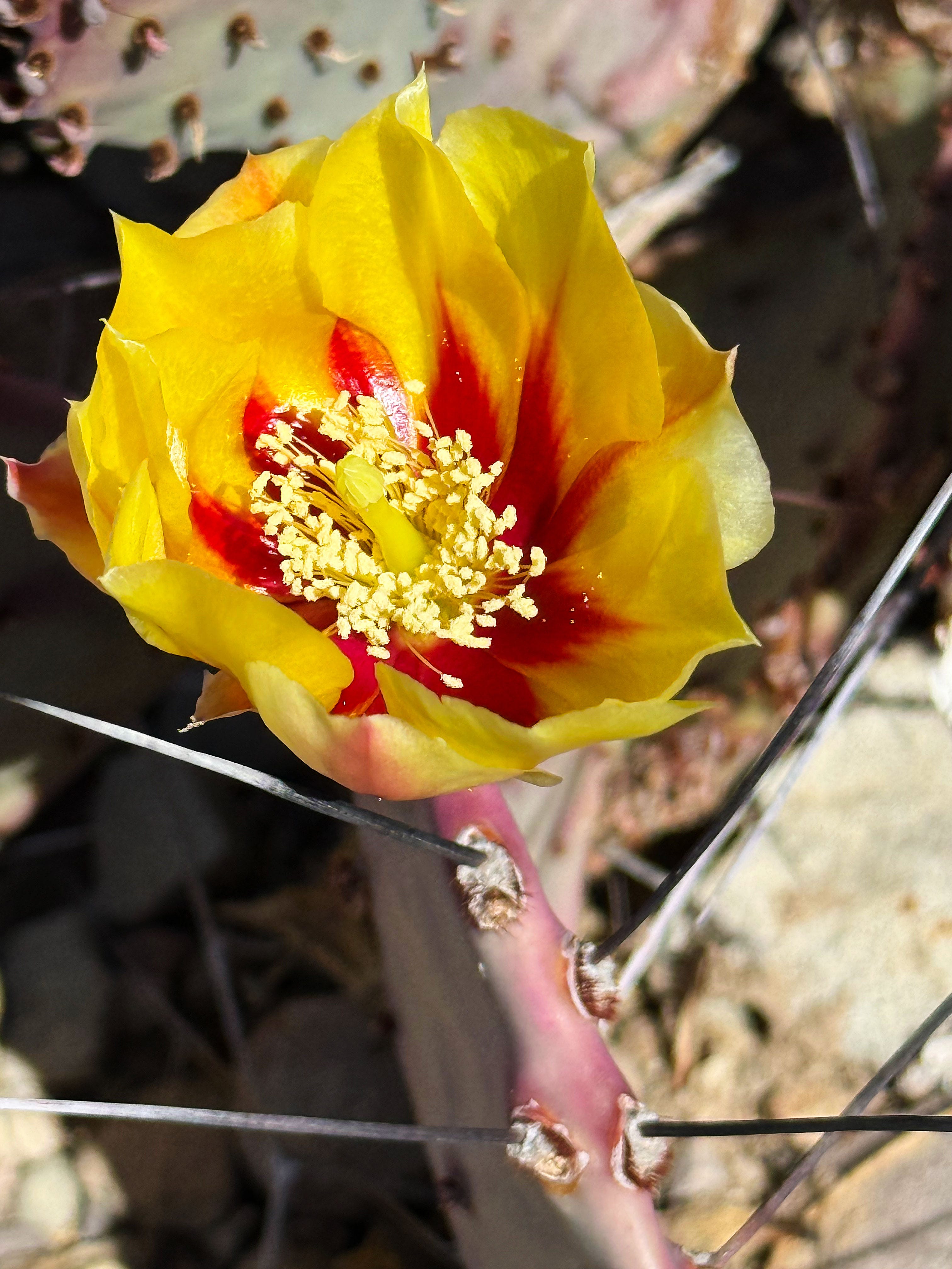
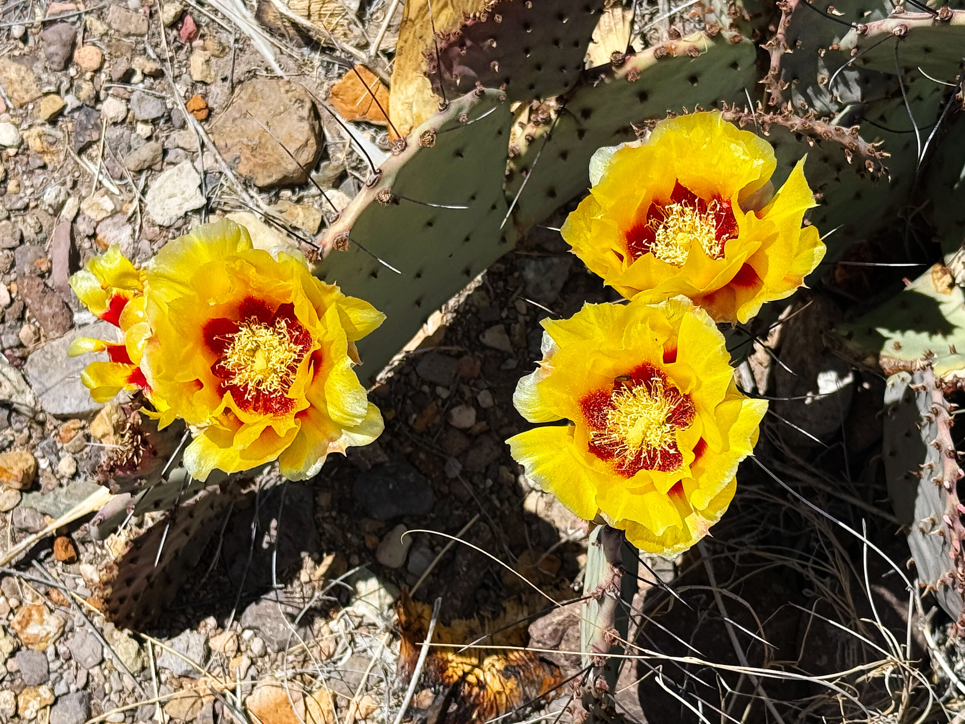
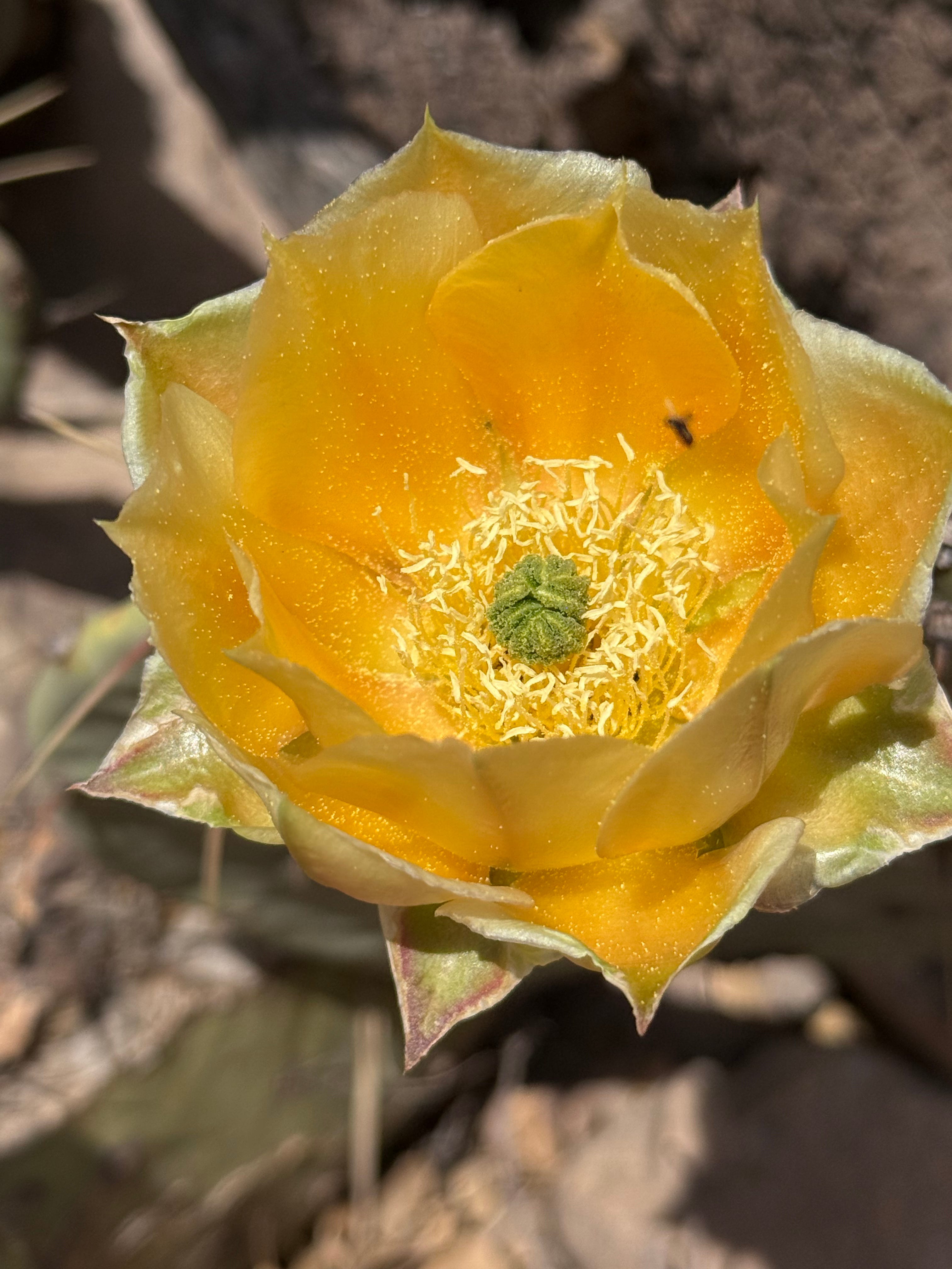
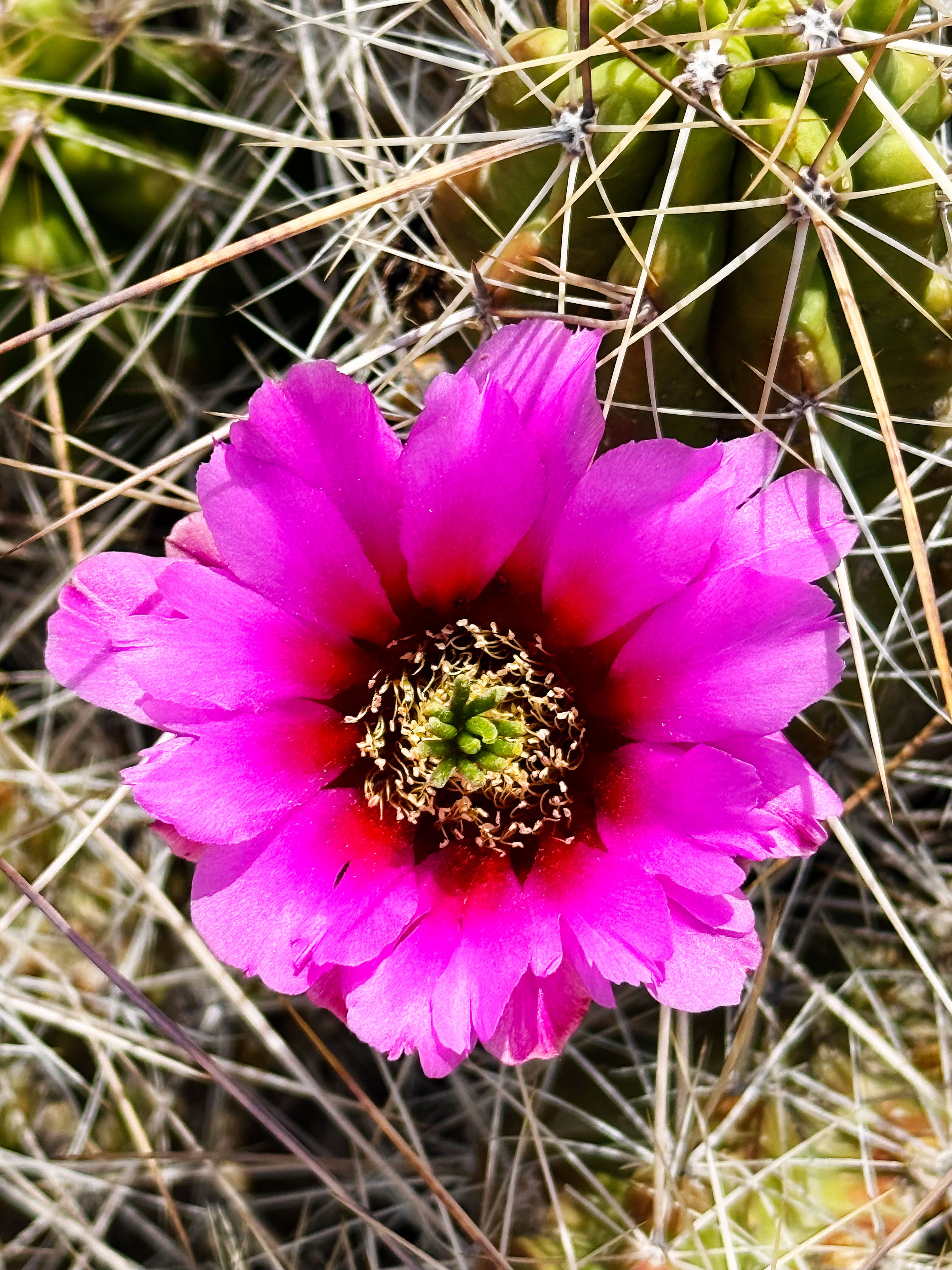
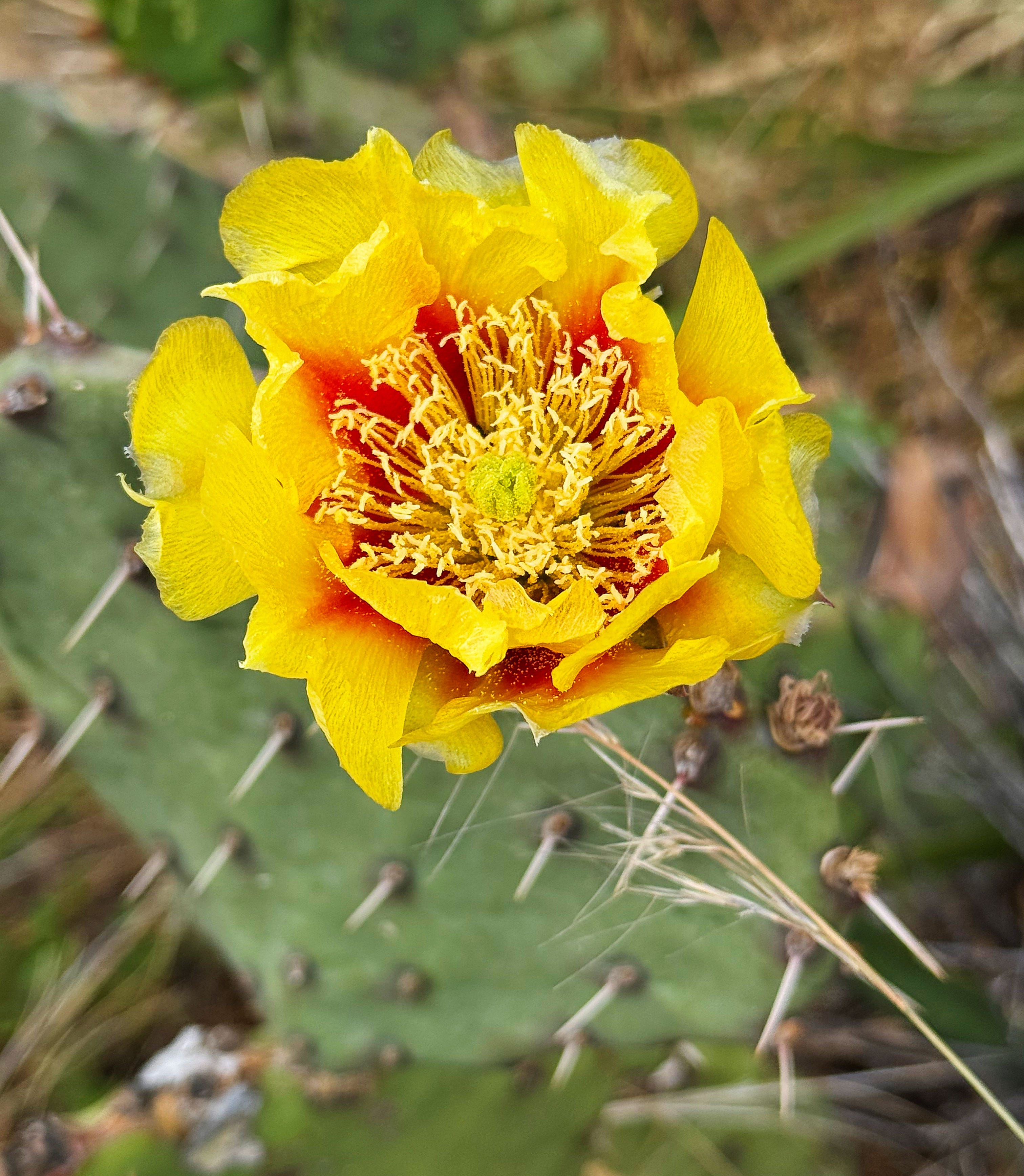
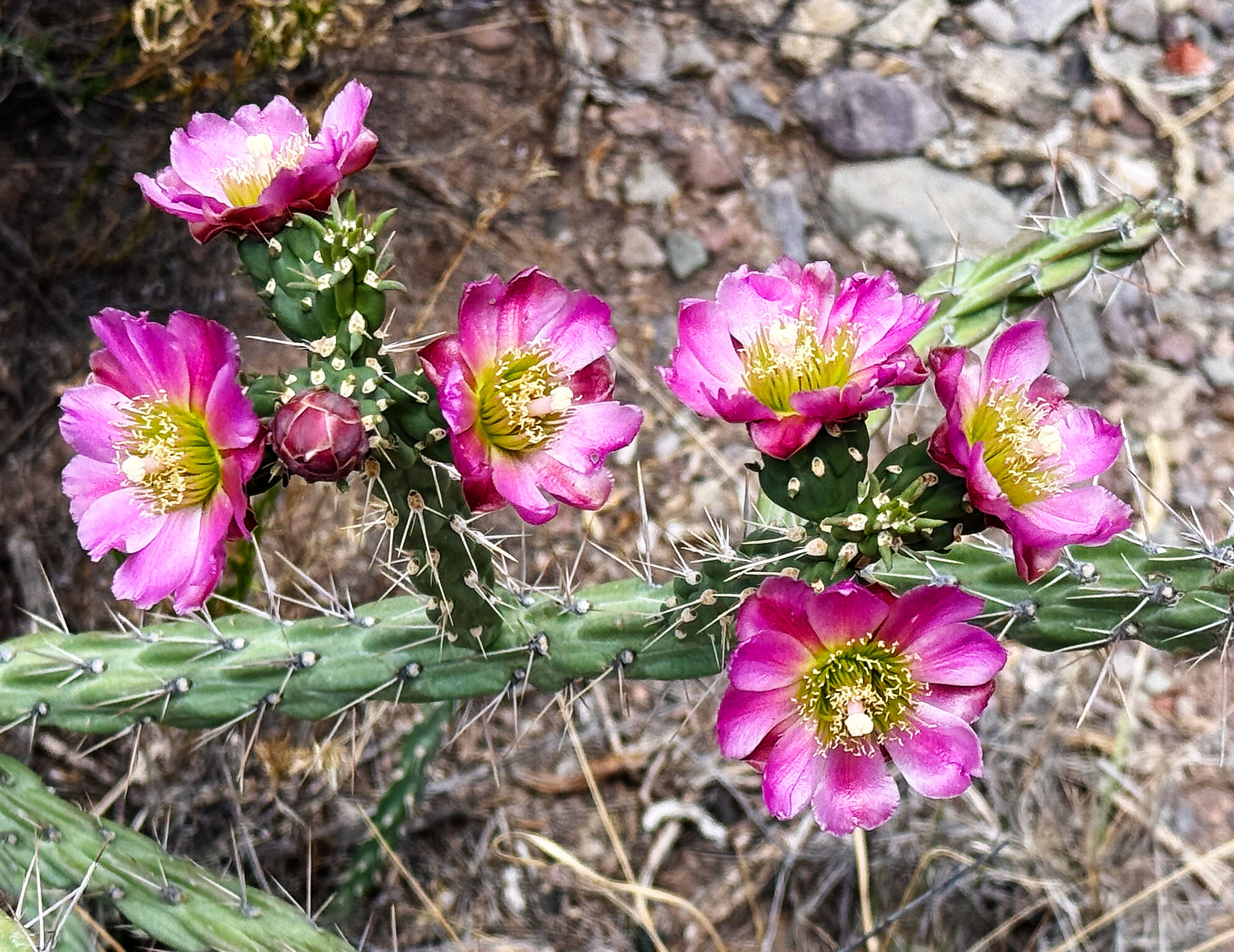
There were a few prickly pears blooming, tho!
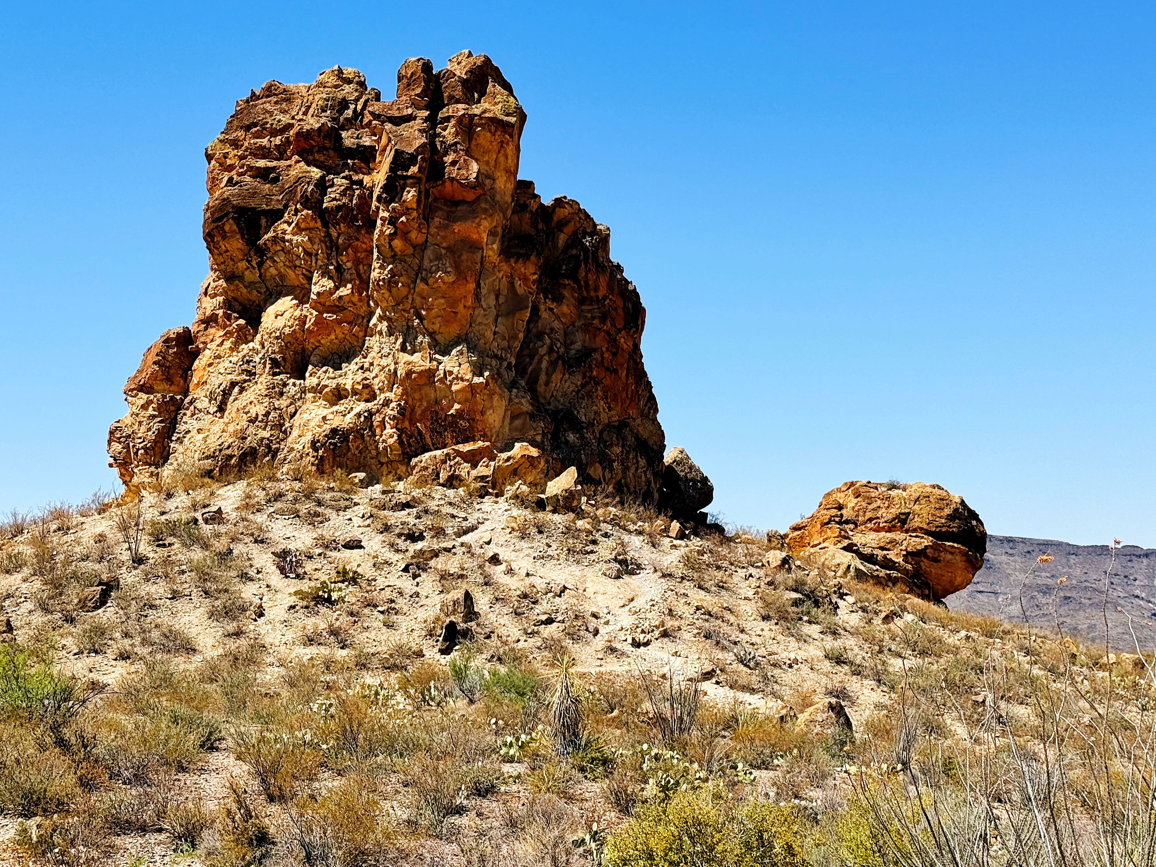
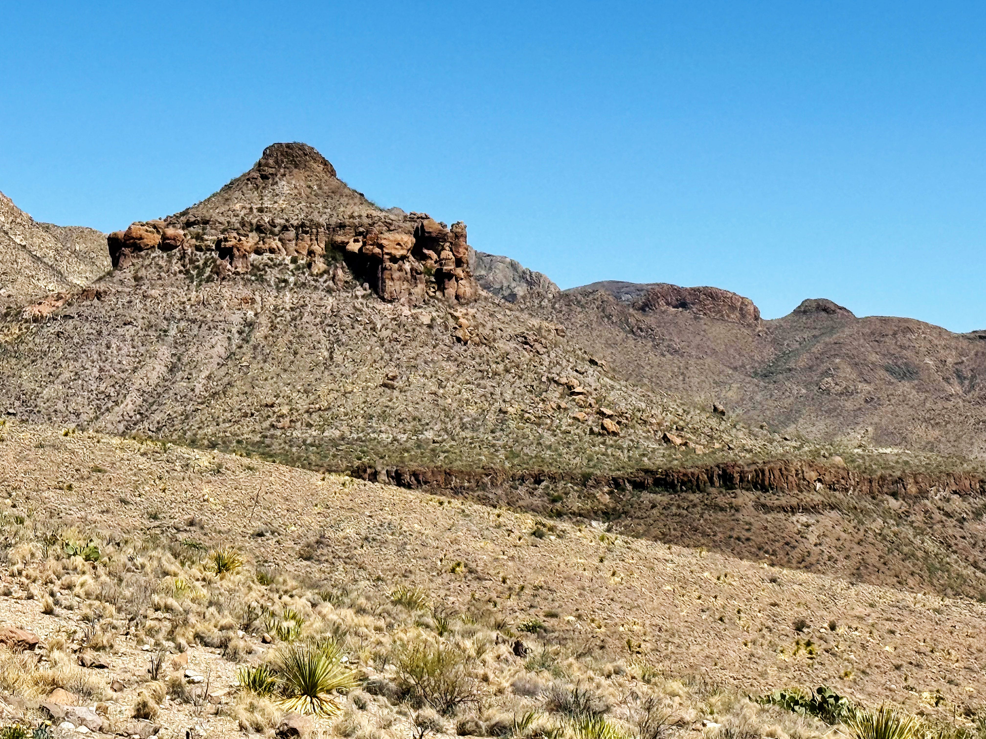
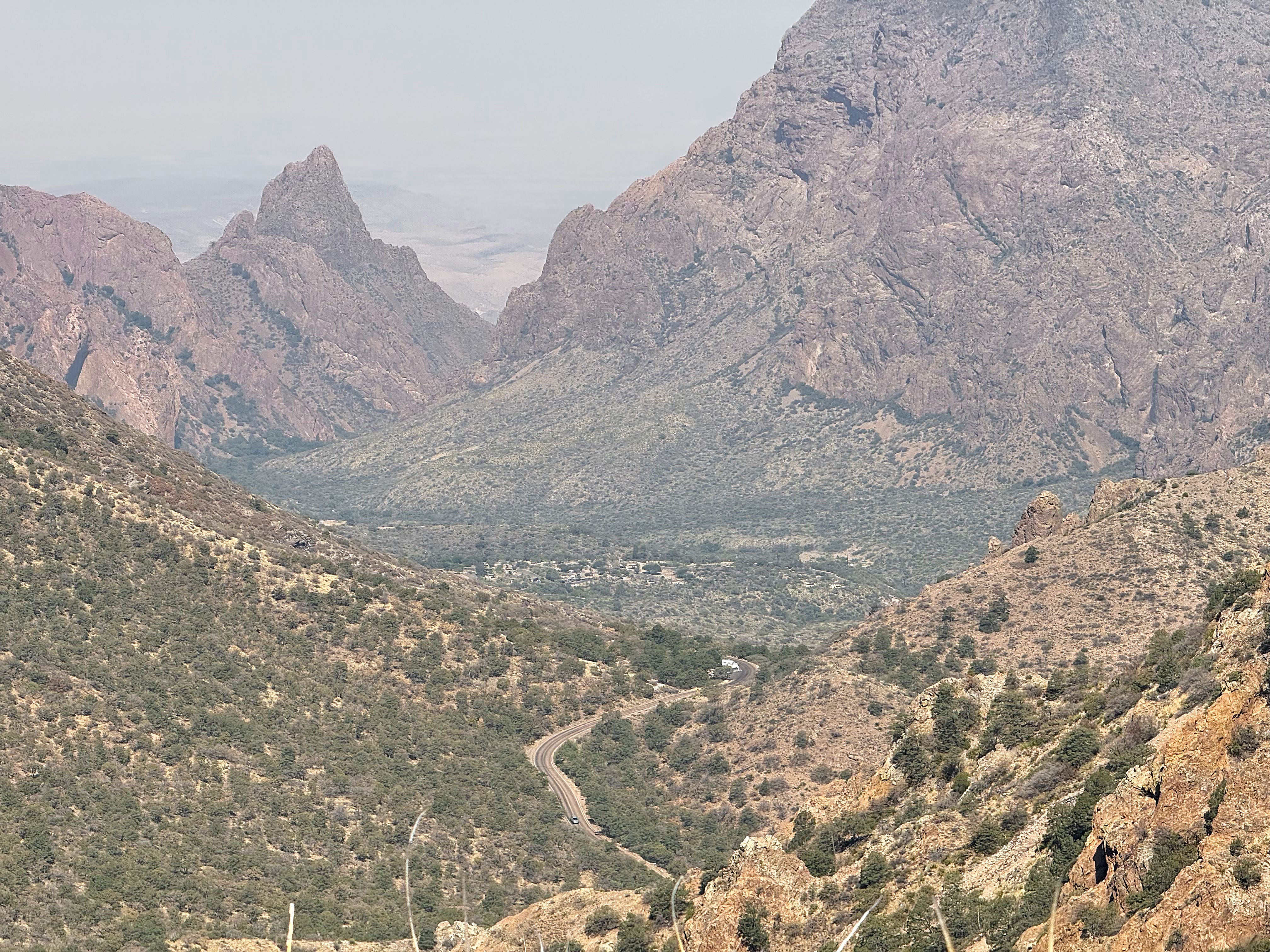
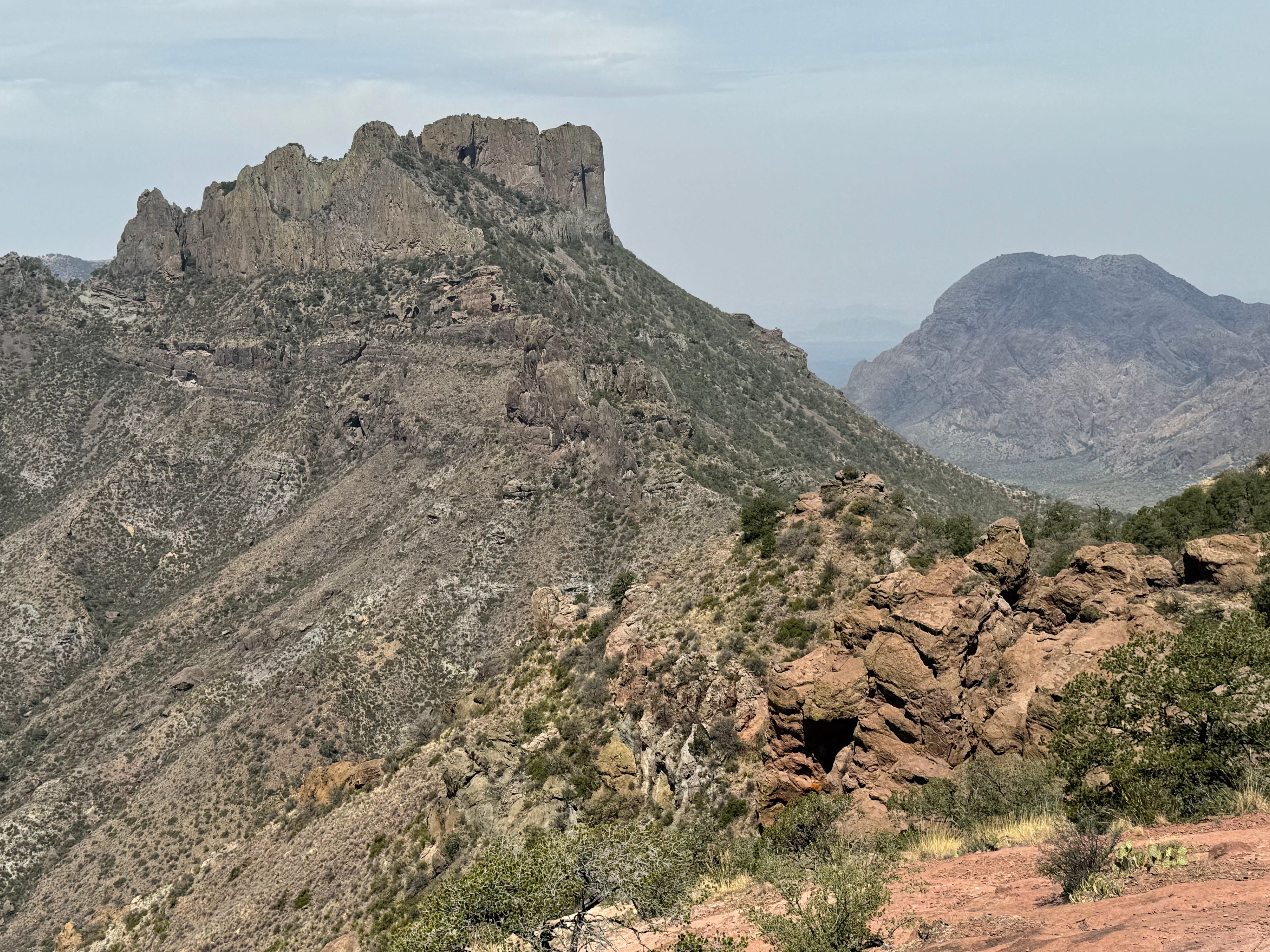
Pretty soon The Chimneys were in view:

I always think the leftmost Chimney looks like a stegosaurus — who’s with me?
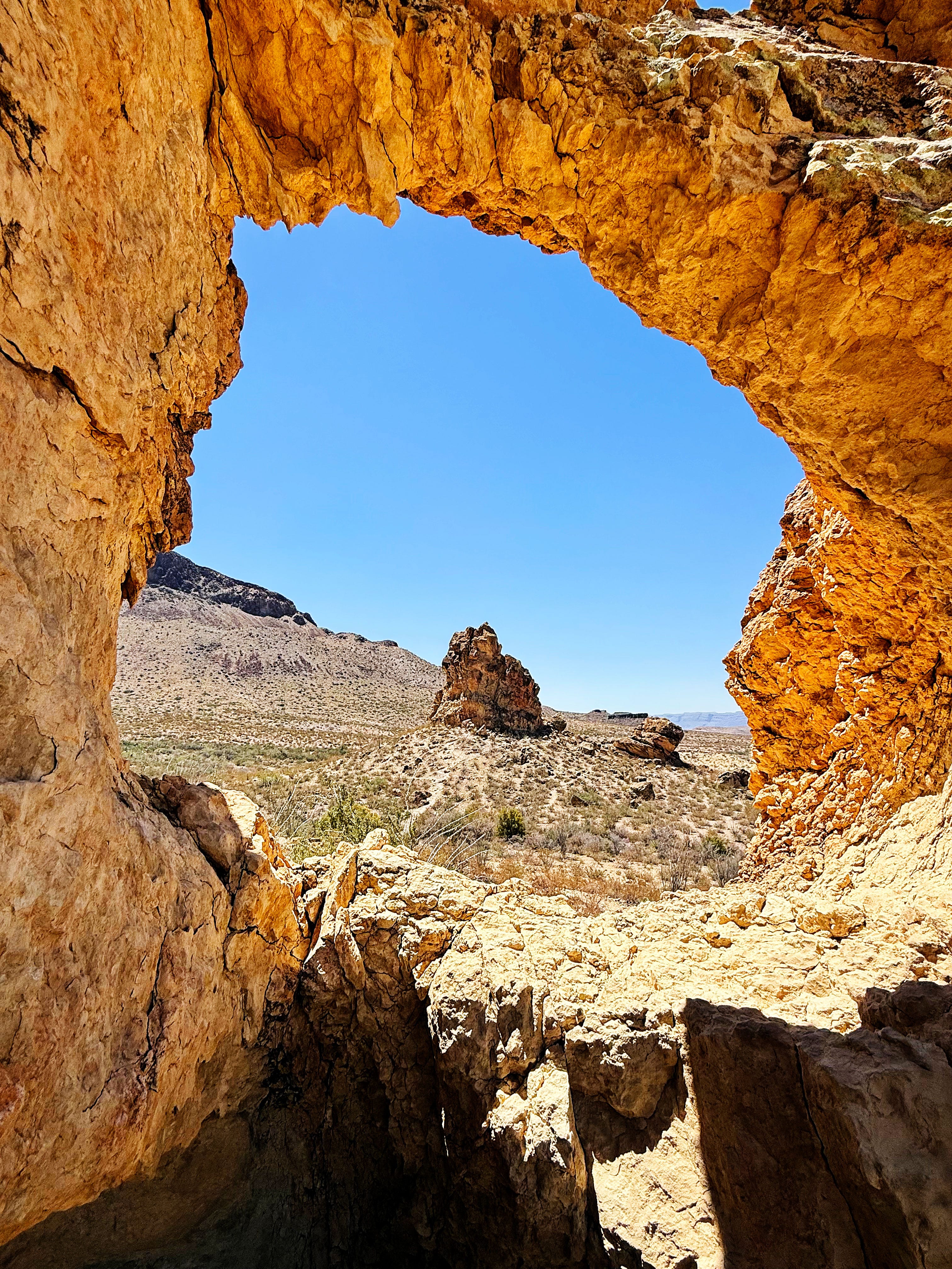
We went to the chimney to the right of the trail first since there’s a cool arch up there and a bit of shade where we like to take a break and have a salty snack.
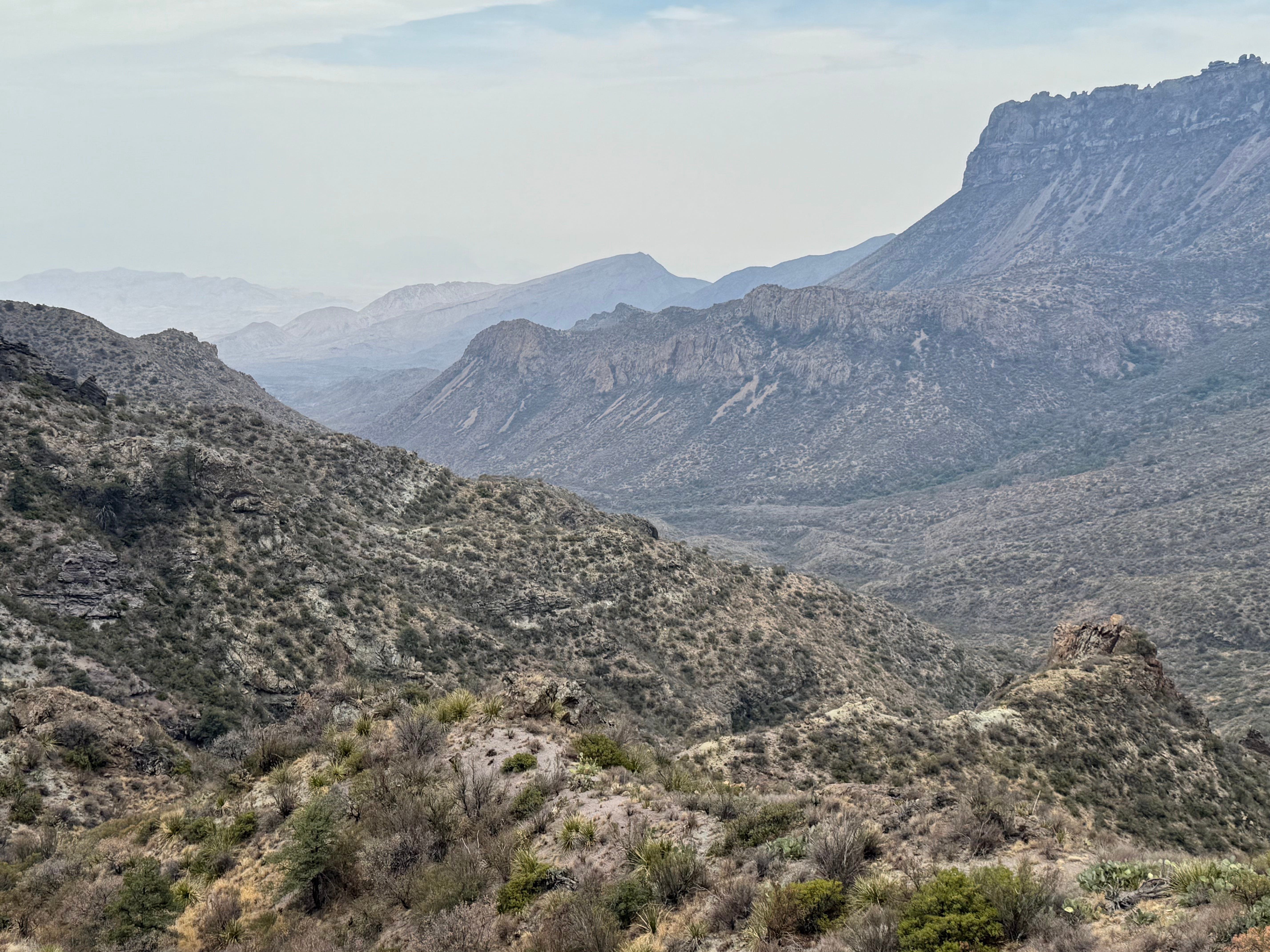
It’s always so peaceful out here. And for some reason I always have cell coverage there too — I resisted the temptation to check email and messages and just soaked in that desert view.

Then on our way over to the Chimney on the far left we had to stop for obligatory arch photos:


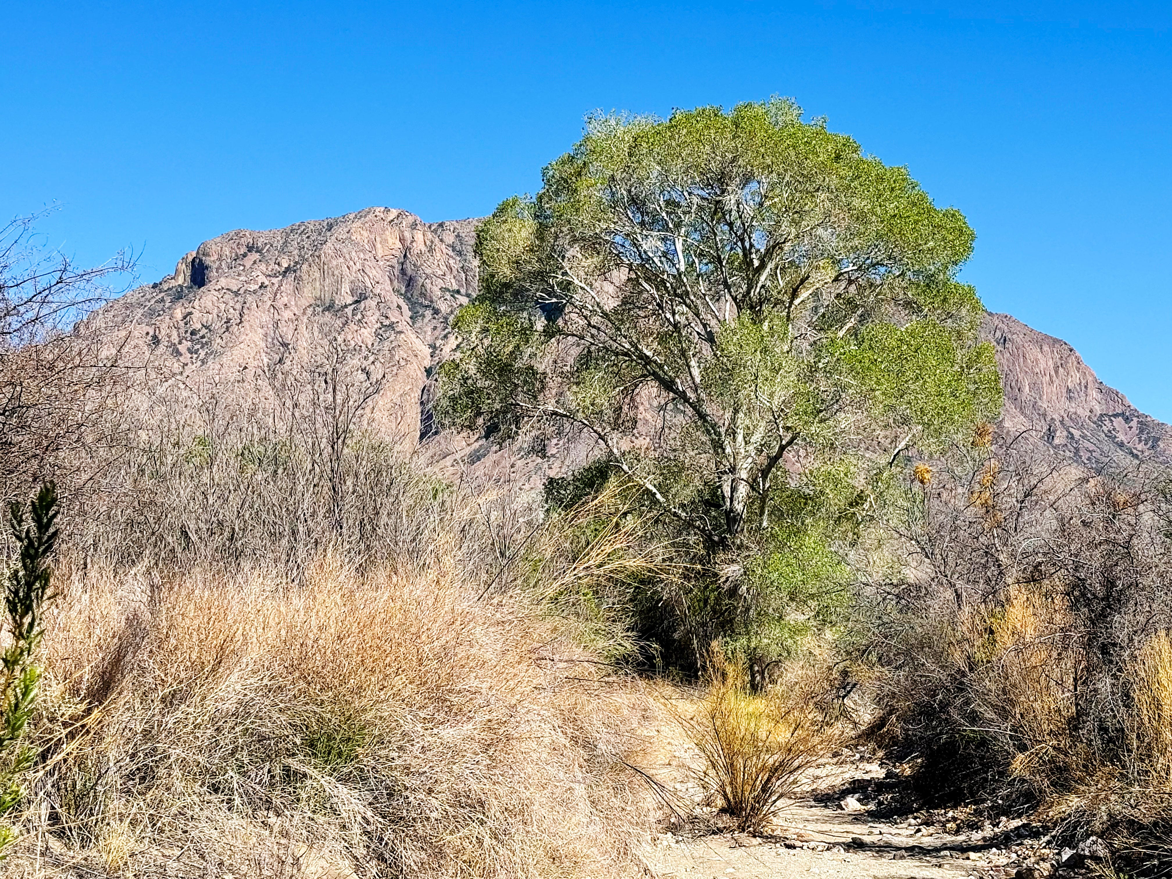
Here’s the view from the stegosaurus looking back up towards the arch:

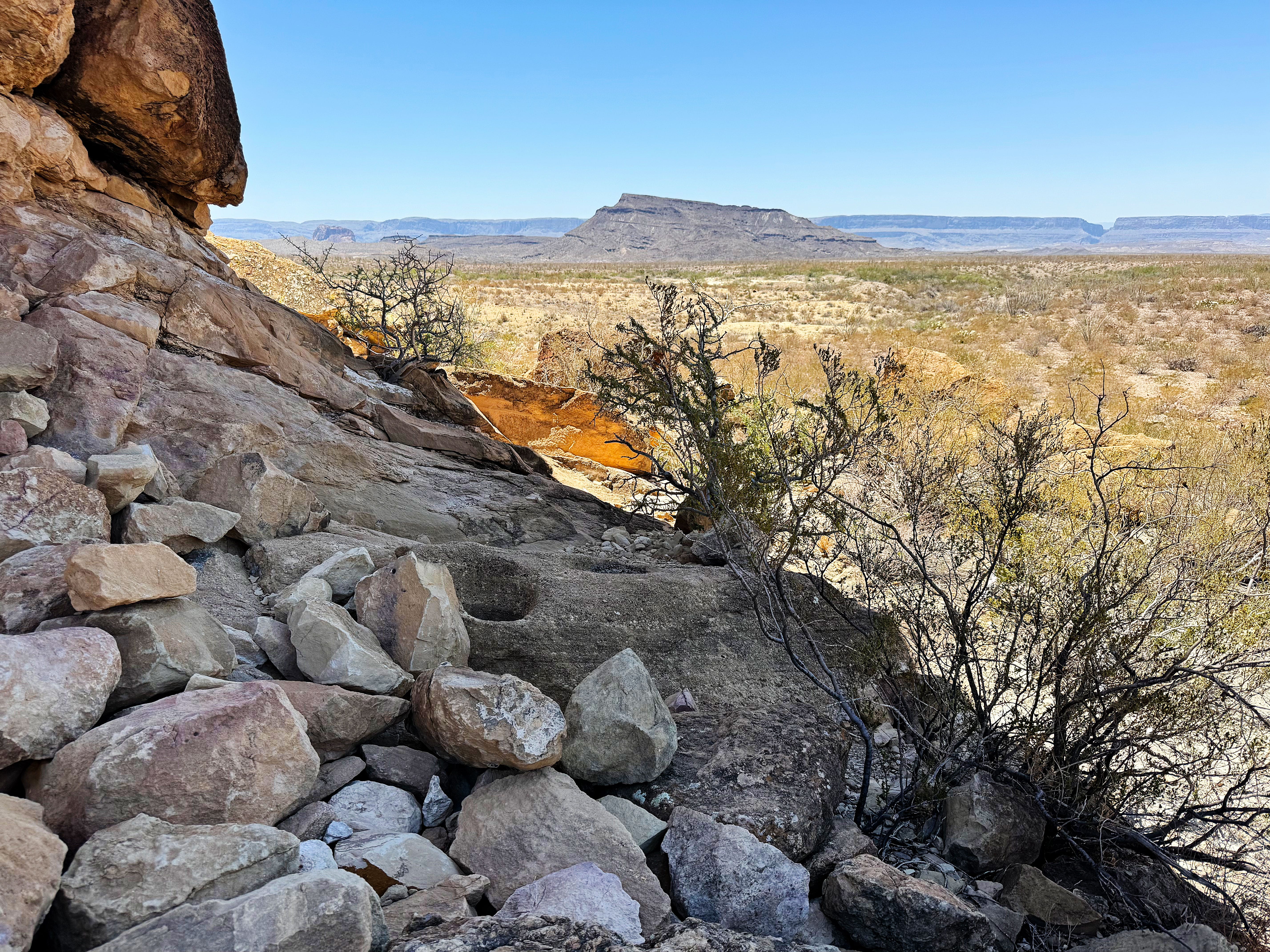
Here are some of the petroglyphs — I wonder what they mean:
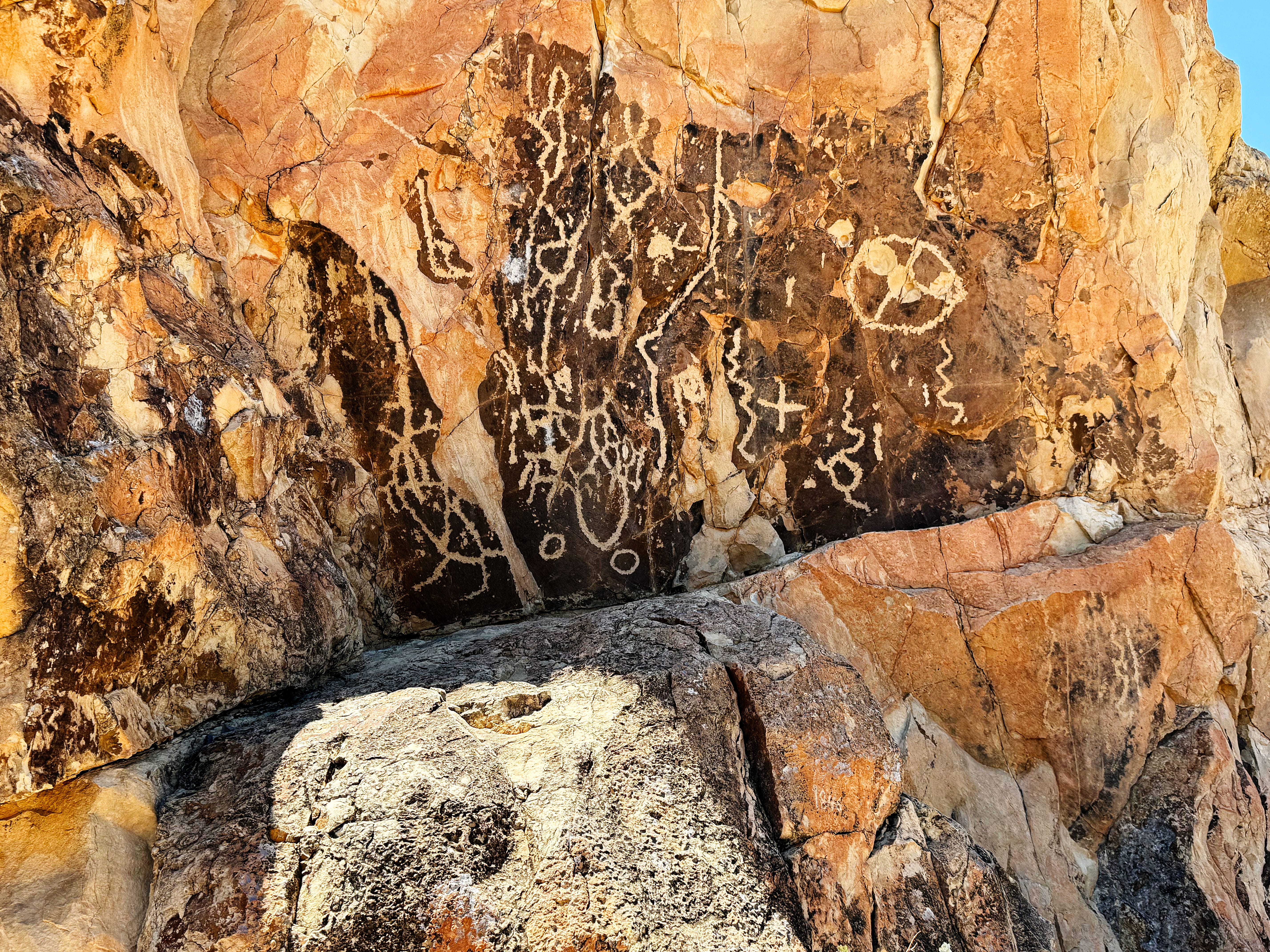
The bullet holes have been there since we started coming to Big Bend 20 years ago. It hurts my heart that someone did this.
There are so many mortar holes too — here’s one with my hand for scale:
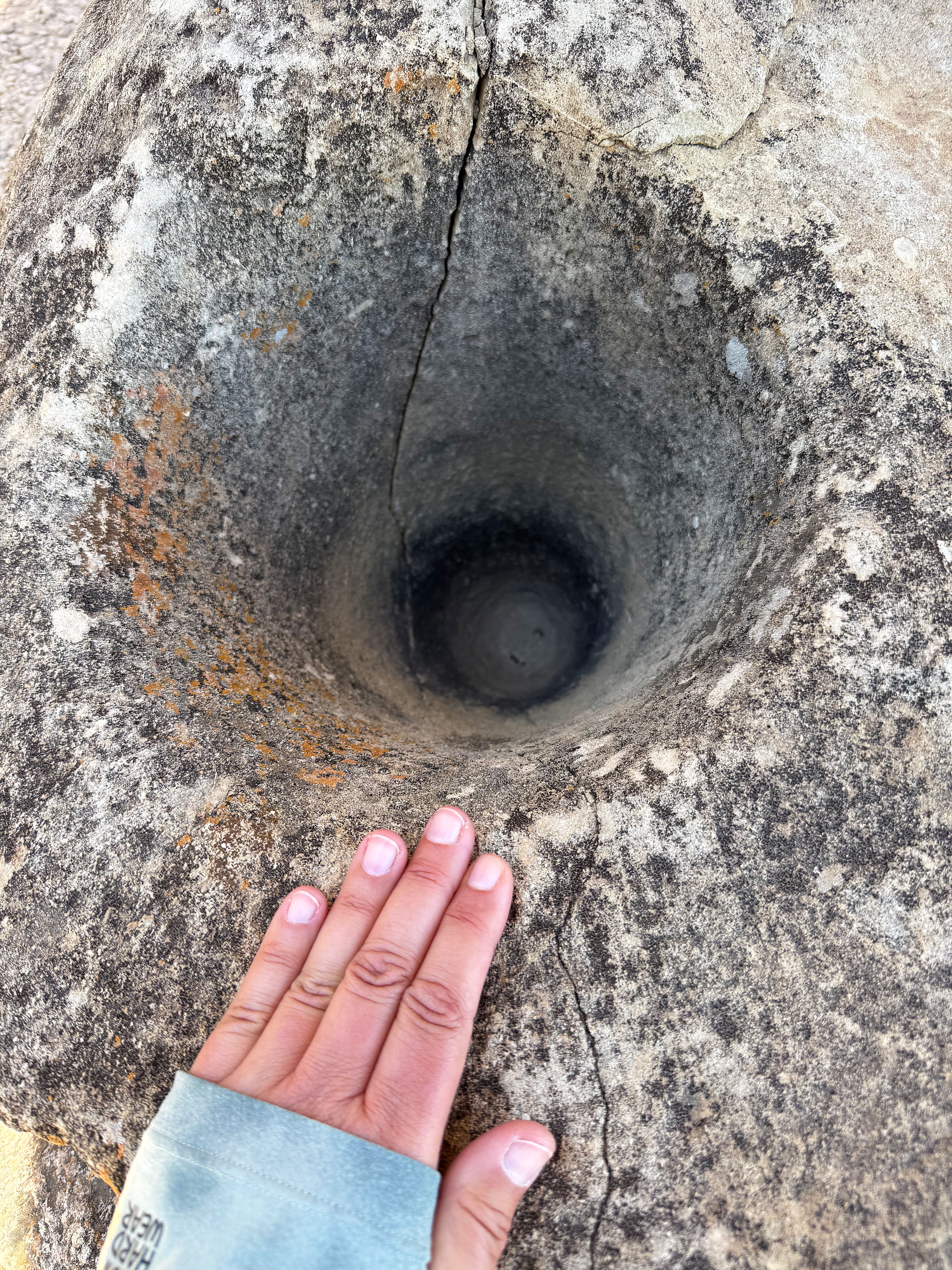
I wonder how long ago these were made? I found this page on the park website that says that the mortar holes were mainly used to grind mesquite and other desert seeds, and that this area used to be a pine/juniper forest. Wow.
A feeling of peace always comes over me on this hike. I always want to stay longer, but then I feel the sun beating down and the desert getting hotter and reluctantly start the return trek. How did I feel after seeing all of the cultural sites at Canyons of the Ancients and Chaco Canyon? It was like coming home.
I wrote a haiku on the way back to distract myself from the uphill slog in the heat:
Hiking the Chimneys.
Heat waves shimmer and cacti bloom.
May in Big Bend Park
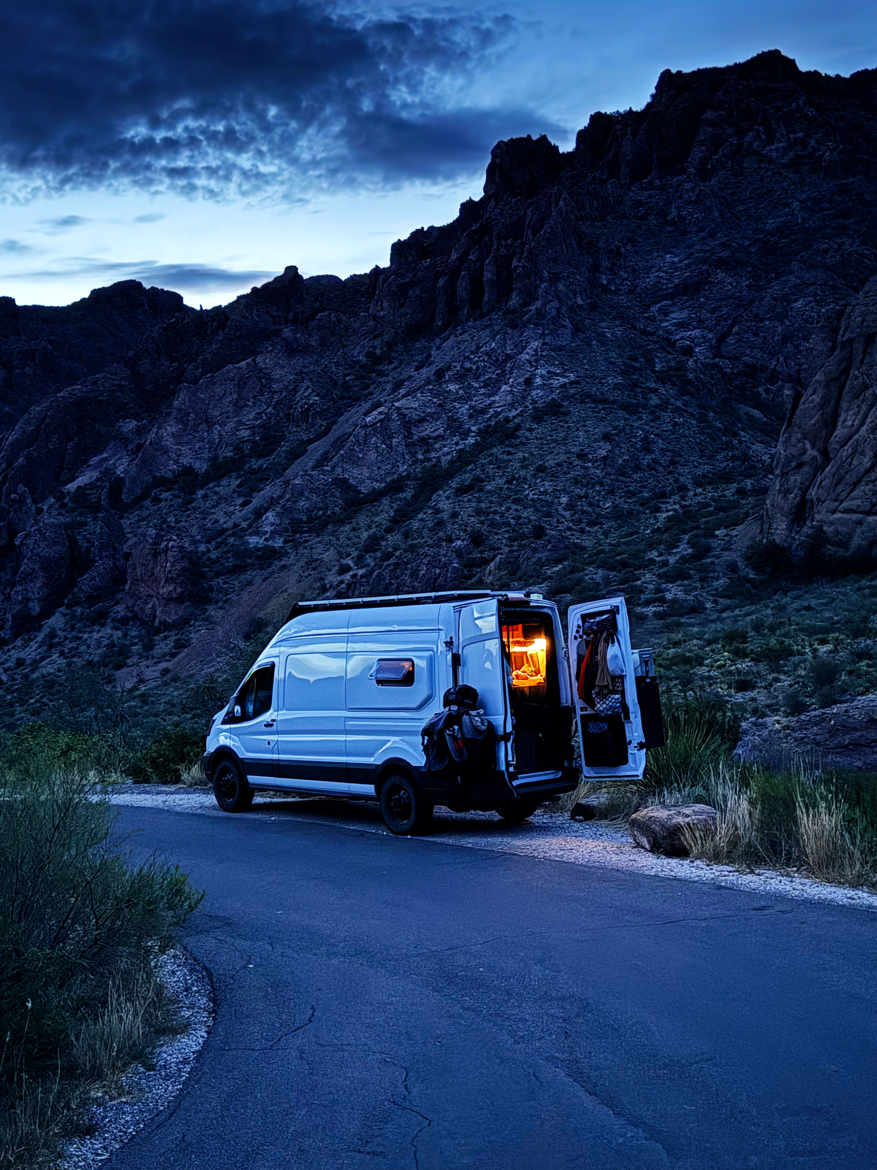
It’s always a good thing when we see the van waiting for us at the end of the hot trail!
Then it was on to…
Sunday: Sotol Vista
Then we just had to stop at Sotol Vista since it was on our way. Sotols are super cool plants that look like kinda like a yucca — they’re actually in the asparagus family. (Did that just blow your mind?) They’re all over the place in this part of the park — in the photo below you can see them on the left and right:

This was the driest we’d ever seen Sotol Vista — I kept thinking it was like a fire waiting to happen. Just like at the Chimneys there were hardly any herbaceous plants, and even the creosote looked drought-stressed.
Speaking of wildfires, on August 29, 2018 we saw a fire burning and reported it to to the rangers — here’s what I wrote on my blog at the time:
On our way to hike Mule Ears Peak this morning we saw a desert grassland fire over near Sotol Vista — first time seeing a fire in the desert. I’ve worked on some prescribed prairie fires and even helped set some and they are similar in how they slowly creep along and crackle and pop — and they smell so good. On the return back after hiking the road was closed, the ranger told us the fire was caused by lightning last night and that they were setting a backfire. Firefighters from Mexico were coming to assist. Will be interesting to see how the fire transforms the area.
Check out this quick video to see how the fire gently creeped along:
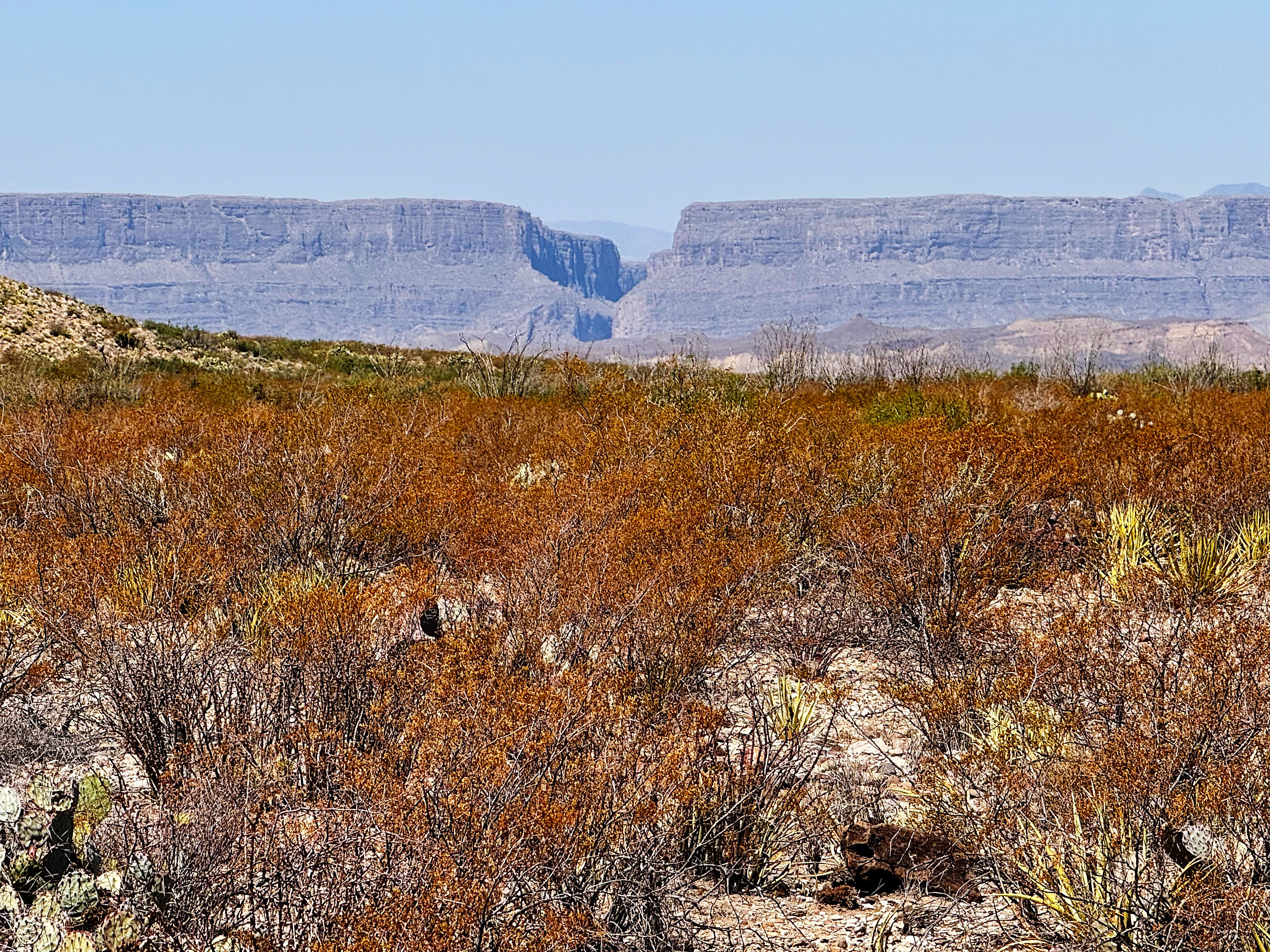
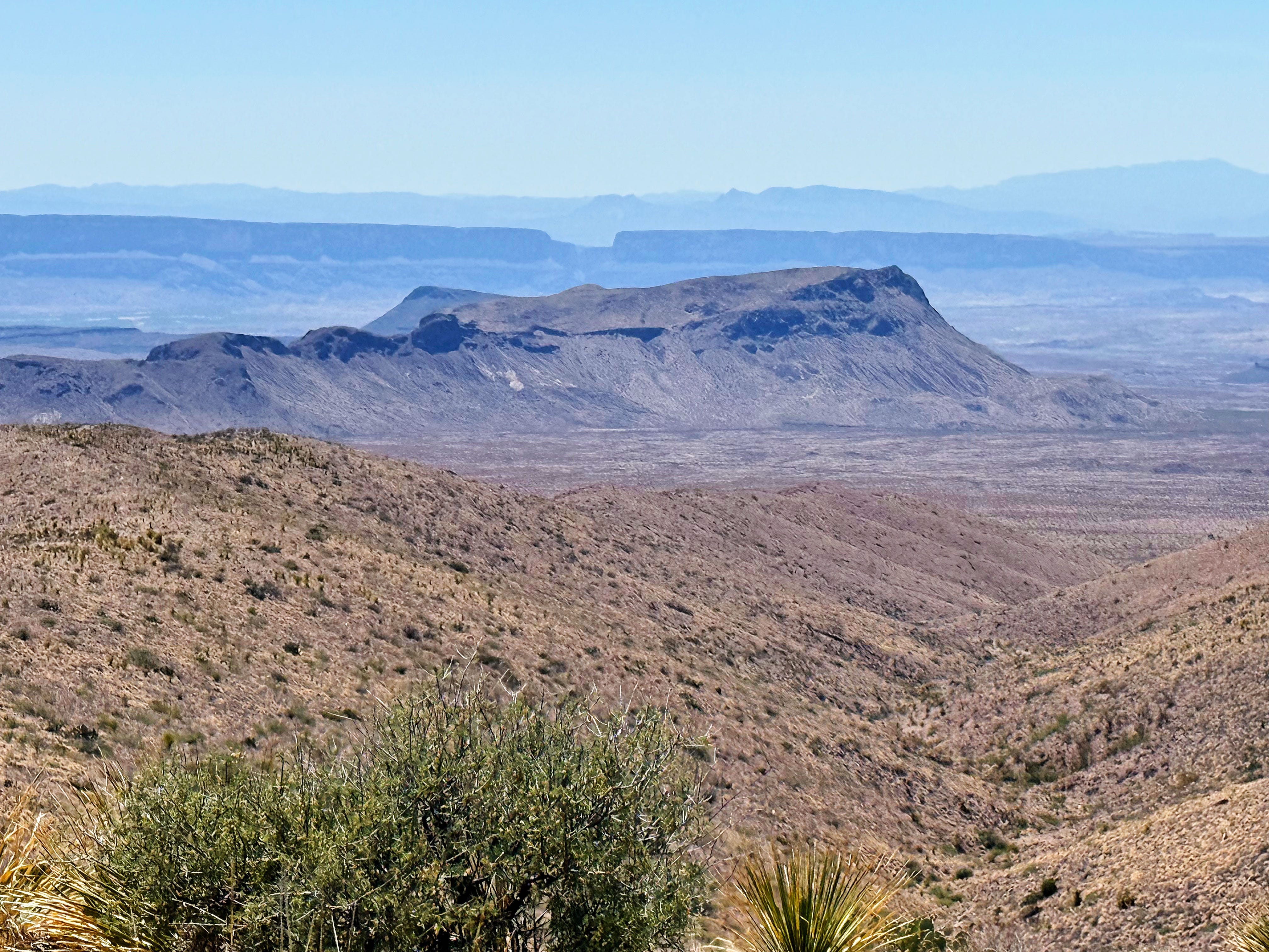
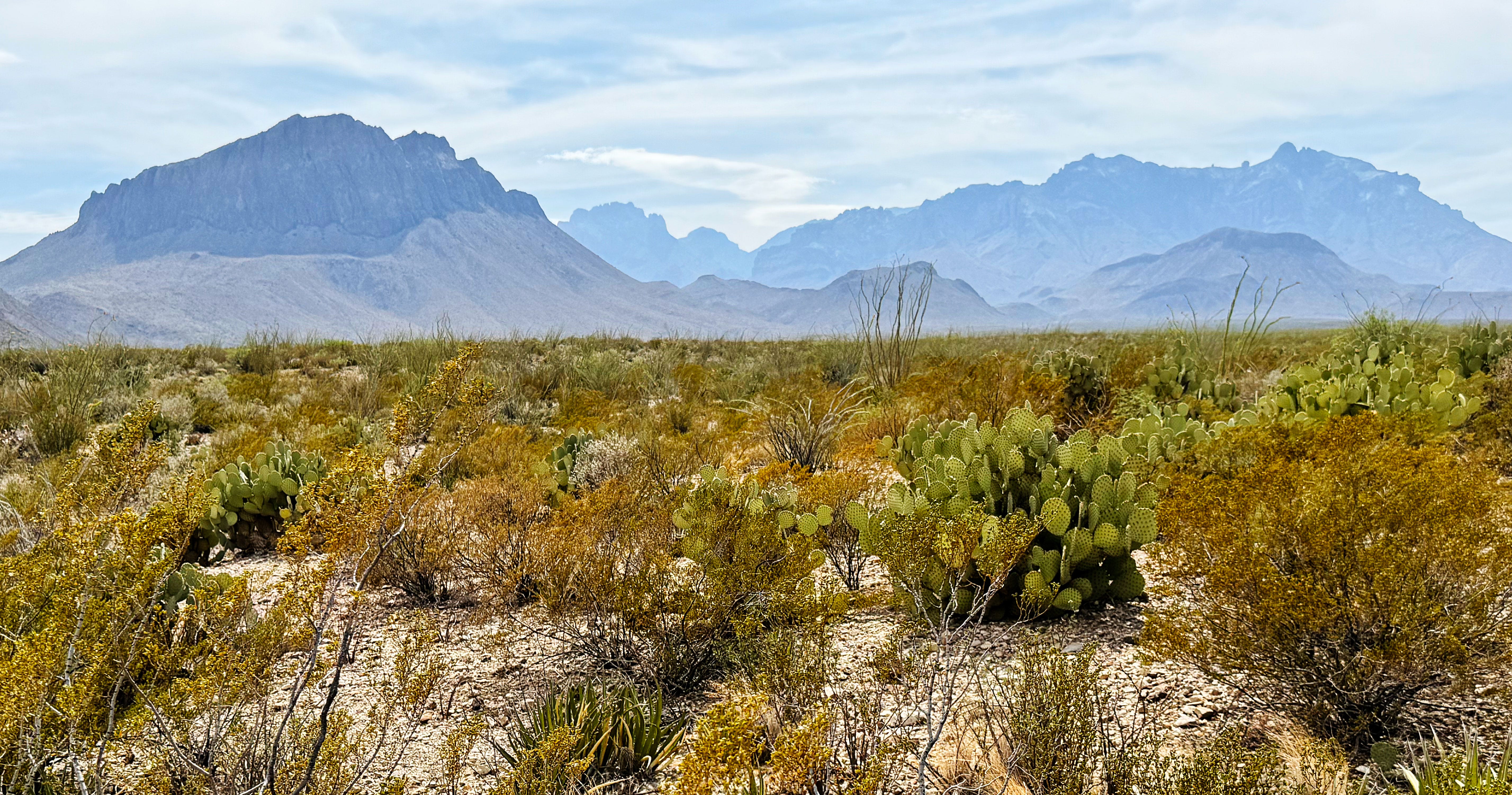
Hopefully the park gets some rain soon! Just look at how dry Carousel Mountain is:
Wow.
Sunday: Hiking Sam Nail Ranch (with a side trip up Cottonwood Creek)
Our next stop was Sam Nail Ranch. The short trail wanders through an old homestead, but that’s not really why we like to hike it — we like to wander up the (usually) dry Cottonwood Creek to visit the cottonwoods.
I forgot to take photos of the homestead since we’ve seen it so many times, so we’ll start with the soapberry/walnut/pecan forest right before Cottonwood Creek:

After making our way through the forest we got to the creek — and found our cottonwood friends:

Everything here looked super drought-stressed as well, but it was so good to see the cottonwoods thriving in spite of it all.

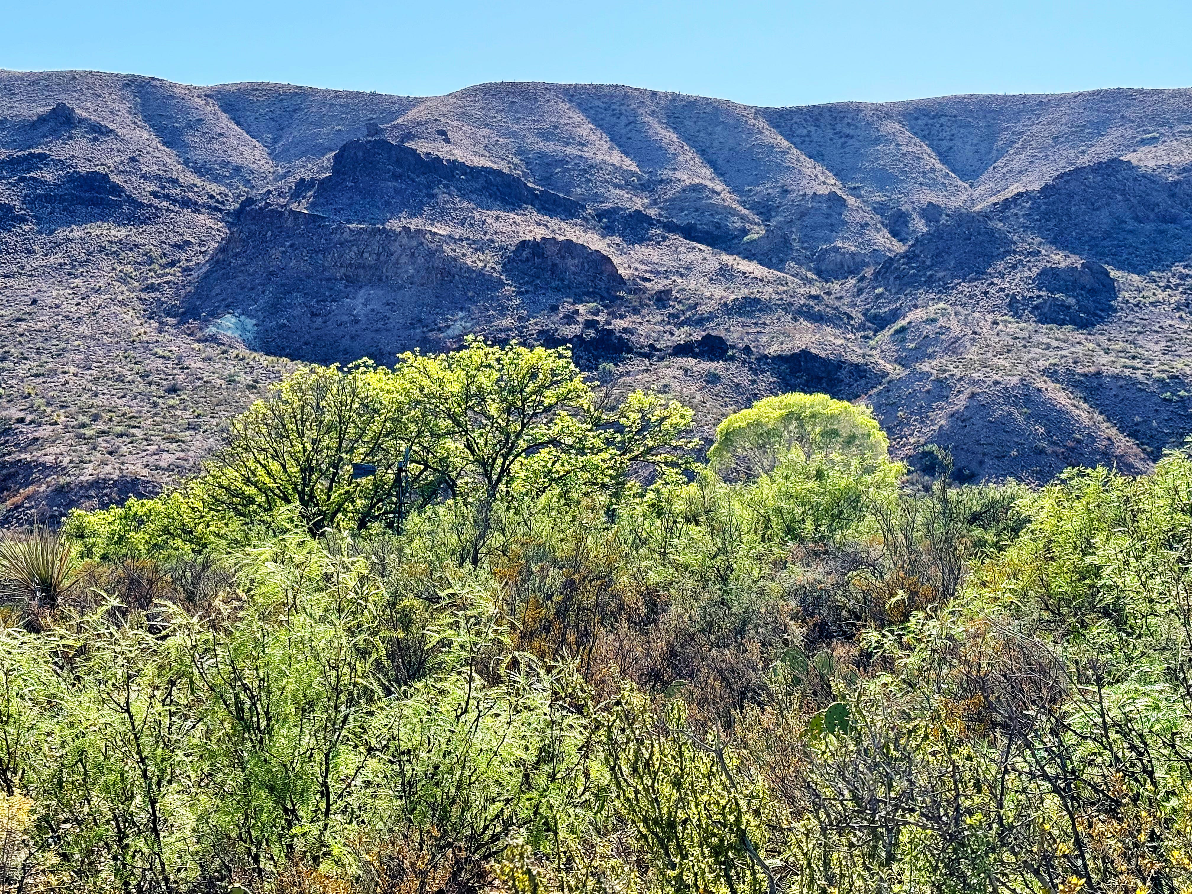
From the road the cottonwoods make a ribbon of green through the desert — such a contrast with the surrounding hills.
We wrapped up with 9 miles hiking on the day.
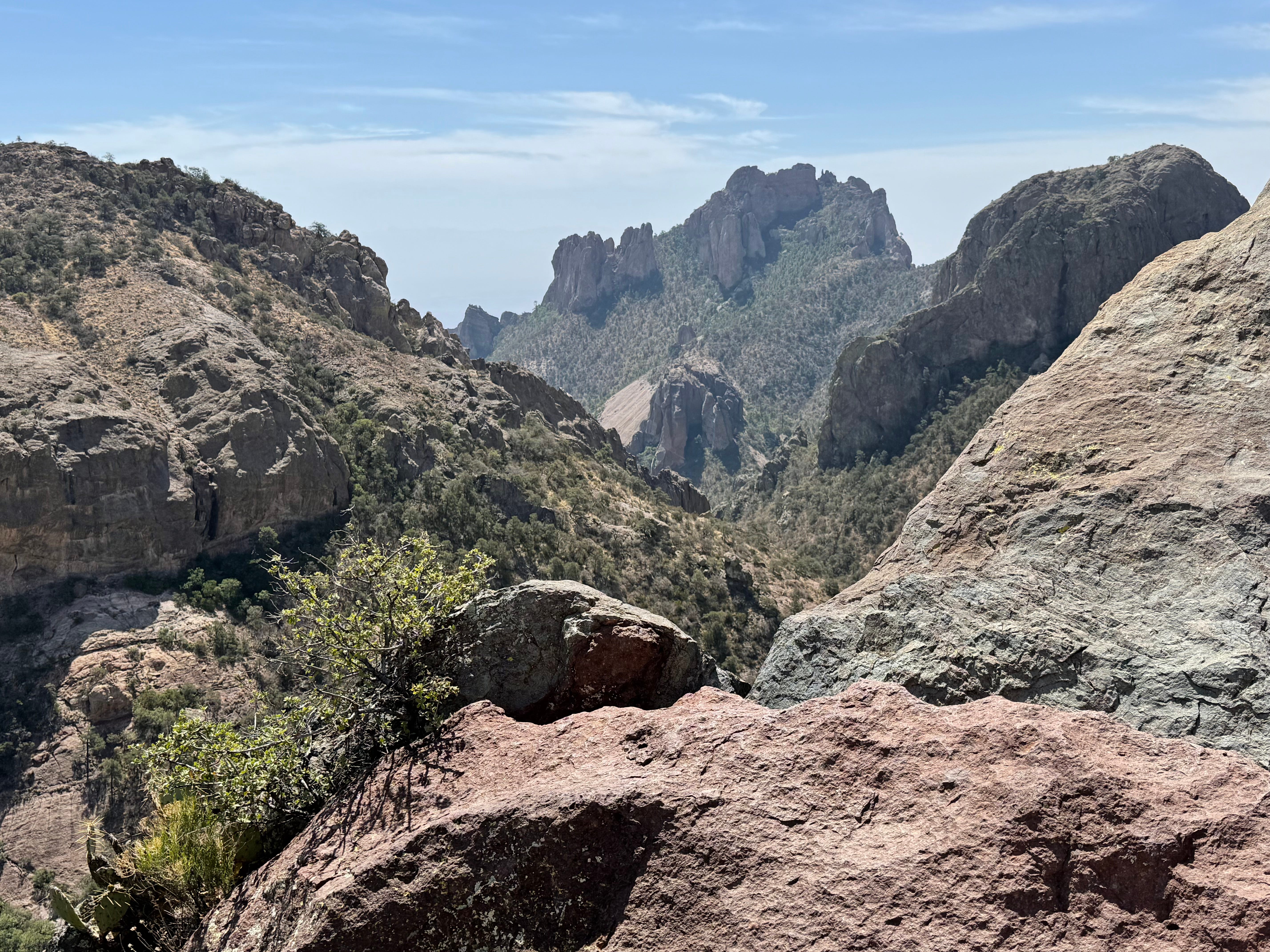
Wednesday: Hiking the Lost Mine Trail
Wednesday was going to be our last chance for a cool-ish hike for a while, and I really wanted to do the Lost Mine Trail since we won’t be able to do it again for two years due to the renovation project.
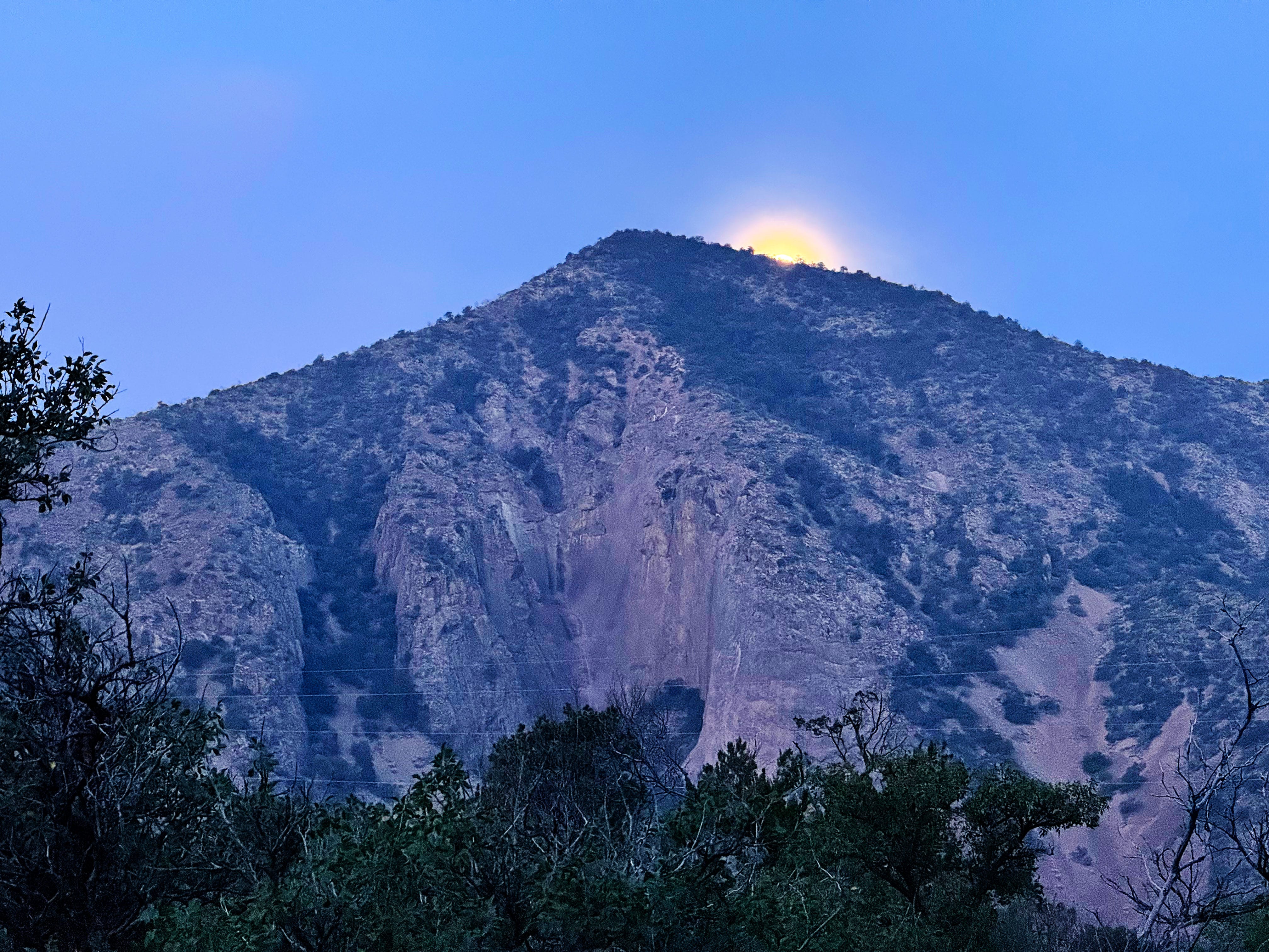
So we set our alarm early to get a head start on the day, and got to see the moon setting behind the Chisos Mountains:
We snagged one of the last 3 parking spots at the trailhead — I was super impressed with J parking the van!
Here’s a bit about the trail from the park website:
From the very first step, the Lost Mine Trail leads hikers into a different world - a woodland-grassland ecosystem with some of the best scenic views in the park. Walk this trail and learn why so many park staff and visitors alike list it as their favorite hike in Big Bend National Park.
The drought story continued here on this normally lush green trail — just look at these crispy oaks:
As we started heading up the trail our eyes started burning and I thought I smelled smoke — it didn’t smell like vegetation burning but more like an industrial type smell. Random fact about me: I have a super nose, ha! J says it’s my super power.
We checked the Watch Duty app but didn’t see any fires nearby, so we continued on.
Things began to get hazy:
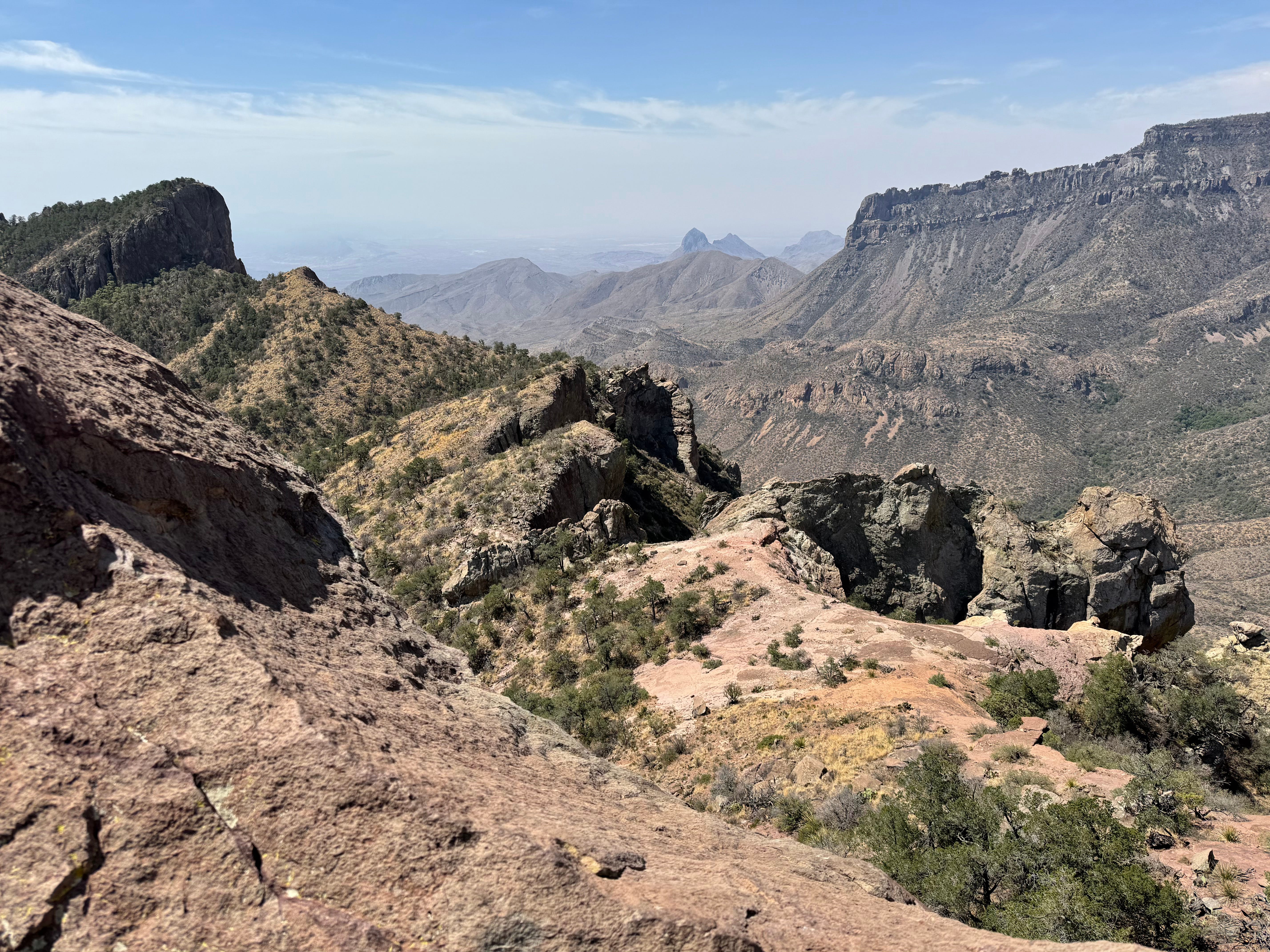
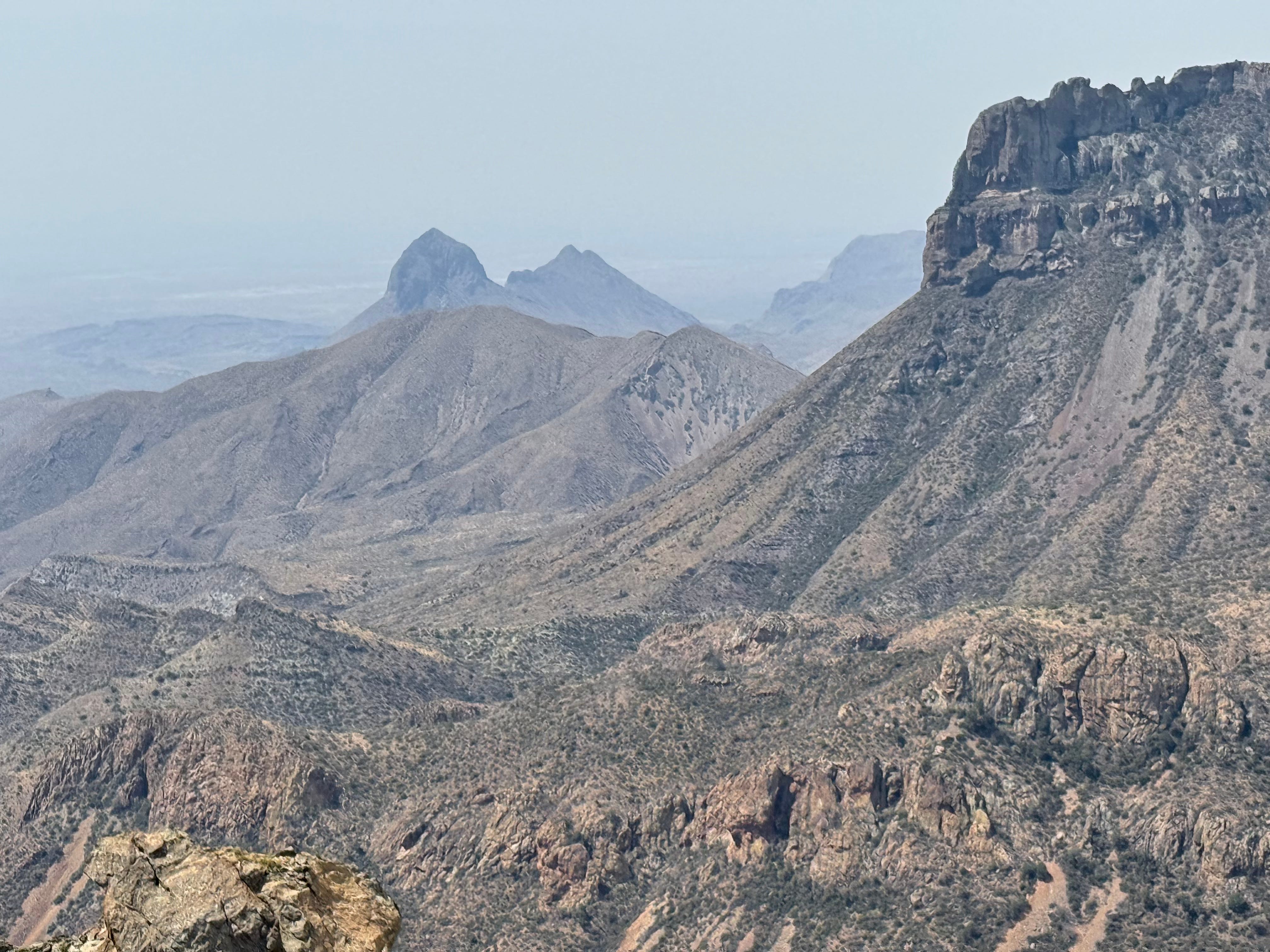
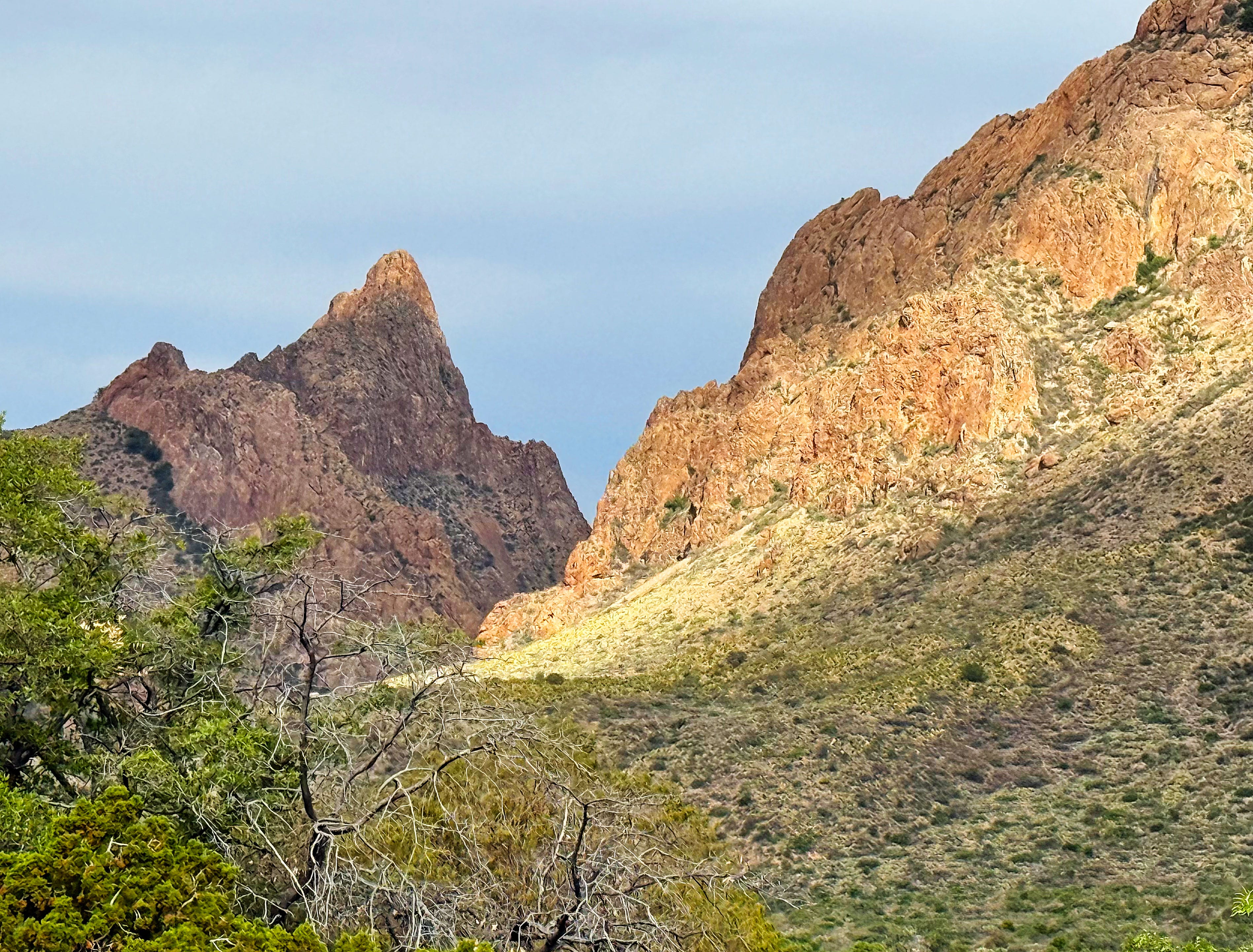
Then when we got to the end of the trail we had a bit of blue sky for a bit, yay! We could see all the way into Mexico:
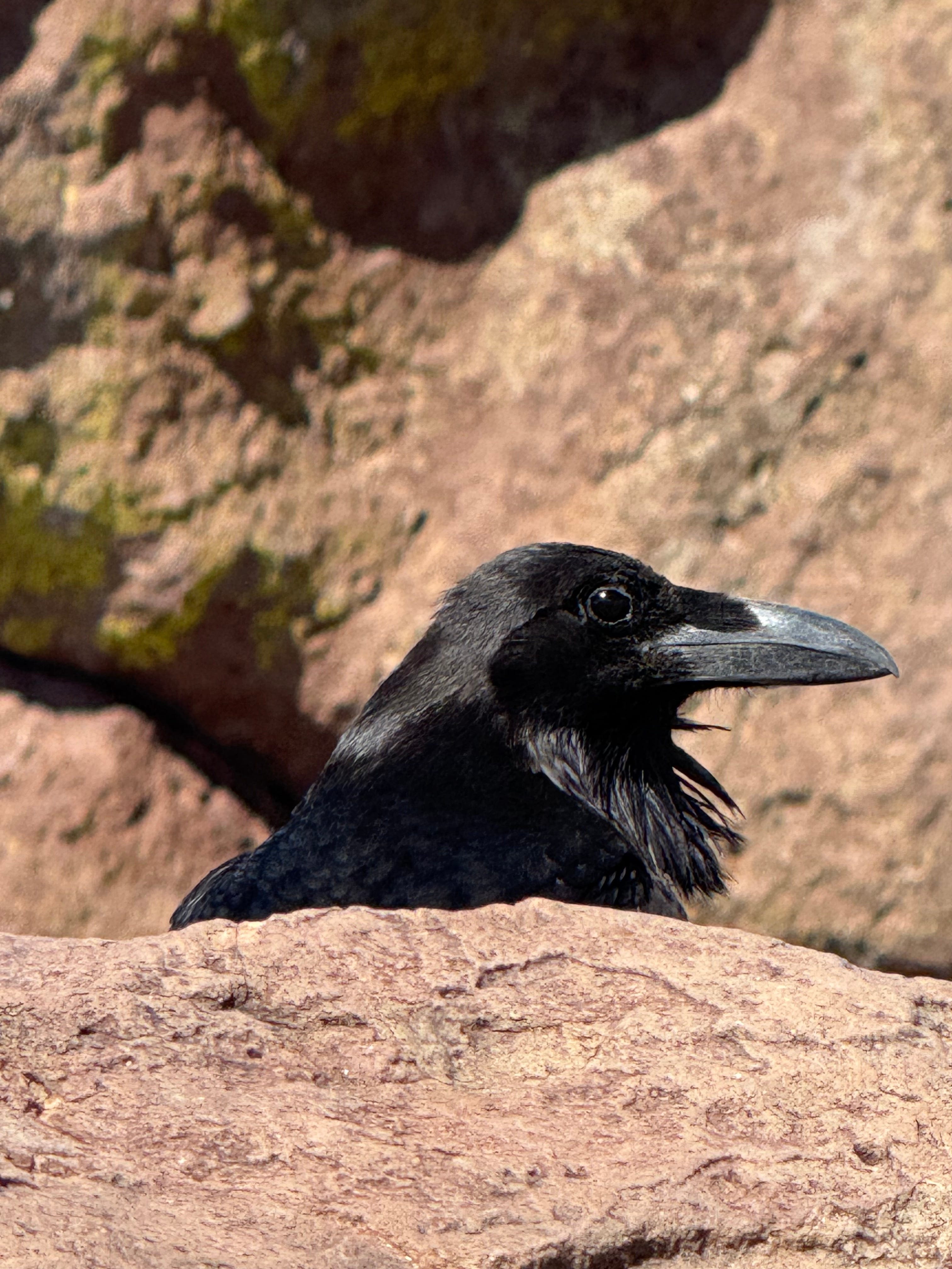
I felt like someone was watching me, and looked over to see this guy:
We hung out for a bit and had a snack, enjoying the cooler 88 degree temps and a nice breeze.
A Wild Kingdom Moment!
As we were having our snack at that top we had a bit of a Wild Kingdom moment when we spotted a tarantula hawk wasp preying on a small tarantula! Whoa!
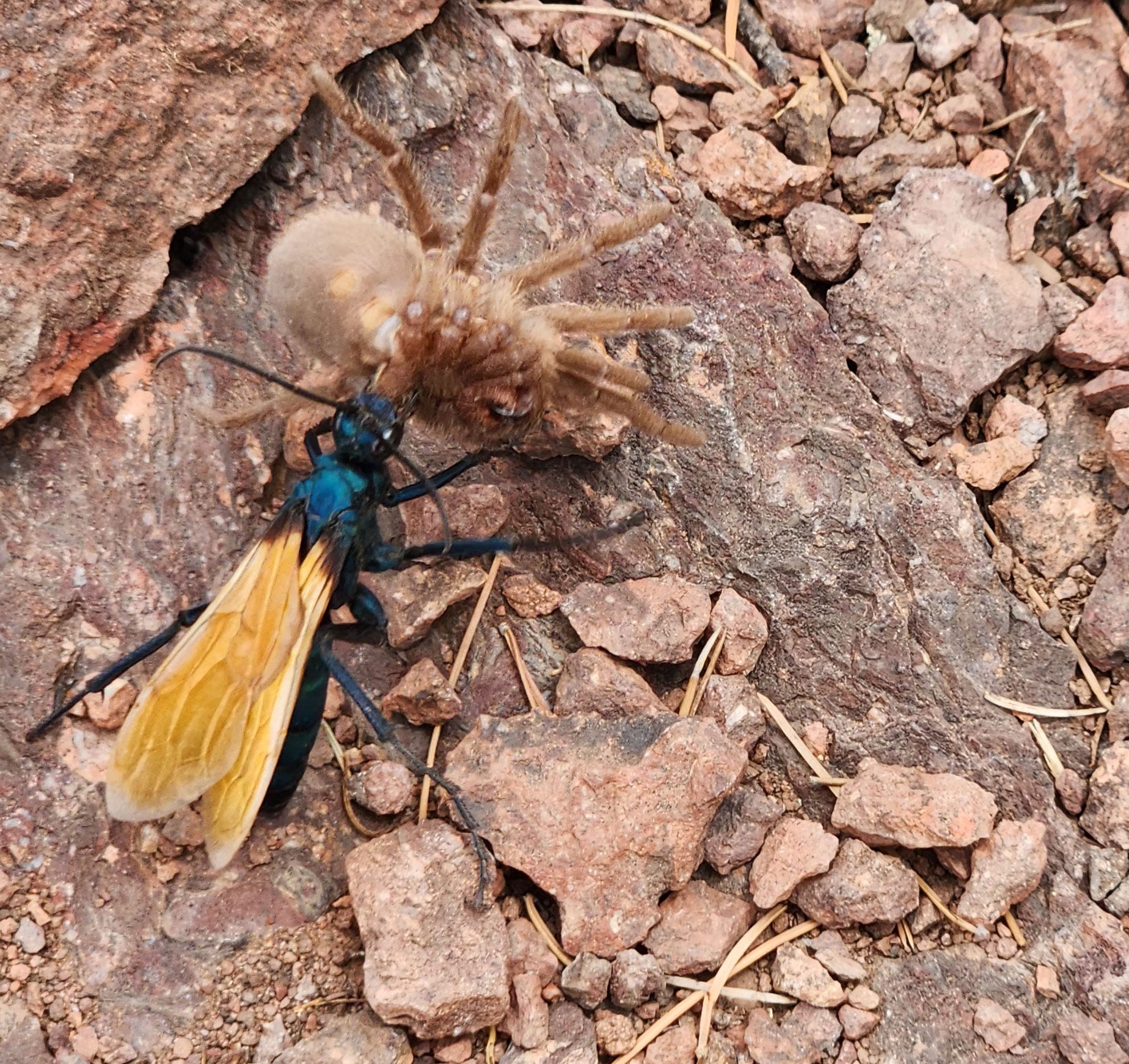
We watched as the hawk carried it into a burrow.
A tarantula hawk is a spider wasp (Pompilidae) that preys on tarantulas. They are some of the largest parasitoid wasps, using their sting to paralyze their prey before dragging it into a brood nest as living food; a single egg is laid on the prey, hatching to a larva, which then eats the still-living host.
Oh my!
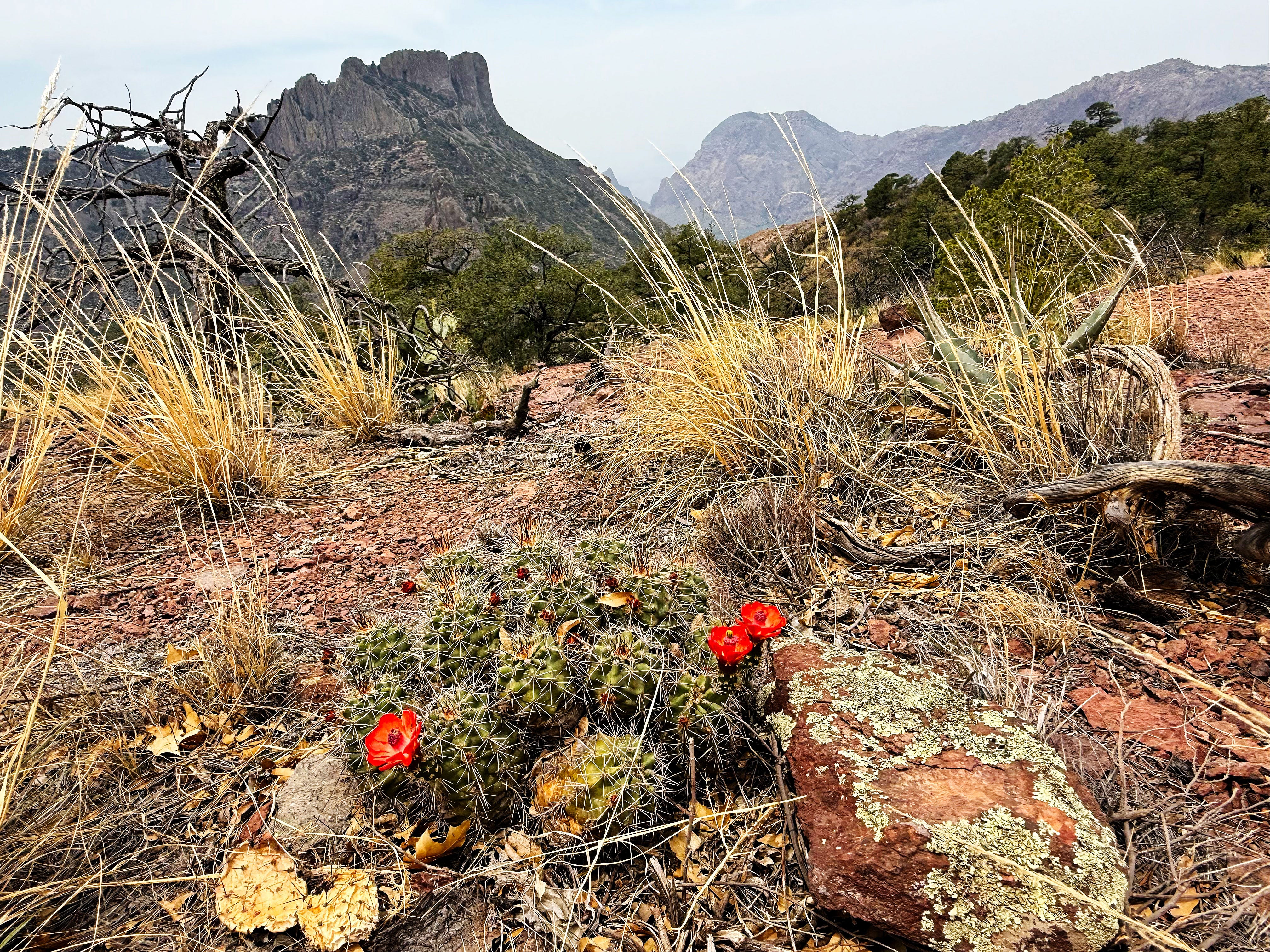
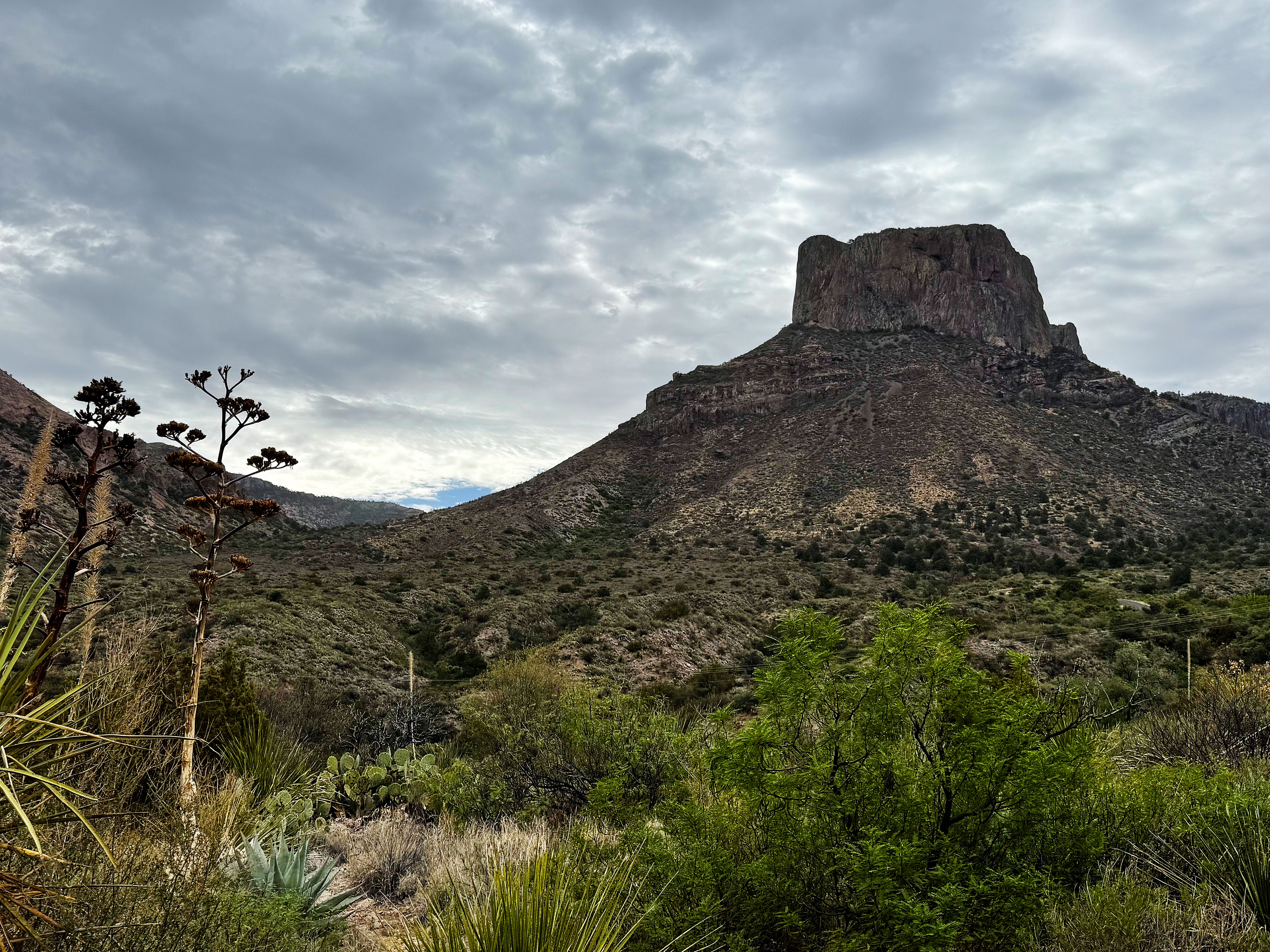
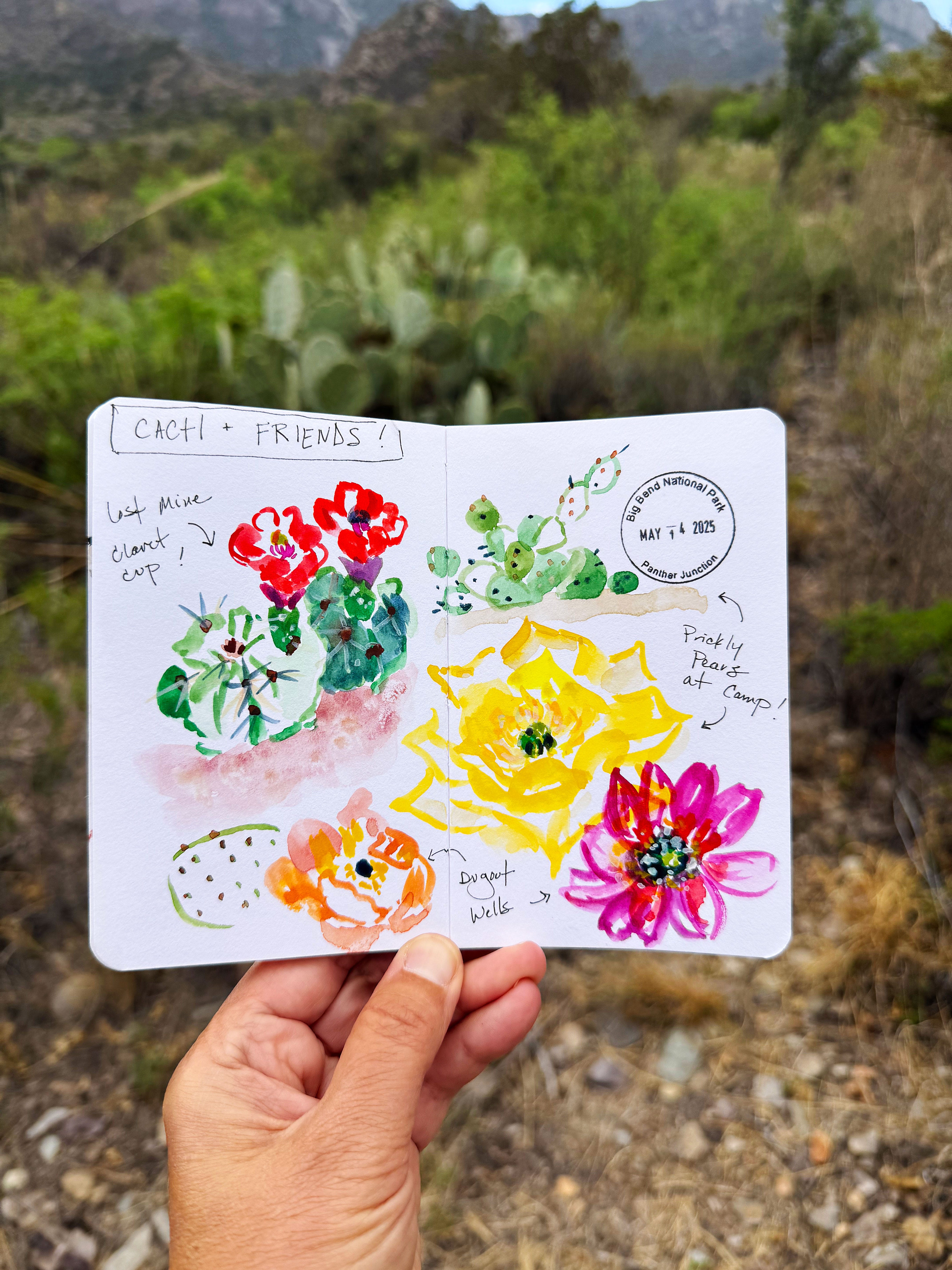
Then the haze moved back in so we figured we better head back down, but not before I sketched the back of Casa Grande Peak and a claret cup cactus:
The haze made everything so surreal — I never saw it like this before — I kept taking photos:
Don’t get me wrong, I’m still glad we got to do the hike — will have to hold me over for 2 whole years!
Wednesday: Panther Junction
Next we stopped by the Panther Junction Visitor Center to see if they knew anything about the haze and smokey smell — the rangers said there were fires burning in Mexico and Fort Davis, Texas so they were guessing that’s where it was coming from.
We also asked about the drought, and they confirmed that the Big Bend region is really suffering. The summer monsoon rains didn’t come last year, so everything is super dry. They think the oaks and madrones are dormant and not dead — so cross your fingers!
The temperatures started ratcheting up — it was 100 degrees F in the parking lot!
Wednesday: Dugout Wells
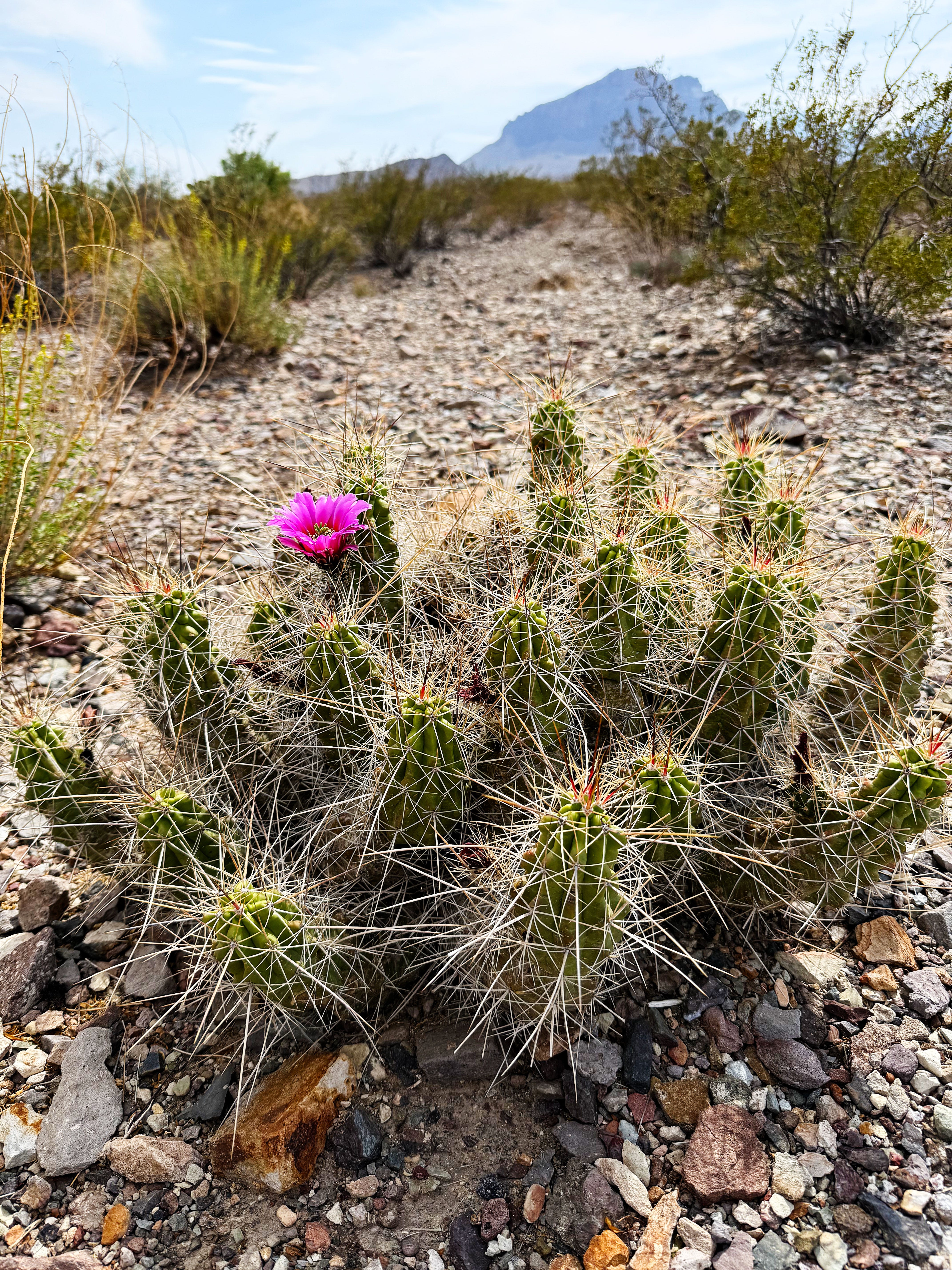
Even though it was getting pretty hot we decided to head to Dugout Wells since it was so close to look for cacti blooms — and we found some hot pink strawberry cacti doing their thing:
It was a 102 degrees by this time, so we just did the short 1/2 mile nature trail. Whew! That left us with 8+ hiking miles on the day.
On the way back to camp the temperature hit 110 degrees. Yep, you read that right!
As we passed the parking lot for the Lost Mine Trail where we started the day it was 104 degrees.
We decided to stop by the store in the Basin to stay in the van’s A/C a little while longer — and it was 100 degrees.
When we got to our campsite in the Chisos Basin Campground around 6:00 it was still 102 degrees.
Whoa.
That set a new record for us. We have an air conditioner in the cabin part of the van so we ran it for a few hours to try and cool things off, but it was still 86 degrees at 9:30 pm.
What a day!
Thursday: Heatwave!
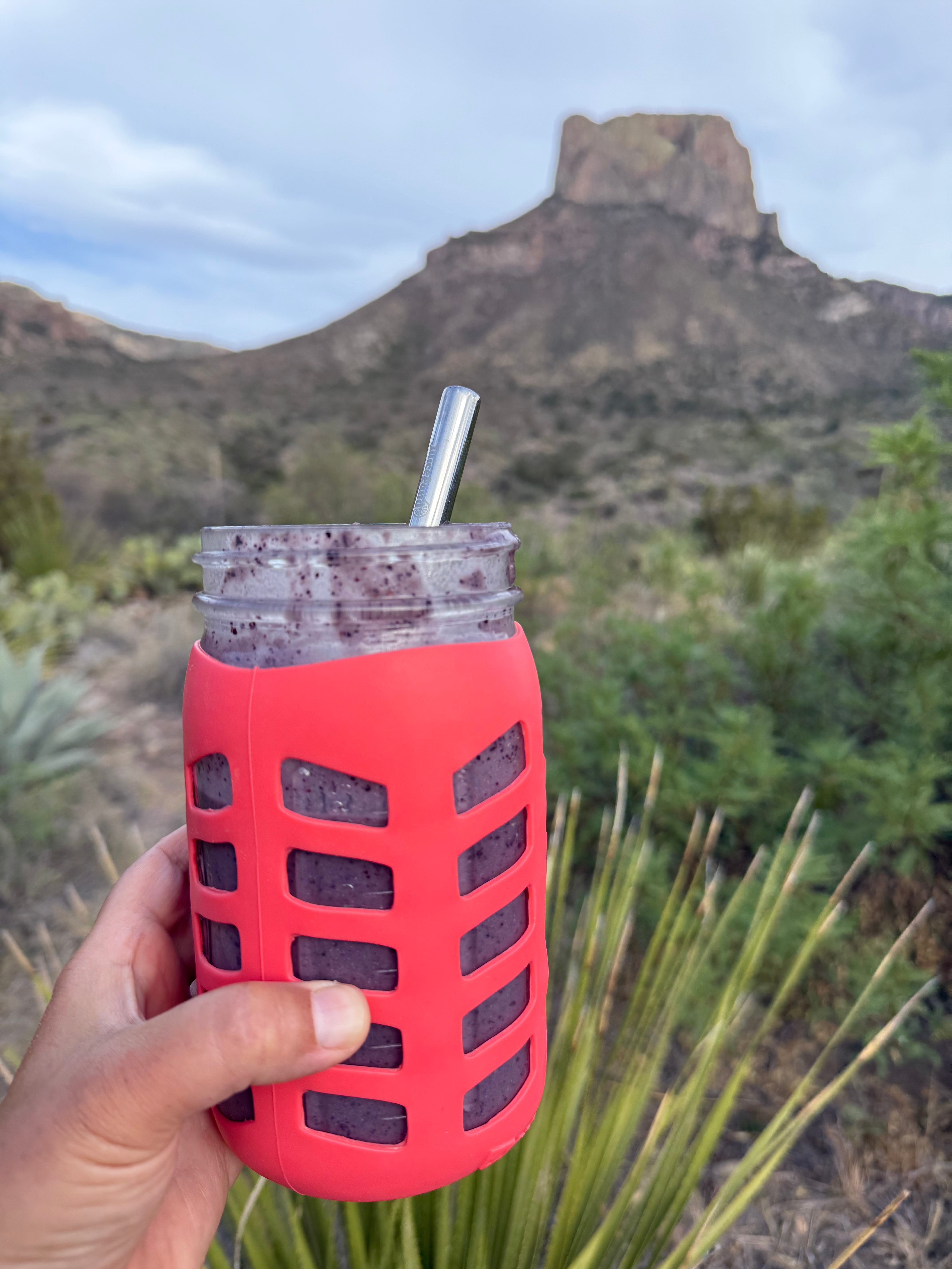
Thursday was another hot one so we stayed in camp and took it easy. We had blueberry/banana smoothies for a treat — thankful for having a freezer and an immersion blender in the van.
But we weren’t so thankful for the gnats! They were out in swarms. And they leave these horrible welts on me and are super itchy. Gah!
Friday: A Rare Cloudy Day
Friday was an unexpected treat! It was a rare, cloudy day in the Chisos. Temperatures stayed in the 70s-mid 80s all day. We even had a few sprinkles of rain!
It felt like heaven!
Art Day
I couldn’t pass up the opportunity to catch up on some art!
First I finished up this cactus spread that I started on Wednesday:
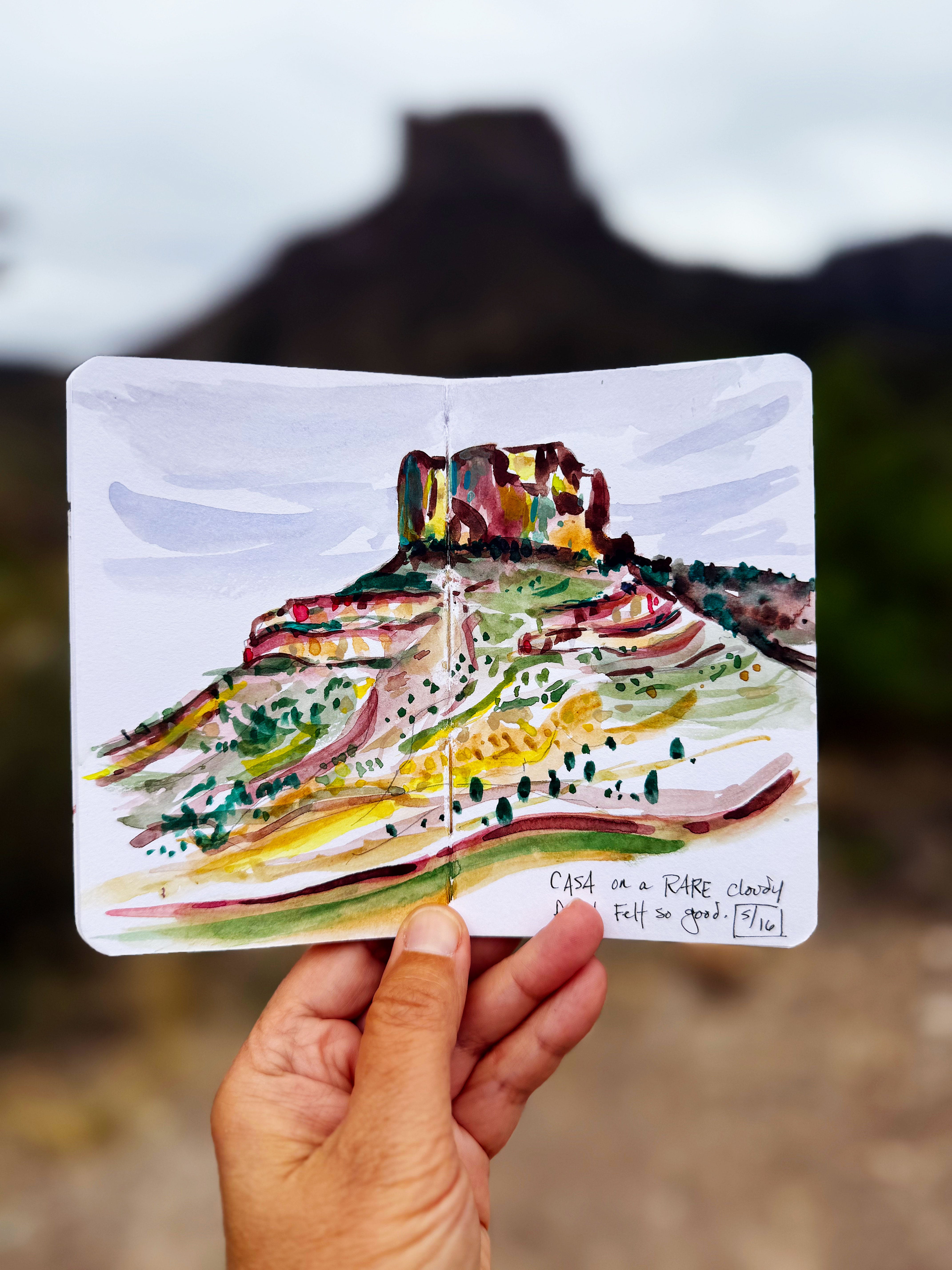
Then I sketched Casa Grande Peak using the bear box as my desk and made a video — you can watch it here on Instagram to see more:
Then I started a project I’ve been wanting to do for a while now: sketching mountains in a special sketchbook I got years ago from Peg & Awl — I brought it with me from Austin and had been saving it for a special project — today was the day!


The sketch on the left is of our camp view of Casa Grande Peak, and the right is The Window from the trailhead a few yards away.
Flora & Fauna
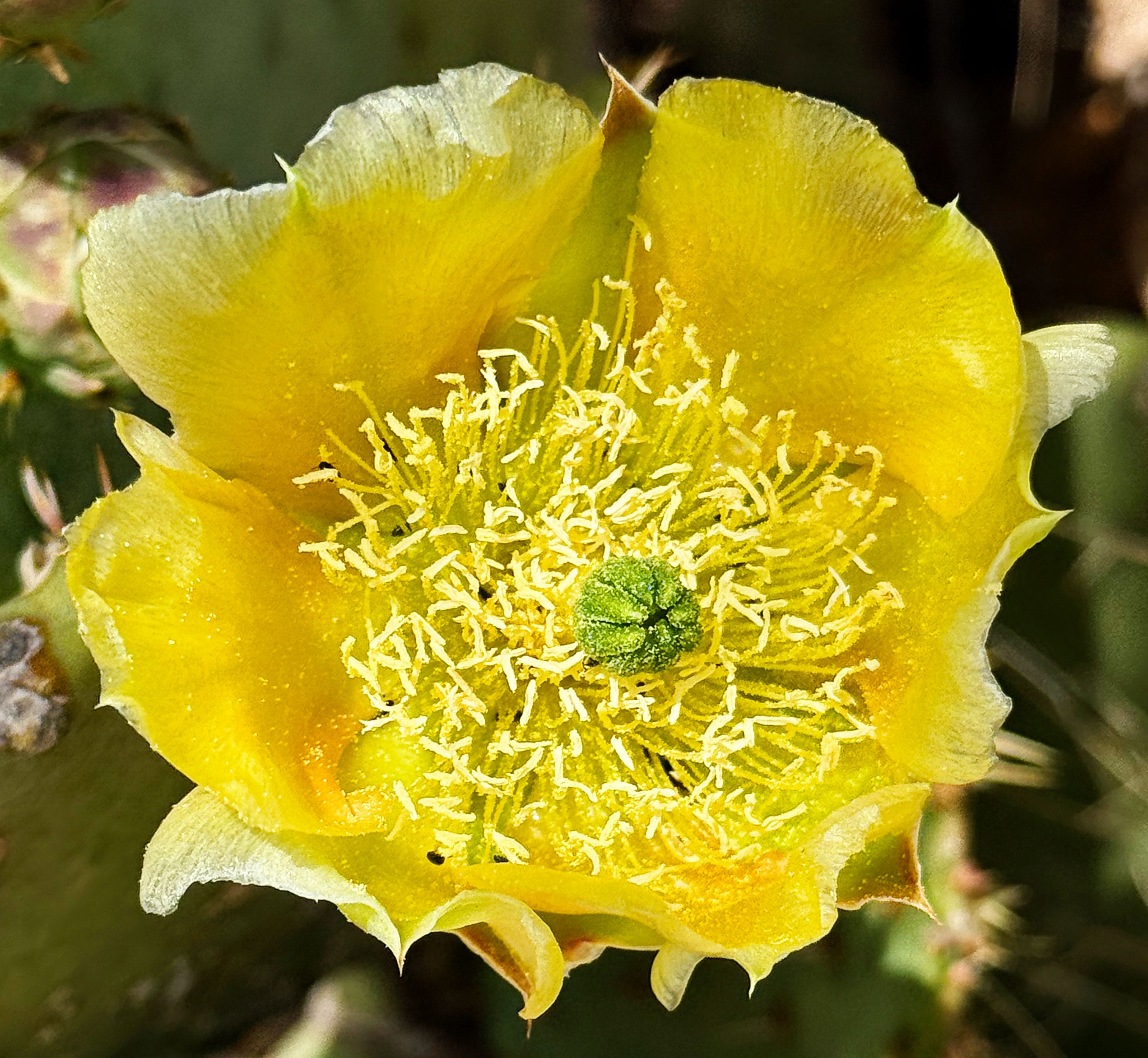
The prickly pears were blooming all over the campground, with bright spots of color on this cloudy day:
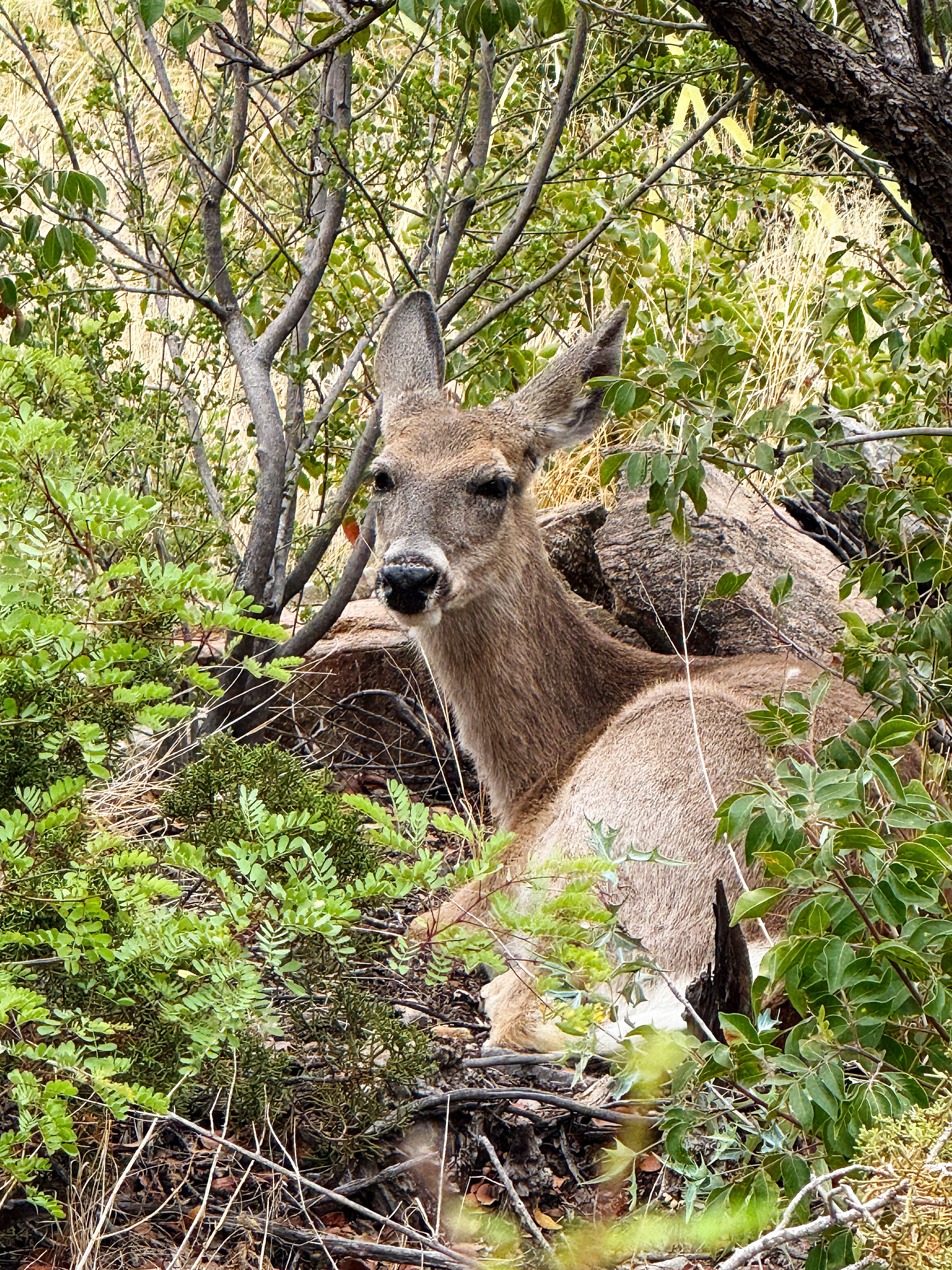
We had a sweet deer hang out in the traffic circle for a while:
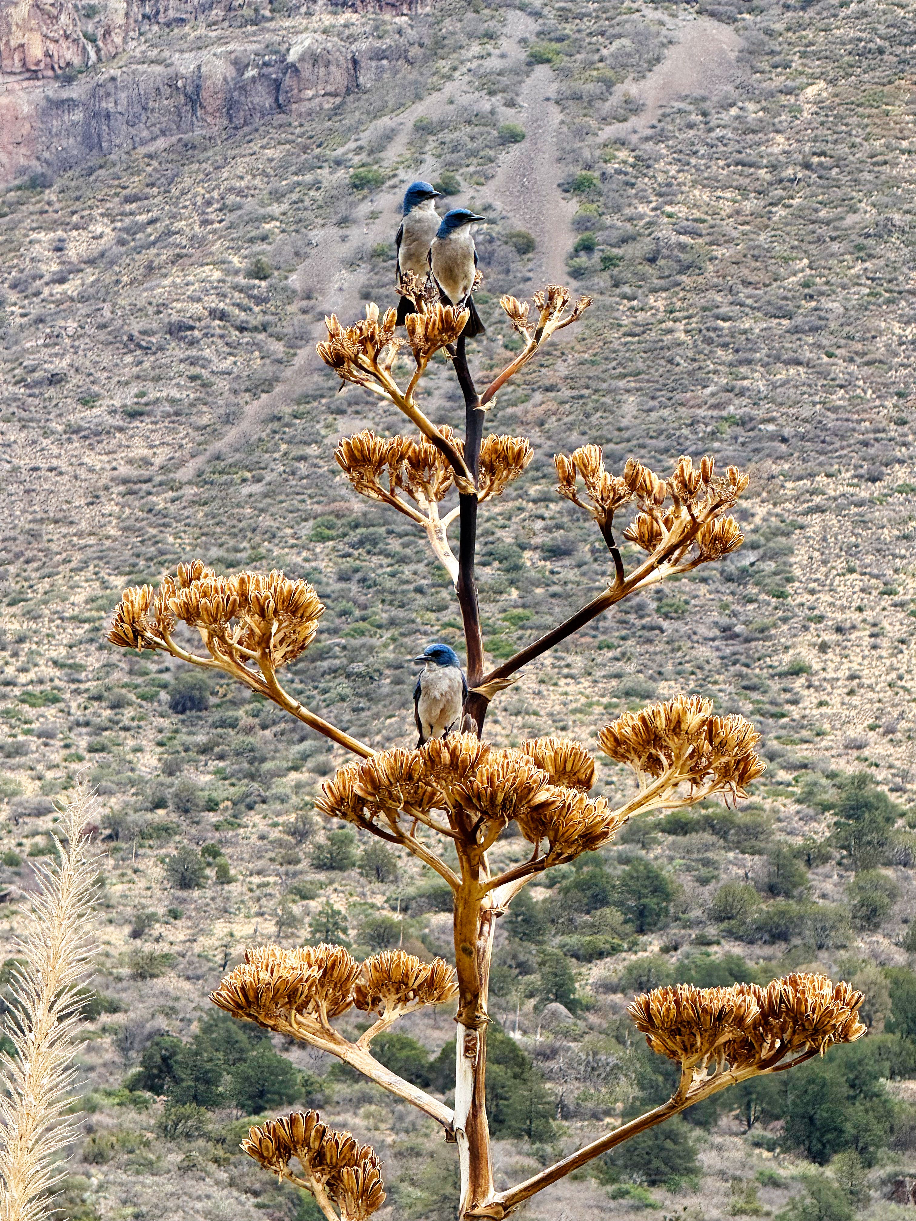
And a group of Mexican Jays hung out in in the agave stalks near the picnic table — they’re so gregarious and funny!
We also had some more wildlife in camp that I didn’t get photos of, including Scott’s Oriole (hi, Scott Lenharth — we were thinking of you!), Wilson’s warbler, cactus wrens, white-crowned sparrows, tarantula hawk wasps, a flock of white-winged doves, and even a huge dragonfly! (We’re guessing they’re getting water from the wastewater treatment plant.)
What a great day! Needed that.
Saturday: Camp Day
The weather forecast called for another hot day so we decided to hang out in camp — I wanted to savor our last full day here.
There was crazy cool morning light on The Window and I sat at the picnic table at the trailhead and watched it play on the peaks. (Read about our hike down to the pour-off last week.)
It turned out to be another cloudy day, and not quite as hot as expected — it “only” got up to 94, ha!
More prickly pears started blooming next to the van and the diffuse light made them seem to glow.
Public Lands Update
With so much going on in the world these days most people don’t realize that our public lands are under attack by the current administration, so I’ve been trying to include some info about it here to keep everyone in the loop.
Essay on the Meaning of Public Lands
More than Just Parks has a really good essay on the meaning of “public lands” that I highly recommend reading and sharing with everyone you know. Warning: I got teary reading it.
National Parks Conservation Association Live Event
The NPCA is having a free live event on May 22nd at 7 pm EST to talk about the latest threats against national parks and how we can take action to help fight back and preserve our shared history and heritage. More than 350 national parks could be lost forever. You can sign up here.
That’s a Wrap!
That’s a wrap for this week! Whew! You made it through this loooooong post. Thanks for reading to the end. It seems like even when we slow down for a heatwave we still do too much, ha!
To thank you for reading, I’d like to send one lucky subscriber a postcard from Big Bend! Just leave me a comment below with your favorite photo from this post, and I’ll use a random number generator to pick a winner sometime next week. (I’ll contact you for your address — don’t leave your address in the comment, y’all!)
Thanks again for following along on our grand advanture — it really means so much to have you along for the ride! — Lisa, Jason & Walter-the-Van
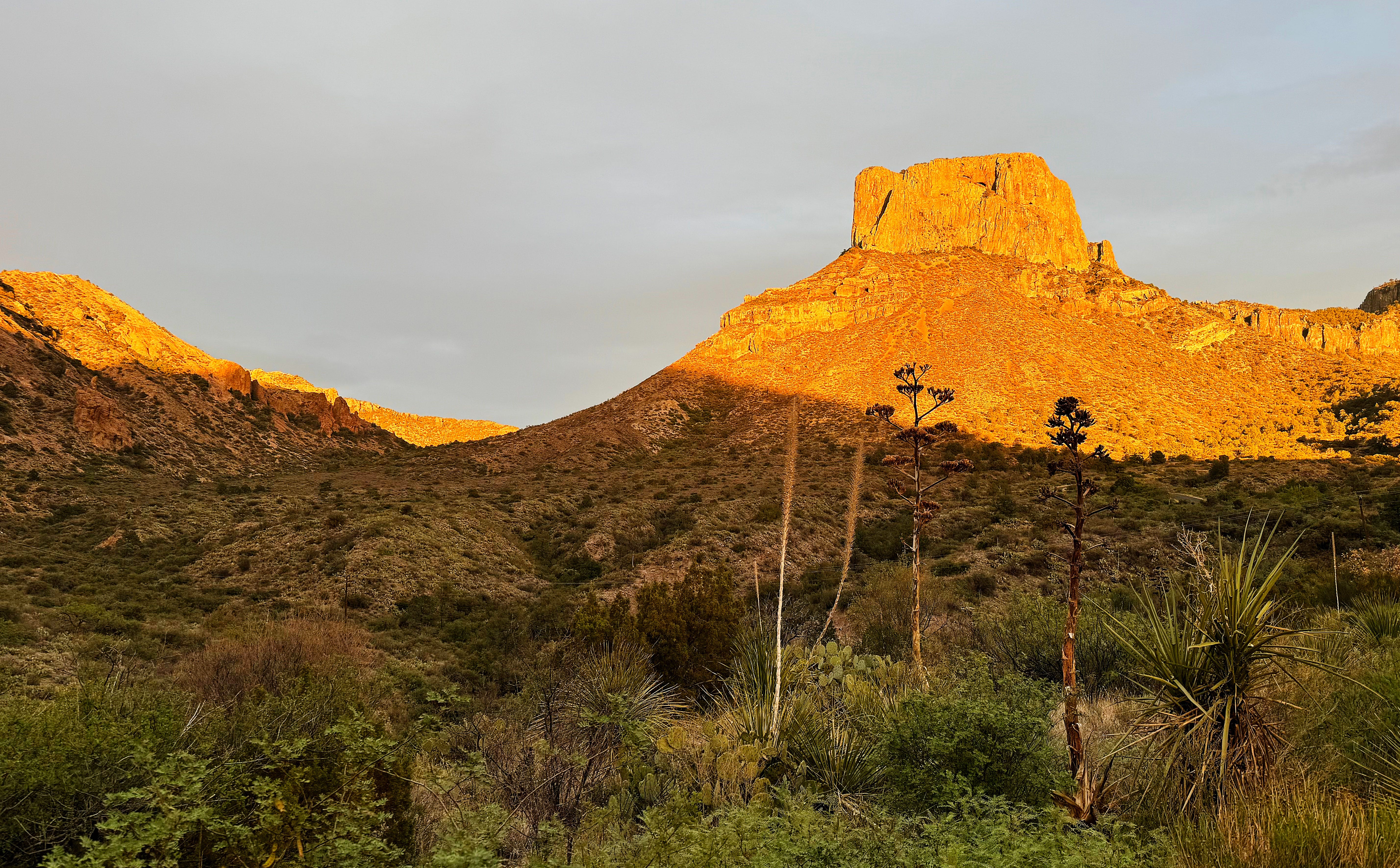
Great read and fabulous photos. Love the final pic of Casa Grande Peak
Returning to say looking at this photos again - The deep shadows and sharp angles reminding me of Annie Dillards - Pilgrim at Tinker Creek (1974). I know before your time I think but the first chapter walks you through the light show of the setting sun of the mountains of Virginia. If you have not read it you should. It is a deep walk into the woods and mountains she lived in. Something you are doing now in the deep western lands.