
Week 43: Back on the road after wrapping up my artist residency.
So many adventures from Utah to Colorado and New Mexico!

Hi friends! Hi fam! How is it Tuesday, April 1st already? I usually try to put our weekly update out by Sunday, but so much happened that I just didn’t have time — it was all good tho!
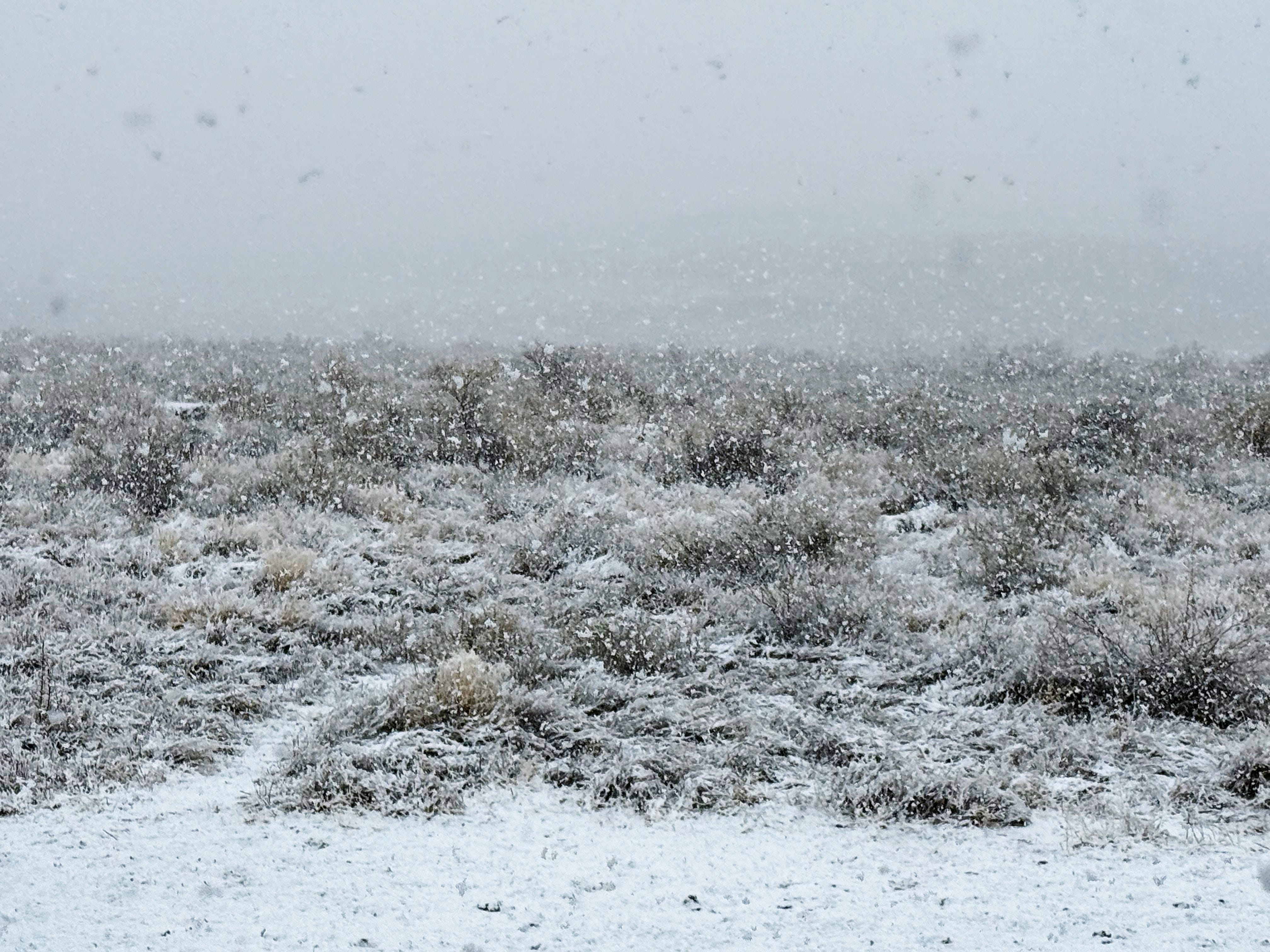
I’m writing this from the campground in Chaco Canyon at Chaco Culture National Historic Site and it’s super windy today — the van is shaking and making it hard to type! We knew this storm was coming so we got some hikes in beforehand and thought today would make the perfect admin day.
So grab a cuppa your favorite beverage and settle in because this is a loooooooong post!
Let’s jump in!
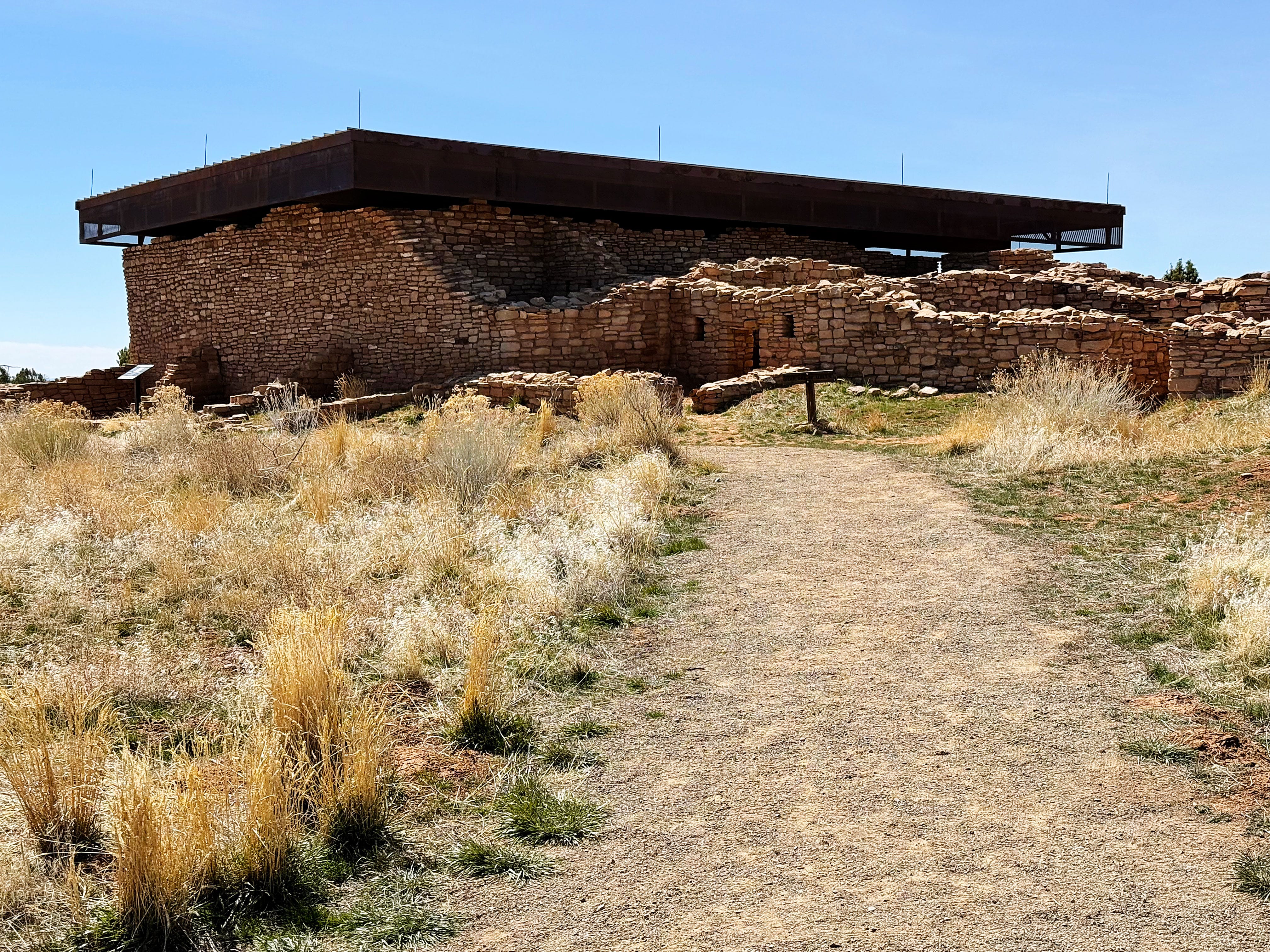
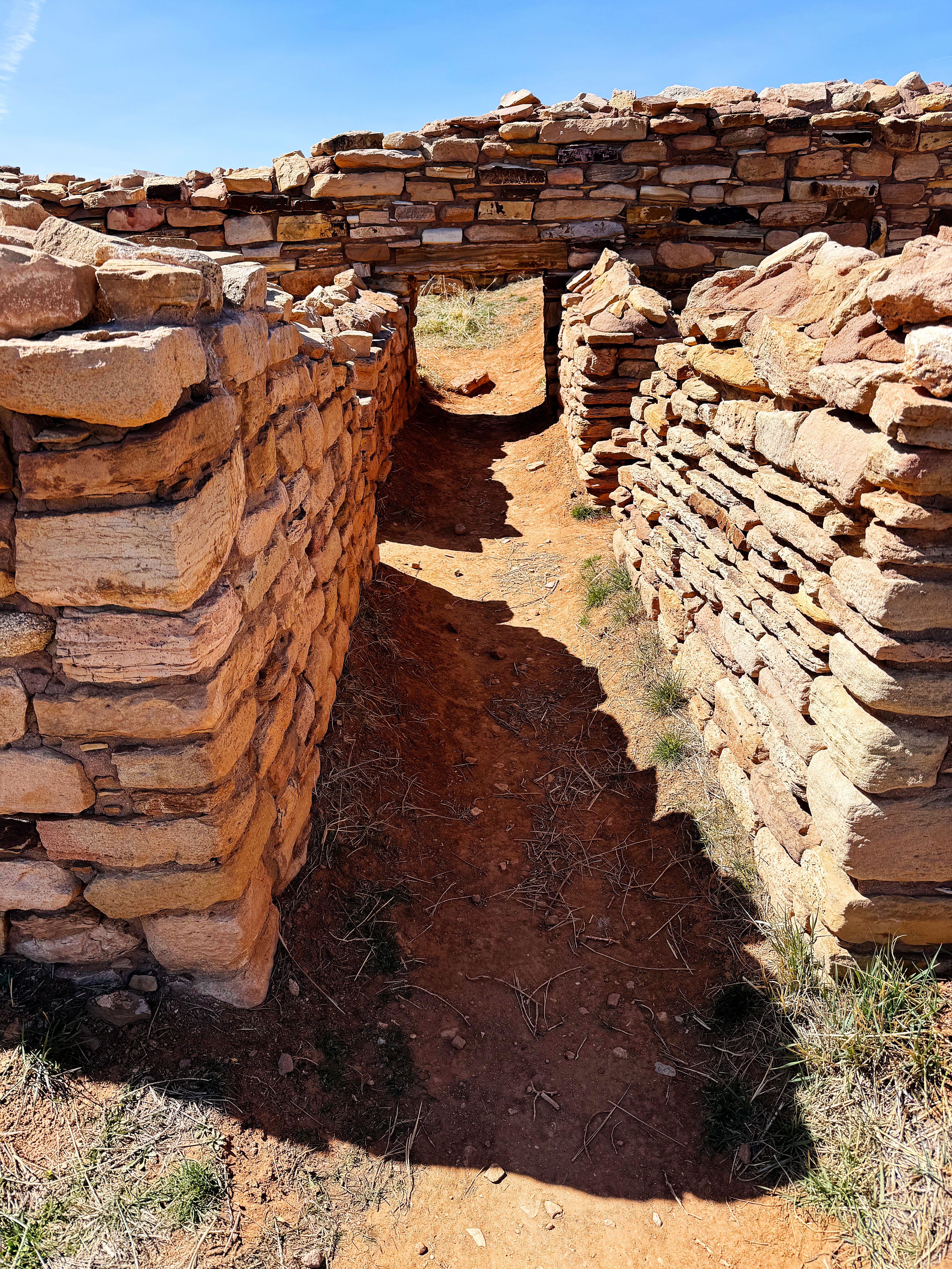
Lowry Pueblo, Canyons of the Ancients National Monument (CANM), Colorado
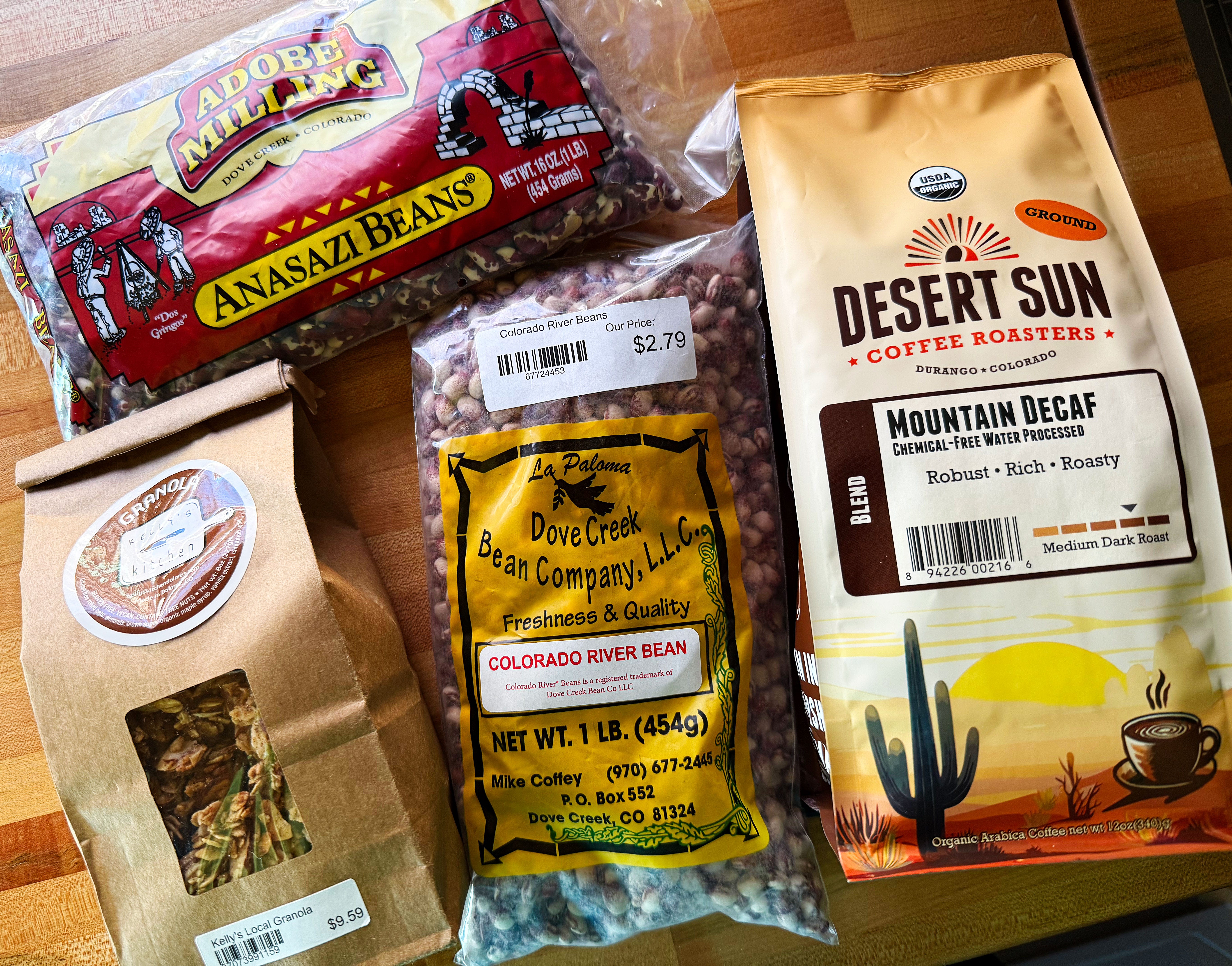
Last Sunday we left our spot in San Juan National forest and after stopping in Dolores, Colorado at the cutest grocery store to pick up a few things we headed to Lowry Pueblo at Canyons of the Ancients National Monument (CANM) in Colorado.
I hadn’t been here since the orientation tour with Ranger Amala when I first started my artist residency at CANM and wanted to stop by this special place to see it one more time.

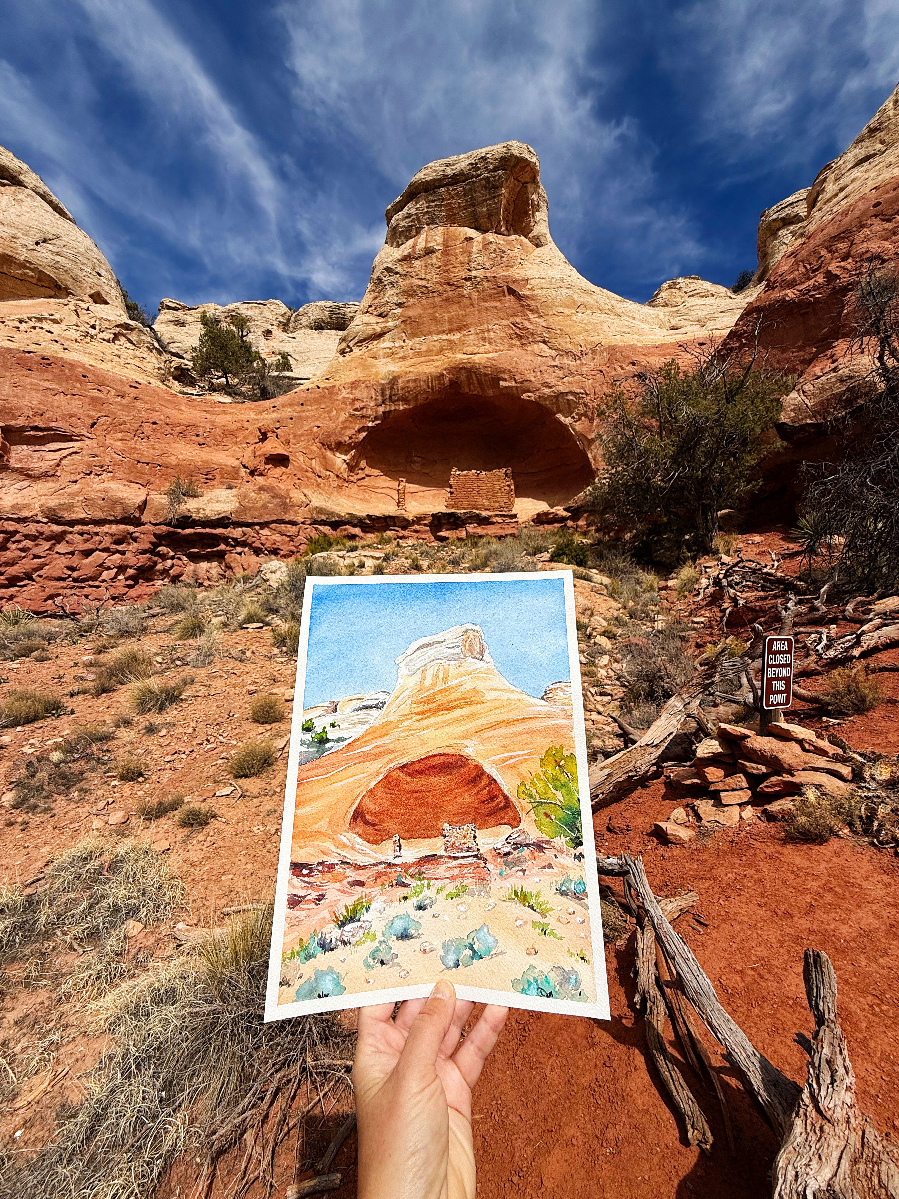
I also wanted to photo onsite one of the paintings of a pottery sherd that I donated to CANM as part of my artist residency. (More on my residency below!) Note: that’s not a typo — one of the things I learned during my residency is to use the word “sherd” for pottery “shards”.
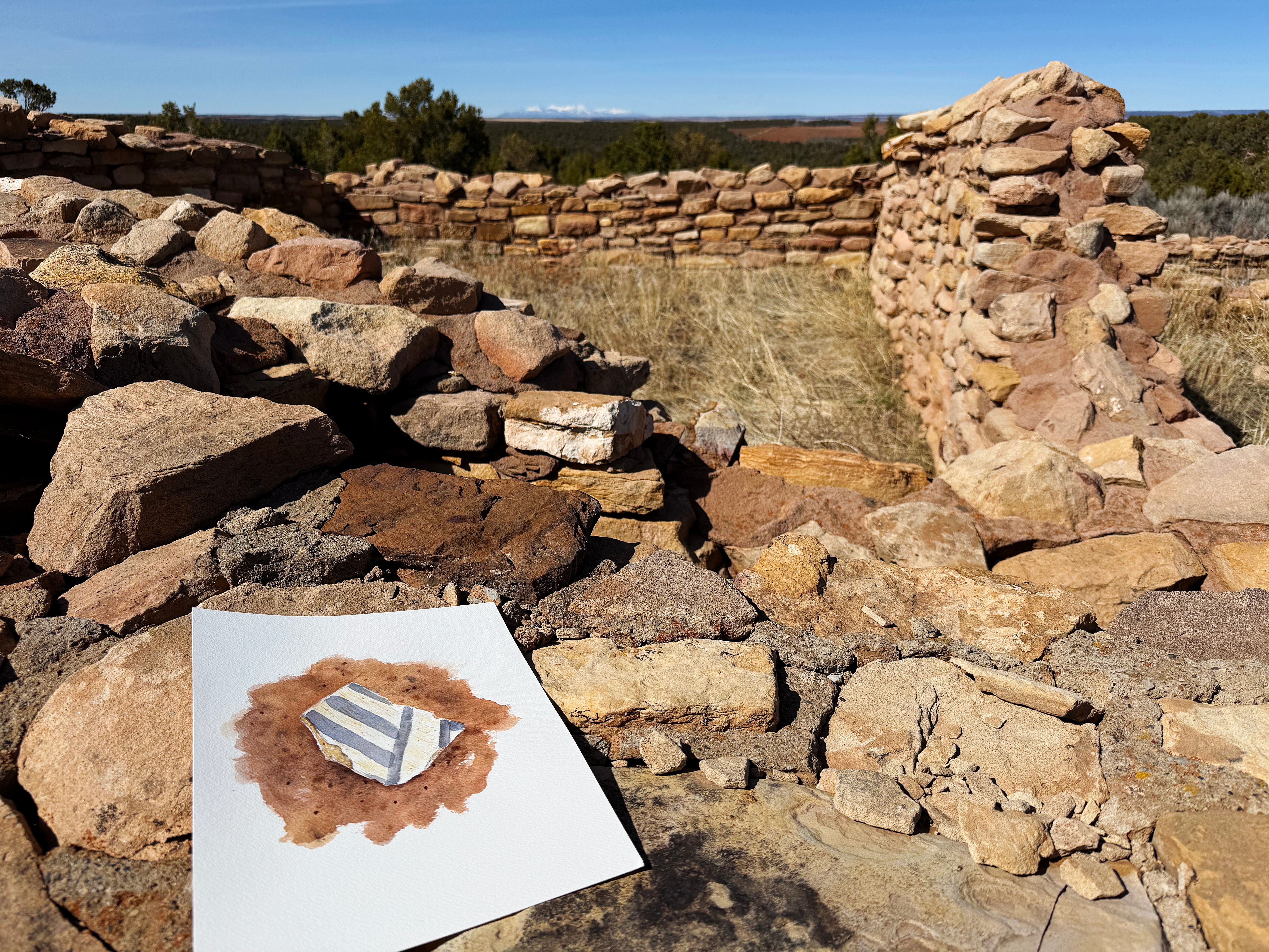
I hope to have of video of painting this piece finished soon — stay tuned!
Then it was on to…
Hovenweep National Monument, Utah
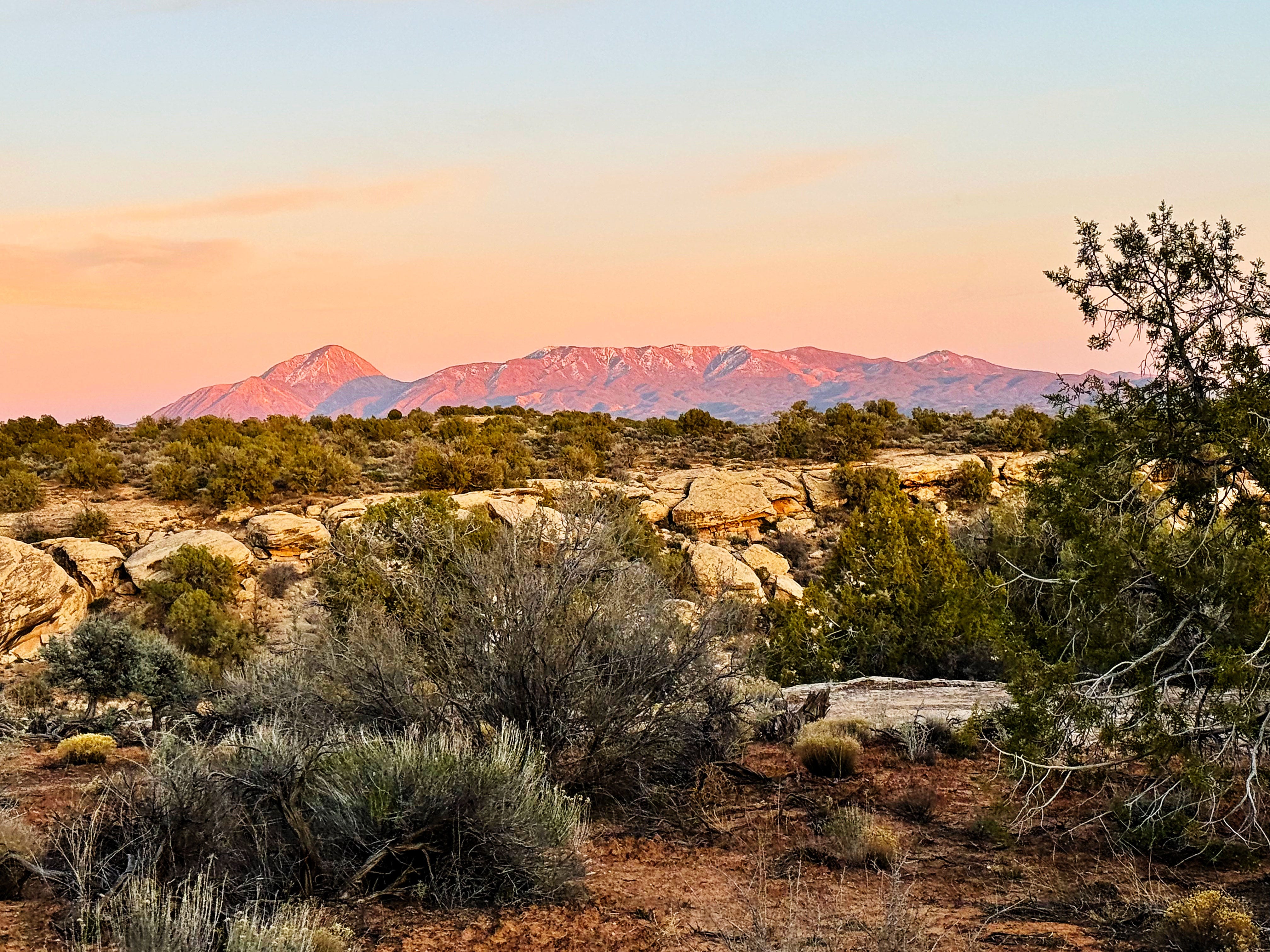
Sunday through Tuesday we camped at Hovenweep National Monument, and were lucky enough to have views of Sleeping Ute Mountain each night.
While we were at Hovenweep we hiked at several Ancient Puebloan people’s cultural sites, and took a few side trips while we were there too. Read on for more.
Hovenweep: Holly Site
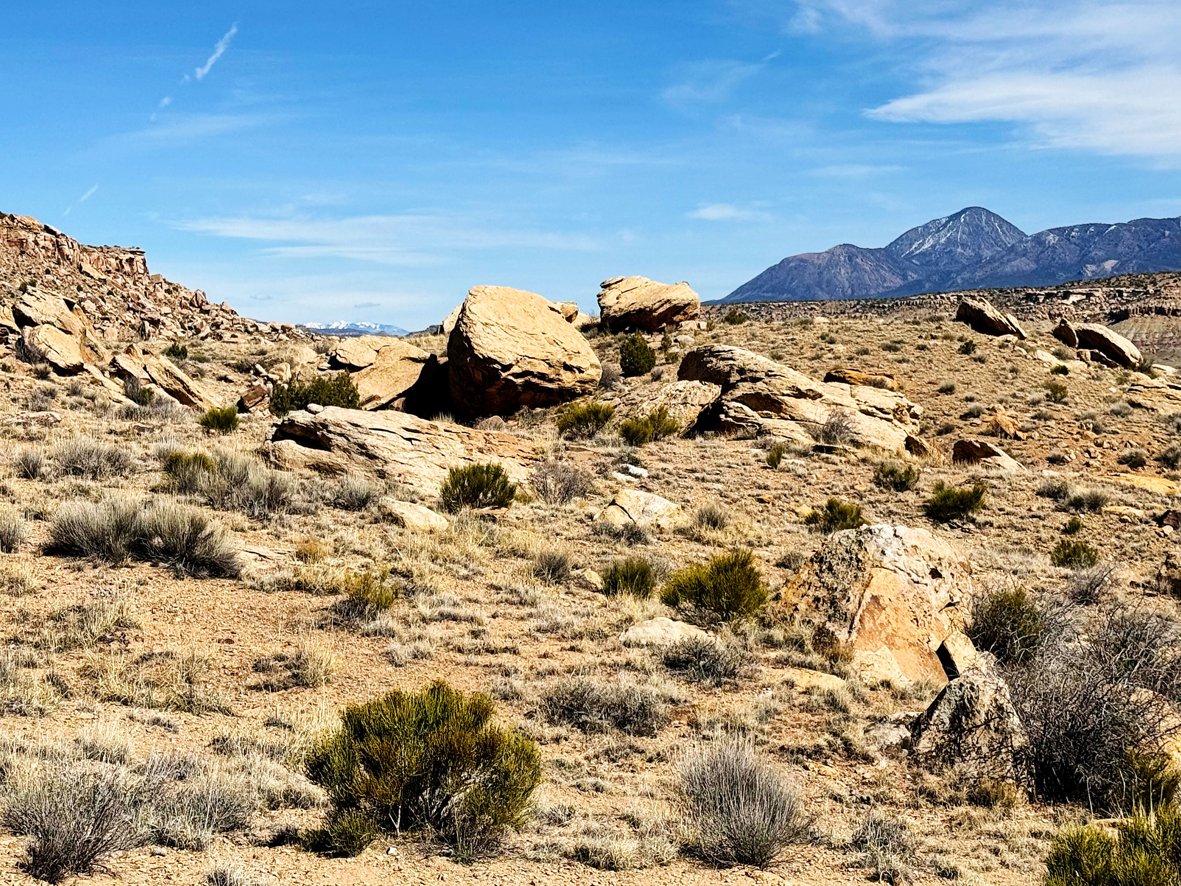
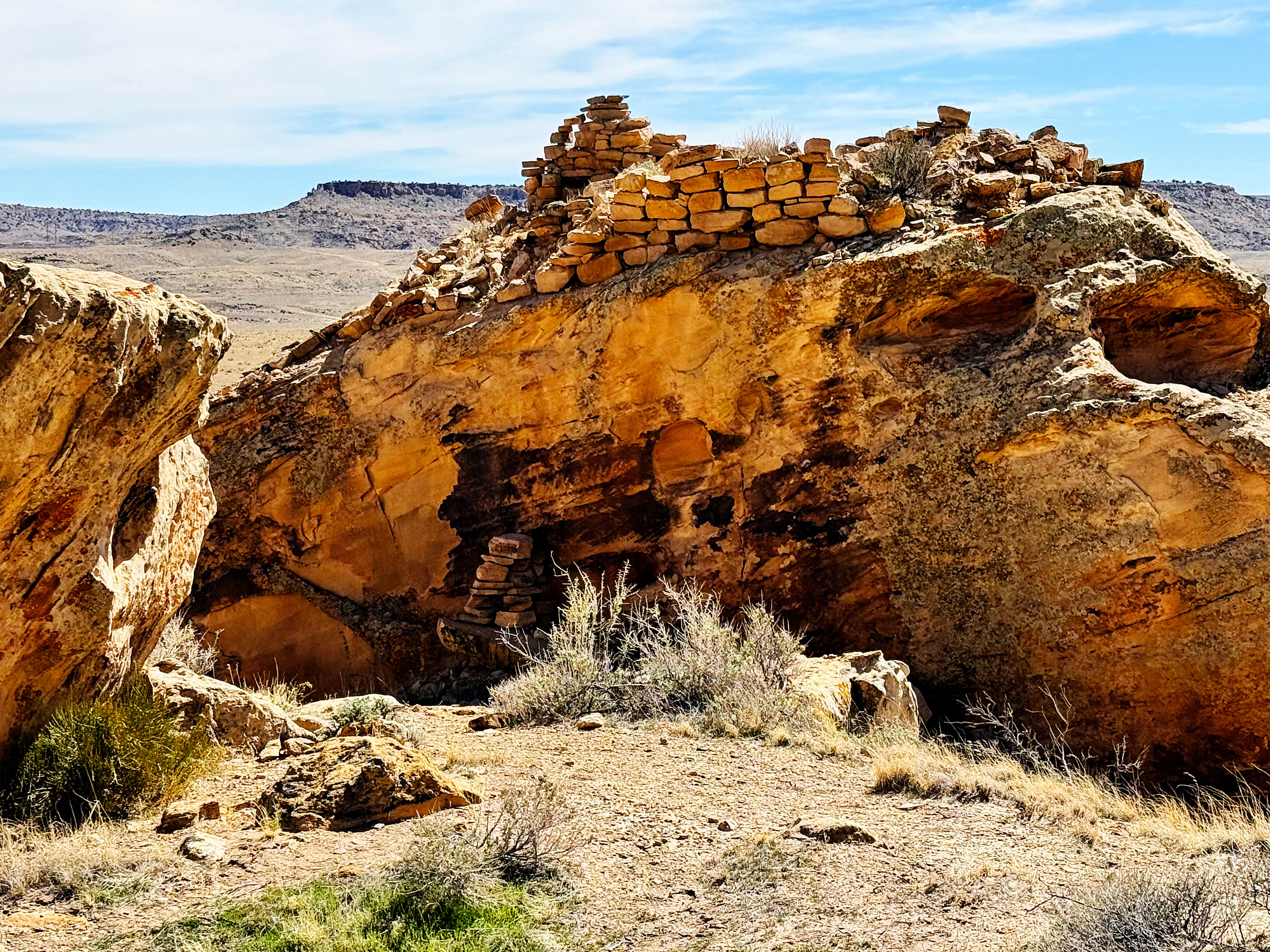
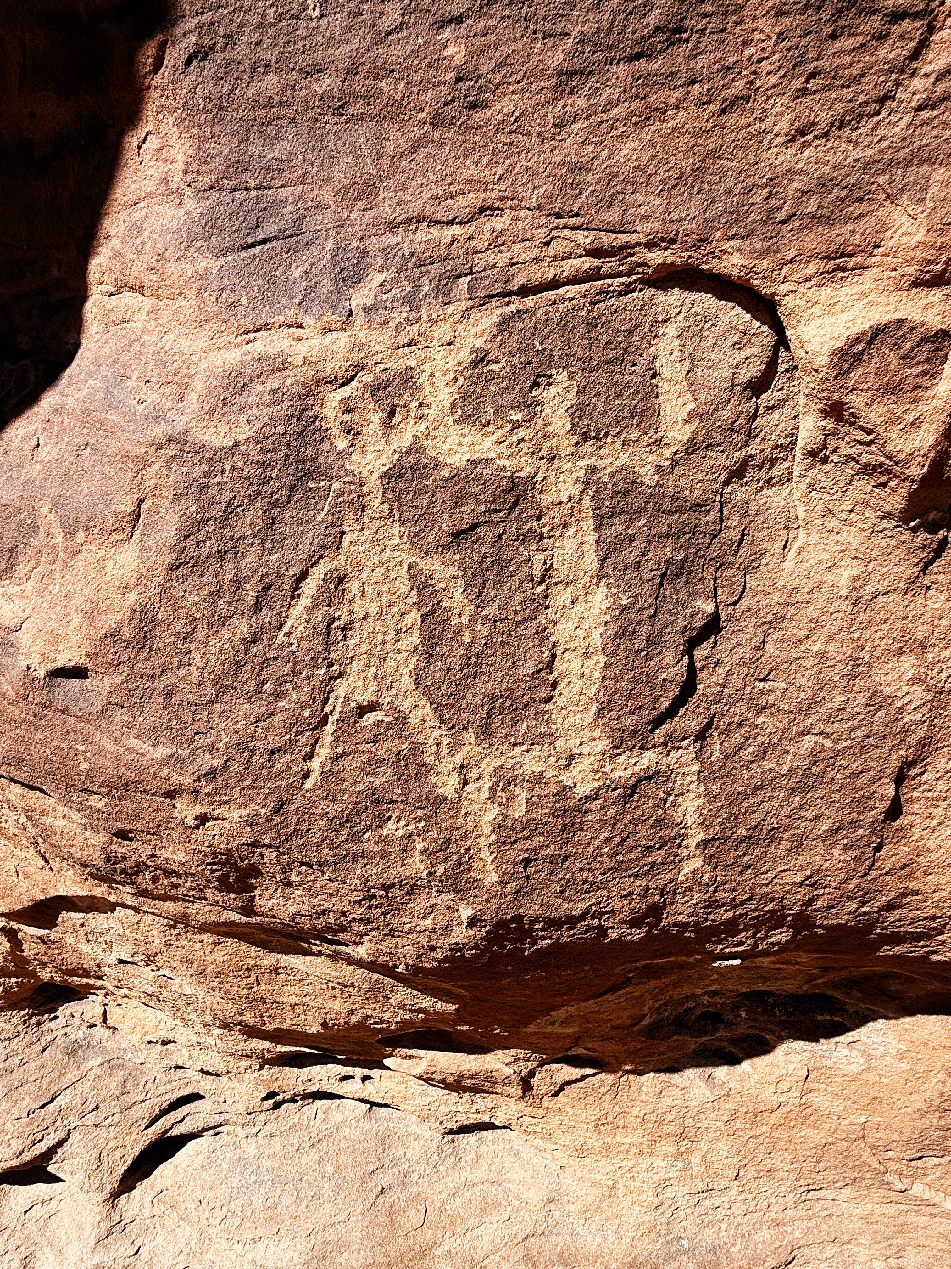
We visited Hovenweep’s Holly Site and I was so impressed by these structures — built without metal tools by the Ancient Puebloans. Just wow! How did they build on that boulder?!?
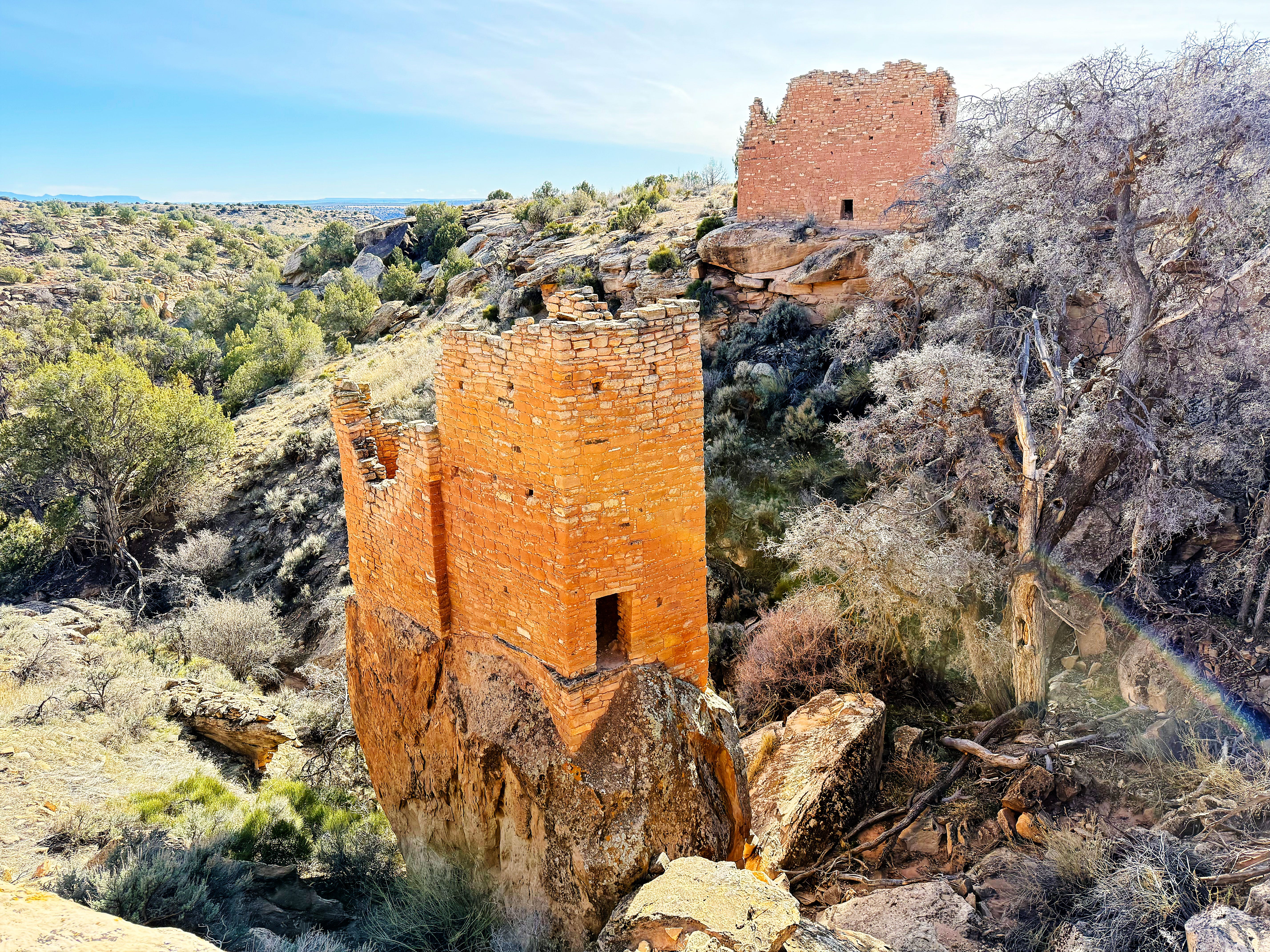
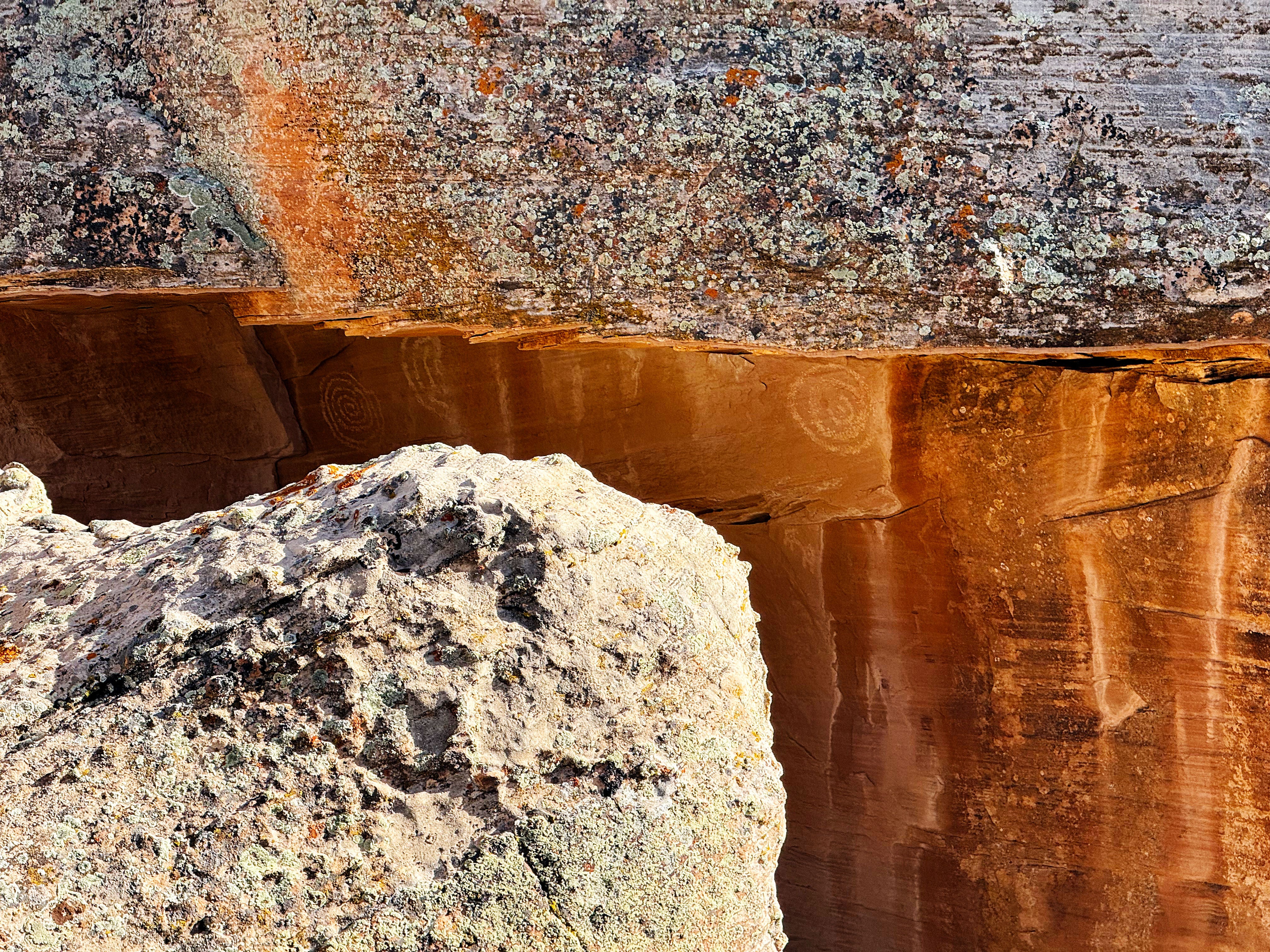
We also got to see the petroglyphs hidden by another boulder — just so amazing to think about someone making these hundreds of years ago.
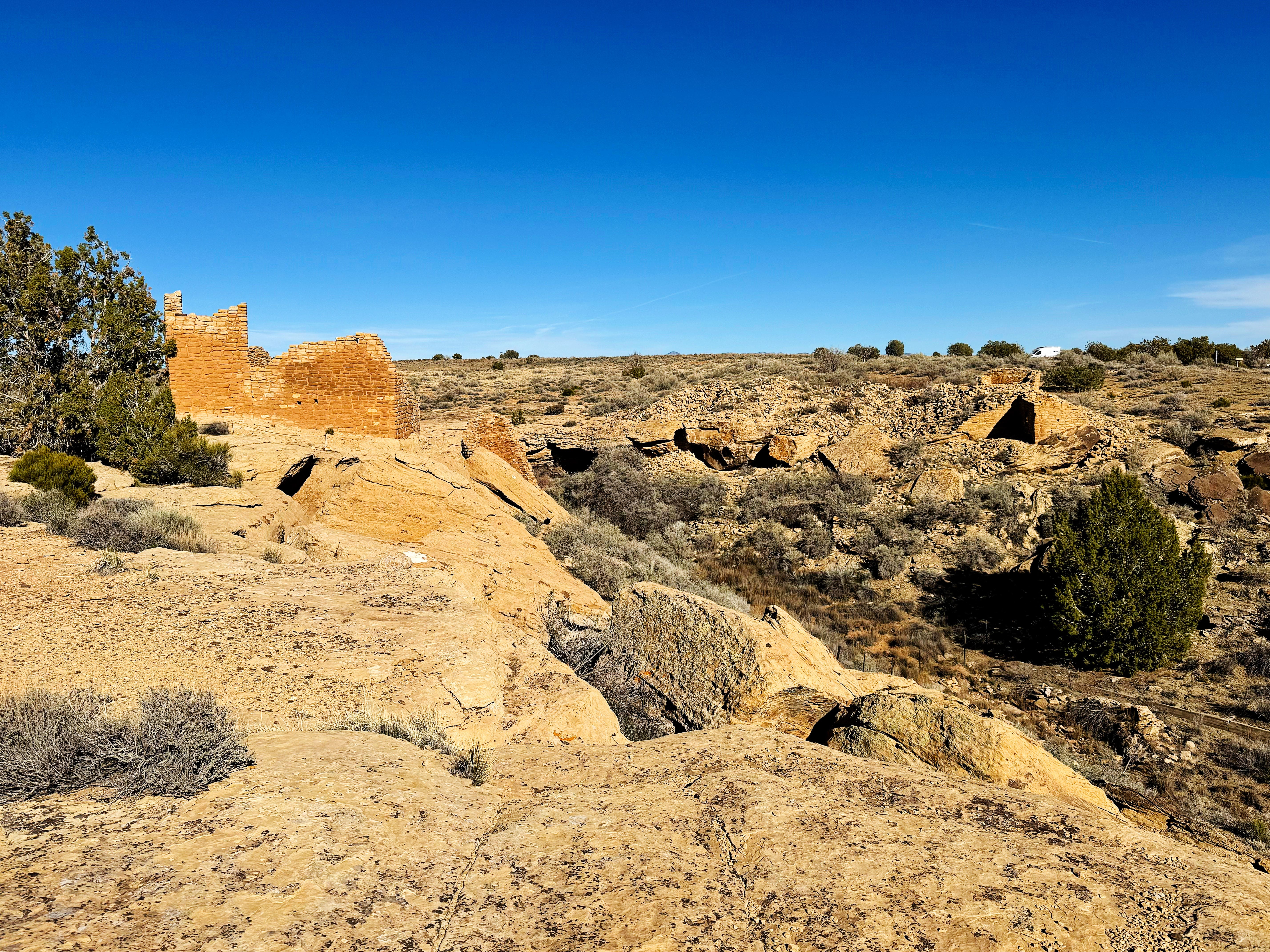
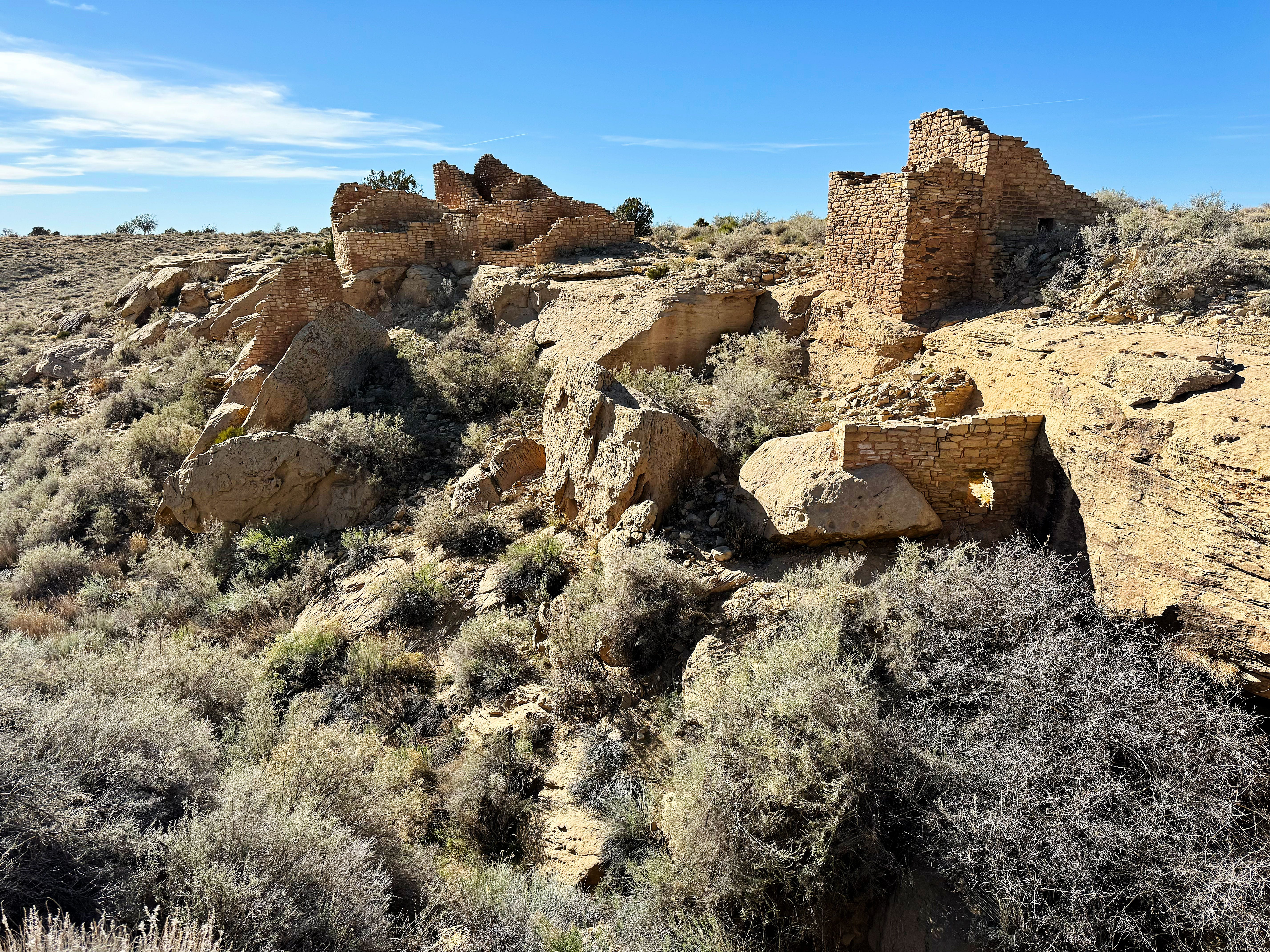
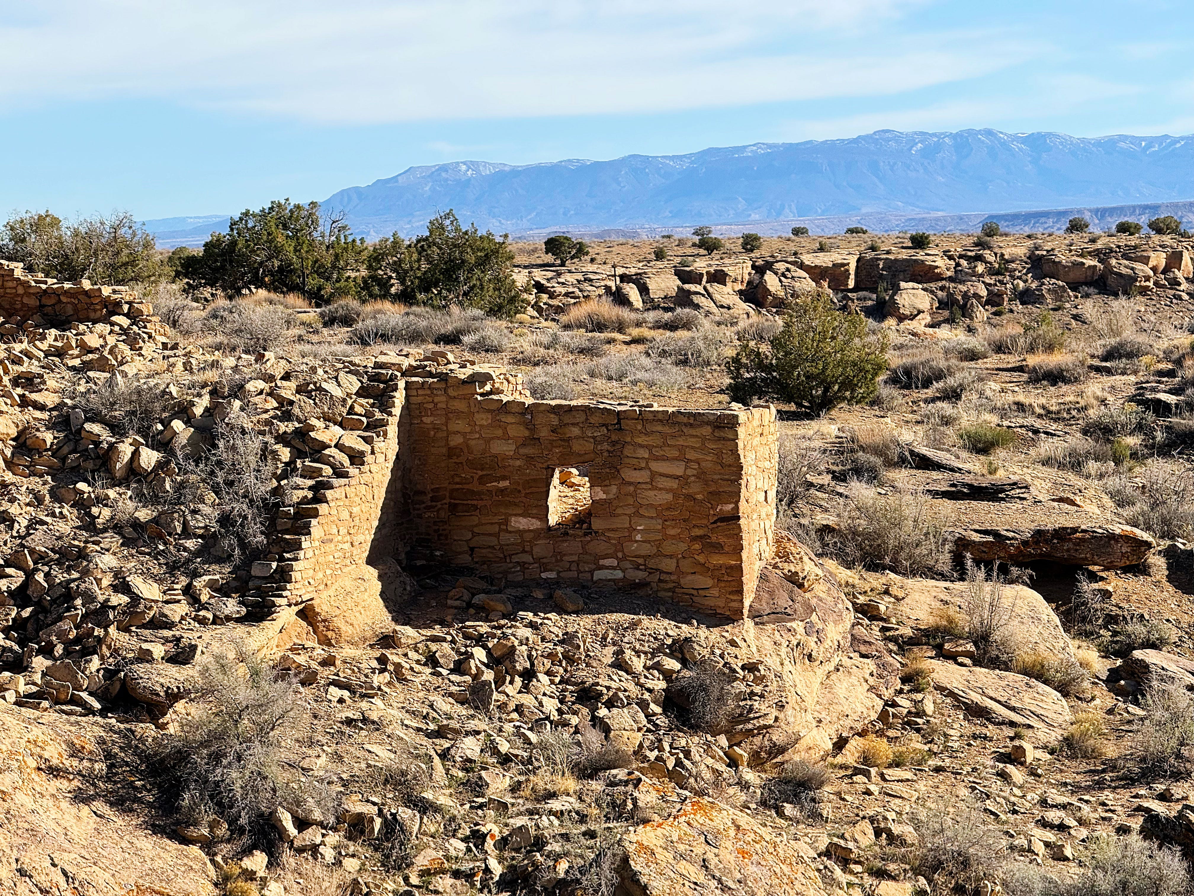
Hovenweep: Horseshoe and Hackberry Sites
Since we had time we decided to hike the nearby Horseshoe and Hackberry sites as well.
From the park website:
Horseshoe and Hackberry are two separate Hovenweep units located within the same NPS boundary. Both units sit around a canyon head – the main drainage and west fork of Hackberry Canyon.
Horseshoe is known for its impressive views of surrounding canyon country. Hackberry is now mostly rubble, but was the largest community in the park. A primitive trail leads along the canyon rim to both units.
Back to Sand Canyon, CANM
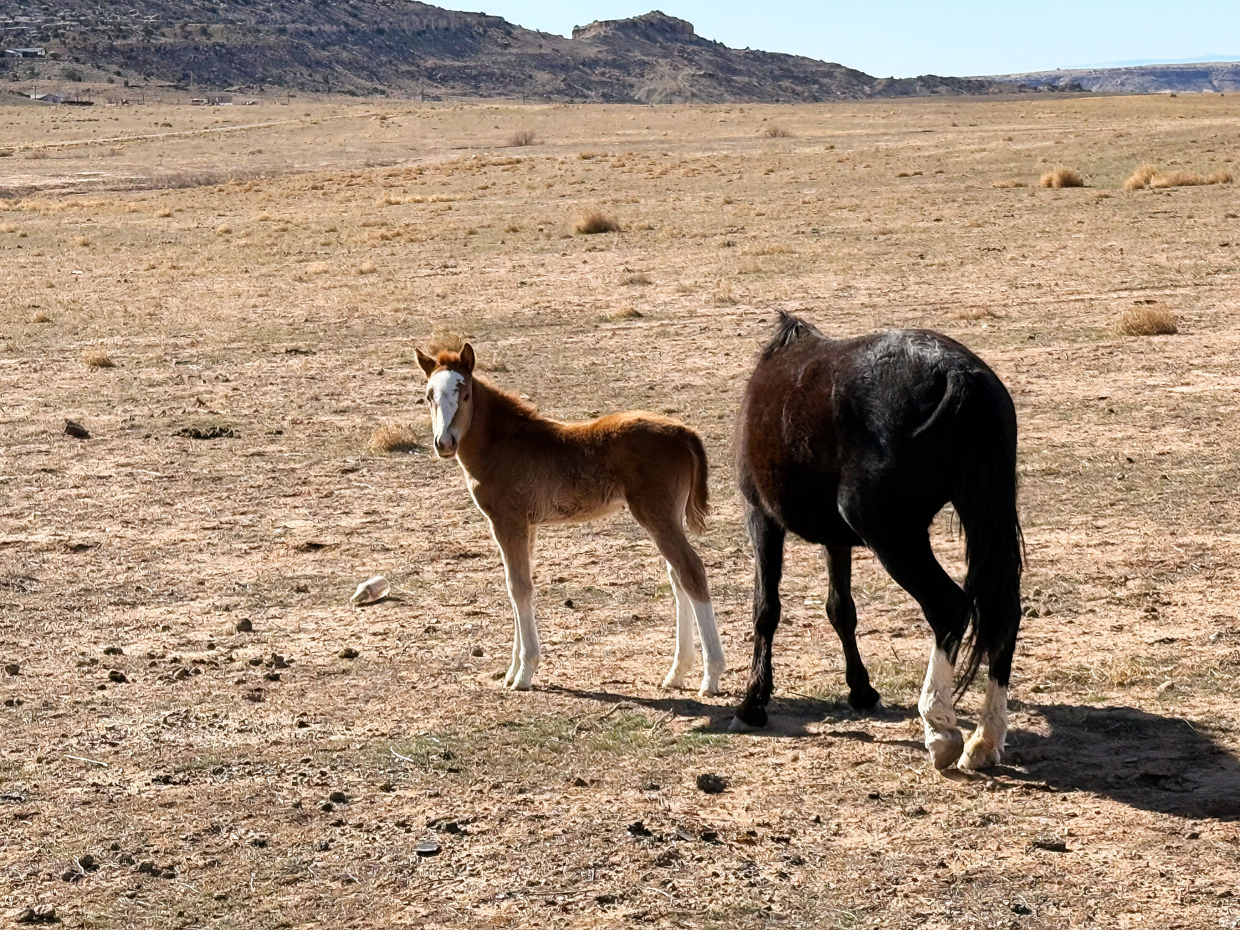
Monday we left camp at Hovenweep to revisit the Sand Canyon area of CANM so that I could photo more of my paintings on location. It’s just so beautiful there! I can’t get enough of those colors.
On our way there we saw this sweet lil girl and her mom and had to stop a photo:
More sites at CANM
Before heading back to the Hovenweep campground we stopped to see some more cultural sites near Road G.
It really reinforced the idea that these Ancient Puebloan sites were all connected. Today’s boundaries like state lines and public/private land are all totally artificial.
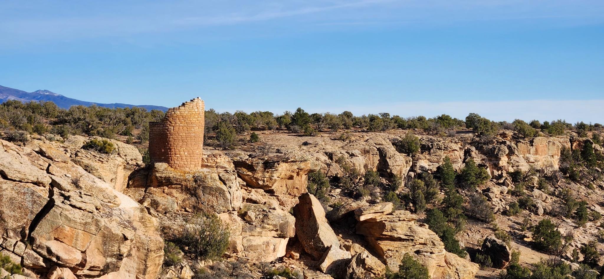
Hovenweep: Cajon Site
According to the park’s website, Cajon is Hovenweep’s most southern and lowest elevation outlier site.
“Perched on the canyon rim at the southern edge of Cajon Mesa, Cajon has spectacular views of prominent natural landmarks. The trip is well-worth the effort to take in the dramatic views and remarkably preserved structures.”
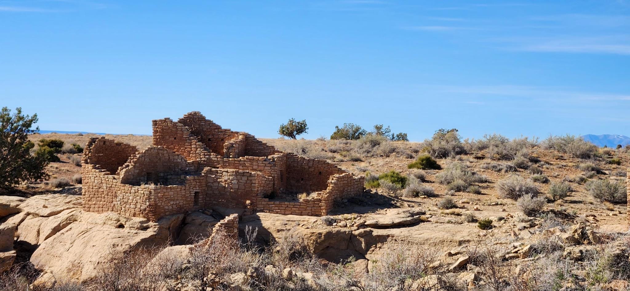
I was struck once again by the beautiful places the Ancient Puebloans made their homes.
Paintings I Donated to Canyons of the Ancients National Monument
As part of my artist residency I was required to donate a work of art — I couldn’t stop at just one — there were just too many things to paint! — so I ended up donating three and I took them to the Visitor Center on Wednesday:
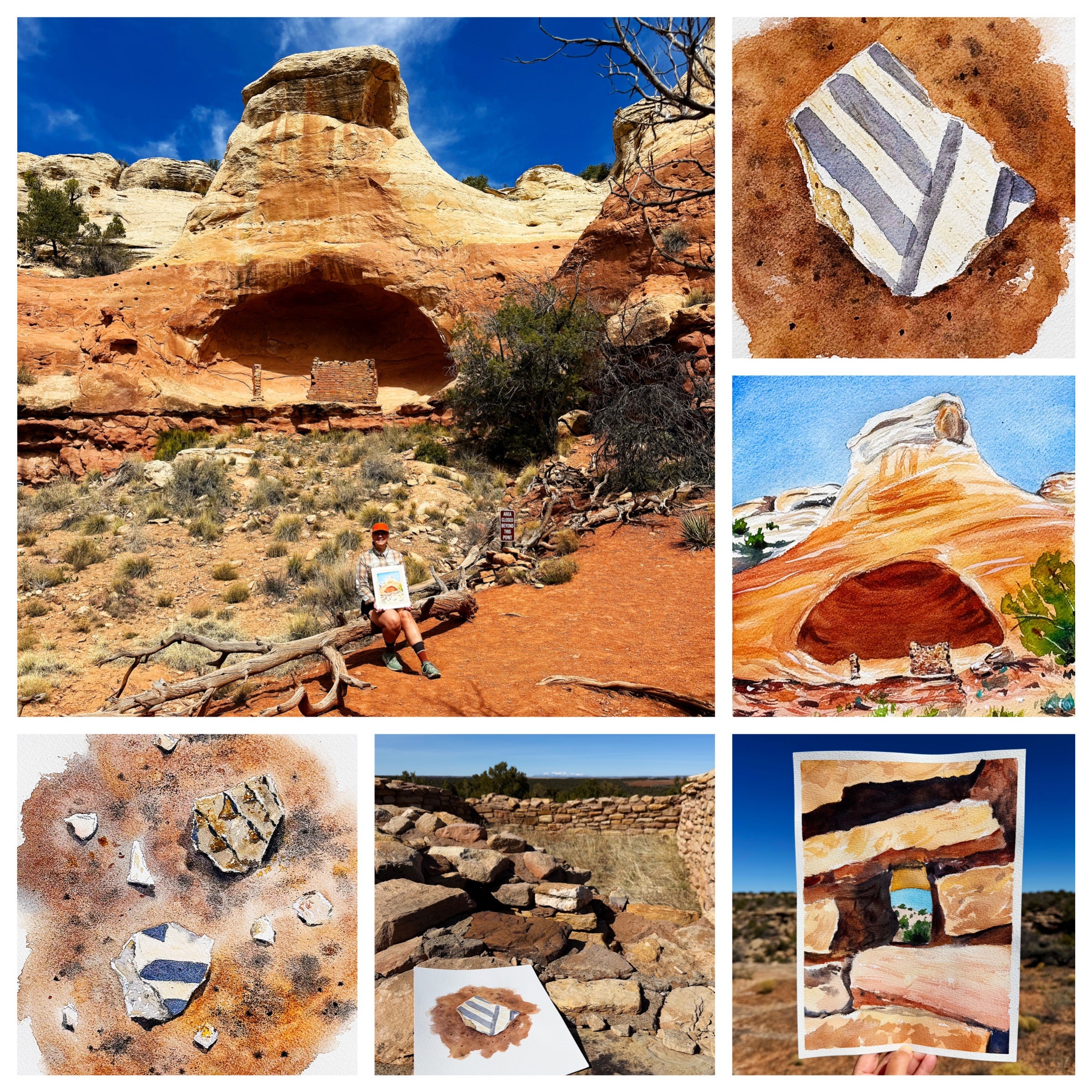
Read more and see larger versions of these pieces over on my portfolio website.
Farewell — for now — CANM! I miss the monument and the whole staff already. Such a special place and I’m so honored to have called it home for a while. What a truly amazing opportunity and an experience I’ll treasure forever.
Then we were off to…
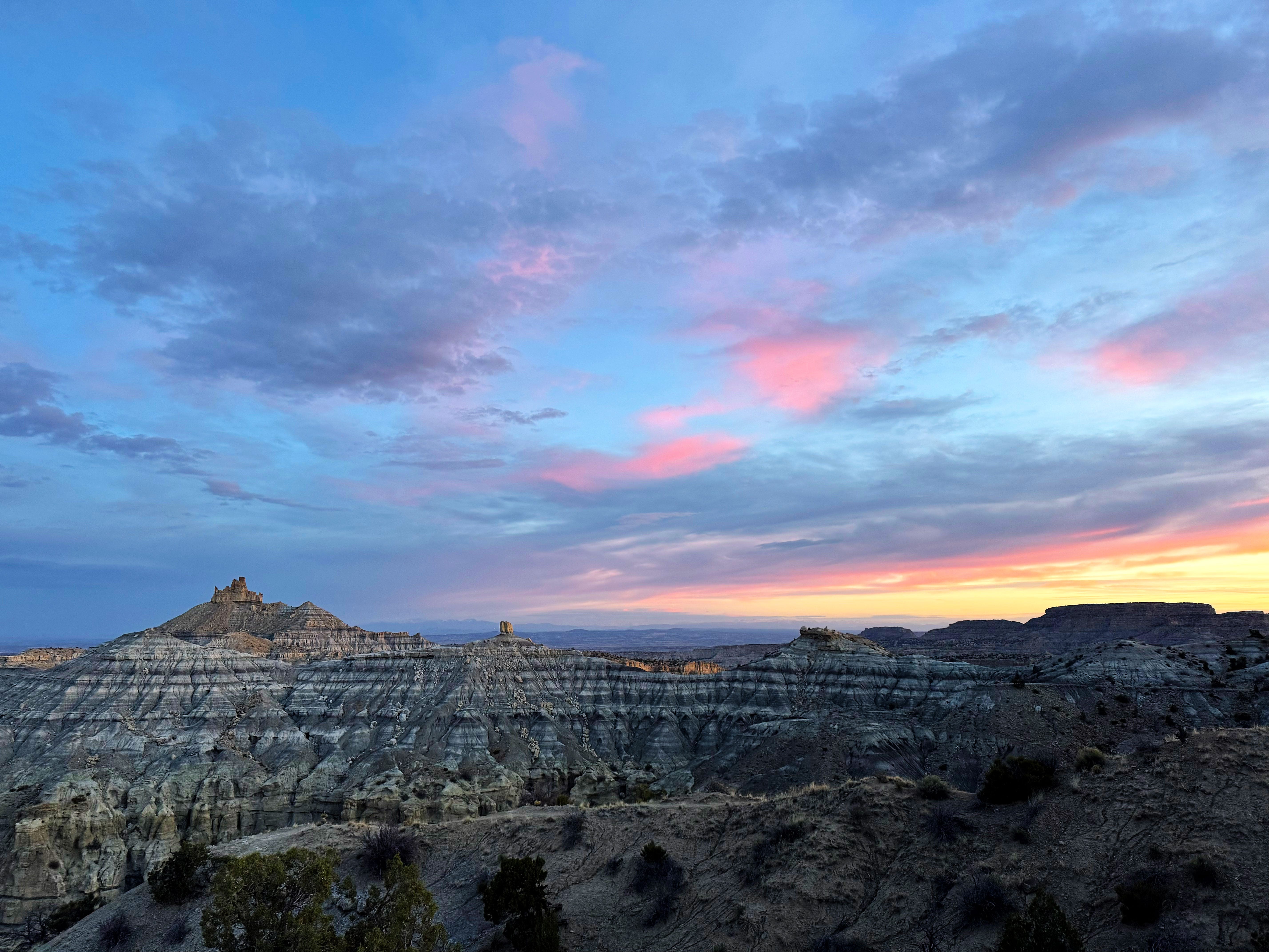
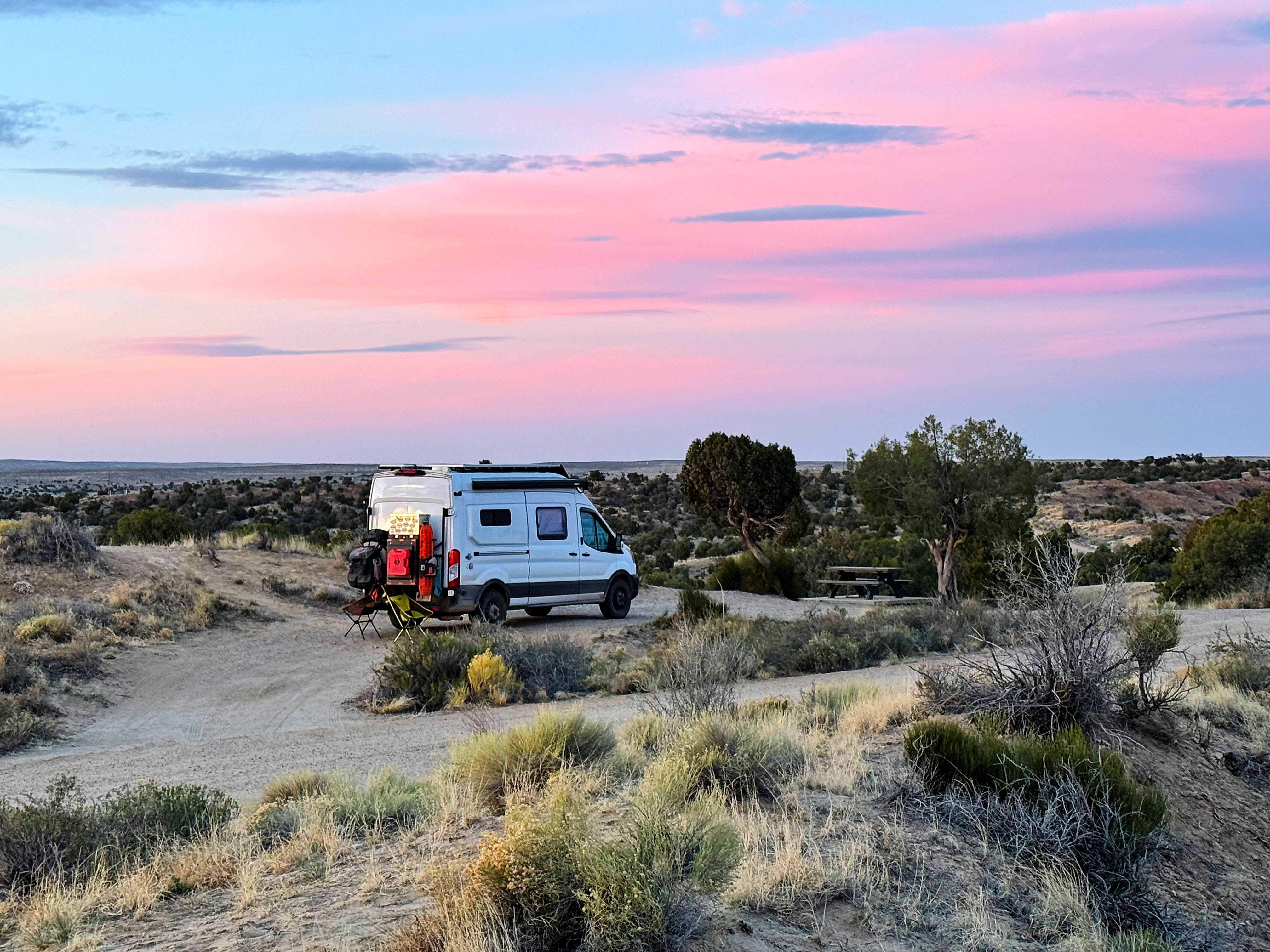
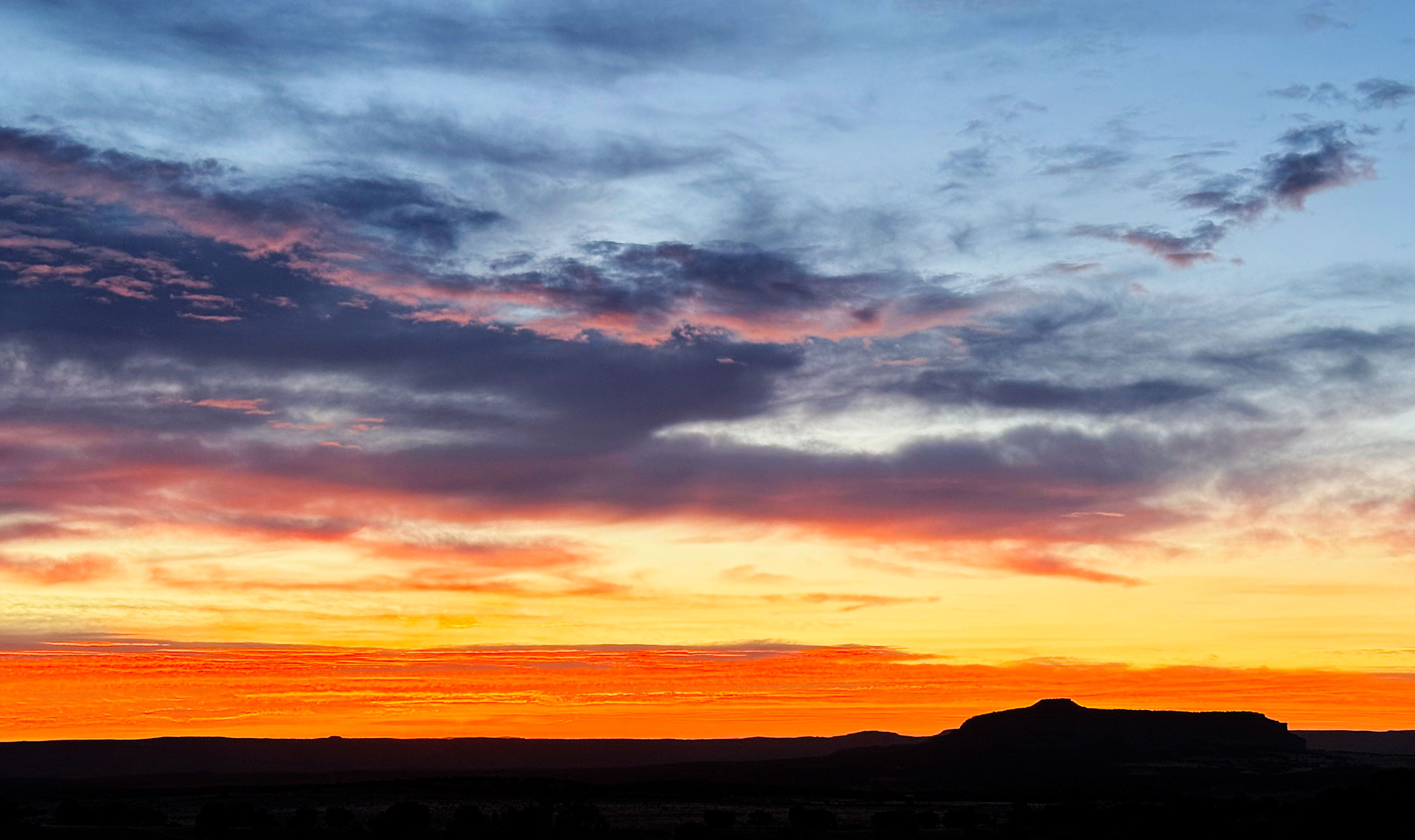
Angel Peak Scenic Area, New Mexico
Wednesday and Thursday we camped at Angel Peak Scenic Area in New Mexico on BLM land — right across from Angel Peak — I think we had the best spot in the whole campground.
Just look at this view, right from the van:
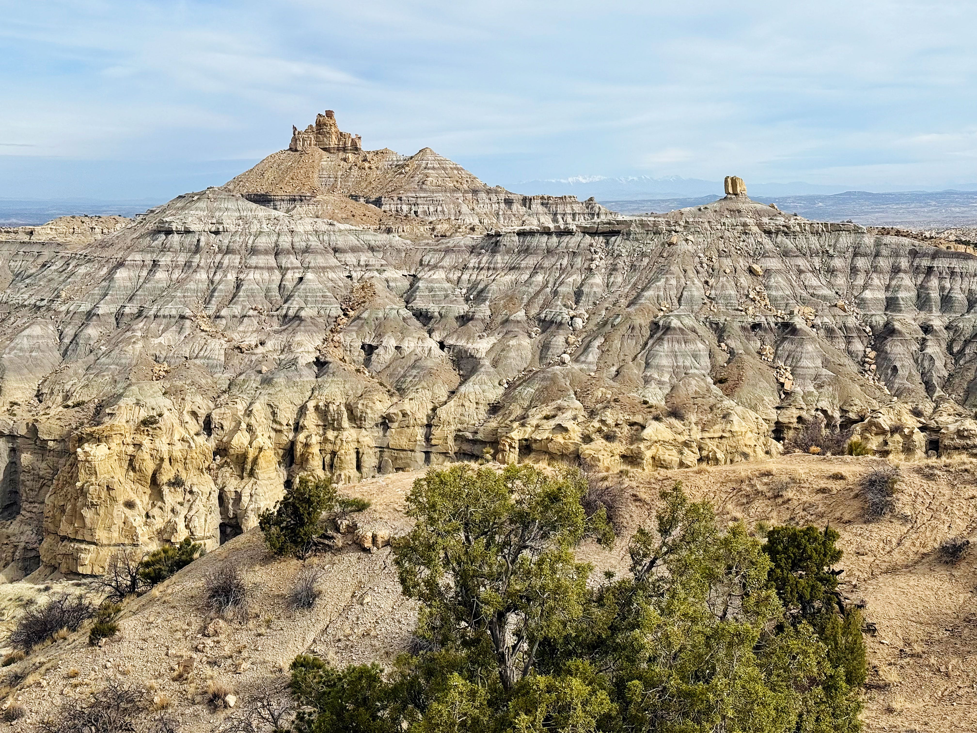
It was even more spectacular at sunrise!
We were sad to leave this spot, but had to head on down the road.
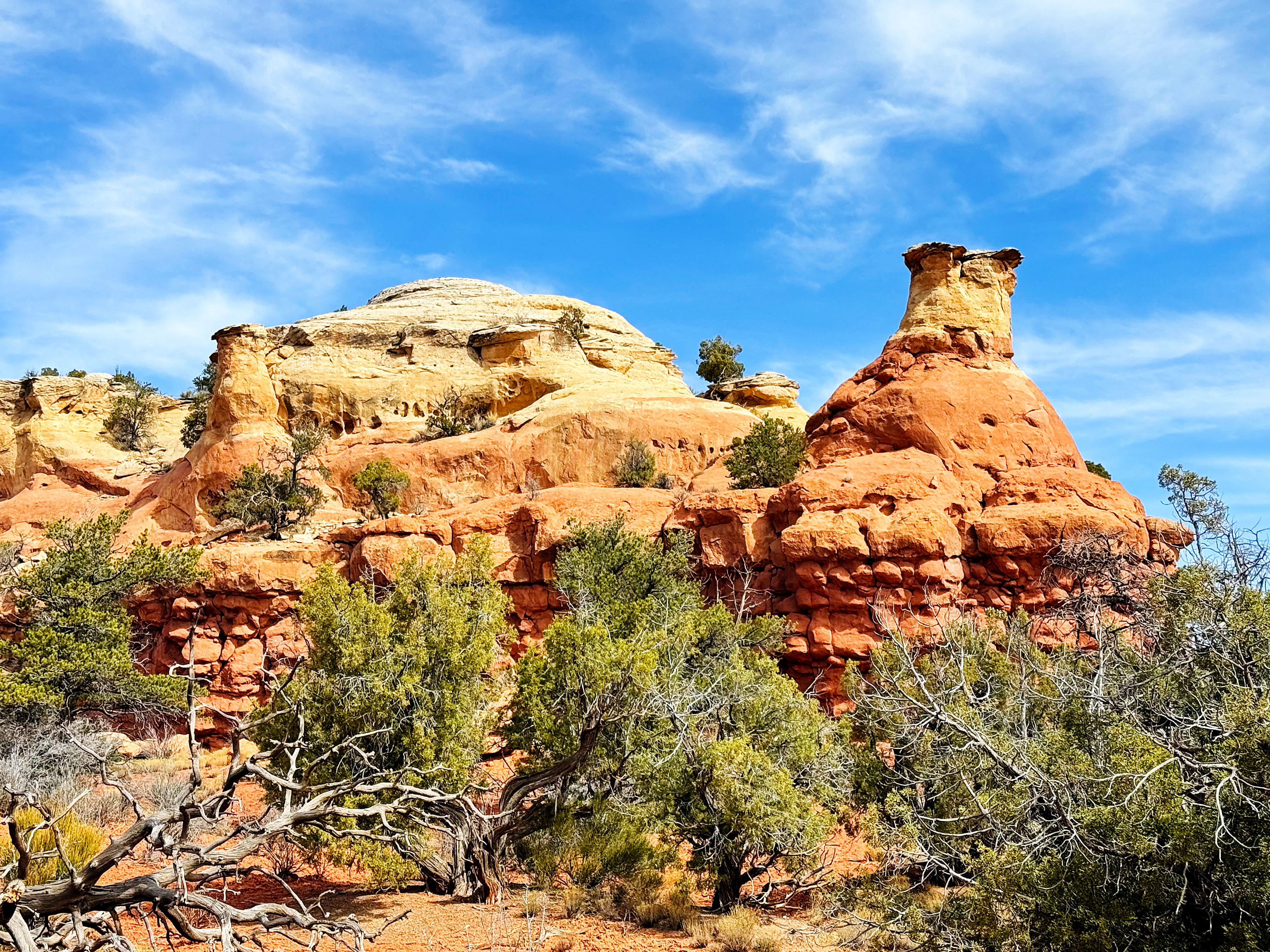
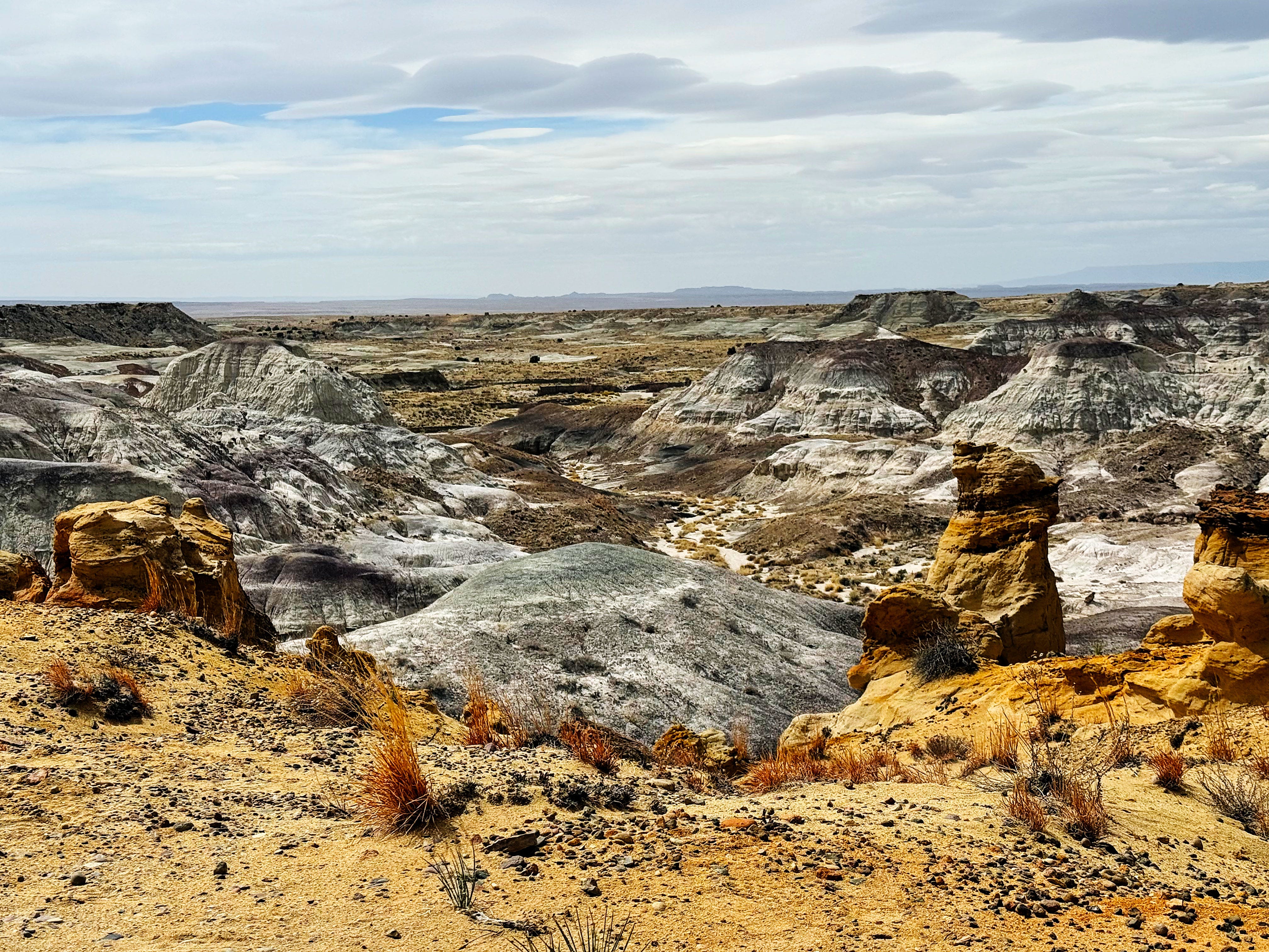
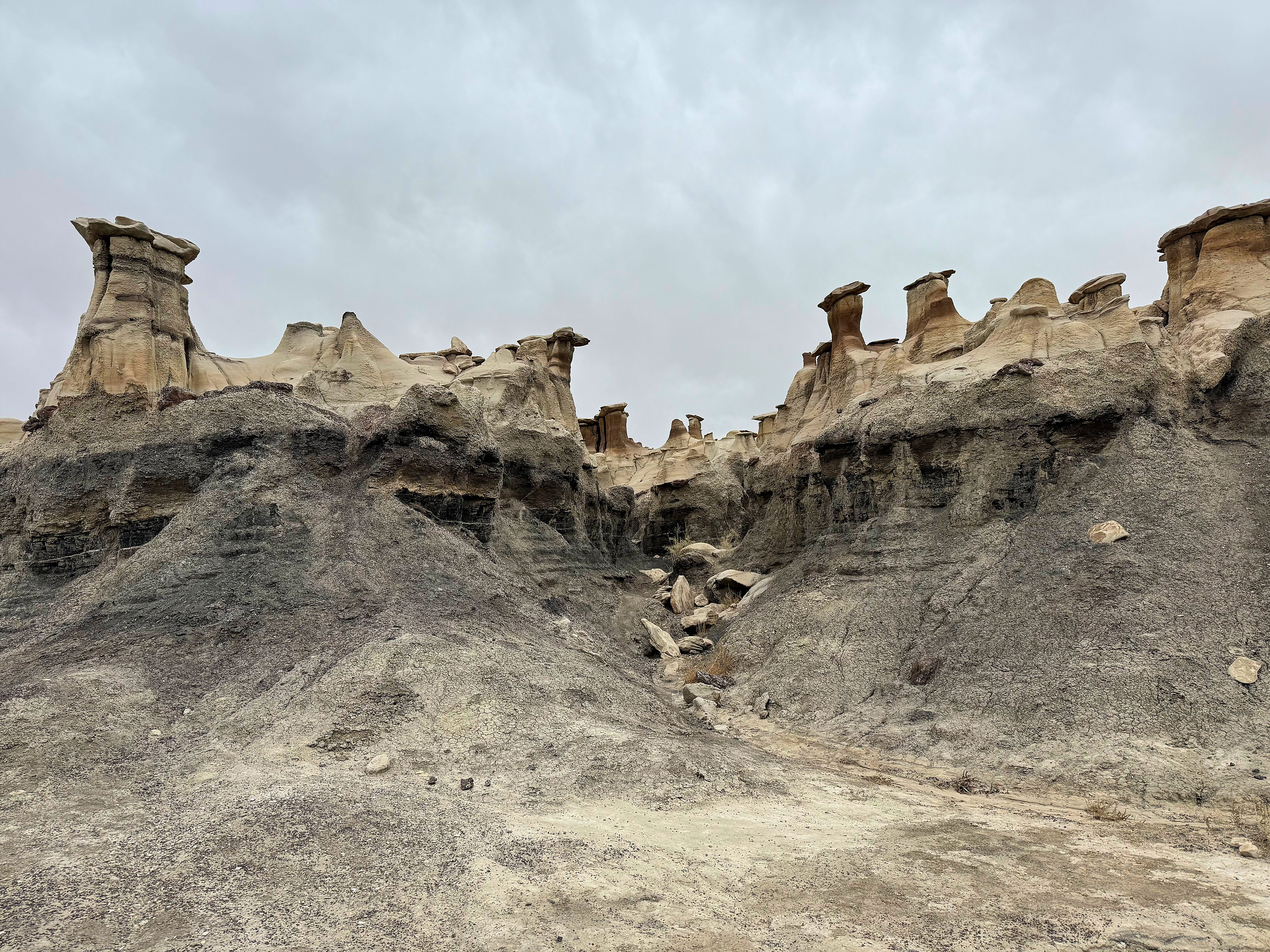
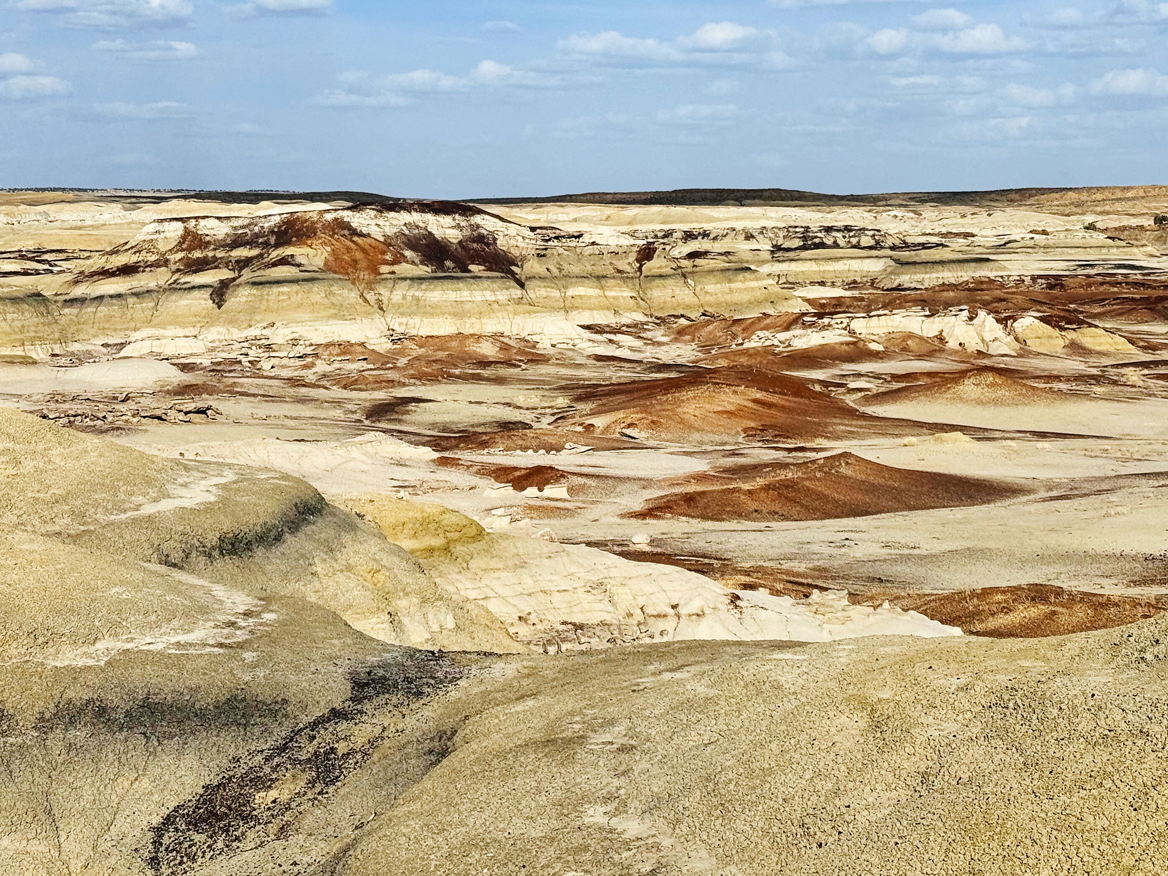
Bisti/De-Na-Zin Wilderness
Friday we woke up early and hit the road to Bisti/De-Na-Zin Wilderness — we were both really looking forward to seeing the badlands! According the the BLM website, the name is translated from the Navajo language, Bisti (Bis-tie) means "a large area of shale hills." De-Na-Zin (Deh-nah-zin) takes its name from the Navajo words for "cranes."
There are no trails here so you have to make your own way cross-country and do some route finding.
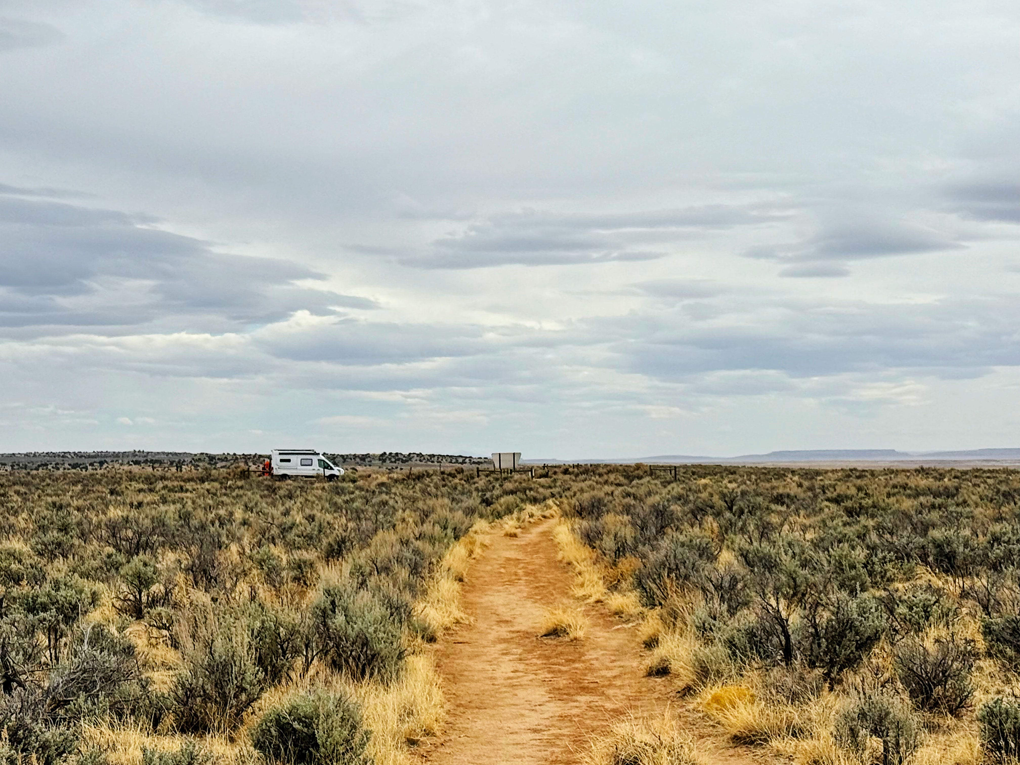
Jason did a ton of research before we headed out. (I was super impressed!) He marked some spots in the Gaia app and downloaded the map so we could have offline access to it. We made sure to take our Garmin inReach mini (it uses satellites instead of cell service so we could get help if needed), plenty of water and snacks, and we both had battery banks so we could recharge our devices if needed.
Hiking from the De-Na-Zin Side
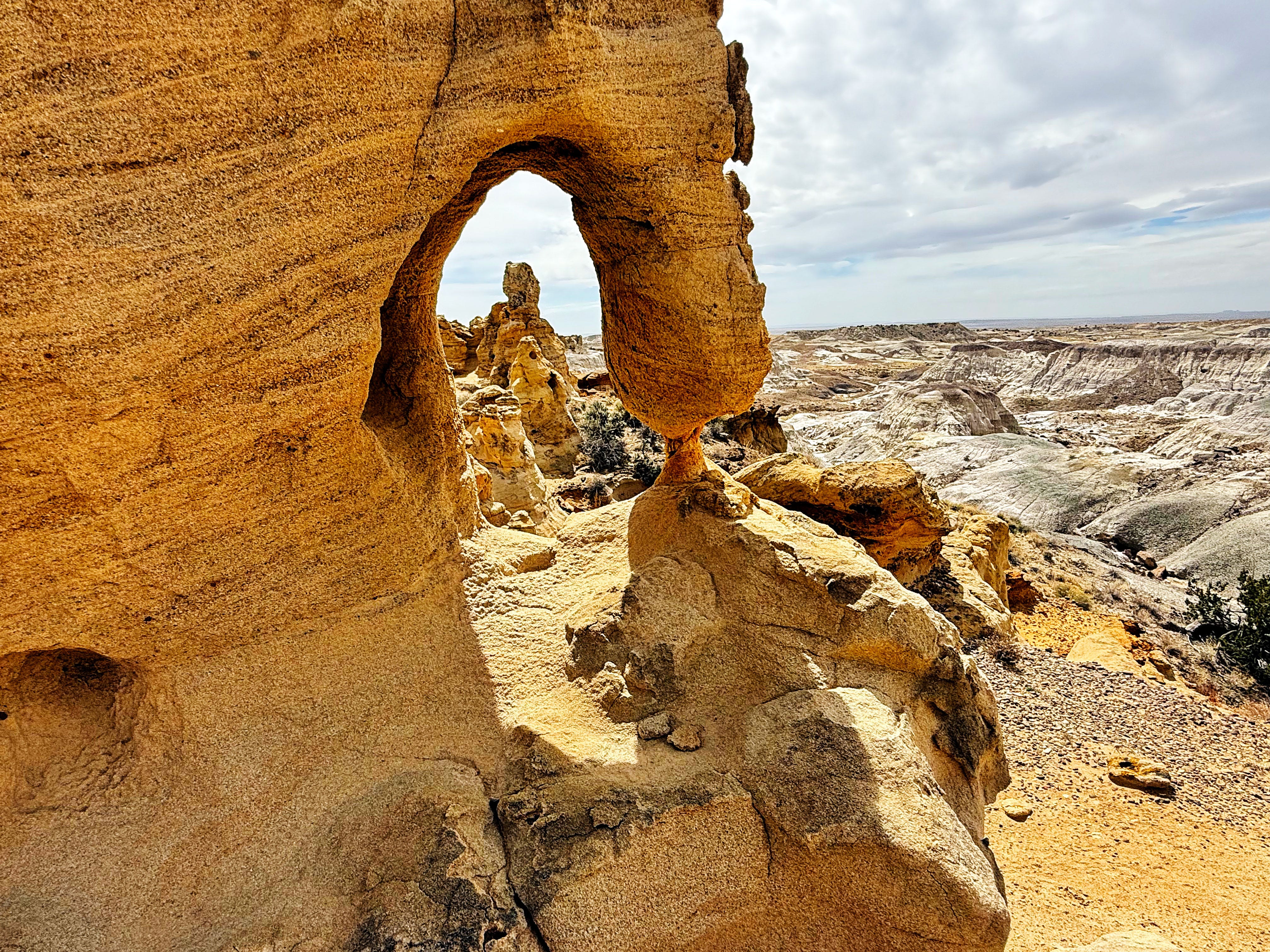
From the parking area you hike through sagebrush and then the badlands seem to appear out of nowhere. It was like being on another planet!
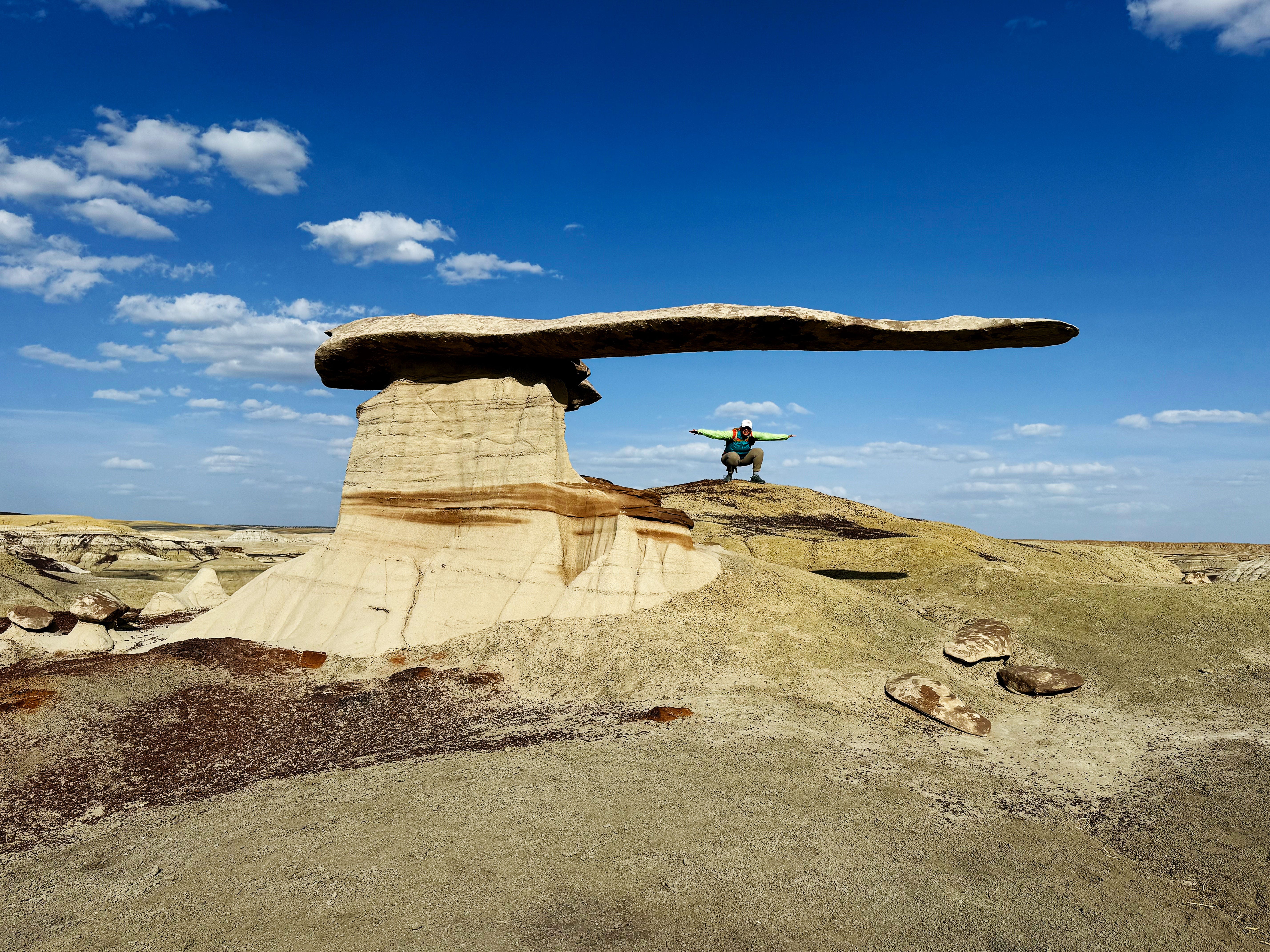
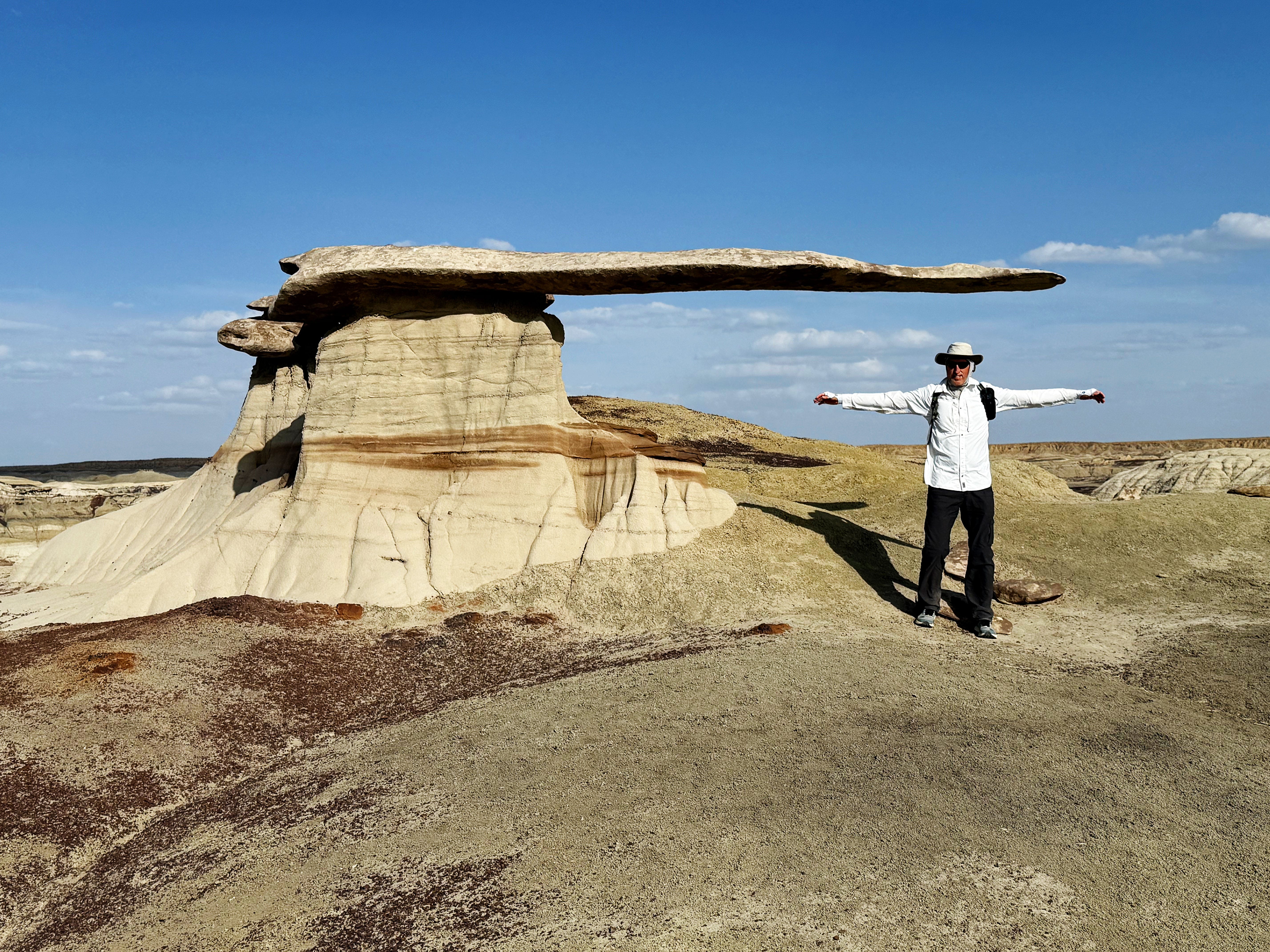
We hiked about 6 miles total and saw so many super cool rock formations, starting with with Right Angle Arch:
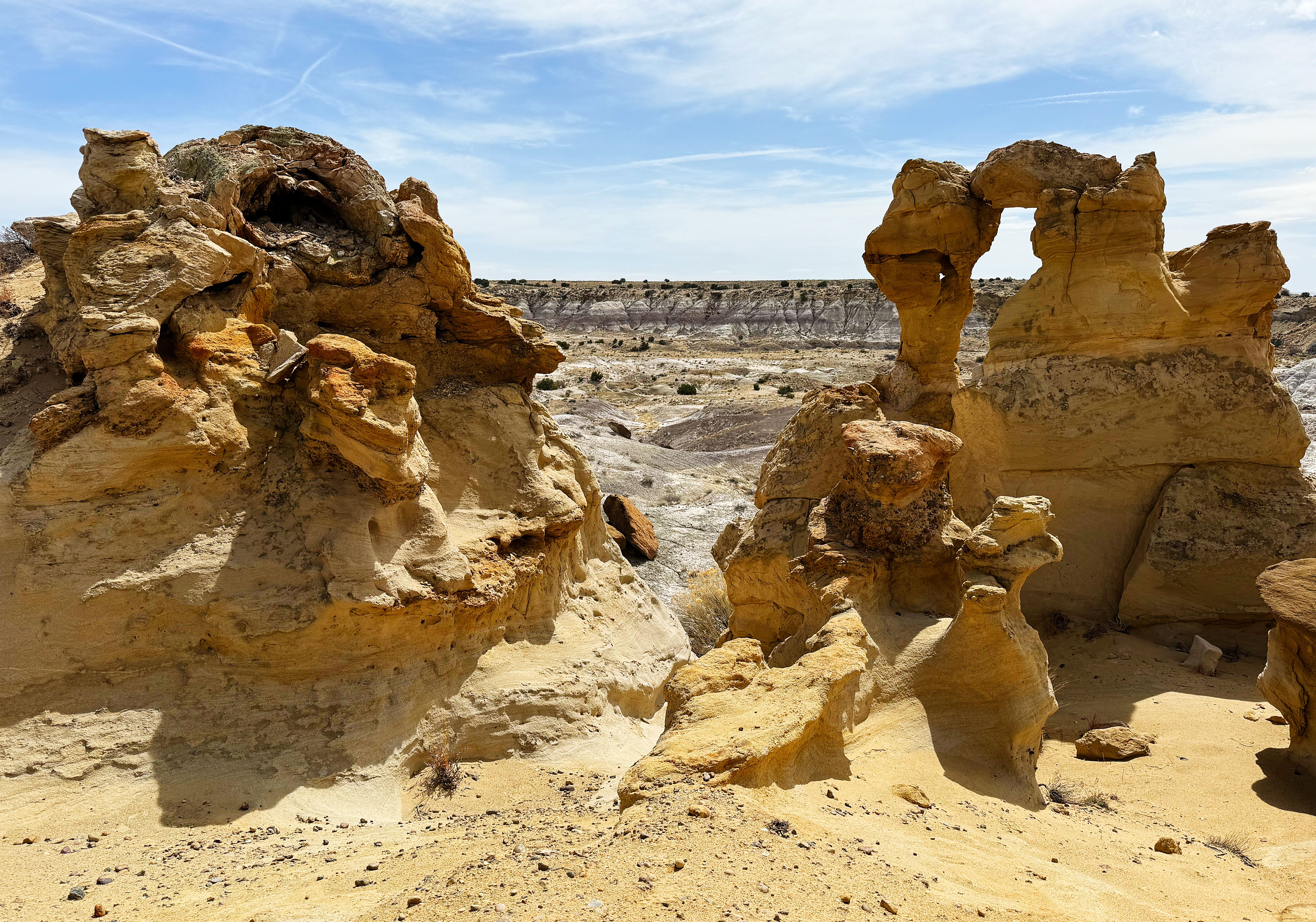
There was an amazing view every few steps!
We had to stop and turn around a few times when we couldn’t find a way to get across a canyon.
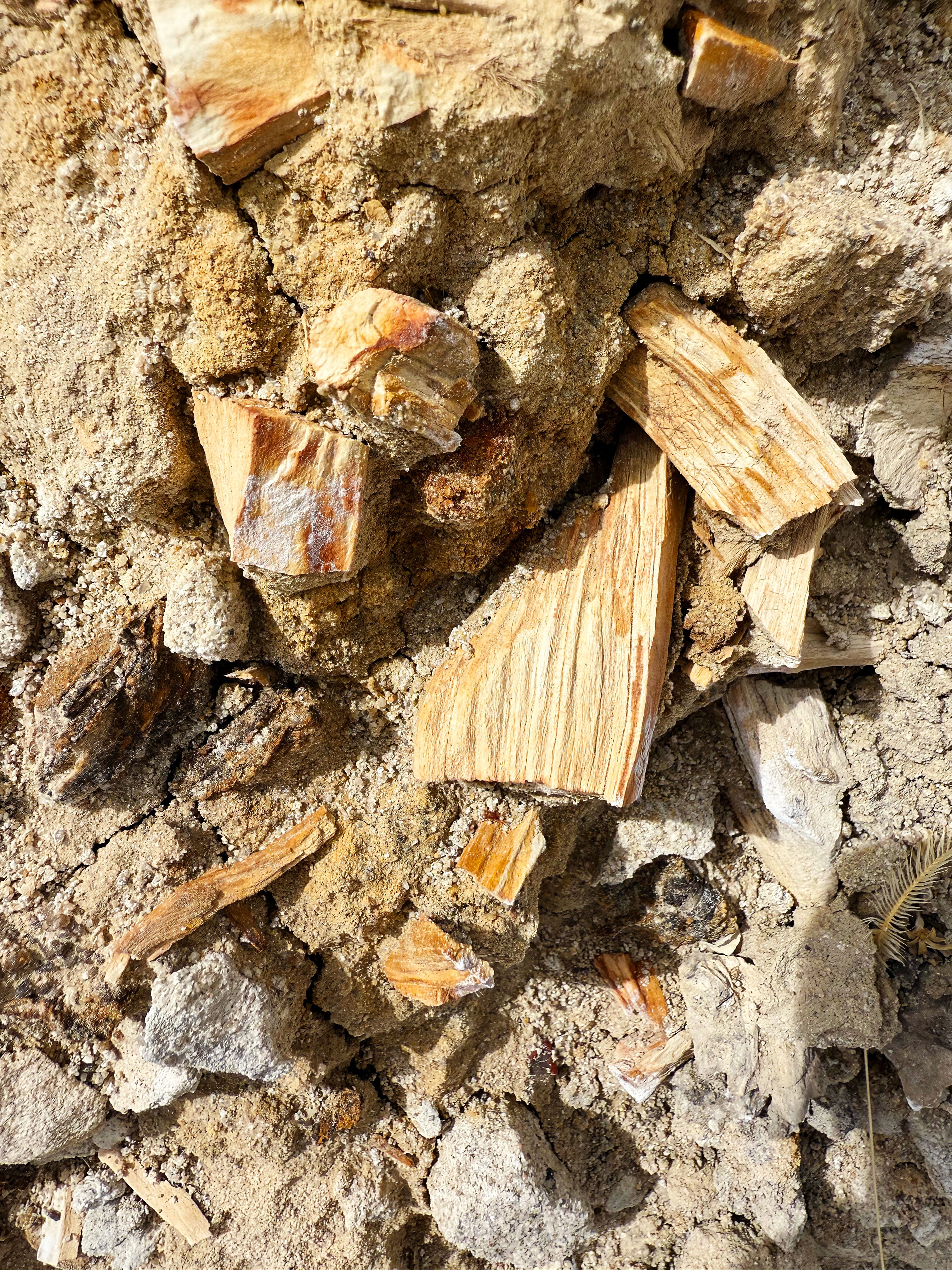
My favorite part of the hike was seeing all of the petrified wood! It’s so wild to think that there were conifer trees growing here in the distant past.
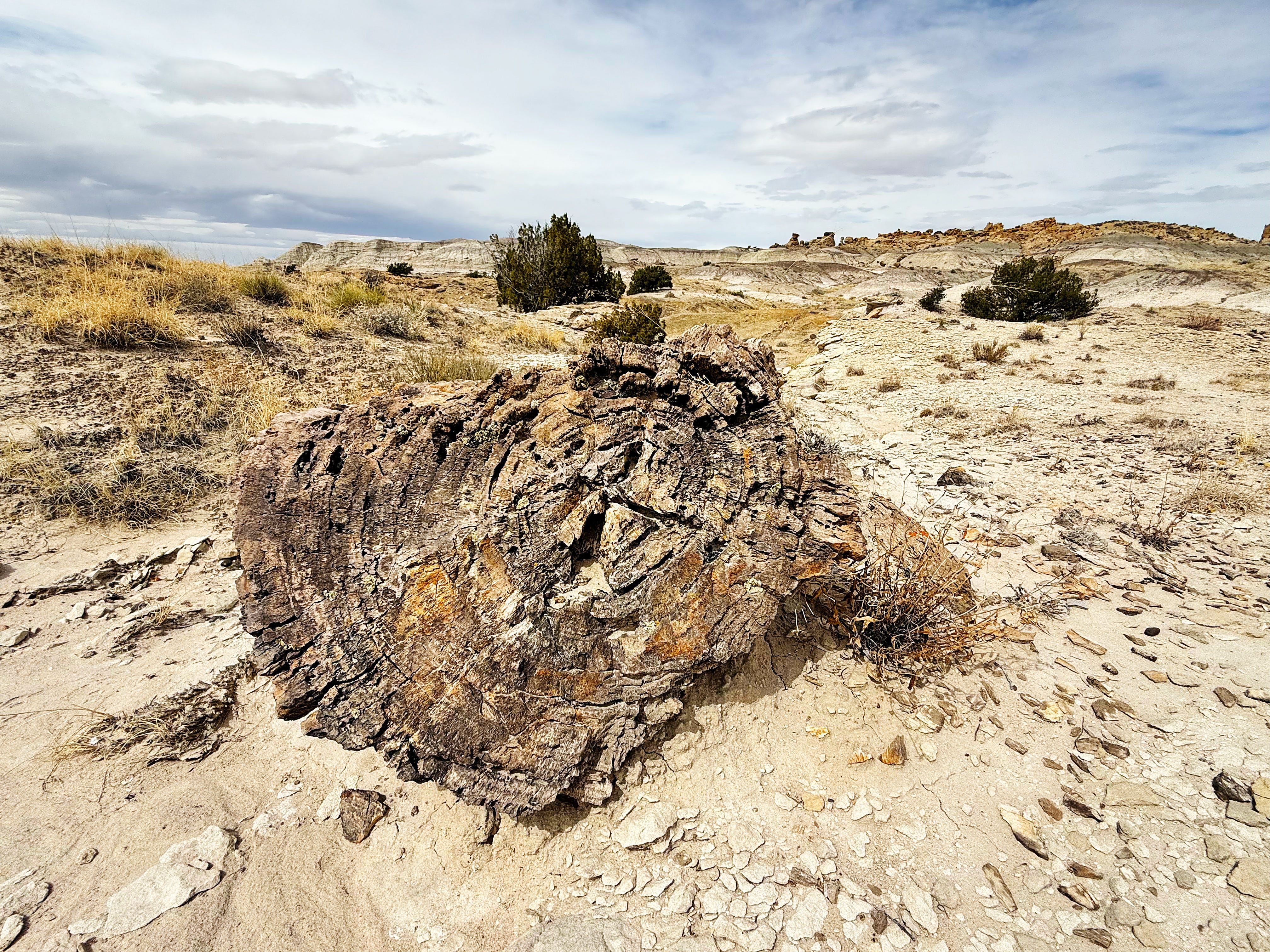
One of the features that J had marked on the map was called “the logjam” — my photos totally don’t do this massive tree justice. I was standing on one end and J on the other:
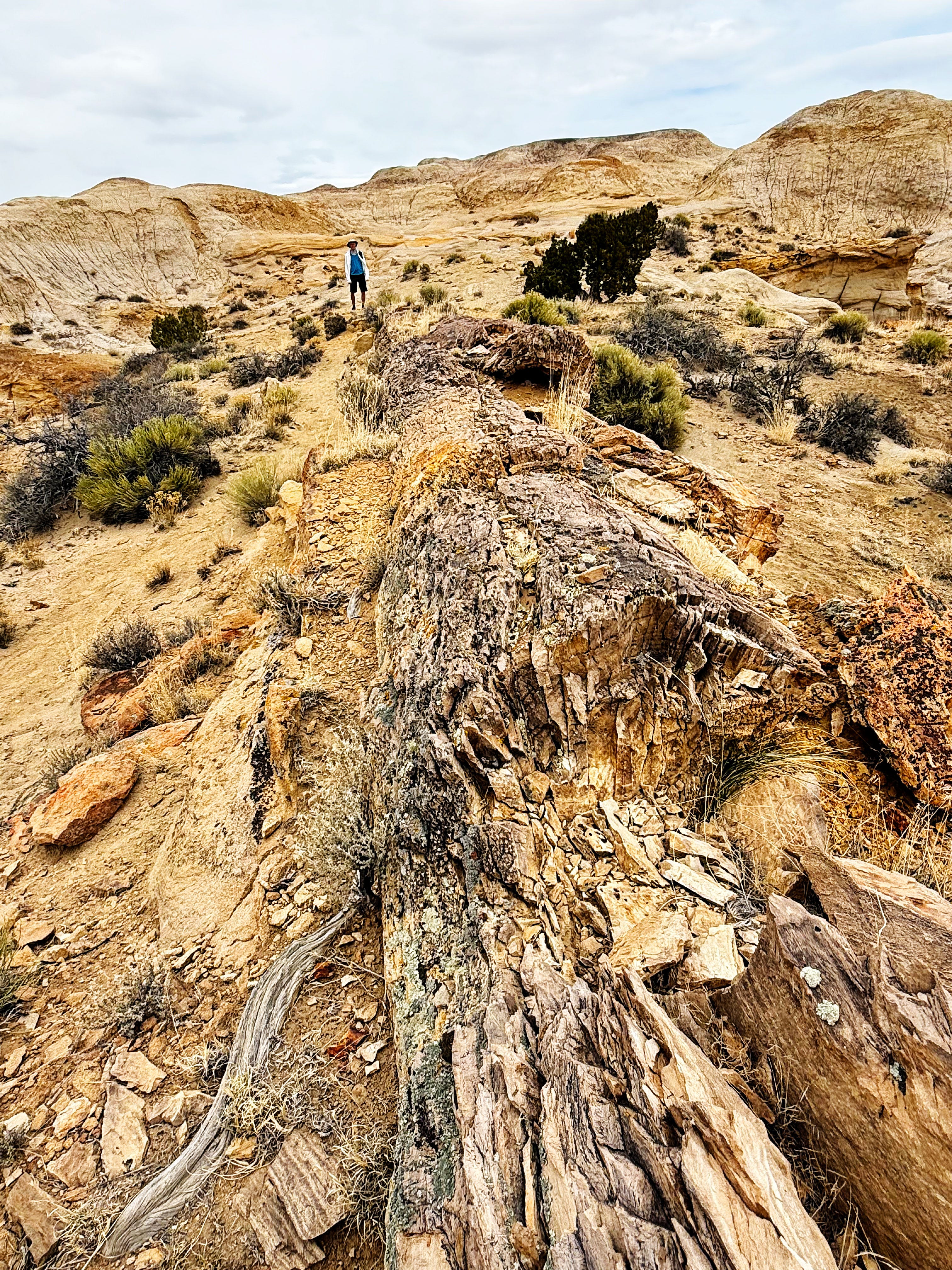
Here’s the view from the side:
Just so cool!
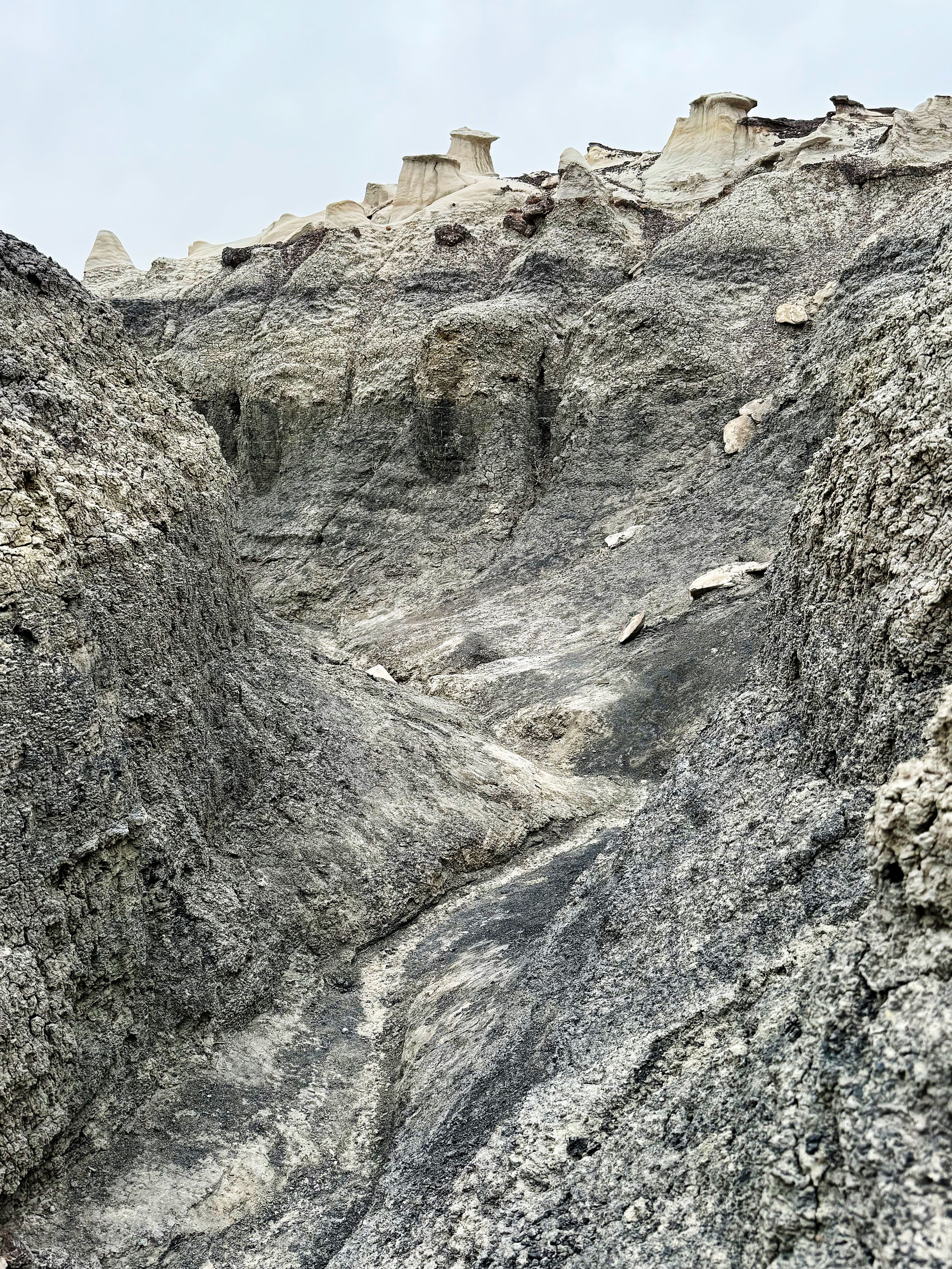
Hiking from the Bisti Side
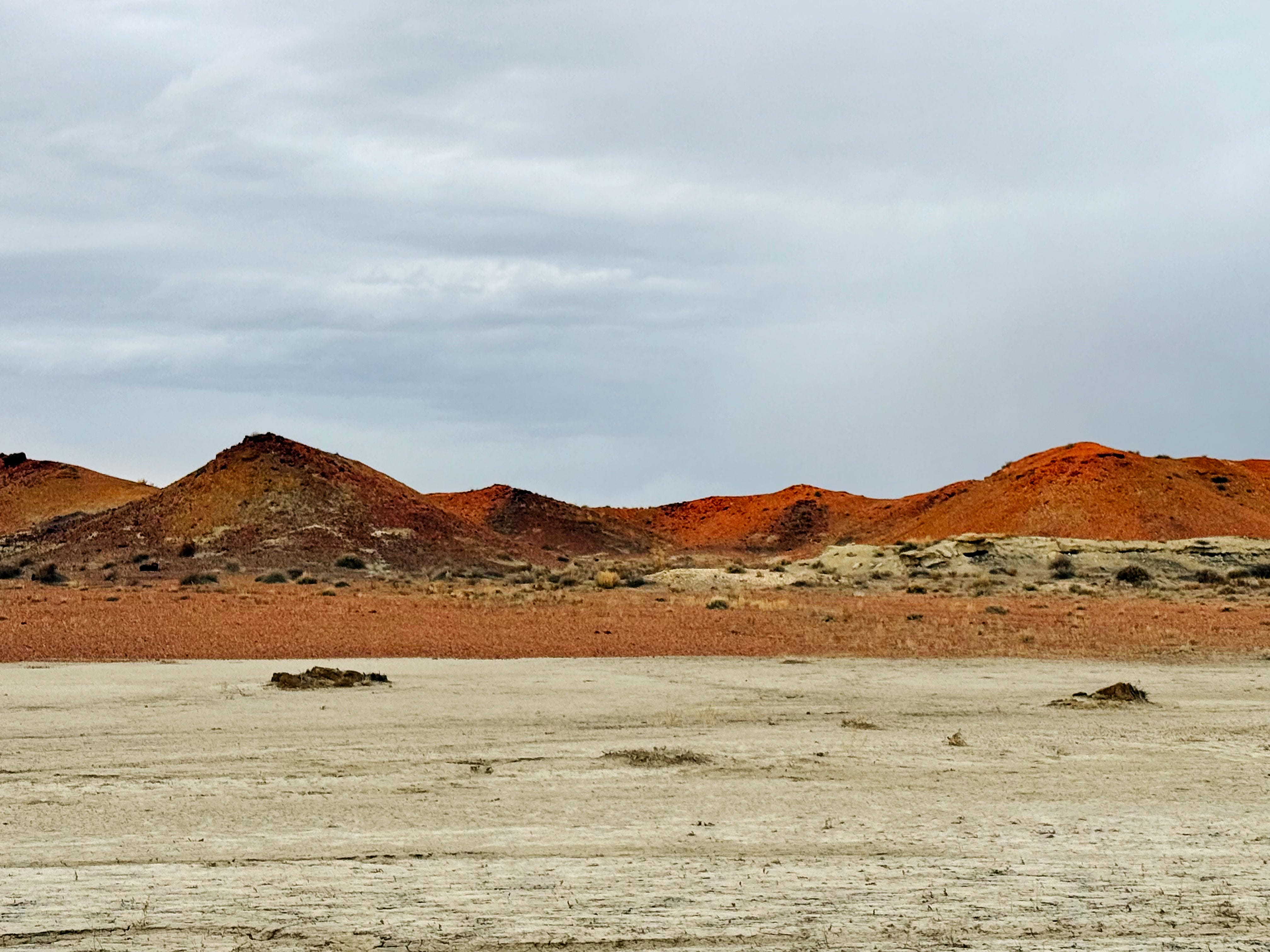
Then we drove down the road a bit to find a camp spot just outside the Bisti wilderness area. After parking the van we just had to do another quick 2 mile hike out to the Chocolate Hoodoos!
The wind started kicking up — and it was a cold wind! — so we headed back to camp, just past these orange hills glowing in the sunset.
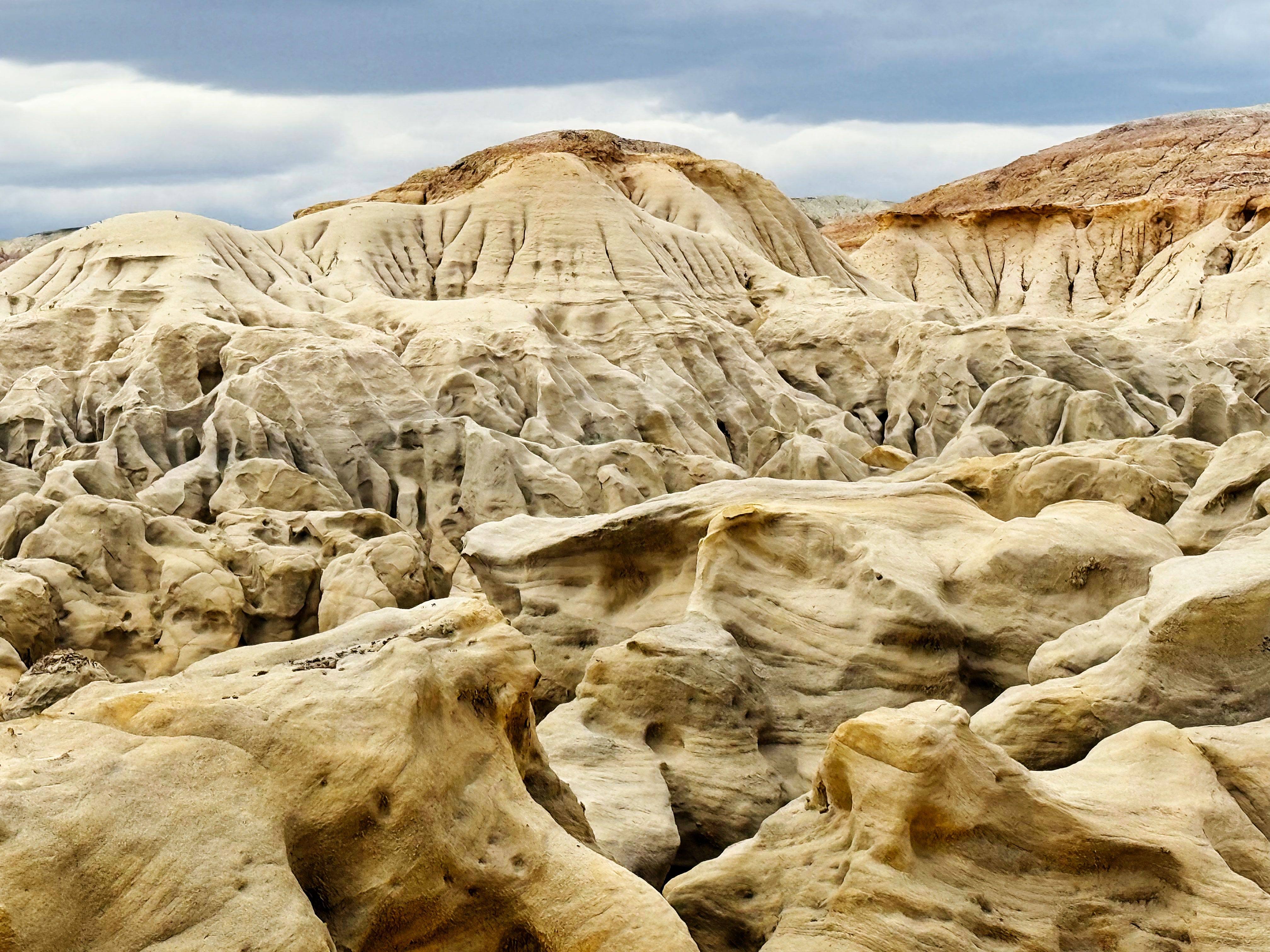
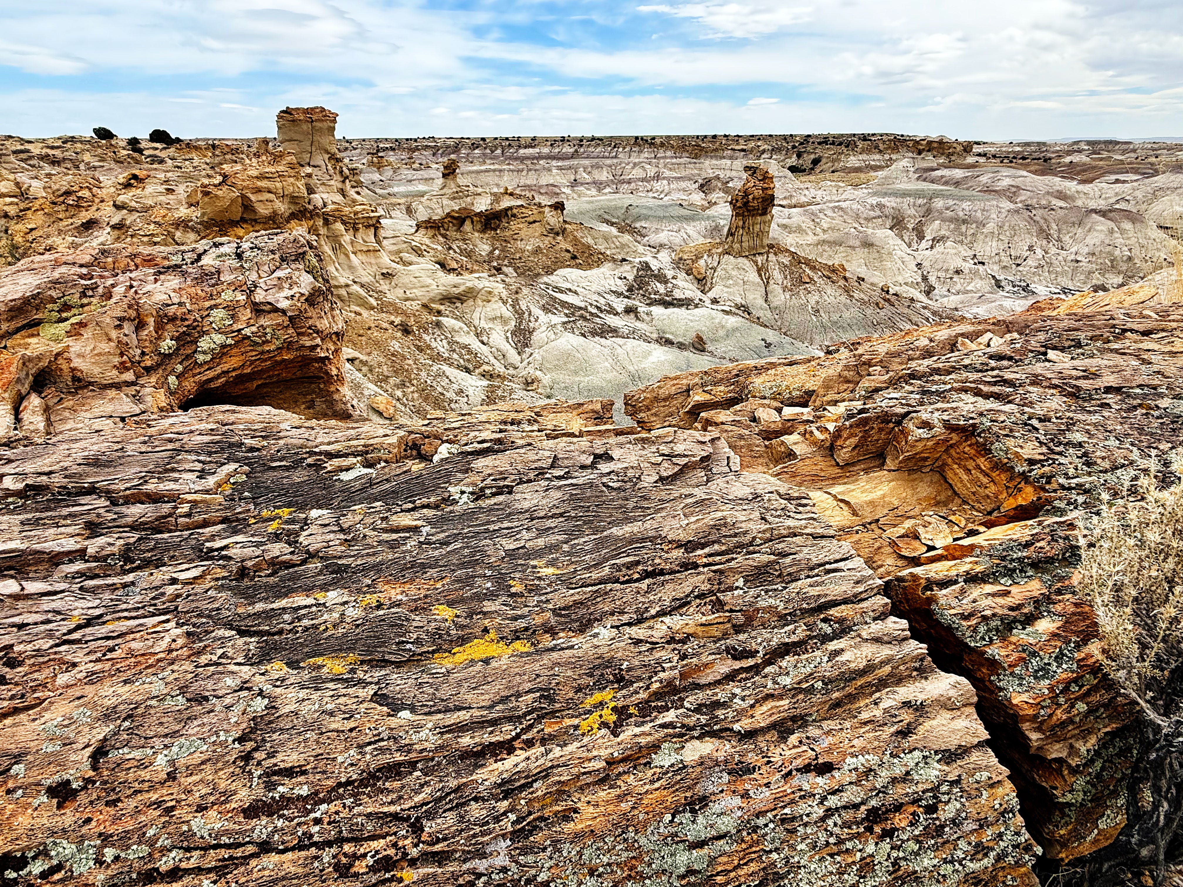
Friday we went for an 8 mile hike to see even more cool rock and soil formations. Here are just a few favorites:
Once again there were no trails and we just had to make our own way.
It’s hard to describe the feeling of being out there in this landscape — it’s so vast, quiet, and other worldly.
Whoa. Just whoa. What an incredible place.
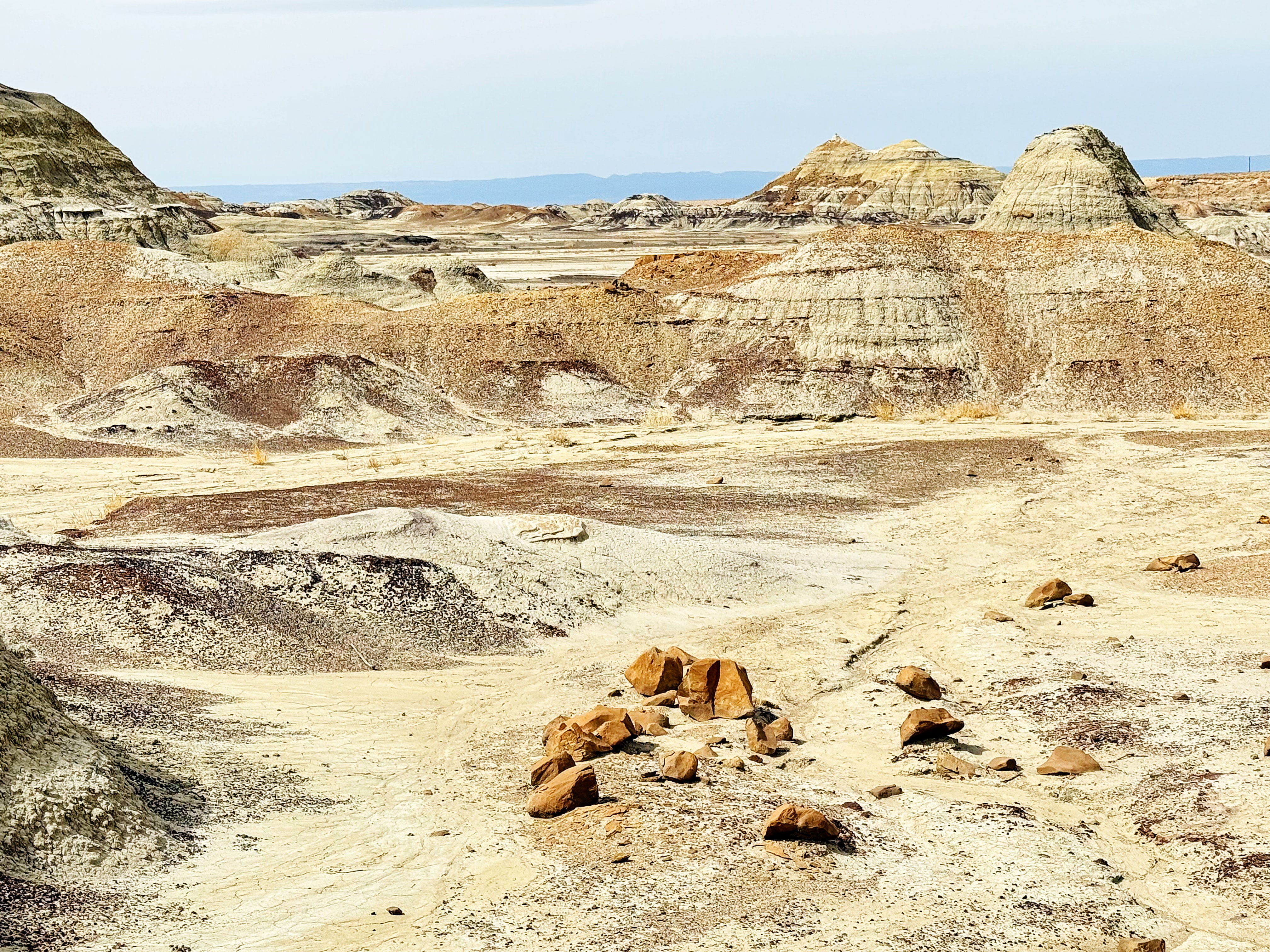
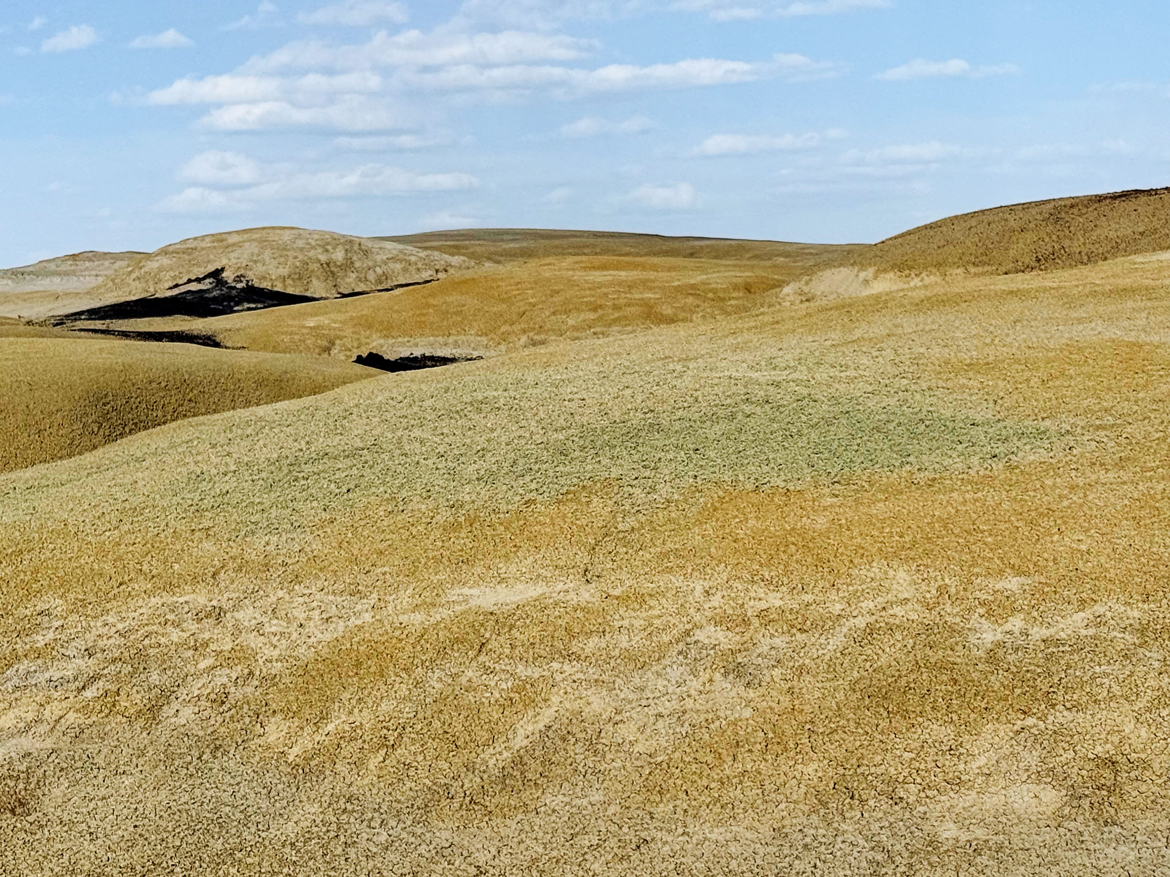
Ah-Shi-Sle-Pah Wilderness
Saturday we hiked around the King of Wings area outside the Ah-shi-sle-pah Wilderness and then stayed the night — what a wild place! According to the BLM website:
The Ah-shi-sle-pah Wilderness is located in northwestern New Mexico and is a badland area of rolling water-carved clay hills. The area is rich in fossils and has little vegetation to conceal geological formations. The thin vegetation includes sagebrush, pińon-juniper, Great Basin scrubland, and grassland. It is a landscape of sandstone cap rocks and scenic olive-colored hills. Water in this area is scarce and there are no trails; however, the area is scenic and contains soft colors rarely seen elsewhere.
We soon discovered that some of the soft colors were formed by…
…LICHENS!
There were lichens crouched down on little tufts of soil:
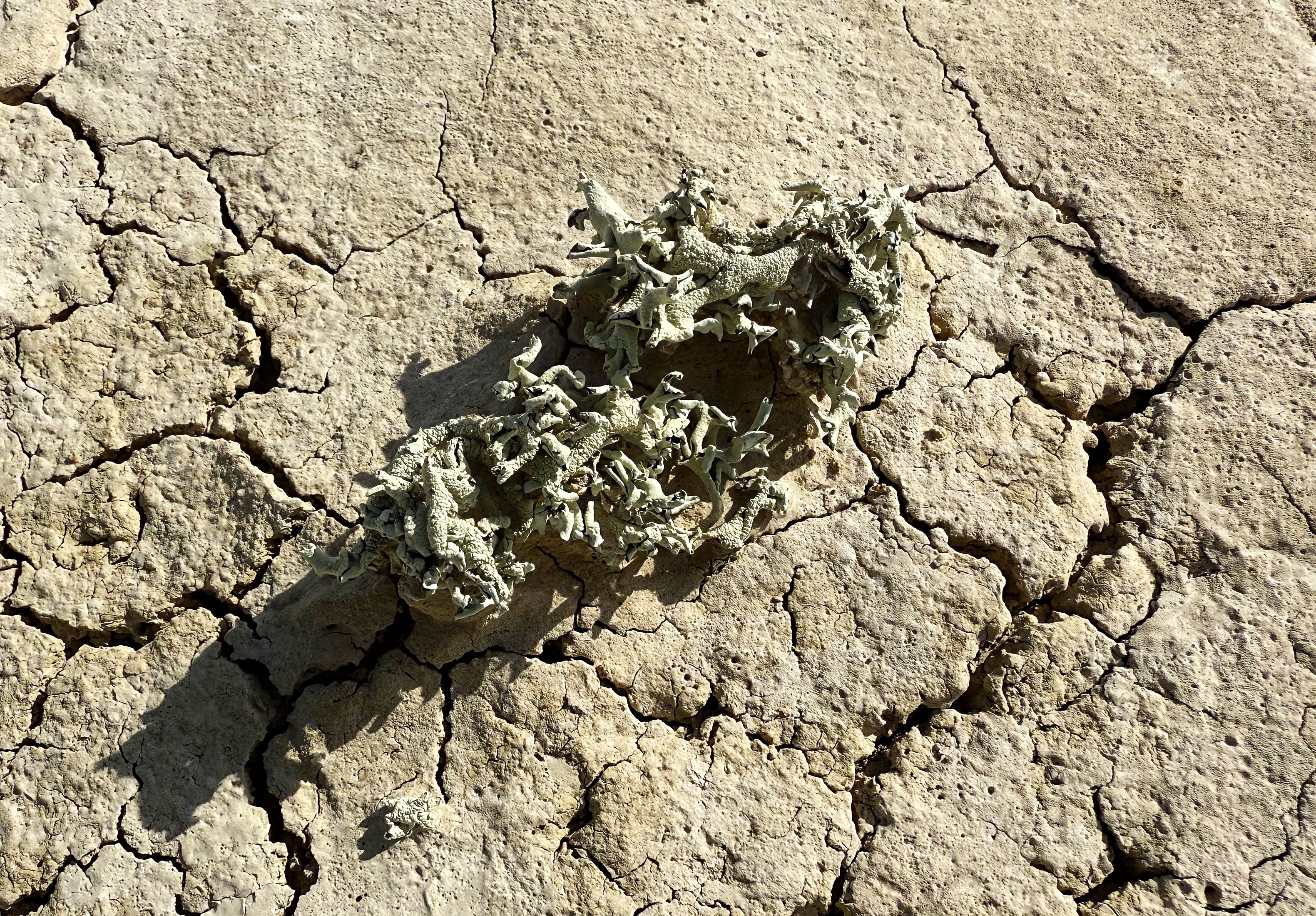
They formed a green haze on the distant hills:

We made our way to see one of the signature rock formations here called the King of Wings — and just had to take photos of each other, ha!
You can definitely see why it’s called the King!
That’s a Wrap!
Annnnnnd that’s it for this week! Whew! Thanks so much for following along on our advantures. What a wild ride!
I’d love to hear what your favorite part of our week was — drop me a comment below and let me know!
Next week I’ll be back with our time here at Chaco Canyon — where it suddenly started snowing! See you then!
Hope you have a great rest-of-your-week! — Lisa, Jason, and Walter-the-Van
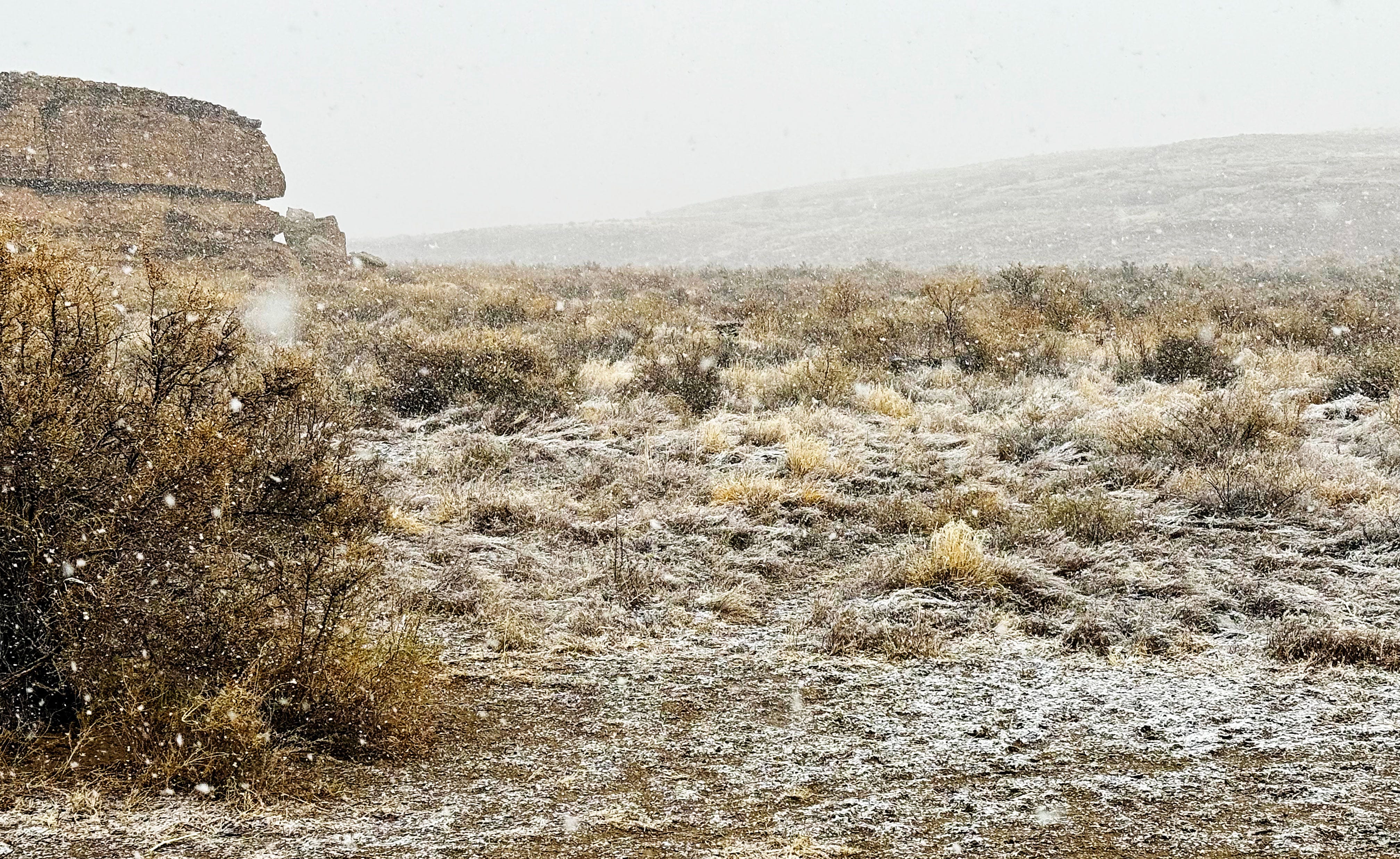
This is no April Fool’s joke — it’s really snowing in Chaco Canyon! We can’t see the mesa right now — wow!
That King of Wings is fantastic. Hard to believe it's real.
Love those rock formations. Photos are gorgrous