
Week 45: the one with the frozen fire.
El Malpais National Monument and Conservation Area, New Mexico

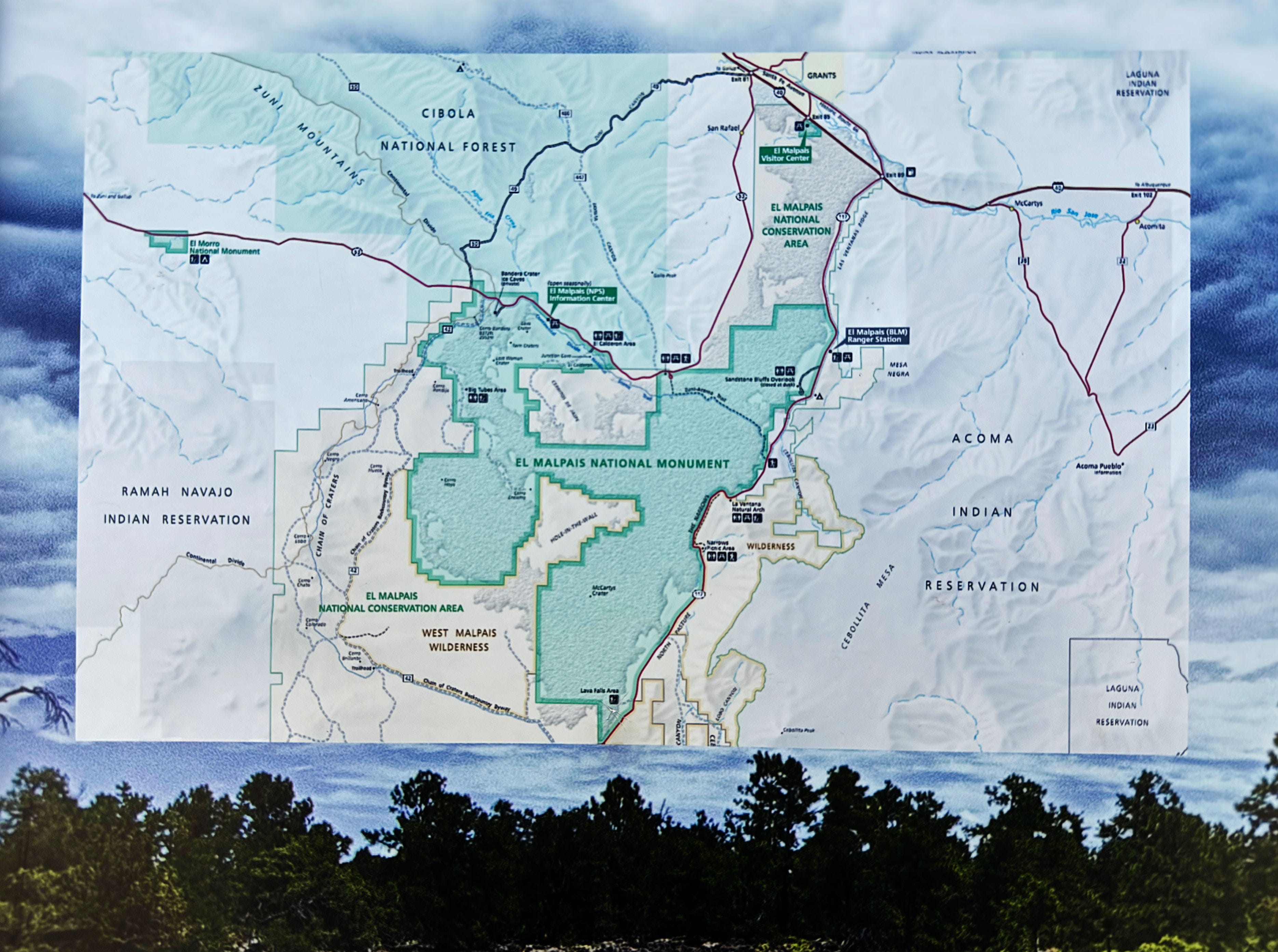
Hi friends! Hi fam! Welcome back to our weekly adVANture blog. This week we stayed in the area in and around El Malpais National Monument (managed by the National Park Service, NPS) and El Malpais National Conservation Area (managed by the Bureau of Land Management, BLM), about 80 miles west of Albuquerque, New Mexico. It was so good to take it easy for a while.
Note: J doesn’t think we took it easy, but I do, ha!
Let’s jump in!
El Malpais Area
El Malpais is Spanish for “bad lands” or “bad country”, named by the Spanish conquistadors because the rugged, volcanic landscape is pretty harsh. However, humans have been interacting with the El Malpais landscape for over 10,000 years!
Let that sink in for a minute…
El Malpais National Monument has an informative video about the area that really explains it better than I ever could — highly recommend watching it.

You may remember that I had artist residencies at Capulin Volcano National Monument and Valles Caldera National Preserve — both are mentioned in the film. So of course we had to come here and continue our volcanic journey, right? :)
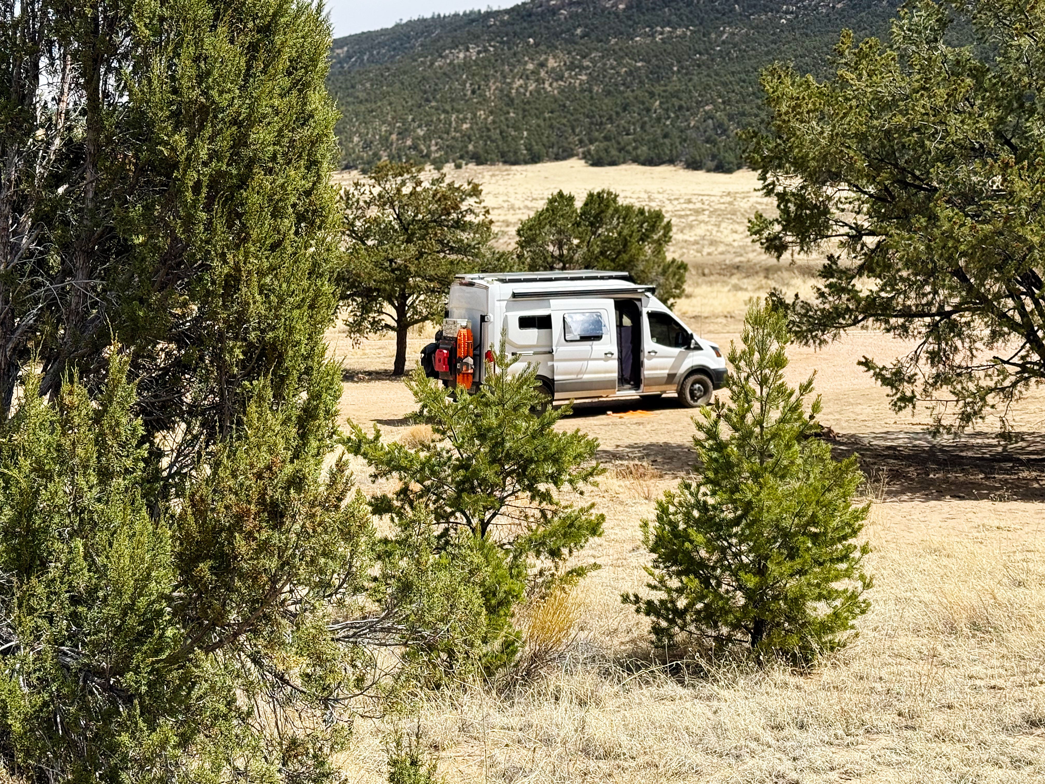
Joe Sheen Campground
Last week we arrived at the Joe Sheen Campground after our visit to Chaco Canyon — and it started snowing! The snow didn’t last long, but I loved it while it lasted!

What a difference a few days make. Here’s a raven’s eye view of the campground that J took from up on top of the ridge:
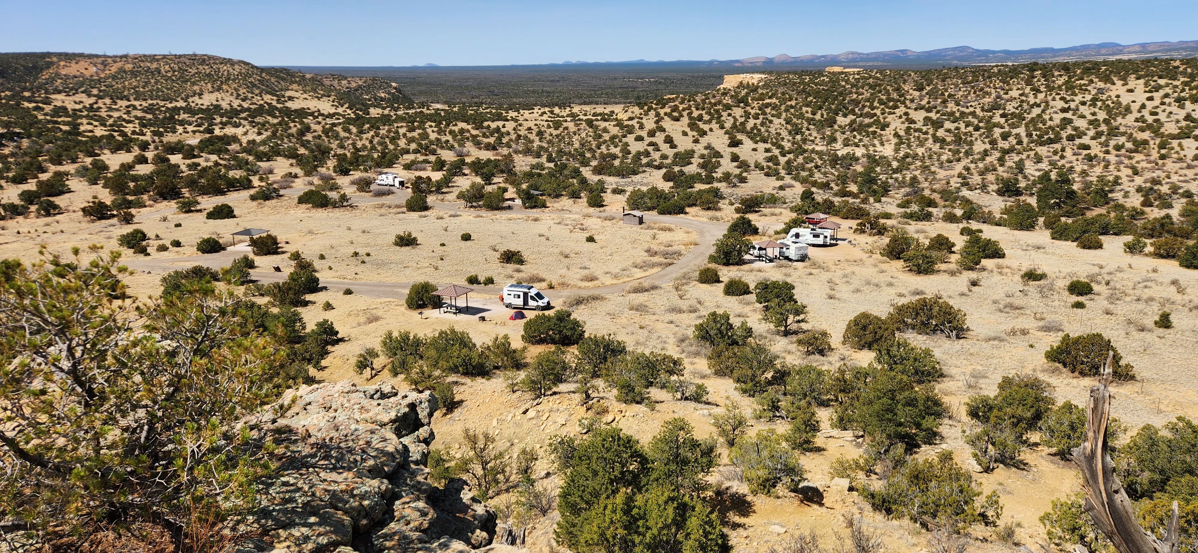
That’s Walter-the-Van in the middle of the shot!
The campground has a seven day limit, and we made it our base of operations to go on a few nearby hikes.
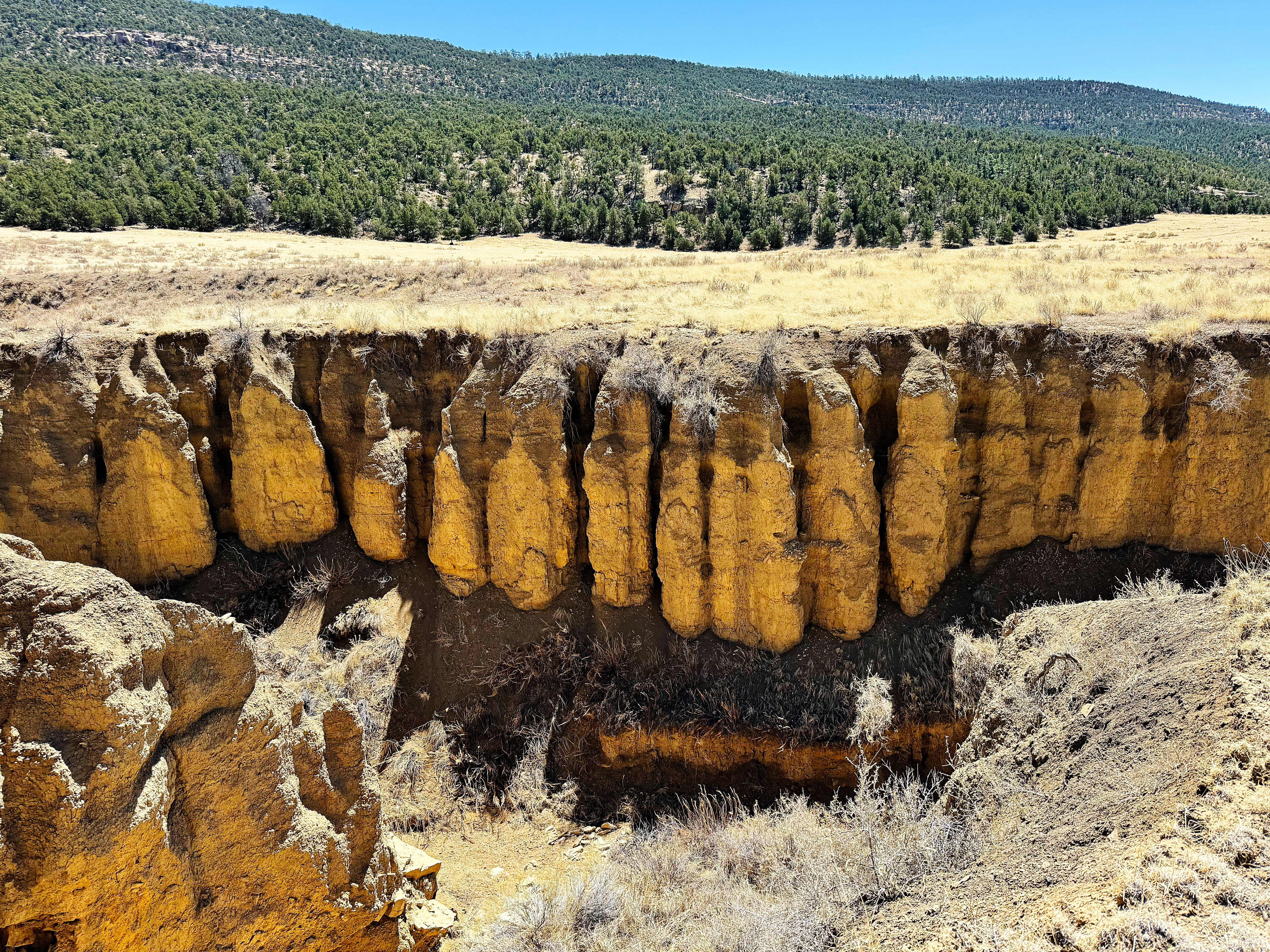
Sandstone Bluffs
Our first stop was across the road from the campground at Sandstone Bluffs, where you can get a great view of the lava fields (see more in the video linked above). The contrast between the orangey/tan of the sandstone and the black basalt of the lava is really striking!
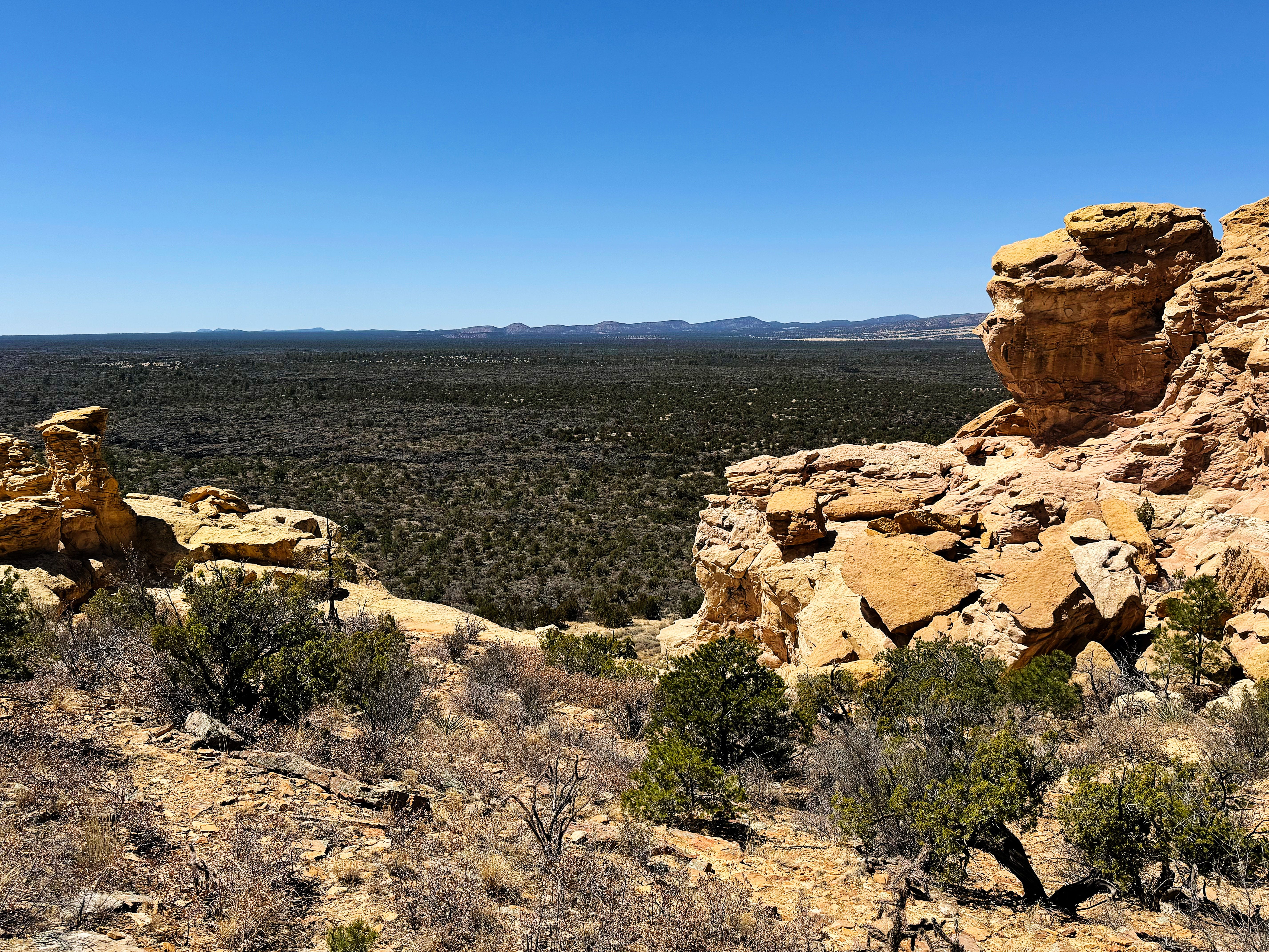
You can definitely see where the sandy soil ends and the lava begins:
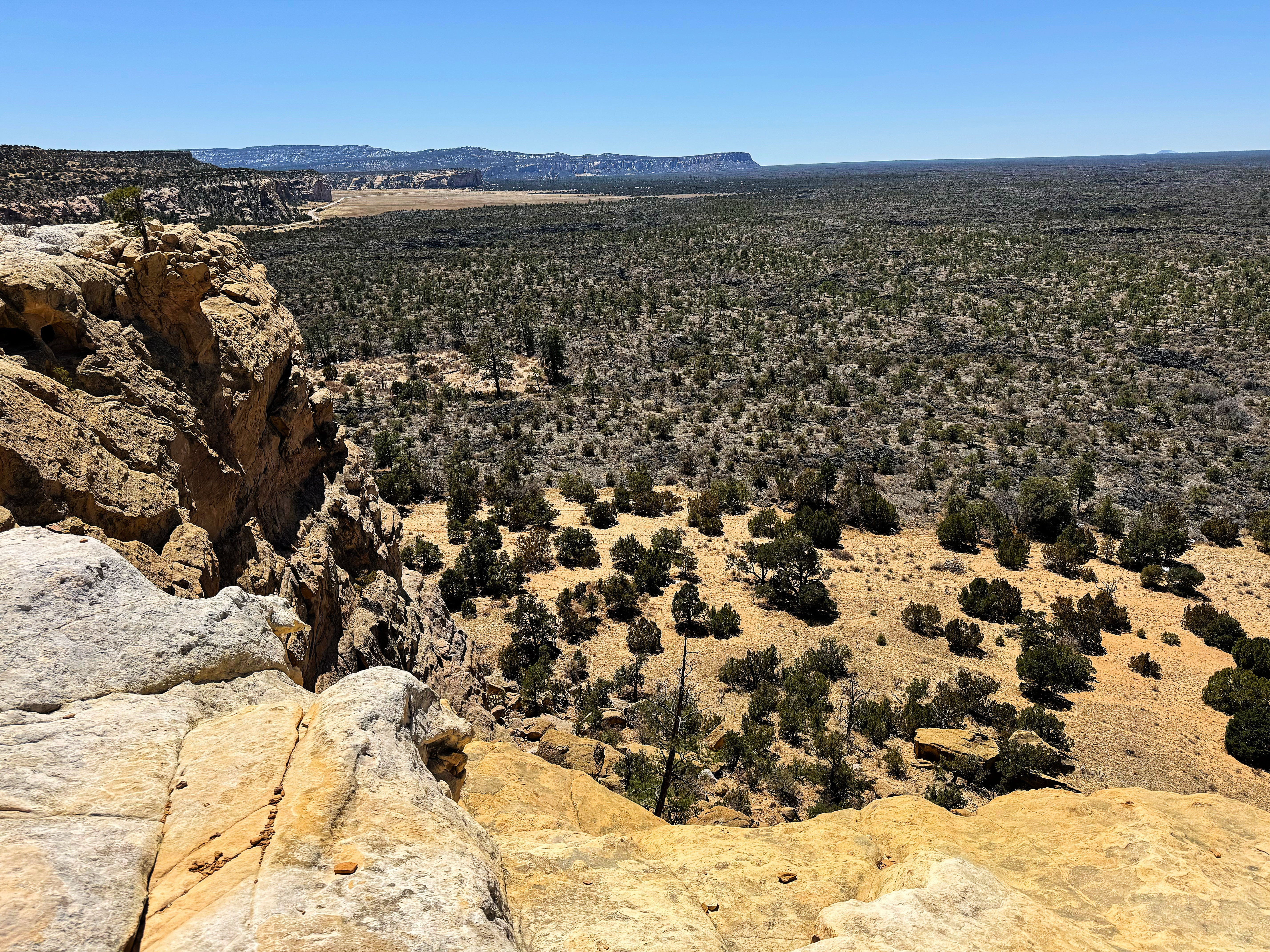
We even got to see Mount Taylor (a dormant stratovolcano) with SNOW off on the distance — this photo was zoomed in:
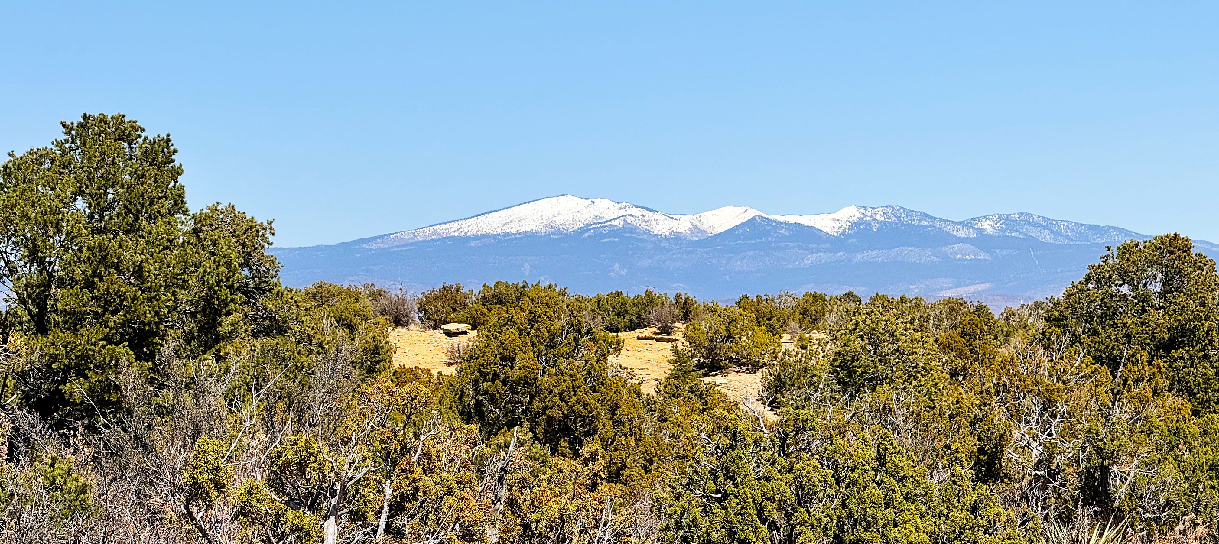
So beautiful!
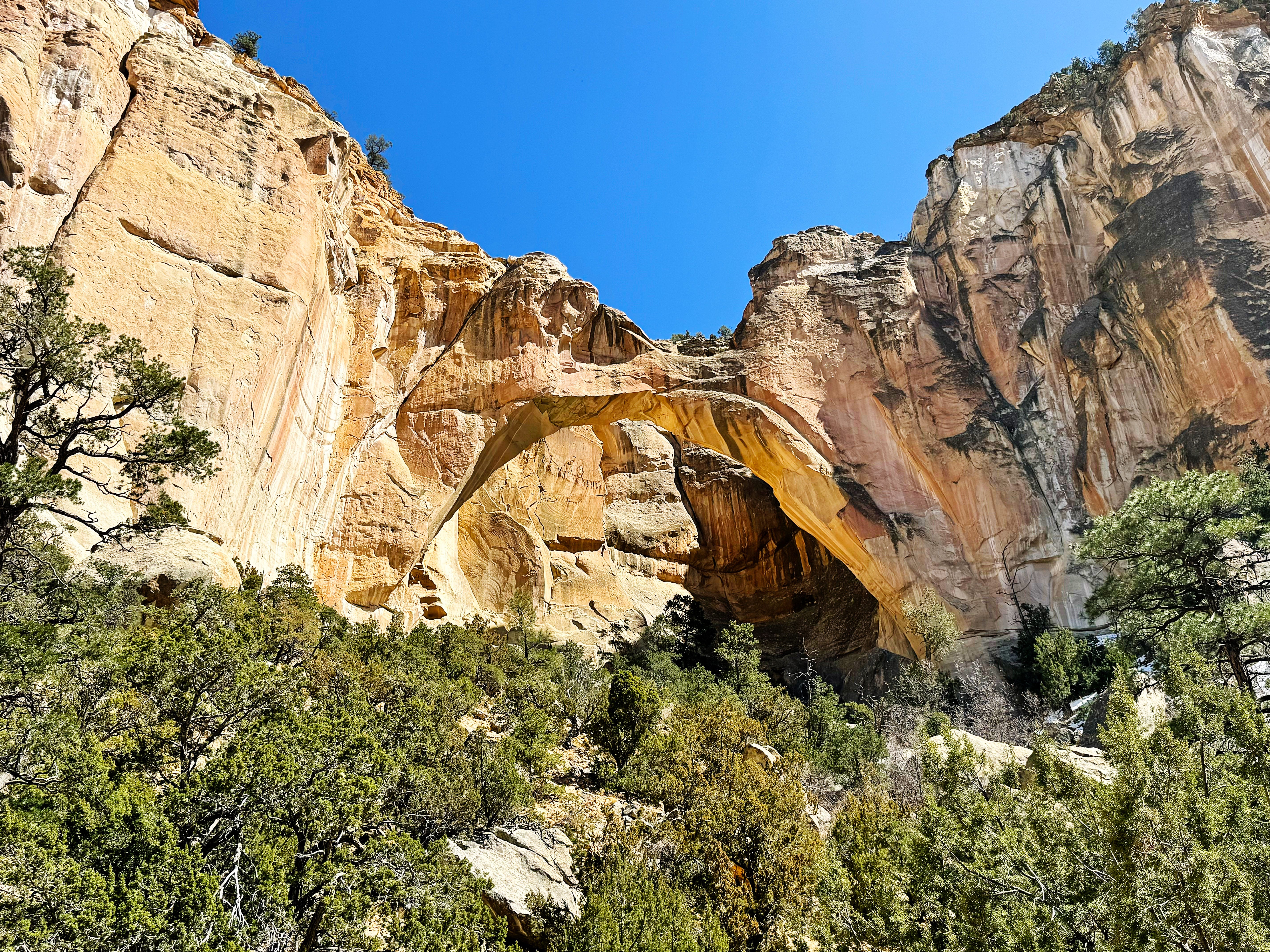
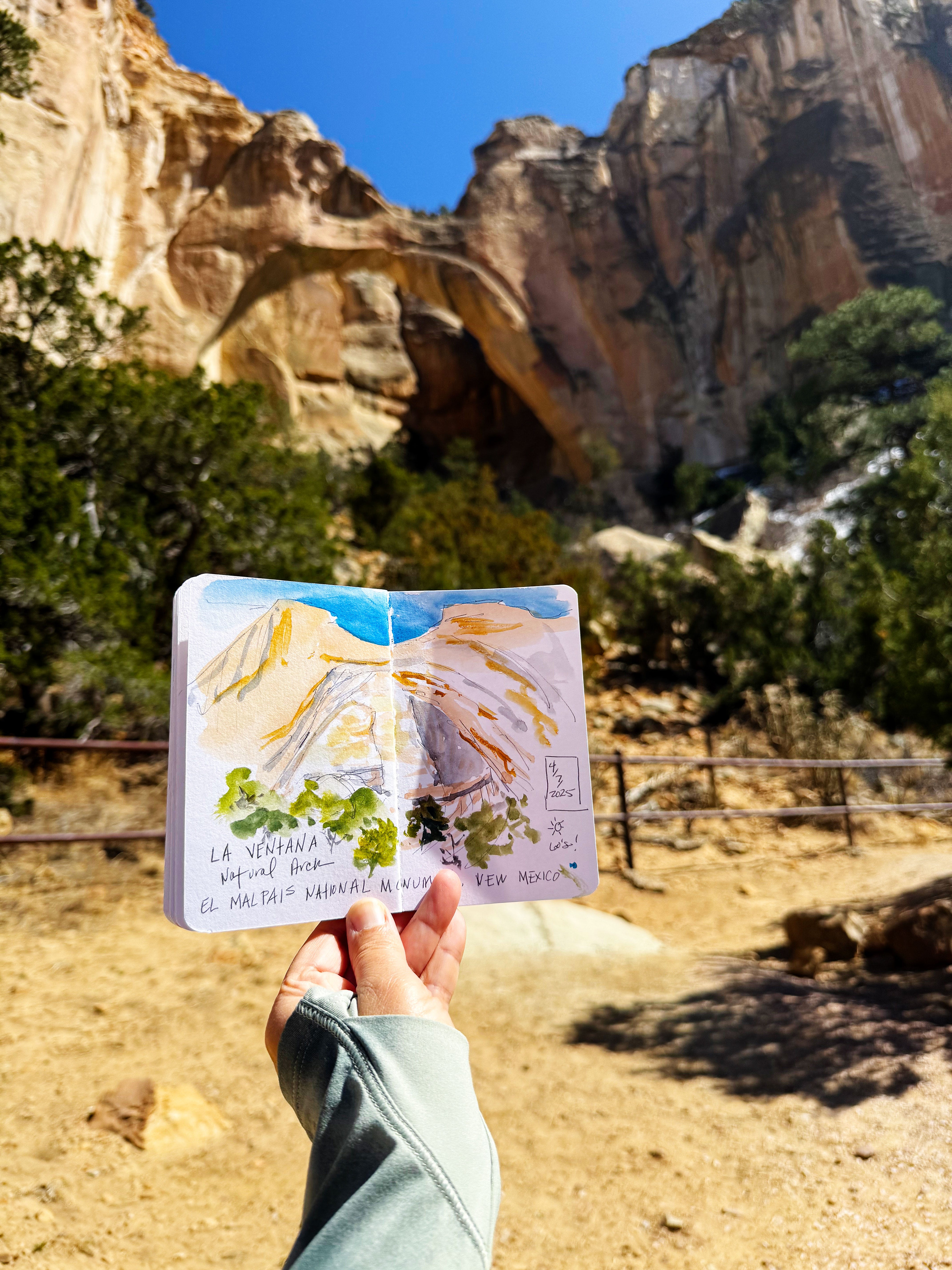
La Ventana Natural Arch
Our next short hike was to La Ventana Natural Arch, the second largest natural arch in New Mexico, formed by wind, rain, and ice eroding the Zuni Sandstone.
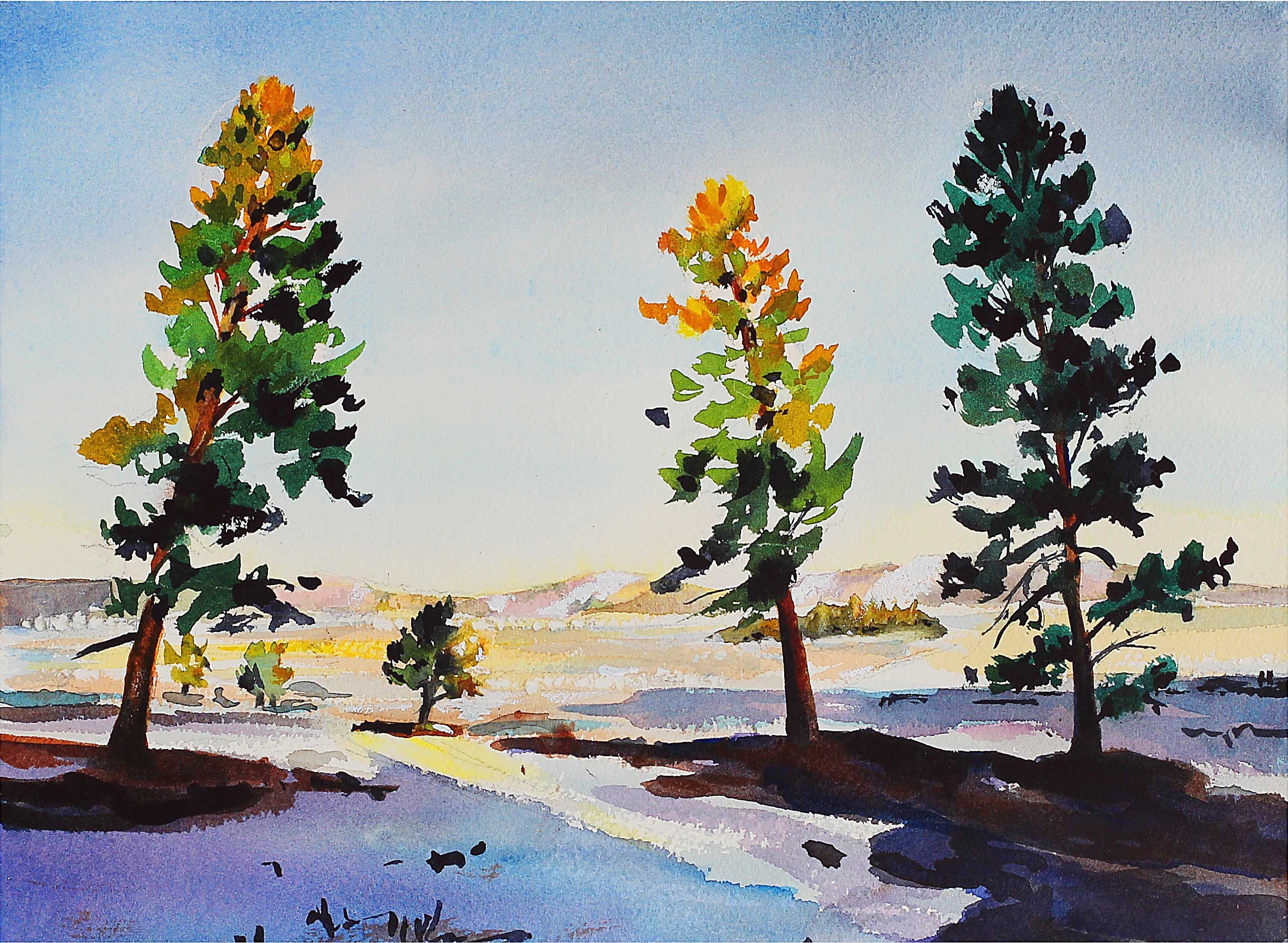
I did a quick sketch while I was there in my nature journal — I wasn’t thrilled with how it turned out, but I’m glad I took the time to do it! (As always.)
Then it was on to…
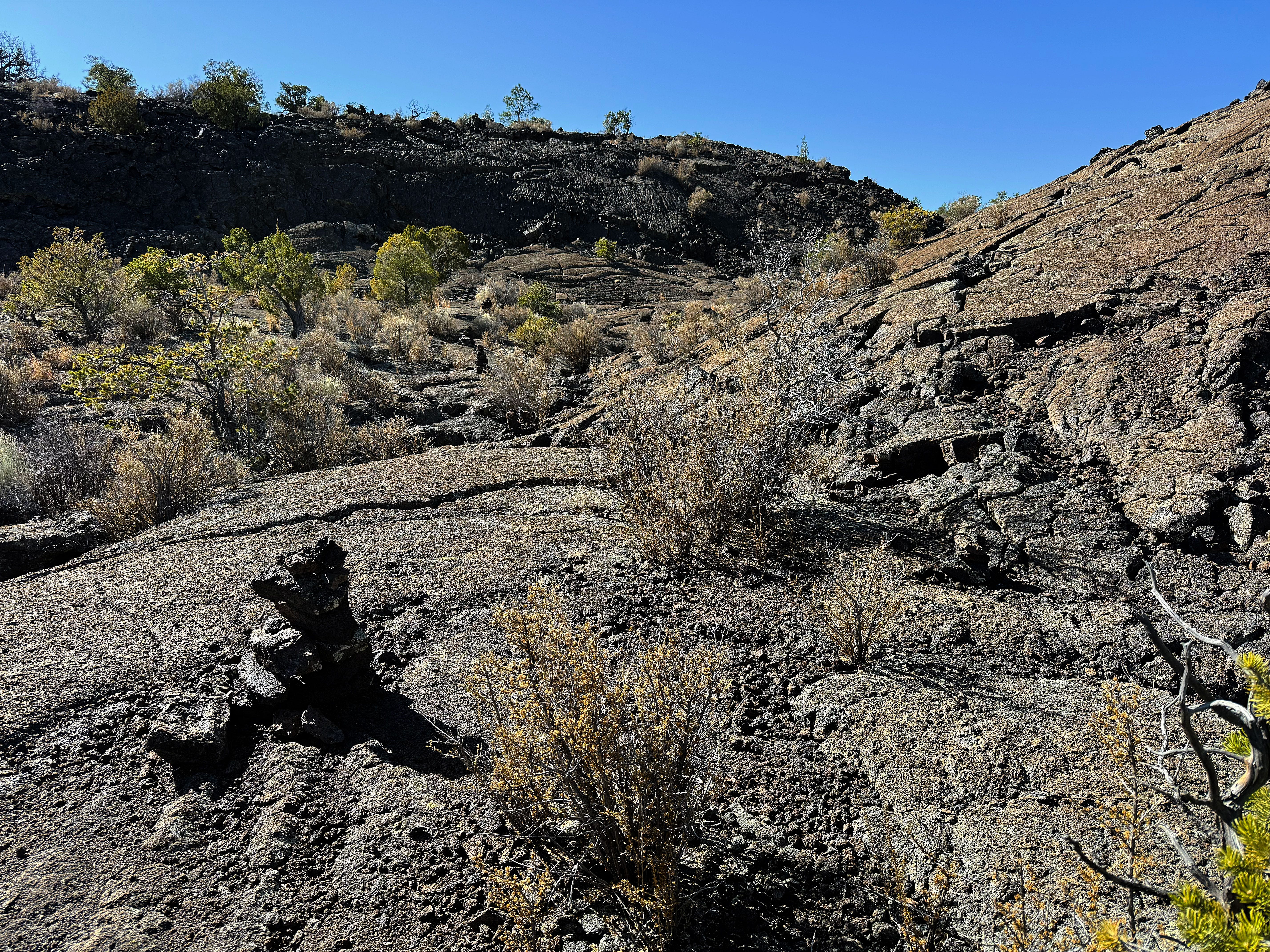
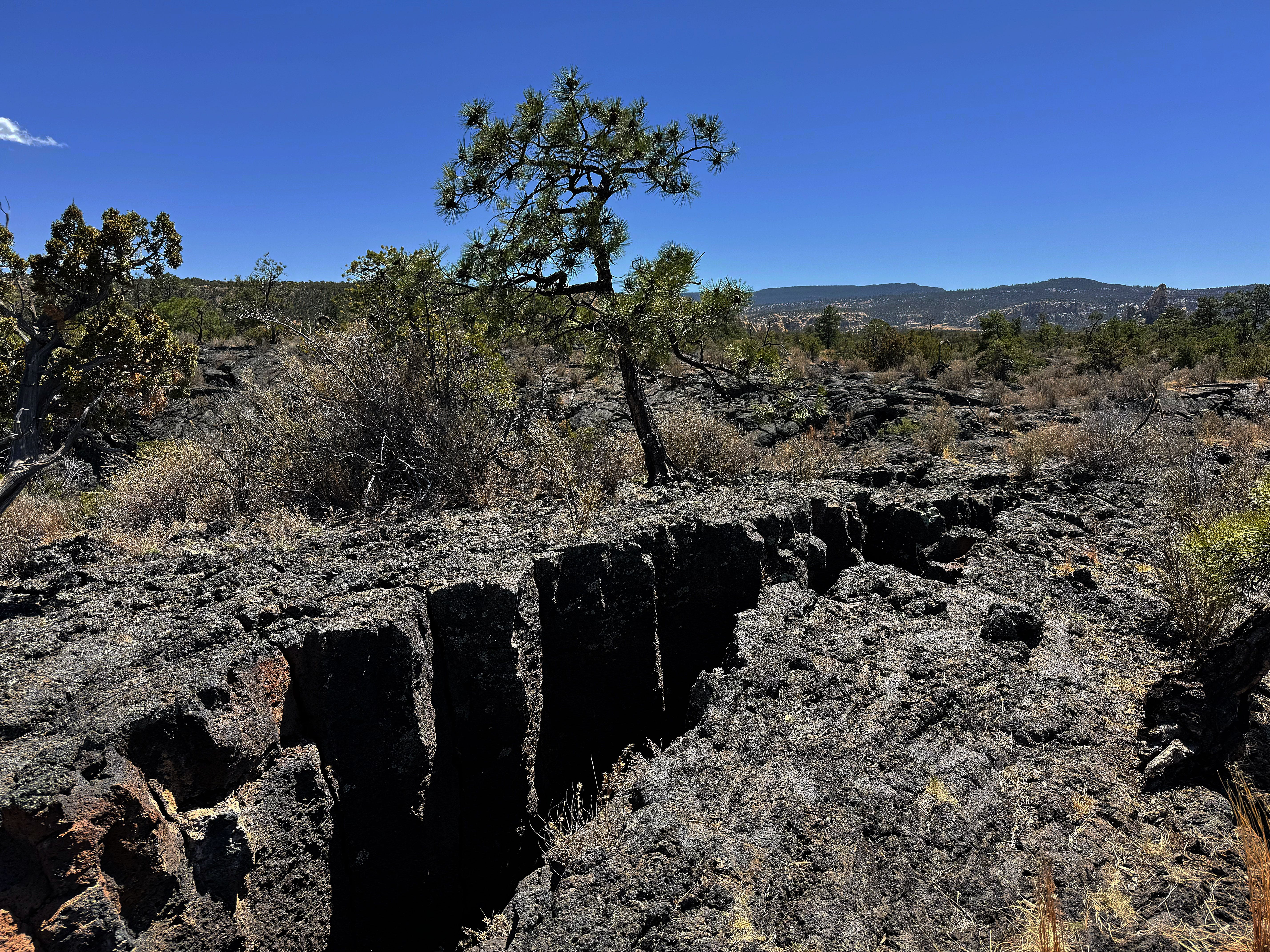
Lava Falls Trail
The Lava Falls Trail is a 1 mile loop — but don’t let the short distance fool you! It’s like an obstacle course out there — and you have to find your route via cairns (rock piles).
To make things even more interesting, you definitely want to be careful here because there may be unexploded ordnance from when it was used as a bombing range in 1943. Yikes!
We’re happy to report that we didn’t find any munitions! :)
But we did find a really cool landscape:


Sometimes it was hard to spot the next cairn…
… but we managed to find our way out.
What an awesome day of hiking through the “frozen fire” — aka lava.
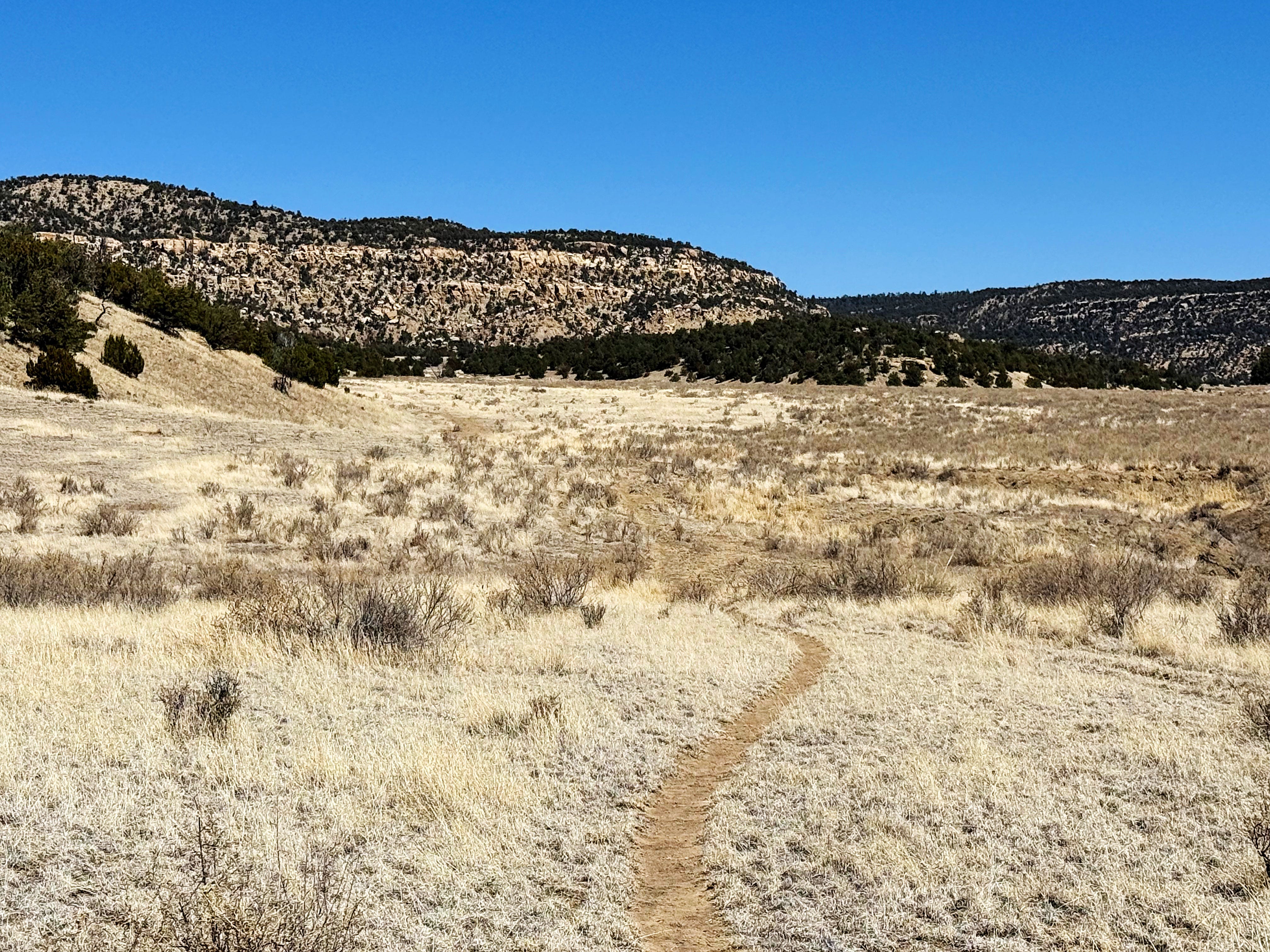
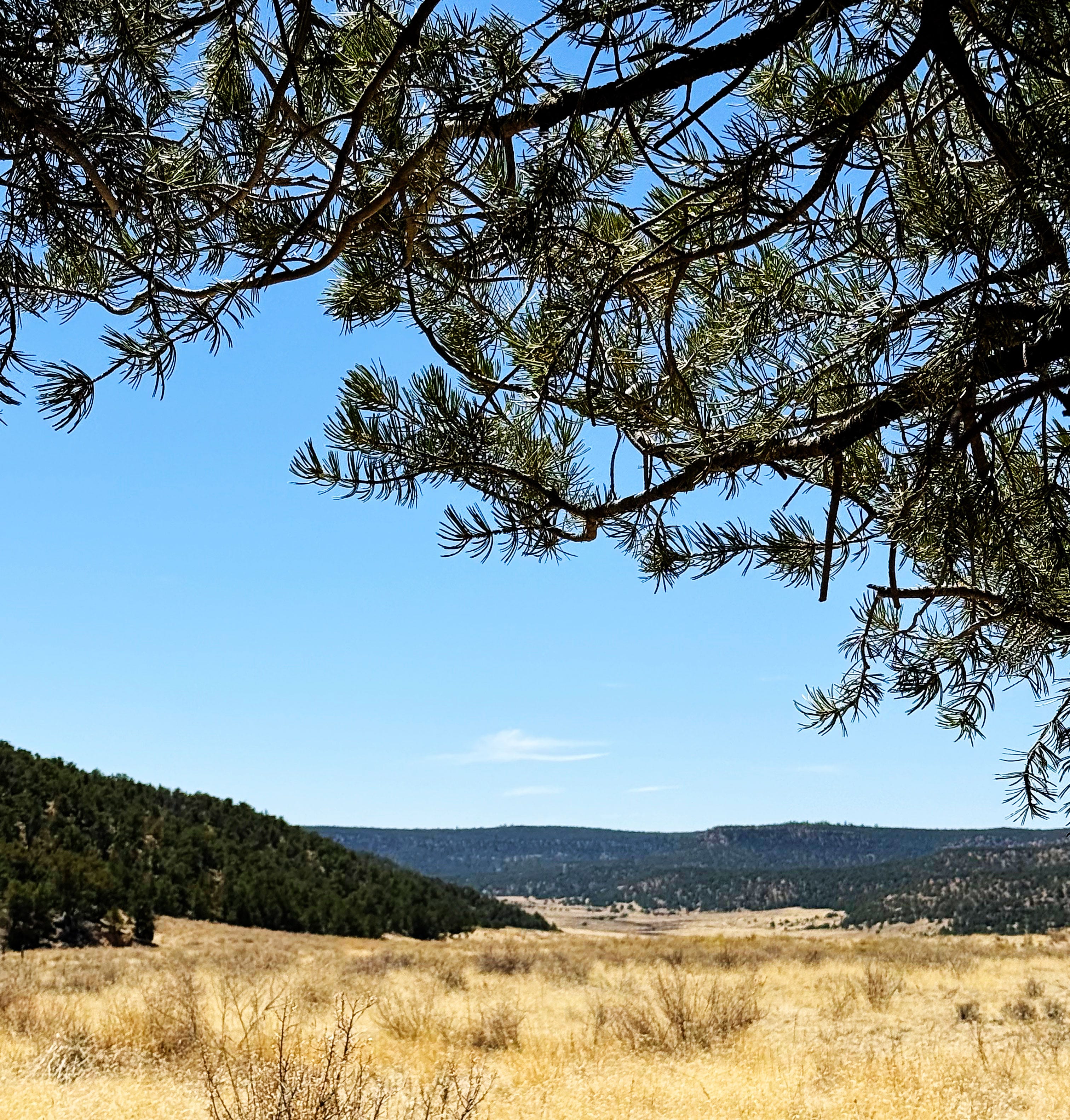
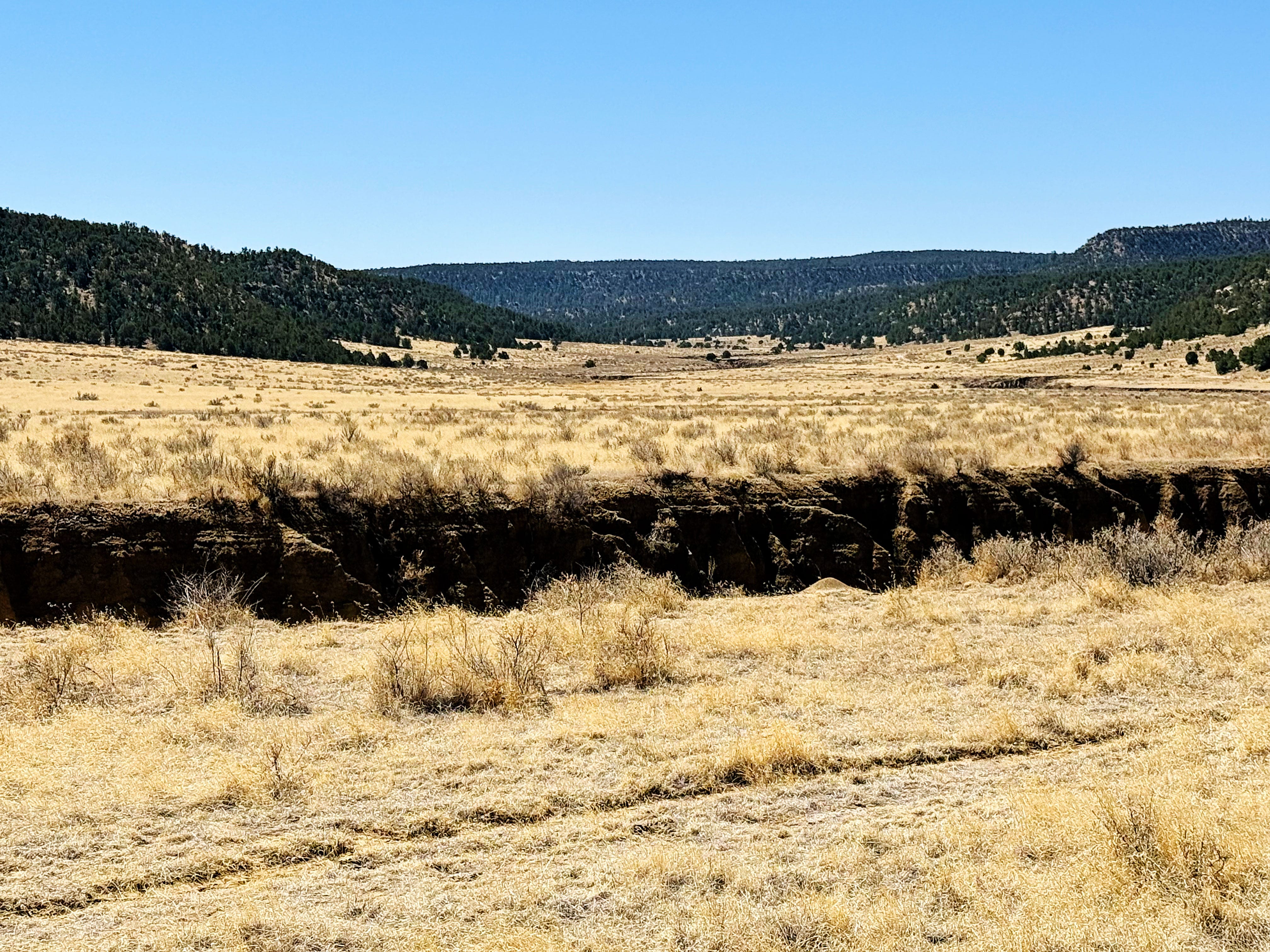
Acoma/Zuni Trail
Friday we broke camp and hiked the Acoma/Zuni Trail. This trail is part of the Continental Divide Trail, so now we can say we hiked part of the CDT!
The trail starts out as soft sand…
… but quickly turns into another follow-the-cairn-adventure-style hike.
The park has this to say about the trail:
Follow an ancient trail across the rugged lava flows that has been used for generations to connect Zuni Pueblo and Acoma Pueblos.
This trail is about 7.5 miles (12 km) one-way as it goes from Highway 53 to Highway 117. This trail is marked by cairns, so it is important to know what to look for before embarking.Sometimes the only trail markers along El Malpais trails are cairns: a series of rock piles used to trace a route across the land. Cairns are common on lava landscapes where creating a traditional trail or footpath is impossible because of the extreme nature of the terrain.
Hiking cairned routes requires more attention to navigation. As you travel, make sure you have the next cairn in sight before moving on to the next one. Keep your eyes on the land while walking; the uneven nature of the terrain demands it since there is no even surface. If you want to enjoy the views, stop first to get a secure footing, and then look around. Look back frequently to stay familiar with the landscape as it changes.
Once again, I loved the contrast between the sandstone and the lava:
After the first lava field the trail turns back to sand — it felt so soft on our feet after the lava!
We turned back around when we hit the second lava field.
Navigating around lava crevasses (or just jumping over them) became our new past time!
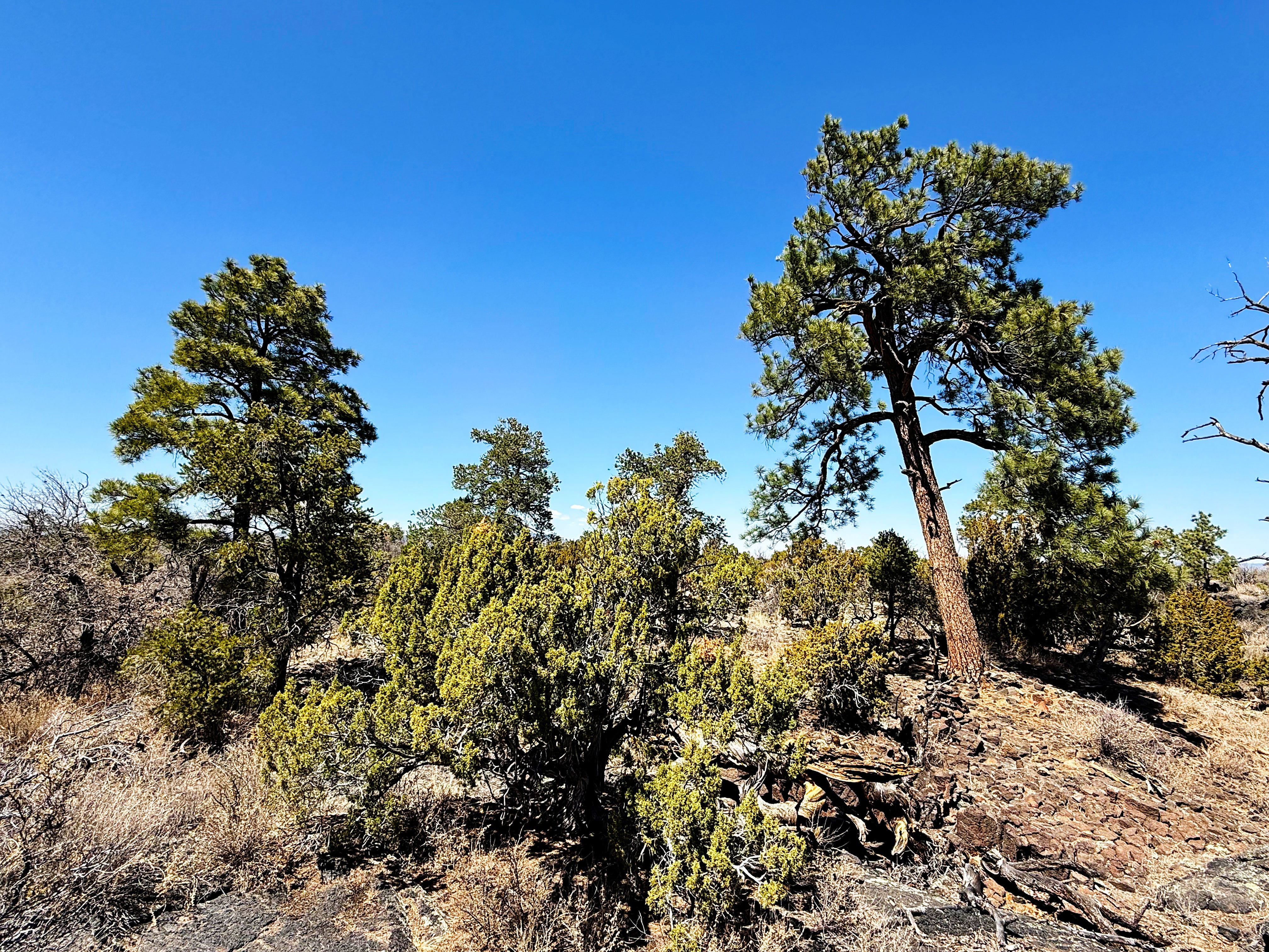
We stopped for lunch under this amazing ponderosa pine — it smelled so good!
My feet started getting hot, so I felt the lava with my hand -- it was really hot to the touch! The air temperature got up to 82 F, and I wondered how hot the lava itself was!
On our way back to the van I turned around for one last look, and I noticed Mount Taylor — the snow had mostly all melted so it looked completely different.

It was an awesome hike but I sure wouldn’t want to do it in the summer!
After the hike we found a dispersed camping spot in the El Malpais Conservation Area (there’s no camping in El Malpais National Monument).
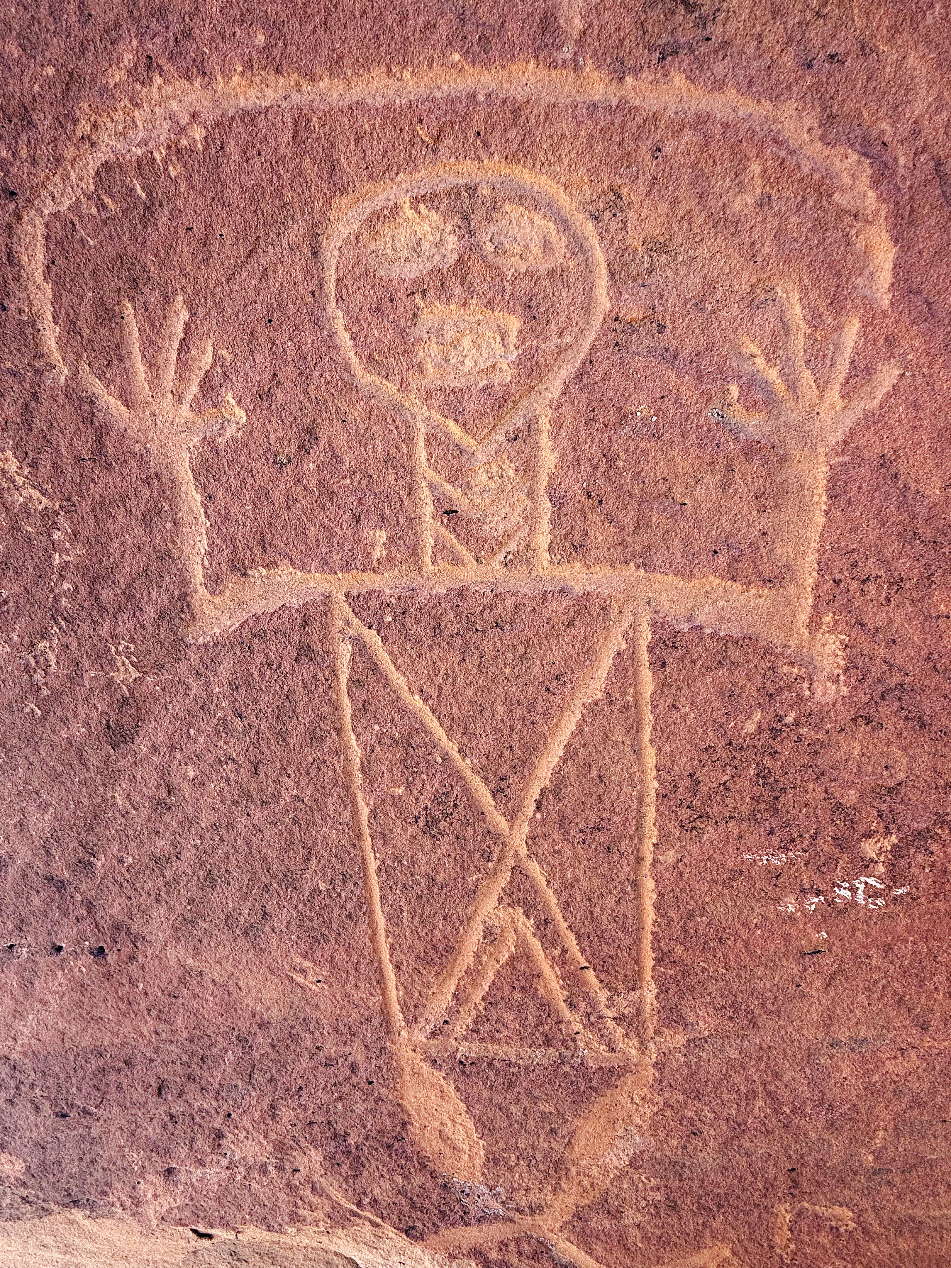
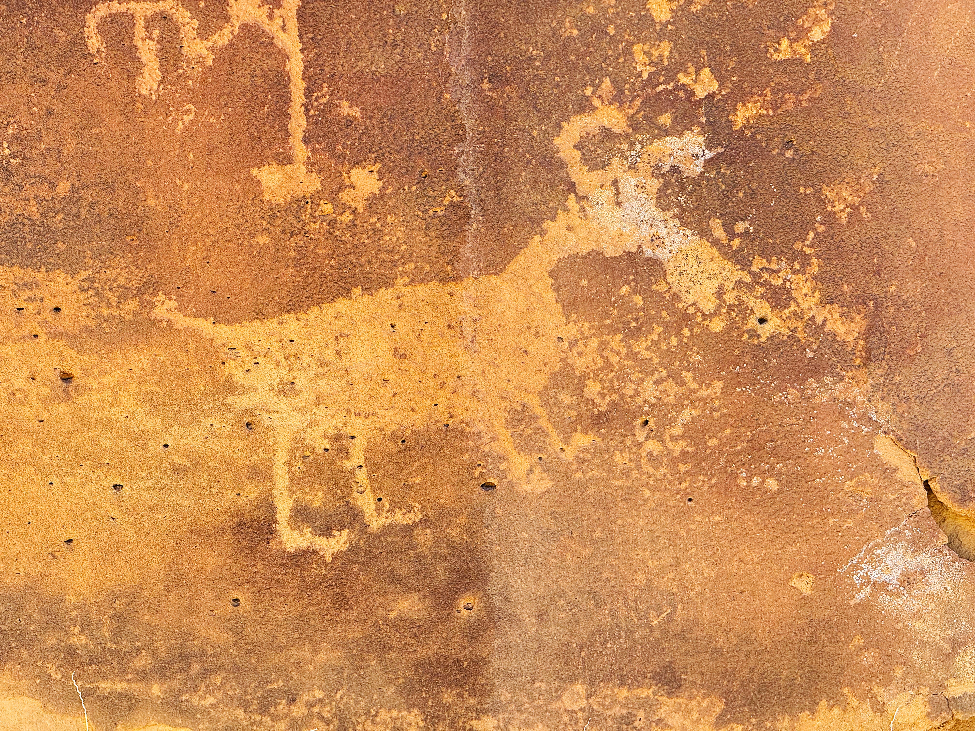
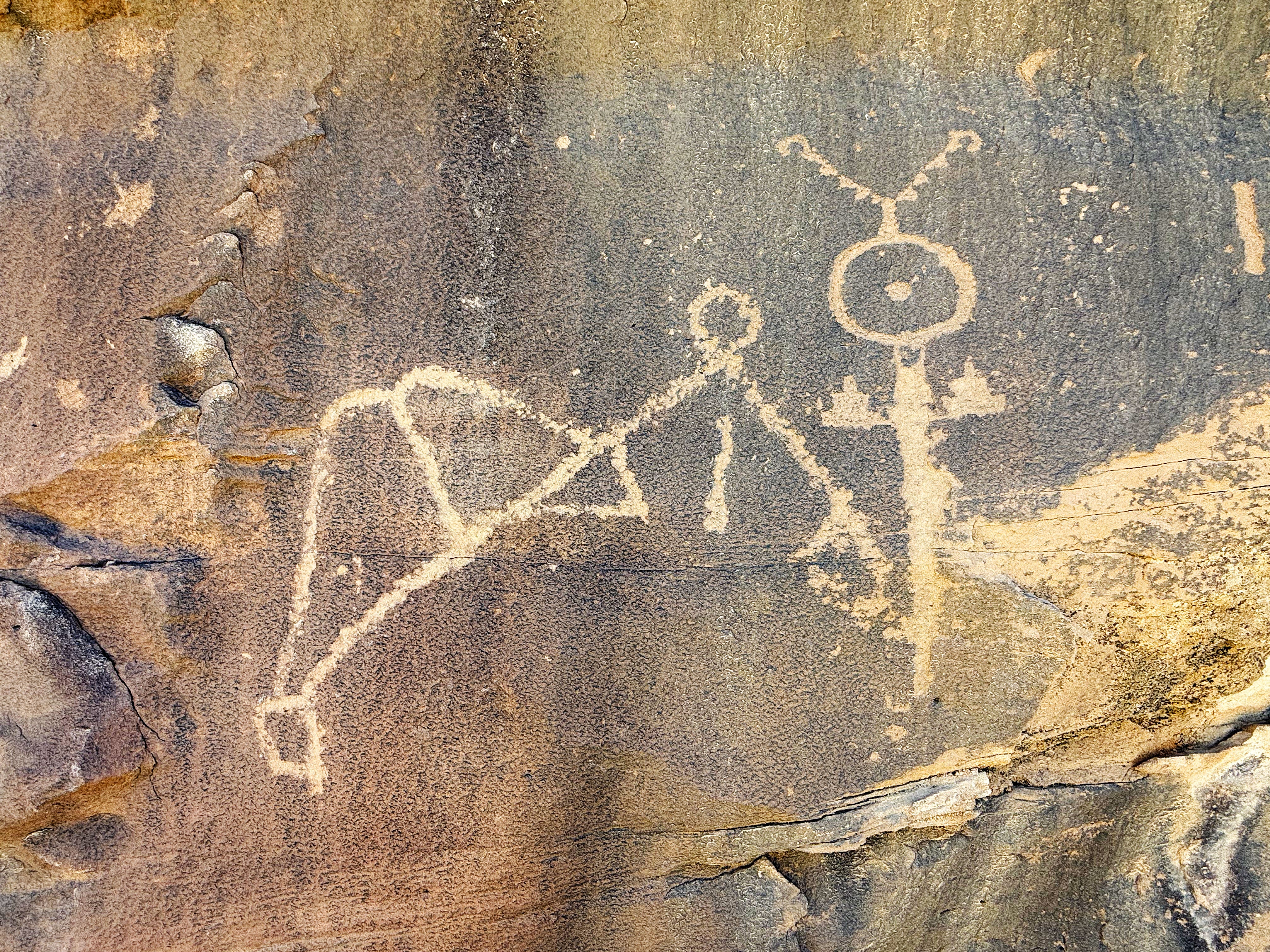
Lobo Canyon Trail & Petroglyphs
Yesterday we hiked the Lobo Canyon Trail to see the petroglyphs. Note: Lobo means “wolf” in Spanish and I was kinda hoping we’d see one — from a safe distance — but we didn’t see any. They have been documented in El Malpais but it seems to be a pretty rare occurrence.
The trail starts out by going down in the canyon and then up across a valley.

Being on the soft sandy trail was a sweet relief for our feet after the lava!
As we were hiking along we kept checking the rocks for the petroglyphs. J spotted a cute ground squirrel running across the top of a cliff, and then we looked down and there they were!
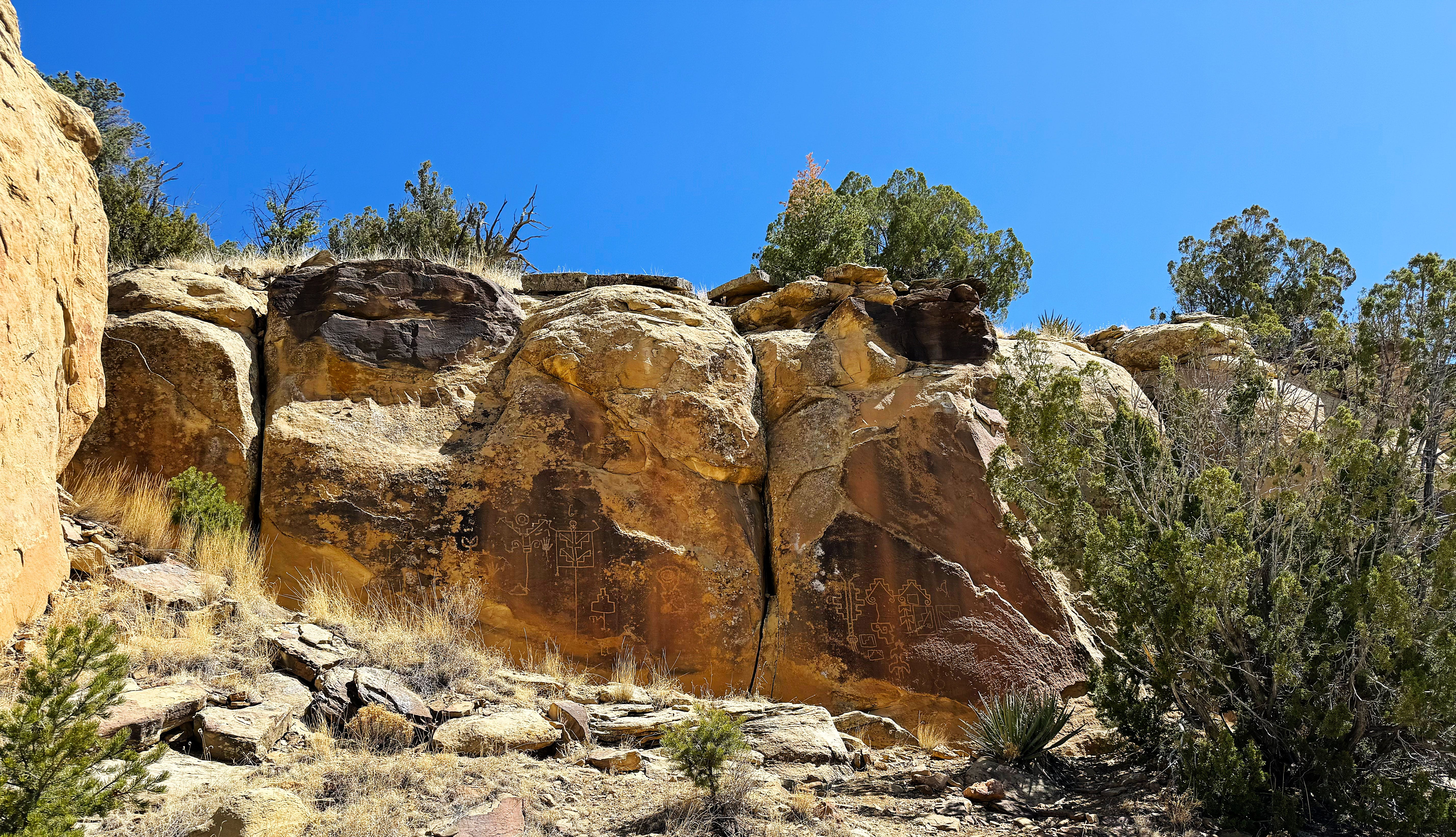
I searched online and can’t find much about the petroglyphs. If you have any info let me know in the comments below. Some of them remind me of the ones we saw at Chaco Canyon which are thought to be supernatural beings.
Here are some closeups so you can see them better:
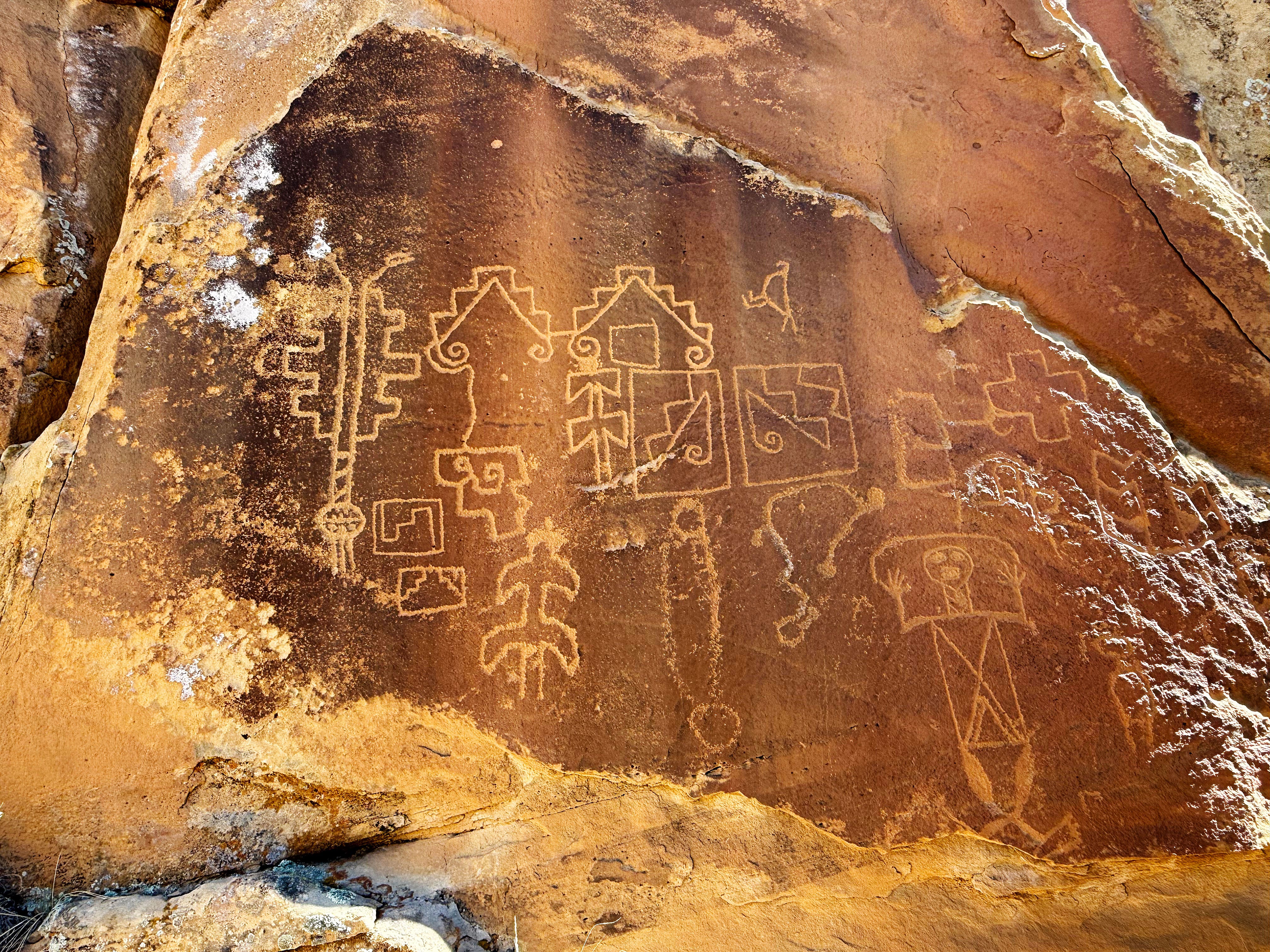
It was amazing to see them this close up!

A little further up we found some more:
After the petroglyphs we hiked further into the canyon to see what we could see, and the views didn’t disappoint:

We stopped for a snack under some piñon pines and I took some time to do a quick sketch.
The wind started kicking up, and it was getting hot (81 F — what happened to spring?!) so we decided to hike a little further and then start heading back to camp. It’s still been going down in the 20s at night so the 80s felt hot!

It’s so hard to put into words what it felt like to see these petroglyphs — it’s a feeling of awe, respect, and wonder. I hope that people visit them with respect and preserve them for generations to come.
My Sketch Kit
It’s been a minute since I shared my sketch kit with y’all, so today’s the day! I keep this kit in my backpack so I’ll always have it with me. I’ve pared it down to the essentials — but I’m always tinkering with it. If there’s something you think I’d like to add to it drop me a comment below.
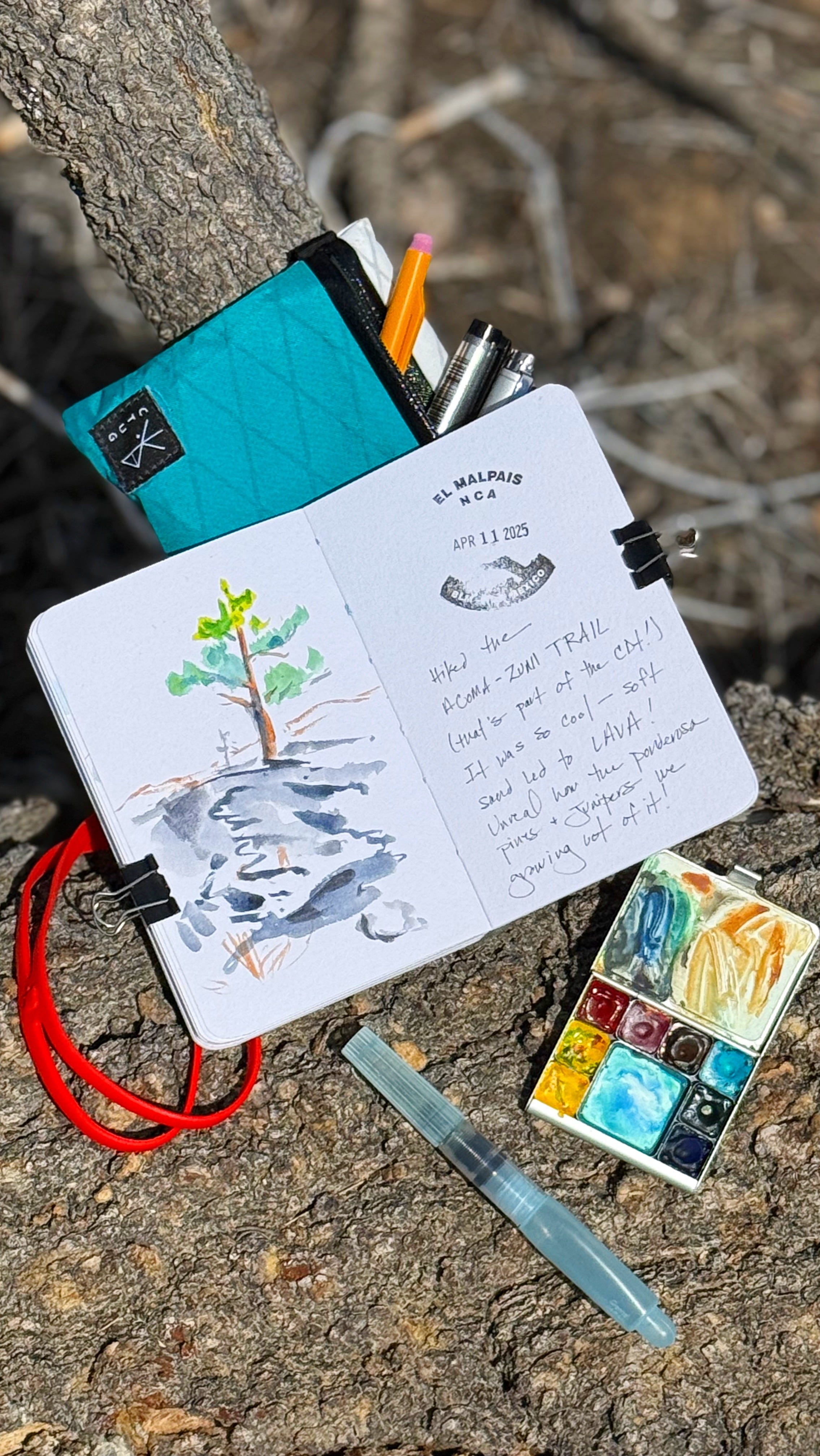
I put together a quick little video so you can see the kit in action — check it out over on Instagram. Here’s what’s in the kit:
Sketchbook: Stillman and Birn Beta Series — with a sticker on it from Capulin Volcano National Monument. I love this book since it’s the perfect size to rubber band from the pouch.
Pouch: water resistant pouch (it’s actually a large wallet) from Chicken Tramper Gear
Pencil: I like this one from Papermate since it’s retractable so you don’t have to worry about your lead breaking and it’s super lightweight. You can refill it but it’s a little tricky!
Pens: I have a generic ballpoint pen and 2 Copic multiliners — one is .3 mm and the other has a brush tip — I love Copics because they don’t leak with changes in elevation!
Waterbrush: I use a short one from Pentel
Syringe for filling the water brush — Texas friends might recognize this one from HEB!
Palette: a Demi palette from Art Toolkit filled with paints: two yellows (DS Hansa yellow medium), one for mixing and one I try to keep clean - ha!, DS quinacridone coral, WN quinacridone magenta, DS transparent red oxide, WN cobalt turquoise light, DS phthalo green (blue shade), H ultramarine blue light (DS = Daniel Smith, WN = Winsor & Newton, H = Holbein)
Misc: binder clips and a shop towel, 6 inch red rubber band and mini water mister, also from Art Toolkit
Hope that helps someone out there! Just let me know if you have any questions — I love nerding out over art supplies!
PS. Some of the links are my Amazon affiliate links, so if you make a purchase by clicking on the link I’ll receive a small commission at no cost to you. Also, I’m honored to be a Brand Ambassador for Art Toolkit and they’ve given me a code to share with you: use code LISAFAN10 for 10% off your purchase of an ArtToolkit, palette, or mixing pans. Thank you so much for your support, it really means a ton.
Traveling Art Exhibit
I’m honored and excited to share that some of my paintings from my time as artist-in-residence at Valles Caldera National Preserve will be part of a traveling art exhibit, including this painting that I did of the “Tres Amigos”:
Featuring original artwork by regional creatives and National Park Service artists in residence, 𝑪𝒂𝒍𝒅𝒆𝒓𝒂 𝑹𝒆𝒗𝒆𝒓𝒊𝒆: 𝑨𝒓𝒕𝒊𝒔𝒕𝒊𝒄 𝑽𝒊𝒔𝒊𝒐𝒏𝒔 𝒇𝒓𝒐𝒎 𝒂 𝑽𝒐𝒍𝒄𝒂𝒏𝒊𝒄 𝑳𝒂𝒏𝒅𝒔𝒄𝒂𝒑𝒆 celebrates the universal connection between humans and the natural world.
This traveling art exhibit will be on display at Jemez Fine Art in Jemez Springs from April 18-24, 2025—just in time for #NationalParkWeek! Free entry; gallery hours are 11 am to 4 pm, Wednesday thru Monday (closed Tuesdays).
I’ll be there for the opening — cannot wait!
Also! You can check out the Valles Caldera webcam to see the Tres Amigos live!
That’s it for this week! Farewell from our dispersed campsite, where the wind is kicking up again and rocking the van.
As always, thanks so much for following along on our adventures — it means so much to have you along for the ride! — Lisa, Jason, & Walter-the-Van
I loved El Malpais when we visited there ages ago! We never had time to hike the Acoma-Zuni Trail, although it intrigued me. We explored some lava tubes before a thunderstorm drove us back to the car. If you get a chance, visit Tent Rocks west of Santa Fe--another amazing BLM area.
How well I remember NM 117 from our visit in October 2022. Our first stop was the El Malpaís Ranger Station, where we ended up having a half-hour conversation with the ranger on duty. She was the first person we'd ever met whose native language was Navajo. She told us her father could get by in basic English but not her mother, who still spoke only Navajo. Later I was sorry that we hadn't chosen a sentence that Eve would translate into her native language (Cebuano) and the ranger into Navajo, to see how different they came out.
Also on NM 117 we stopped, as you did, at Sandstone Bluffs, and spent a couple of hours there. Later, on our way to La Ventana, we stopped at an eroded cliff whose markings struck me as natural hieroglyphics:
https://portraitsofwildflowers.wordpress.com/2022/11/13/more-unexpected-stops/
Did you see it, too?